Dunstaffnage Chapel
Chapel (Medieval), Font (Period Unassigned)(Possible)
Site Name Dunstaffnage Chapel
Classification Chapel (Medieval), Font (Period Unassigned)(Possible)
Alternative Name(s) Dunstaffnage Castle, Chapel
Canmore ID 23047
Site Number NM83SE 3
NGR NM 88081 34412
Datum OSGB36 - NGR
Permalink http://canmore.org.uk/site/23047
- Council Argyll And Bute
- Parish Kilmore And Kilbride
- Former Region Strathclyde
- Former District Argyll And Bute
- Former County Argyll
NM83SE 3 88081 34412.
(NM 88081 34412) Chapel (NR) (remains of)
OS 1:10000 map (1976)
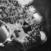
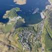
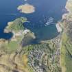
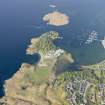
The richly ornamented remains of Dunstaffnage Chapel, whose dedication is unknown, stand about 150 metres WSW of Dunstaffnage Castle(NM83SE 2), on a small knoll overlooked from the south by Chapel Hill. The architectural detail indicates the chapel dates from the second quarter of the 13th century. A roofless burial aisle, for use by the Campbells of Dunstaffnage, was added to the east end in 1740 when the chapel was already ruinous.
The chapel is a single-chambered, unvaulted rectangular structure measuring 20.3 metres E-W by 6.3 metres transversely within walls 0.9 metres thick. The principal entrance to the nave is near the west end of the south wall, but it is now completely ruinous. Directly opposite, in the north wall, there is another doorway of which only the bases remain in situ. The single entrance to the chancel is on the south side. The interior of the chapel was divided into a nave and chancel by a timber screen 1 metre west of the chancel doorway.
The 18th century burial aisle continues the lines of north and south walls. It measures 5.4 metres E-W by 8.2 metres over walls varying in thickness from 0.7 to 0.9 metres. The rubble walls of the aisle incorporate many moulded fragments from the medieval chapel. The entrance doorway is in the centre of the east wall. There are a number of inscribed stones in the burial aisle. These are of 17th and 18th century date and are mainly commemorative. However, two fragments of yellowish sandstone which evidently formed part of a circular or octagonal structure, perhaps a font, are probably of medieval date.
RCAHMS 1975, visited 1969
As described.
Surveyed at 1:2500.
Visited by OS (RD) 25 August 1971.
This site has only been partially upgraded for SCRAN. For full details, please consult the Architecture Catalogues for Argyll and Bute District.
March 1998
Publication Account (1985)
This magnificent castle occupies the summit of an isolated rock stack at the head of Loch Etive, with the sheltered anchorage ofDunstaffuage Bay to the east. The castle was founded by the MacDougall family, Lords of Lorn, either Duncan MacDougall, who founded the priory of Ardchattan, or his son Ewen, and it dates in origin to the middle of the 13th century. The ground plan is largely determined by the quadrangular shape of the top of the rock stack; the walls are massive, rising from the conglomerate stack to form a castle of enclosure but with stout slightly projecting angle towers at the north and west corners and with an entrance tower at the east angle.Doubtless much of the accommodation within the castle would have been in stone and timber ranges against the curtain walls particularly on the northwest; rather grander accommodation, possibly including a first-floor hall, is implied by the architectural details of the east side, with the blocked windows of these rooms still visible from the outside. The castle was captured from the MacDougalls by Robert Bruce in 1309 and for some years it remained in royal hands. After several other holders in the 14th and 15th centuries the castle was, in 1470, granted to Colin, 1st Earl of Argyll; in 1502 the custody of the castle was vested by the then earl in his cousin, who became known as the Captain ofDunstaffnage. Today the castle belongs to the Duke of Argyll, with the hereditary Captain as the keeper of the castle with right of residence, though the guardianship of the castle is now vested in the Secretary of State for Scotland.
It is a measure of the success of the original concept that the castle has, except at the entrance tower, been so little altered. In the late 15th or early 16th century the entrance was re-arranged with the rebuilding of part of the east tower; access was across a wooden drawbridge at the head of angled steps leading from the base of the rock stack. The upper part of the gateway is probably oflate 16th century date. Further alterations continued till 1810 largely to improve the domestic arrangements of the north-west range and the gate-tower, though work to allow the greater use of firearms in the defence of the castle was also undertaken.
The chapel situated about 150m WSW of the castle was built in the second quarter of the 13th century, with the burial-aisle of the Campbells of Dunstaffnage continuing the line of building at the east end. The chapel is of simple rectangular plan, but the detail of the mouldings of the windows is of an intricacy and quality remarkable in the west of Scotland at this time. The three pairs of windows of the chancel have been the main areas of such decoration with dog-tooth ornament on the outside; the paired windows on the north and south sides of the chancel are particularly fine examples of Gothic embellishment. The architectural style of the chapel has been compared to contemporary work at the Nunnery on Iona (no. 43)and the parish church at Killean (no. 46).
Information from ‘Exploring Scotland’s Heritage: Argyll and the Western Isles’, (1985).
Watching Brief (16 November 2009 - 18 November 2009)
NM 8810 3410 An archaeological watching brief was undertaken in advance of development at Dunstaffnage Marine Research Facility on the outskirts of Dunstaffnage village. The area for development lay within an area of medieval activity and adjacent to two Scheduled monuments: Dunstaffnage Castle (NM83SE 2) and Dunstaffnage Castle Chapel (NM83SE 3).
No archaeological remains were encountered, although there were considerable remains mainly of concrete bases and brick foundations relating to the WW2 base that occupied the site prior to the Marine Research Facility. (GUARD 1126)
Sponsors: Dunstaffnage Developments Ltd, Davis Duncan Architects.
K Seretis 2002.


