Ayr Harbour
Harbour (Period Unassigned)
Site Name Ayr Harbour
Classification Harbour (Period Unassigned)
Alternative Name(s) River Ayr; Newton-upon-ayr
Canmore ID 41760
Site Number NS32SW 123
NGR NS 32930 22754
NGR Description Centred NS 32930 22754
Datum OSGB36 - NGR
Permalink http://canmore.org.uk/site/41760
- Council South Ayrshire
- Parish Ayr
- Former Region Strathclyde
- Former District Kyle And Carrick
- Former County Ayrshire
NS32SW 123.00 centred 32930 22754
Harbour [NAT]
OS 1:10,000 map, 1978.
Ayr Harbour [NAT] (at NS 3293 2275)
Ayr Harbour [NAT] (at NS 3343 2241)
Ayr Harbour [NAT] (at NS 3363 2226)
OS (GIS) AIB, May 2006.
NS32SW 123.01 NS 33311 22611 Harbour Master's Office (Wet Dock Entrance: Port Office)
NS32SW 123.02 NS 33364 22635 Leading Light [Beacon] (North Harbour Quay: inner Light: Ayr High Light)
NS32SW 123.03 NS 33287 22649 Workshops
NS32SW 123.04 NS 33234 22657 Leading Light [Beacon] (Wet Dock Entrance: Inner Light)
NS32SW 123.05 NS 33179 22583 to NS c. 33211 22553 Compass Pier
NS32SW 123.06 NS 32855 22705 Lighthouse [Beacon] (South Breakwater)
NS32SW 123.07 NS 33344 22798 Griffin (Wet) Dock
NS32SW 123.08 NS 33229 22651 Pilot House (Wet Dock Entrance)
NS32SW 123.09 NS 32811 22784 Lighthouse [Beacon] (North Breakwater)
NS32SW 123.10 NS 33145 22527 Foot Bridge (to N of disused dock)
NS32SW 123.11 NS 33141 22458 (Disused) Slip Dock (Harbour St)
NS32SW 123.12 NS 32856 22797 North Breakwater (detached)
NS32SW 123.13 NS 32848 22707 South Breakwater
NS32SW 123.14 NS 33289 22582 North Harbour Quay (North Ratton Quay)
NS32SW 123.15 NS 33323 22442 South Harbour Quay (South Ratton Quay)
See also:
NS32SW 6 NS 33859 22113 Auld Brig
NS32SW 153 NS 33749 22197 New Bridge
NS32SW 337 Centred NS 33253 22157 Cromwellian Citadel
NS32SW 948 NS 33111 22519 Observation Post (Esplanade)
Incorporates harbour-works of Newton-upon-Ayr.
Formerly also entered as NS32SW 141 at cited location NS 3344 2239.
For associated warehouses (centred NS 3345 2223) in South Harbour Street, see NS32SW 124.
For New Bridge (adjacent to SE), see NS32SW 153.
Not to be confused with Ayr, South Pier (NS 32851 22708 to NS 33107 22602), for which see NS32SW 427.
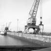
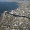
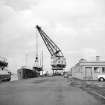
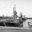
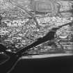
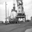
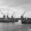
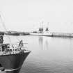
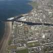
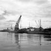
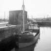
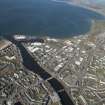
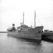
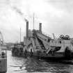
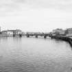
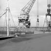
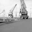
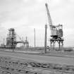
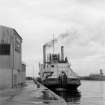
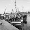
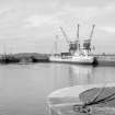
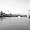
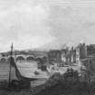
(Location cited as NS 333 228). Ayr Harbour. Quays on both sides of the River Ayr, with a mid 19th century breakwater projecting from the S bank. Also on the S bank was a slip dock (now disused). On the N side is an enclosed basin, formerly gated, built 1874-8. The S quay is used largely by fishing vessels and the N quay and basin are designed for coal export, with modern coaling cranes and a coal drop. There is an attractive 2-storey harbourmaster's office with a corner pepperpot turret.
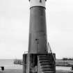
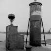
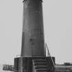
(Locations cited as NS 333 227 and NS 333 228). Lighthouses, Ayr Harbour, mid 19th century. The larger of the two [NS32SW 123.02], now inland, is a 5-storey circular tower, with a corbelled machicolated parapet, and a circular lantern, with rectangular panes and a domed top. Adjoining the base is a small single-storey keeper's cottage. The other lighthouse [NS32SW 123.04] is an unmanned circular iron tower on a concrete base with a conical cap.
J R Hume 1976.
(Location cited as NS 33 22 and NS 33 23). The River Ayr falls into the sea within a few miles of the predominantly sandy coast that begins at Saltcoats [name: NS 245 413], and Ayr harbour occupies its lowermost reach, an estuary below the bridges [Auld Brig: NS32SW 6]. Its strategic potential was evidently appreciated by Cromwell, the impressive remains of whose Citadel [NS32SW 337] stand on its S bank immediately downstream from the confines of the mediaeval burgh [NS32SW 108]. His choice of the Ayr, rather than the Irvine, estuary may well have been influenced by the serious navigational difficulties from which the Irvine was suffering at the time.
Ayr harbour is no doubt at least as old as the burgh, which received its charter in 1205. The earliest explicit evidence of a seaport's existence appears in a confirmation of Alexander II, which forbade the use of timber cut in Alloway for purposes other than the building of Ayr's own ships. From a later date comes a favourable note by Bishop Leslie, who writes in 1578 of 'a prettie set porte quhair strange natiouns oft arrives and their landes, the porte is sa commodious'. Camden, again, calls Ayr a 'small seaport and well-known harbour'. Other records, however, tell of decay and ruin. Thus in 1587 commissioners were appointed to inspect the 'decayit' harbour and bridge, and arrangements were made for their repair if this should be found possible. In 1600 an impost was granted for harbour repairs, and in 1612 another was asked for, but an answer was postponed. A similar application, made in 1622 for the repair of the 'herberie and bulwarkis' stated that the works had become ruinous and were likely to 'fall doun and perish', to the 'overthrow' of the town, which depended largely on maritime trade. Tucker made the same point in 1655, reporting that the town was deteriorating as a result of the town becoming clogged with sand 'beaten up' into it by the 'W esterne Sea' and by winds from the islands. In 1695, an application, which was granted, described the harbour as ruined and lying 'in rubbish'. Outright monetary grants made for harbour repairs were of 4,000 marks between 1631 and 1649, and of £40 sterling in 1724; at the latter date the word 'ruinous' was again used.
The picture that emerges from records of the late 18th and early 19th centuries is one of a tidal reach at the river's mouth, with harbour-works on either bank. The channel was liable to silt up with sand brought down by the current, and this, with a bar formed outside by the same cause, obstructed navigation considerably. For that matter, longitudinal banks of shingle still appear at low tide in the centre of the channel well up the improved harbour. There was room for eighty vessels inside the bar. In 1771 Watt advised that the piers that flanked the waterway should be extended seawards, parallel with one another and of equal length. In 1772 Smeaton recommended that the N pier should be slightly curved and made 30 yds [27.4m] longer than the S one, and that both should be raised above the level of high water. This recommendation seems to have been carried out, for the S bank was, in 1837, over 300yds [274m] long, 20 to 25ft [6.1 to 7.6m] high, 8 to 9 ft [2.4 to 2.7m] thick at the top, and three times as much at the bottom. In 1805, Rennie agreed with Smeaton's opinions, but favoured a further extension of the piers and the formation of the wet dock. In the event, the N pier was extended in 1800 and the S pier was rebuilt and extended in 1825, after which it projected 100yds [91.4m] beyond the N one. In 1830, Stevenson advised that the N pier should be pushed out further beyond the S one and given a southerly cant, and that rocks and other obstructions should be cleared out of the channel. He disapproved of the idea of a breakwater, but one was built none the less, in 1836 on the advice of Gibb. It was 133yds [121.6m] long and was placed 100yds [91.4m] in advance of the N pier-head, but it was incomplete when the Parliamentary Report was prepared, being only at high-water level. Points made in the evidence produced to the Commissioners included: insufficient quayage, risks resulting from freshets in the river, exposure to swell in SW gales, which made a tidal basin necessary, and the necessity of heightening the breakwater, of removing boulders from the harbour, of repairing piers and quays, and of restricting the dumping of sand and rubbish into the river above the bridge. It also remarked that backwater was prevented from forming by a mill-dam.
In 1846, the mouth of the harbour, which opened NW by N, was 320ft [97.6m] between the piers, and was protected by a detached breakwater of rubble masonry. The bar gave a depth of 15ft [4.8m] at high springs, but this harbour, like those at Irvine [NS33NW 40.00] and Saltcoats [NS24SW 44] could not be entered by ships of over 220 tons. Both sides of the harbour were provided with quays from the bridge [NS32SW 6] downwards, the total length of wharfage being 1200yds [1098m]. 50yds [45.7m] of the N quay were rebuilt in 1845. Equipment existed for shipbuilding and repairs, including two iron foundries; a steam dredge was in use, which deepened the river by 3ft [0.9m] and improved the bar. The system of lighting was regarded as satisfactory.
These records seem positive enough, but it is hard to establish correspondence between them and the existing work on any but the broadest lines. Discrepancies appear in respect both of dimensions and compass-directions, and little would be gained by elaborate attempts to resolve them. Generally speaking, however, both banks of the river, from the New Bridge [NS32SW 153] downwards, have been improved as quays, the masonry of which seems fairly homogenous throughout, though the bollards vary in style from section to section. At low tide, banks of shingle appear in the centre of the river, and in recesses in the built wharfage.
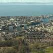
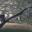
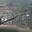
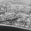
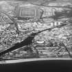
The main features of the harbour of today can be summarised as follows. On the right [N] bank, North Harbour Street runs, with wharfage its outer side, for some 770yds [704m] to end on the entrance-channel of a large wet dock [NS32SW 123.07], part of its face being slightly set back for 100yds [91.5m] to face a shallow recess. The entrance-channel of the dock narrows gradually from a width of some 77yds [70.4m] at its opening and contains a pair of lateral projections adaptable for holding dockgates, although no gates in fact exist. The frontage of this area is called the North Quay [NS32SW 123.14], and is revetted in masonry. From its W corner, there projects the ruin of a wooden jetty, known locally as the Monkey Pier; this may, or may not, have been the structure recorded in 1827 as existing at Newton-upon-Ayr, the whole of this right bank being then outwith the Royal Burgh.
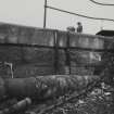
The left [S] bank of the river, which carries the S pier, has been similarly improved with wharfage throughout its length. Its upper section, some 750yds [686m] long, begins at the 'Ratton-key' mentioned in Burns' poem 'The Brigs of Ayr', and ends at the remains of the Compass Pier [NS32SW 123.05]. This is now ruined, but possesses some interest regarding building methods that is given by its surviving terminal fragment. This shows the structure to have been a stout masonry jetty, with an ashlar skin on both faces and a core of large rubble. The N face, fronting on the harbour, is supported by pairs of heavy, vertical timbers. The S face gave onto an inlet about 60yds [54.9m] long, from which opened a long, narrow dock [NS32SW 123.11] furnished with shipbuilding slipways. This dock lies close to an alignment with the seashore S of the river-mouth. The Compass Pier was thus exposed to tidal action on both its faces, and it was this that led to the weakening of the whole structure. Its upper parts, except for the terminal block, were accordingly removed in order to reduce its weight, at the same time as the existing slip for small boats was arranged on its inner side. It is interesting further to find among the pier's ruins two of its plain iron bollards, sunk to a great depth to obtain a form foundation. These measured only 2ft [0.61m] above ground, but 7ft [2.1m] above it. In and beyond the inlet there stand remains of what seem to have been timber jetties or wharfage.
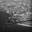
Beyond the entrance to the dock, which is about 60yds [54.9m] wide, the S Pier [NS32SW 123.13] continues in WNW direction to the lighthouse [NS32SW 123.06] marking the S side of the harbour's entrance. This opens westwards, and is 90yds [82.3m] from the end of the N breakwater [NS32SW 123.12], which carries another lighthouse [NS32SW 123.09]. That breakwater, a masonry structure 110yds [100.6m] long which is nearly awash at high tide, occupies a ridge of tidal rocks connected, at its other end, with an eastward-going belt of shingle, and this last completes the closing-off of the harbour-area to northwards. The S Pier has evidently seen considerable additions and reconstruction. Its landward portion carries a protective sea-wall, and the angle between its root and the shore to the S is strongly supported on a widely-flared base. This latter feature extends as far to the S as the coastguard lookout [NS32SW 948], which overlooks a battery-platform bearing four rectangles of pavement, representing positions for guns.
Many of the improvements now seen were evidently made before 1837, partly no doubt on the strength of profits made in the Napoleonic Wars, but at that date the right-bank works were not yet complete. An interesting pointer to bygone conditions seems to be provided by a short, angular lane, the Boat Vennel, which gave access from the mediaeval burgh to the river. Slezer's drawing of 1693 shows the rover-bank in front of the Citadel [NS32SW 337] as unimproved beach. The Citadel had no specific function in respect of the harbour.
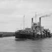
By 1837, the principal export was coal, of which 50,000 to 60,000 tons went out annually, most of it to Ireland. Nearly all of it was shipped from the right-bank installations in Newton upon Ayr. Other exports were cordage, leather, textiles, oatmeal, wheat and wheat flour, the main imports from foreign sources being hemp, tallow, iron, tar, pitch and American tobacco. In the 1830's, about 1100 sail of coastal shipping left Ayr annually and about 300 arrived, while foreign trade accounted for some 14 to 17 departures and 16 arrivals. Eighteen ships were owned in the town in 1837. Regular packets and trading craft ran to Liverpool, Dublin and Glasgow, and to Glasgow a daily steamer. Formerly, Ayr had been the chief fishing-station for the whole Firth, but its share in this trade had lately decreased as different arrangements were made in other areas for the transport of fish to market.
(Location cited as NS 33 22). Newton-upon-Ayr: the part of the modern town of Ayr [NS32SW 108] that lies N of the river was originally a separate community, Newton upon Ayr, and distinct from the Royal Burgh. It was described in 1792 as a 'seaport town' with an extensive herring-fishery. Engaged in this, in 1837, there were descendants of some fishermen from Pitsligo in Buchan, who had come to know about the fishery in the 1770's when serving in these waters as pressed men in a naval vessel.
These harbour works are considered as part of those of Ayr.
A Graham 1984.
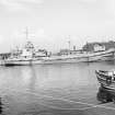
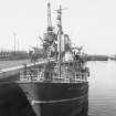
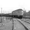
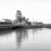
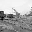
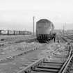
This harbour remains in regular use by commercial traffic, no recreational vessels being apparent. New warehouses and dedicated quays for coal, scrap iron and timber (logs) are in use around the N dock [NS32SW 123.07] and along the N bank of the river to the E of it (North Quay: NS32SW 123.14). These facilities are served by a branch railway, which enters from the N. The harbour and N dock entrances (at NS 3282 2274 and NS 3317 2266 respectively) are surprisingly narrow.
The two breakwater lights (NS32SW 123.06 and NS32SW 123.09) and two leading lights (NS32SW 123.02 and NS32SW 123.04) are apparent, as is the harbour office (NS32SW 123.01). There is a tall brick-built observation post (NS32SW 948) just S of the inner end of the S breakwater.
The S (Slip) dock (NS32SW 123.11) is disused, and has been incorporated (as a landscaping feature) into a recently-built residential development.
Visited by RCAHMS (RJCM), 29 May 2006.


