
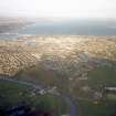
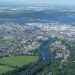
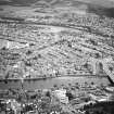
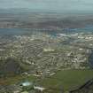
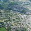
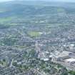
Inverness, Montague Row, Inverness High School


School (Period Unassigned)
Site Name Inverness, Montague Row, Inverness High School
Classification School (Period Unassigned)
Alternative Name(s) New Advanced Division School
Canmore ID 98557
Site Number NH64NE 809
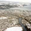
NGR NH 65926 45045
NGR Description Centred NH 65926 45045
Datum OSGB36 - NGR
Permalink http://canmore.org.uk/site/98557


- Council Highland
- Parish Inverness And Bona
- Former Region Highland
- Former District Inverness
- Former County Inverness-shire
NH64NE 809 centred 65926 45045
Incorporates information from cancelled site NH64SE 135.

