Castle Sween
Castle (Medieval)
Site Name Castle Sween
Classification Castle (Medieval)
Alternative Name(s) Macmillan's Tower; Loch Sween
Canmore ID 39028
Site Number NR77NW 1
NGR NR 71235 78829
Datum OSGB36 - NGR
Permalink http://canmore.org.uk/site/39028
First 100 images shown. See the Collections panel (below) for a link to all digital images.
- Council Argyll And Bute
- Parish North Knapdale
- Former Region Strathclyde
- Former District Argyll And Bute
- Former County Argyll
NR77NW 1.00 71235 78829
NR77NW 1.01 7123 7883 Carved Stone Ball; Flint Arrowhead
NR77NW 1.02 7123 7882 Platforms; Kilns; Building
For industrial remains (including kilns and platforms) towards SE corner of curtain-wall enclosure, see NR77NW 1.02.
(NR 7123 7883) Castle Sween (NR)
Macmillan's Tower (NR) Well (NR)
OS 6" map, Argyllshire, 2nd ed., (1924)
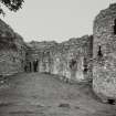
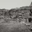
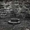
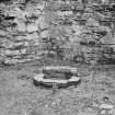
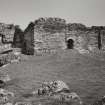
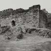
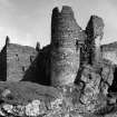
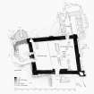
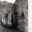
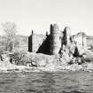
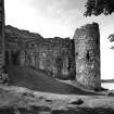
Castle Sween, now ruinous, was probably built in the mid-12th century (S Piggott and W D Simpson 1970). The main structure, a quadrangular enclosing wall, 6'-7' thick, measuring 84' x 70' over all, against the inner face of which three main ranges of timber buildings were originally disposed round a small court, is Norman in appearance. The annexe to the W and its round tower - Macmillan's Tower - were probably added in the early 14th century, while the rectangular keep was probably added to the NE corner in the 16th century. There is also a well, doubtless original, in the NE angle of the courtyard.
The castle was beseiged by Robert the Bruce, and was finally destroyed by Sir Alexander Macdonald in 1647.
S Piggott and W D Simpson 1970; W D Simpson 1967; J G Dunbar 1966.
The castle is as described and planned.
Visited by OS (DWR) 6 June 1973
No change to the report of OS (DWR).
Surveyed at 1/10,000.
Visited by OS (BS) 25 January 1977
This site has only been partially upgraded for SCRAN. For full details, please consult the Architecture Catalogues for Argyll and Bute District.
March 1998
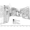
Measured Survey (August 1982)
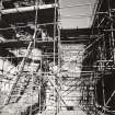
RCAHMS surveyed Castle Sween in August 1982 producing sections at a scale of 1:100. The sections were redrawn in ink and published at a scale of 1:250 (RCAHMS 1992, 248).
Measured Survey (June 1982)
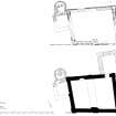
RCAHMS surveyed Castle Sween in June 1982 producing ground-, first-floor and parapet-plans at a scale of 1:100. The plans were redrawn in ink and published at a scale of 1:250 (RCAHMS 1992, 246B-247).
Publication Account (1985)
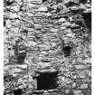
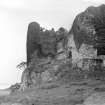
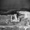
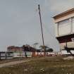
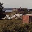
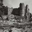
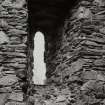
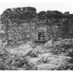
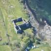
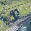
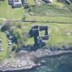
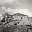
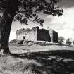
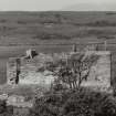
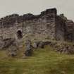
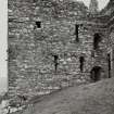
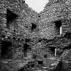
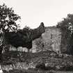
The imposing castle stands on a rocky ridge close to the shore of Loch Sween within the policies of the Castle Sween Caravan Park. The castle is remarkable both for the state of preservation of the main walls and for the sophistication of the original construction. On plan it is a quadrangular castle of enclosure with projecting buttresses at the angles and at the centre of each of the walls; although primarily for defensive strength, the buttresses also give the castle a more pleasing exterior than many of the bare boxes of the west highland castles of enceinte. The gateway is in the south wall where the wall has been made thicker, not only to provide additional defence at door level, but also to make possible a platform above the door. Within the interior of this late 12th century castle, timber ranges round the wall would have provided accommodation, and the lines of support for internal floors and roofmg are clearly visible. There is a well in the north-east angle. The MacMillan Tower outside the north-east angle is of later, probably 15th century date; the basement floor contains kitchen and bakehouse oven with on upper floors, the hall, the lord's apartment and bedrooms. The unadorned narrow windows with pointed arches and simple inner splays are almost the only surviving architectural features of the tower. The round tower at the northwest angle, which appears to be of similar date, contained a prison and has a complex drain arrangement
Little is known of the castle's history but it was probably besieged by Robert Bruce during his campaigns in the west Some impression of the more civilised aspects oflife in the castle is provided by the description of the meeting between John, Lord of the Isles and Earl Douglas in 1483, probably at Castle Sween; the former received 'right great gifts' of clothes,wine, silk, English cloth and silver, and offered Earl Douglas a present of mantles. The castle became ruinous after attack by Colkitto in 1647.
Information from ‘Exploring Scotland’s Heritage: Argyll and the Western Isles’, (1985).
Excavation (30 May 1989 - 6 October 1989)
Two small-scale excavations within the E half of the courtyard of this castle revealed a sequence of domestic and service ranges, culminating in an elaborate industrial complex, all of which broadly echoed the succession of families associated with the site. The original simple enclosure castle as occupied by the MacSweens until the mid 13th century may have featured some form of tower-like structure in the NE corner of the enclosure. The site was then extensively remodelled under the Stewart Earls of Menteith, who built two towers outside the W wall of the primary enclosure, and a stone-built N range inside (c.1262 to 1362). When the site was later occupied by the MacNeills of Gigha on behalf of the Lords of the Isles, a substantial E range with first floor hall, was built within the courtyard, to compliment the new NE or 'Macmillans Tower' during the 15th century. Finally, with the discovery of a series of kiln-like structures and ancillary sheds and compounds, it was evident that up to the end of its active life, under the Earls of Argyll c.1650, the E courtyard was largely cleared of major buildings and the area given over to industrial usage, probably metal working.
G Ewart 1989a
Sponsor: SDD Historic Buildings and Monuments
Kirkdale Archaeology
Field Visit (May 1989)
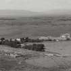
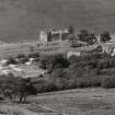
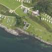
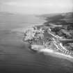
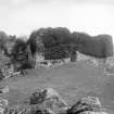
The castle is situated on the N summit of a low rocky ridge on the E shore of Loch Sween, about 3km from the mouth of the loch. A level valley-bottom some 150m in width separates it from rising ground to the E, and it commands an extensive prospect of Loch Sween itself and, to the W, Jura.
Immediately NW of the castle a small inlet has been cleared of rocks to provide a boat-landing, while 160m to the SSW there is a gently shelving sandy beach. A more secure anchorage was available in the inner recesses of Loch Sween, in the Tayvallich area.
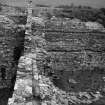
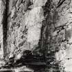
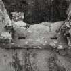
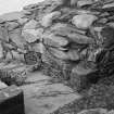
The rocks of the ridge on which the castle stands are bedded almost vertically, forming a series of rocky bosses interspersed with turf. Within the building, outcropping is visible in the E part of the courtyard and in the NE and W towers, while in the curtain-walls occasional tongues of rock project above the level of the foundations, which for the most part accommodate themselves to the irregularities of the underlying surface. Whereas the original quadrangular enclosure is founded on a fairly level platform, except at the SW angle, the addition of the NE tower required a considerable amount of underbuilding, and the NW round tower extends 7m below the level of the courtyard. The enlargement of the W range involved building upon a shattered mass of rock with a rounded upper surface, penetrated on the W by a gully and underlain at the SW angle by a small cave. Underpinning was provided by roofing the249 gully with three courses of mortared chlorite-schist voussoirs carrying the footing-course of the W wall of the range. The E wall of the cave has been lined with masonry arranged in ‘herring-bone' fashion. To arrest continued movement of the rock in this area, a concrete support-pier was inserted in the cave in 1983.
About 11m S of the S angle of the castle, a few courses of drystone masonry fill a gully in an otherwise uniform E facing rock-face some 3m in average height. About 10m further S the outcrop is interrupted by a trough, 7m in width, which may have been enlarged by quarrying and probably formed the main landward approach. Several large tumbled boulders at the S edge of this trough may have fallen from a wall above, but there are no other identifiable remains of outer defences.
SUMMARY
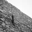
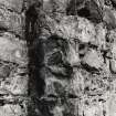
The earliest part of the castle, a quadrangular enclosure, was probably begun by Suibhne, ancestor of the MacSween family, about the end of the 12th century. Some recent scholars, following Simpson, have interpreted this as the lower part of an intended keep (en.1), but its irregular layout, comparatively limited wall-thickness and absence of windows all militate against this theory (en.2). It is probable that the later arrangement of a small courtyard flanked by ranges was planned from the first, but the upper parts of the curtainwalls, containing chases for the roofs of these buildings, are constructed of different materials and belong to a second phase, probably in the early 13th century. This work no doubt followed the original intention in height and layout, but that some changes were made is demonstrated by the blocking of a garderobe-chute at the SE angle. Probably at the same period, a small single-storeyed wing with attached garderobe was built on a terrace outside the W curtain-wall and at right angles to it. The earliest identifiable range to be completed in the courtyard was attached to the E half of the N curtainwall, but since the masonry of the surviving E gable differs from that of the early 13th-century wall-head on which it was set it cannot be closely dated.
During the second half of the 13th century the MacSweens were replaced as Lords of Knapdale by the Stewart Earls of Menteith, and although an expedition about 1300 by John MacSween to regain the castle is the subject of one of the earliest Scottish Gaelic poems, it remained in the hands of the Menteith family for at least a century. At about the beginning of the 14th century, when Sir John Menteith played an important role as the owner or constable of several castles in the Clyde estuary, the small W wing was incorporated into a three-storeyed tower with an attached circular garderobe tower of impressive height, lit by crosslet-slits. There construction of a mural garderobe at the NW angle of the courtyard probably belongs to the same period.
The final addition to the courtyard was the rectangular tower added to the NE angle, which contained a kitchen on the ground floor and a spacious chamber above. Although this has frequently been ascribed to the 13th century, partly because of two lancet window-heads which may be in re-use, it more probably belongs to the 15th century, when the MacNeill family of Gigha or their MacMillan kinsmen were constables on behalf of the MacDonald Lords of the Isles. The tower was associated with a two- or three-storeyed range filling the E part of the courtyard, which presumably contained the great hall, and the continuity of the wall-walk was interrupted by the N gable of this range. A parallel W range, leaving a narrow central corridor, was probably built about the same time.
From the late 15th century the keepership of the castle was held by the Campbell Earls of Argyll, but the only building works that can be assigned to this period were the intended insertion of vaults in the kitchen-tower and E range, perhaps in the late 16th century. The castle was garrisoned in the1640s, but thereafter became ruinous. It was transferred to the guardianship of the Office of Works, now the Scottish Development Department, in 1933. The present survey was carried out in advance of a major consolidation of the masonry in 1985-8, but has been revised to take account of information revealed by that work and by the excavation of part of the courtyard in 1989 (en.3*).
RCAHMS 1992, visited May 1989
[A full architectural description and historical note is provided in RCAHMS 1992, 245-259]
Mortar Analysis
NR 71235 78829 A programme of landscape, buildings and
materials analysis is being carried out at Castle Sween within
the framework of this project. Buildings analysis suggested
that Castle Sween had been constructed with a variety of
phase-specific compositionally-contrasting wood-fired lime
mortars, including both limestone-lime and shell-lime bound
materials. In situ characterisation of these materials across
the site generally supported the phasing narrative previously
suggested by the RCAHMS, where those interpretations were
based on direct stratigraphic relationships. Where those
relationships are more indirect, however, then interpretations
are more problematic. A comparative approach to on-site
materials analysis demonstrated that the secondary postern
gate in the W wall was not coeval with the NW Tower, and
suggested that the secondary buttressing against the NE
tower was likely to be contemporary with the secondary
vaulting within that same structure.
A materials sampling programme was subsequently
instigated at Castle Sween, to allow lab-based investigation
of these constructional materials. The sample assemblage
DISCOVERY AND EXCAVATION IN SCOTLAND 49
ARGYLL AND BUTE
ultimately included 10 mortar fragments, 1 relict limestone
clast, 1 shell fragment, 1 sandstone fragment and 72 relict
fuel inclusions.
Materials analysis of the Castle Sween assemblage
included microscopic thick and thin section analysis of the
mortar samples. These analyses both supported and refined
previous provenance interpretations, demonstrating that all
limestone-lime mortars on the site had been manufactured
from a meta-limestone consistent with very local outcrops,
while the shell-lime mortars displayed evidence of both
C. Edule and O. Edulis lime sources. Temper grades and
fuel taxonomy profiles also varied with constructional
phase/chronology, and a typology of 5–6 phase-specific
compositionally-contrasting mortar types ultimately
emerged from the study.
Archive: NRHE (intended)
Funder: University of Stirling and Historic Environment Scotland
Mark Thacker – University of Stirling
(Source: DES, Volume 19)


