
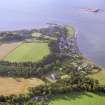
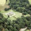
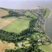
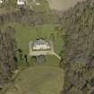
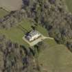
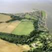
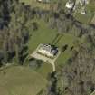
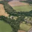
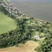
Cromarty House


Country House (Period Unassigned)
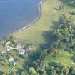
Site Name Cromarty House
Classification Country House (Period Unassigned)
Alternative Name(s) Cromarty House Policies
Canmore ID 105508
Site Number NH76NE 64
NGR NH 79295 67018
Datum OSGB36 - NGR
Permalink http://canmore.org.uk/site/105508


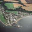


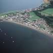


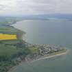


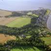
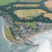


- Council Highland
- Parish Cromarty
- Former Region Highland
- Former District Ross And Cromarty
- Former County Ross And Cromarty
NH76NE 64.00 79295 67018
Cromarty House [NAT]
OS (GIS) MasterMap, May 2010.
NH76NE 64.01 NH 7941 6708 graveyard
NH76NE 64.02 NH 793 670 ice house
NH76NE 64.03 NH 78667 66905 lodge
See also
NH76NE 16 NH 79346 67036 Servants Tunnel
NH76NE 44 NH 79385 66857 Stables
REFERENCE: NATIONAL LIBRARY
"Nattes Drawings" Oct 3rd, Vol 1, No 9 -1 drawing of house
(Undated) information in NMRS.
Photographic Survey (1953)
Photographic survey of Cromarty House, Ross and Cromarty, by the National Buildings Record Scottish Council in 1953.
Photographic Survey (October 1963)
Photographic survey of Cromarty House, Ross and Cromarty, by the Scottish National Buildings Record/Ministry of Works in October 1963.

