Pricing Change
New pricing for orders of material from this site will come into place shortly. Charges for supply of digital images, digitisation on demand, prints and licensing will be altered.
Arbroath Abbey
Abbey (12th Century)
Site Name Arbroath Abbey
Classification Abbey (12th Century)
Alternative Name(s) Aberbrothock Abbey; Arbroath Abbey And Associated Buildings, Including The Abbot's House
Canmore ID 35546
Site Number NO64SW 18
NGR NO 64311 41334
Datum OSGB36 - NGR
Permalink http://canmore.org.uk/site/35546
First 100 images shown. See the Collections panel (below) for a link to all digital images.
- Council Angus
- Parish Arbroath And St Vigeans
- Former Region Tayside
- Former District Angus
- Former County Angus
NO64SW 18.00 64311 41334
NO64SW 18.01 64316 41393 Burial Ground
NO64SW 18.02 64277 41297 Conventual Building
NO64SW 18.03 64236 41299 Pend
NO64SW 18.04 64210 41286 Regality Tower
NO64SW 18.05 64276 41275 Abbot's House
(NO 6430 4133) Abbey (NR) (remains of)
(NO 6423 4132) Abbey Wall (NR) (course of)
OS 1:10000 map (1975)
See also NO64SW 19.
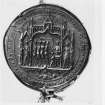
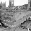
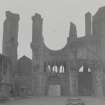
The remains of Arbroath Abbey, Tironensian, founded 1178 and dedicated to St Thomas of Canterbury.
S Cruden 1954
The abbey wall is said to have been of great height and to have extended 150' on the east and west, 760' on the north and 480' on the south. There were great towers at the angles (the NW is still extant) and entrance gateways on the north (still extant) and at the SE angle.
D MacGibbon and T Ross 1896
The ruins remain as described. Where the walls have been removed either the foundation has been exposed by excavation or the course is indicated by kerb stones.
Visited by OS (JLD) 16 June 1958
Photographed by RCAHMS in 1980.
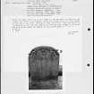
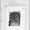
(Undated) information in NMRS record cards.
EXTERNAL REFERENCE:
Scottish Record Office:
GD1/138/1 Case for the King's Council respecting the ruins. 1739
E342/25 & 36 Depositions concerning measurement of ground within precinct. July 21 1752
Letters (2 on 1 sheet) concerning allowance to Charles Cramond, Sexton, for looking after ruins.
April 10-18 1823
National Library of Scotland:
MSS.3294-5 Journey of James Baile in 1787
Pennants Tours in Scotland
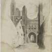
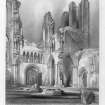
Old prints of Abbots house
Online Gallery (1306 - 1329)
The year 2014 sees the 700th anniversary of the Battle of Bannockburn, in which the army of Robert I of Scotland defeated that of Edward II of England. The battle marked a major turning point in the long, drawn-out struggle of the Wars of Independence.
The Wars have had a lasting influence upon all the nations of the United Kingdom and upon the national story. Each age has seen fit to commemorate the events in its own way: through the perpetuation of the genuine historical associations of buildings and places and also through the endowment of others with improbable or fanciful traditions. Where past generations allowed its historic buildings to decay and disappear, later generations began to value and actively preserve these for their associations. Where an event lacked a tangible reminder, as at Kinghorn where Alexander III was killed in a riding accident, a commemorative monument would be erected to act as a focus. The Wars of Independence predate the fashion for accurate portraiture: the weathered, generic military effigy of Sir James Douglas is one of the few to survive in Scotland. Later centuries saw a need and supplied it by a crowd of images of its historic heroes, William Wallace and Robert the Bruce, each depicted according to contemporary taste and imagination. The opening of the new heritage centre at Bannockburn takes this into a new dimension, through the use of three-dimensional, digital technology.
RCAHMS Collections hold many images of these buildings and locations from battlefields, castles and churches, to the many commemorative monuments erected in later years. This gallery highlights a selection of these, including antiquarian sketches, photographic and drawn surveys, and architectural designs.
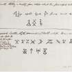
Antiquarian Observation (1857 - 1861)
Mason's marks from Scottish churches, abbeys and castles recorded between 1857 and 1861 on 29 drawings in the Society of Antiquaries of Scotland Collection.
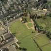
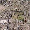
Aerial Photography (September 1970)
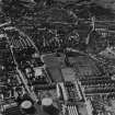
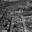
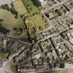
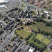
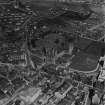
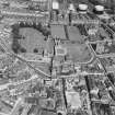
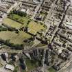
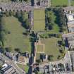
Oblique aerial photographs of Arbroath Abbey, Angus, taken by John Dewar in September 1970.
Publication Account (1982)
The foundation of the Abbey dedicated to St. Thomas Martyr in the second half of the twelfth century gave Arbroath burgh its identity. William the Lion, founder and benefactor of the Abbey, granted the monastic establishment a total of twenty-four parish churches, including Inverness, Fyvie, Tarves, Abernethy and Haltwhistle in the north of England (Arb.Lit., 1843, i, xvi). Tironensian Monks were brought from Kelso but that monastery exercised no authority over Arbroath (Arb. Lib.,1843, i, xxii). The church was dedicated in 1233 and is said to have suffered damage from English ships in 1350 and from lightning in 1380 (Cowan, 1976, 66, 67). In 1517 the Abbey passed into lay commendatorship (Cowan, 1976, 67) and in 1600 a charter was issued in favour of the Marquis of Hamilton confirming the dissolution of the monastery and erecting its vast possessions into a temporal lordship (Mackie, 1954, 15).
From the period of the Reformation and down to the eighteenth century, the Abbey buildings suffered greatly through the effects of quarrying and nature. In 1580 the magistrates applied to the commendator of the Abbey for a grant of stones and other materials for the building of a new parish church. The necessary material was granted to the burgesses from the Abbey's dormitory (Hay, 1876, 91). In the reign of George I the town council acquired land within the precinct wall to the south of the abbey church and allocated building plots. This led to the destruction of both the greater part of the precinct wall and the final obliteration of the remaining conventual buildings (MacKie, 1954, 16). Part of the Abbey walls was still visible in 1782 and described as twenty feet (6.10m) high (Douglas, 1826, 46). The Abbey wall is said to have extended 150 feet (45•72m) on the east and west, 760 feet (231?65m) on the north and 450 feet (137•16m) on the south (MacGibbon and Ross, 1896, ii, 45). The two western towers blew down in two separate storms, one in 1739, the other in 1772 (Anon, 1799, 60). Douglas wrote that 'the church and remaining ruins are on an eminence on the west of the town and in spite of the depredations of time and enthusiasts still have a majestically grand appearance' (1826, 46).
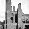
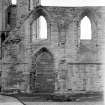
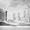
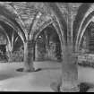
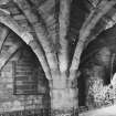
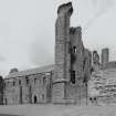
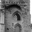
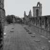
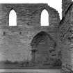
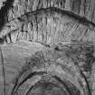
On plan the Abbey church is cruciform. It had an aisled nave of nine bays and an aisled choir of three bays; The transepts each had two eastern chapels and a tower rose over the crossing. The southern transept with its famous 'round O' window is still largely complete, although the foundations of the northern transept have suffered due to the encroaching cemetery. Part of one of the western towers survives, as does the latter day 'Abbot's House'. The cloisters to the south which have recently been excavated are of no great size (MacKie, 1954, 20).
Information from ‘Historic Arbroath: The Archaeological Implications of Development’, (1982).
Publication Account (1987)
The Abbey of Arbroath was founded by King William the Lion in 1178 and dedicated to St Thomas Becket of Canterbury. It was a Tironensian house established by monks from Kelso but independent of the parent monastery from the outset William heaped endowments on the new foundation: the tithes and patronage of twenty-four parish churches; a toft of land in each of the Scottish Royal burghs; lands, fisheries, ferries and salt-pans in various parts of Scotland; Arbroath and the whole region about it with the right to establish a burgh, the burgesses to be toll-free in any part of Scotland, to hold a market every Saturday, to build a harbour and to exact customs. This was augmented by gifts of lands, fisheries, ferries and churches from other Scottish nobles, particularly the Earl of Angus. Even King John of England granted a charter allowing the monks of Arbroath to trade, toll-free, in any part of England except the City of London. The new abbey buildings reflected this wealth and William obviously intended it to become the principal monastery in Scotland. On his death at Stirling on 4 December 1214, King William's body was carried to Arbroath to be buried at the high altar of the then incomplete church. Royal patronage continued and it was at Arbroath that the Scottish nobles met on 6 April 1320 to sign the Scottish Declaration of Independence which was sent to Pope John XXII in Avignon.
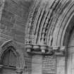
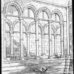
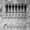
After the reformation the abbey suffered from neglect and vandalism, being used as a quarry to obtain stones for the building of much of the older parts of Arbroath. The most interesting portions to have survived are: the south transept with its bold but simple fenestration; the west front, massively proportioned and containing an arcaded gallery over the deeply recessed west doorway (a similar arrangement formerly existed at St Andrews Cathedral (no. 64)); the Abbot's House (no. 41), now containing a small museum; and the Gatehouse range.
Information from ‘Exploring Scotland’s Heritage: Fife and Tayside’, (1987).
Excavation (2000)
NO 642 413 Excavations in advance of the new Arbroath Abbey Visitor Centre uncovered part of the original wall around the medieval abbey, together with a fragment of a previously unknown gateway and traces of a metalled roadway or track into the abbey precinct itself. The wall is some 3-4m out from the present wall around the abbey, and lying between the two walls were four human burials indicating that the monastic burial ground may have been in the excavated area, so the remains found may be those of medieval monks.
The excavations also unearthed a large number of carved stones, some with mason's marks, dumps of stone chippings and metalworking debris which suggest that this same area was also used by craftsmen working on the abbey. Other finds include coins, window glass, buckles, pottery and animal bone.
A watching brief is due to take place on the new construction.
Sponsor: Angus Council.
R Cachart 2000
Watching Brief (31 May 2011)
NO 6429 4129 and NO 6430 Two trenches were excavated on 31 May 2011 to allow the installation of information signs at Arbroath Abbey. The deposits mostly consisted of levelling material; however, a number of possible structural remains were noted in the S trench (NO 6430 4124). These remains were undisturbed during the excavation.
Archive: RCAHMS (intended)
Funder: Historic Scotland
Kirkdale Archaeology, 2011
Information also reported in Oasis (kirkdale1-122349) 26 July 2012
Project (13 March 2018 - 21 March 2018)
NO 64311 41334 A geophysical survey over 1.4ha was undertaken, 13–21 March 2018, within the grounds of Arbroath Abbey, and over the adjacent Abbey Green. Gradiometer, resistance and ground penetrating radar (GPR) survey were undertaken within all available/suitable areas of Arbroath Abbey. Gradiometer and resistance survey were also undertaken within Abbey Green.
On the whole the background level of magnetic response across the site is perhaps lower than one might expect on such a site. This is perhaps an indicator of how thoroughly the site was ‘cleared’ in the 1800s. The resistance and the GPR data are dominated by responses
from the surface markers used to illustrate the original layout of the Abbey.
The gradiometer data is dominated by areas of magnetic disturbance generated by ferrous material within, and adjacent to, the site. Several modern services were also noted. Within the resistance and GPR data several coherent anomalies have been detected which suggest elements of structural remains or surfaces surviving in situ. However, later occupation within the area and exaction and consolidation
of the site makes interpretation cautious. Indeed, anomalies thought to be associated with later occupation within the area have been detected. Numerous drains have also been identified.
Archive: Rose Geophysical Consultants
Funder: CFA Archaeology on behalf of HES
Susan Ovenden – Rose Geophysical Consultants
(Source: DES, Volume 19)
Resistivity (13 March 2018 - 21 March 2018)
NO 64311 41334 Resistivity survey.
Archive: Rose Geophysical Consultants
Funder: CFA Archaeology on behalf of HES
Susan Ovenden – Rose Geophysical Consultants
(Source: DES, Volume 19)
Magnetometry (13 March 2018 - 21 March 2018)
NO 64311 41334 Magnetometry survey.
Archive: Rose Geophysical Consultants
Funder: CFA Archaeology on behalf of HES
Susan Ovenden – Rose Geophysical Consultants
(Source: DES, Volume 19)
Ground Penetrating Radar (13 March 2018 - 21 March 2018)
NO 64311 41334 Ground penetrating radar survey.
Archive: Rose Geophysical Consultants
Funder: CFA Archaeology on behalf of HES
Susan Ovenden – Rose Geophysical Consultants
(Source: DES, Volume 19)
Archaeological Evaluation (3 February 2020 - 20 February 2020)
Twelve trenches were excavated by CFA Archaeology within the grounds of
Arbroath Abbey as part of the Minor Archaeological Services Call Off Contract between 3rd and 20th February 2020, to test a range of geophysical anomalies and to try to answer research questions on the extent of 19th/20th century clearance and the survival and sensitivities of any archaeological remains within the grounds.
It is apparent that archaeological structures and deposits do survive
in this area, particularly in Trenches 1, 3, 5, 6, 7, 9 and 12: Stone walls were recorded in Trenches 1 and 7; A linear clay feature with a groove was recorded in Trench 3; Negative cut features were recorded at the base of Trenches 3 and 5; Two concreted, flat-topped sandstone structures were recorded in Trench 6. Their purpose and function is unknown but it is almost certain that they were contemporary and functioned together; Possibly in situ medieval deposits were recorded in Trench 8; The top of a possible vaulted flue was recorded in Trench 9; A metalled surface was recorded in Trench 12.
Several trenches did not contain any archaeological features: these
are Trenches 2, 4 and 10. The presence of live tree roots did not
allow the full evaluation of Trench 11.
Information from: Stuart Mitchell and Oliver Rusk (CFA Archaeology) August 2020
OASIS ID: cfaarcha1-386049
Watching Brief (1 March 2022)
NO 6433 4138 A watching brief was carried out during the groundworks associated with the construction of a temporary scriptorium within the grounds of Arbroath Abbey, Angus. No features or finds of archaeological significance were observed.
Information from Dave McNicol, CFA Archaeology Ltd., March 2022
OASIS ID: cfaarcha1-436074


