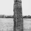
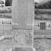
Forres, Sueno's Stone
Cross Slab (Early Medieval), Pit (Period Unassigned), Post Hole(S) (Period Unassigned)
Site Name Forres, Sueno's Stone
Classification Cross Slab (Early Medieval), Pit (Period Unassigned), Post Hole(S) (Period Unassigned)
Alternative Name(s) Sueno's Pillar
Canmore ID 15785
Site Number NJ05NW 1
NGR NJ 04655 59533
Datum OSGB36 - NGR
Permalink http://canmore.org.uk/site/15785
First 100 images shown. See the Collections panel (below) for a link to all digital images.
- Council Moray
- Parish Rafford
- Former Region Grampian
- Former District Moray
- Former County Morayshire
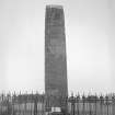
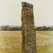
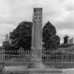
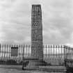
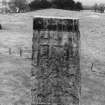
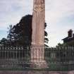
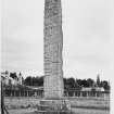
Forres 1, Sueno’s Stone, Moray, cross-slab
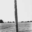
Measurements: H 6.50m above socket stone, W 1.14m, D 0.36m
Stone type: red sandstone
Place of discovery: NJ 04655 59533
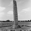
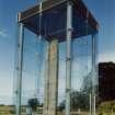
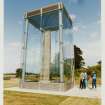
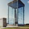
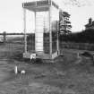
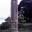
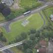
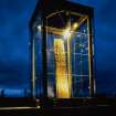
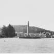
Present location: within a glass shelter in a field off Findhorn Road, Forres.
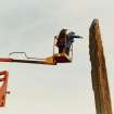
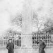
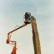
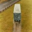
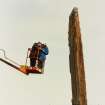
Evidence for discovery: the first reference to the stone is possibly Pont’s map of about 1590, which shows a pair of pillars north of Forres (McCullagh 1995). The socketed base appears to have been cladded with dressed stones to form a three-stepped circular plinth early in the eighteenth century, and a protective metal cap was added sometime before 1890. The stone was covered by a glass pavilion in 1991.
Present condition: very weathered, particularly at the top, with edge damage.
Description
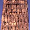
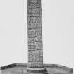
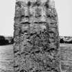
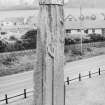
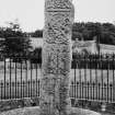
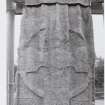
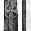
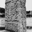
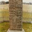
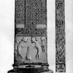
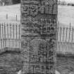
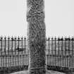
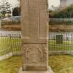
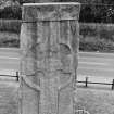
This tall rectangular slab tapers very slightly towards the top, and it is carved in relief on all four vertical faces. Face A is bordered by a high roll moulding, within which is a ringed cross on a long shaft, which rises from a rectangular base in the form of a horizontal bar stretching across the width of the stone. The arms of the cross have squared terminals and rounded armpits. Both the cross and its background are filled with ring-knotted interlace designs. Below the base of the cross is a panel with two tall figures in profile bending over a seated frontal figure, with a small figure tucked into each of the top corners.
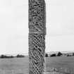
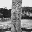
Face B is divided into two panels: vine-scroll inhabited by small striding men at the top, and uninhabited vine stems without leaves or scrolls below.
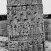
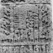
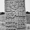
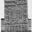
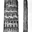
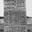
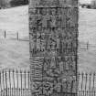
Face C is entirely filled with the visual narrative of a great battle. The top panel depicts a central mounted warrior with two rows of three horsemen below, all riding towards the left. The central panel contains five rows of upright figures, both frontal and profile, along with decapitated horizontal bodies, heads and a conical object, mounted warriors and foot soldiers. The third panel has an arch over decapitated bodies and pairs of fighting foot soldiers, and there is another row of figures in the lowest panel of which only part can be seen.
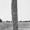
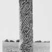
Narrow face D is divided into four panels, at least three of which contain zoomorphic interlace and figures.
Date range: later ninth or tenth century.
Primary references: Gordon 1726, 158; ECMS pt 3, 149-51; McCullagh 1995; Henderson & Henderson 2004, 55-7, 135-6 ff.
Desk-based information compiled by A Ritchie 2018.
Field Visit (18 September 1963)
Generally as described above. A MOW notice on the site gives the following information "SUENO'S STONE- This great monolith was worked by the Picts in the 9th or 10th centuries AD. Its name only recalls a
later legendary association. On one side that facing West is a ringed crosshead above long panels of interlaced ornament characteristic of Dark Age art. The sides bear more linear art a vine scroll and beasts. On the other side is an immense battle scene with ranks of horse and foot soldiers, many armed with swords spears and shields. There are rows of decapitated bodies and heaps of heads about a bell-like object which could be a pictish broch. This outstanding example might be a cenotaph".
Visited by OS (RDL) 18 September 1963.
Desk Based Assessment (1963)
NJ05NW 1 04655 59533.
(NJ 0465 5953) Sueno's Stone (NR)
OS 6" map 1938.
'Its connection with the name Sueno, is no older than Hector Boece ...'
W Skene 1880.
There is a local tradition that the Runic obelisk, Sueno's Stone or (since its connection with Sueno, and 11th c. king of Denmark, is not proved) the Forres Pillar was found during the reclamation of the field. When found it was lying flat, and buried, and was raised in its present position. The preservation of the sculpture and the rate of weathering tend to support this tradition. The circular steps at the base are modern.
R Douglas 1934.
One of the most remarkable early sculptured monuments in Scotland; 20 ft high. On one side a tall cross accompanied by once elaborate figure sculpture at the base; on the other sculptured groups of figures of warriors, etc., disposed as though depicting hunting and warlike scenes.
Information from OS.
Sources: V G Childe and W G Simpson 1954; J R Allen and J Anderson 1903.
Publication Account (1986)
This, the tallest and most complex piece of early medieval sculpture in Scotland, most probably commemorates a heroic battle campaign, possibly against the Norse settlers of Orkney, by the men of Moray. The extensive province of Moray, from the 8th to the 12th century, retained considerable independence within the new kingdom. The stone has no connection with Swein Forkbeard who harried London in 994 and became King of Denmark (d 1014); it was given its misconceived name in 1726, probably shortly after it had been discovered, lying buried. Standing over 6.5m high, this 7.6 ton slab of sandstone was probably brought from the coast near Covesea, 15km to the north-east. In many ways it is the culmination of several centuries of Pictish stone carving, while the organised narrative of its eastern face looks also to later complex tapestry stories, such as Bayeux.
The western face bears a relief carving of a great ringheaded cross whose shaft, rising from a horizontal base, is filled with interlace spiral knotwork. Below, two long, bearded figures confront each other, with smaller attendants behind. The sides are highly decorated, most notably on the upper half of the south side, where a vine scroll is inhabited, unusually, by little male fIgures which recall the imp-like figures in the Book of Kells.
The east face is divided into four panels of unequal length which can be read as a heroic narrative from top to bottom. The top panel (a line of figures above three lines of horsemen) shows a leader and his guard arnving on horseback for a battle. The top third of the great central panel shows the early medieval practice of fIghting on foot; the upper line showing the leader flanked by his guard; the second row the single combat of the respective champions of both sides: note that the two left-most figures have tumed to run away, denoting defeat. The third row shows a beseiged stronghold (probably a broch) and, on the left, the treatment meted out to the captured defenders: six headless corpses, their hands tied, and a pile of severed heads in front of the tower. Below the pile is a seventh body which has just been decapitated, the executioner holds the head in his left hand. The bottom row of this large panel shows the rout of the defeated force, the six horses on the left fleeing from the infantry on the right. The third panel, with a curved object, perhaps a canopy, beneath which are piled more headless corpses and severed heads (including one in a little frame which may be the captured chiefs) represents the final defeat of the enemy. The last panel, partially obscured by the modem base, shows the dispersal of the vanquished army.
This is war reporting on a monumentally self confIdent scale.
Information from ‘Exploring Scotland’s Heritage: Grampian’, (1986).
Excavation (1991)
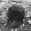
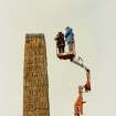
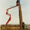
Clearance of the overburden and cutting of foundation trenches prior to the construction of the glass and steel canopy required trenching in the vicinity of the stone. Following from the 1990 archaeological work, further sub-soil features, including one deep pit, were examined. Further clearance and trenching works will take place before the coming winter. The final archaeological investigations will take place in concordance with this schedule for the completion of the new display area.
Excavation to date has not produced firm evidence for a date of erection, method of erection, or purpose, but the rumoured presence of burials can be discounted. Sponsor: Historic Scotland.
R McCullagh 1991a.
Excavation (1994)
In preparation for the eventual erection of a glass canopy over the stone, and other alterations in landscaping, the areas of possible foundation trenches were investigated.
Within the metal fence around the stone, two opposed areas on the NW and SE were excavated. More extensive excavation work near to the stone was, at this stage, prohibited by factors of architectural and personal safety. Larger trenches outwith the fence, in areas to be affected by landscaping, were also opened.
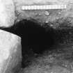
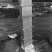
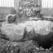
It was established that the stone is set into a socketed, dressed block. The present collar of masonry was removed on the SE side to reveal the lowest panel of figures. Fragments of re-used stonework which were found set in mortar at the lowest level of the present collar, are probably remnants of the much illustrated 19th century collar.
Several sub-surface features were excavated. These included two large, deep and vertical post holes on the SE of the stone; a similar post hole was excavated on the NW. On both sides, arcs of a circular bedding trench containing the stumps of wooden posts were also found. Whilst the bedding trench must be a recent feature, the post holes may date from the erection of the stone. It is hoped that radiocarbon dates will be obtained from samples of post-hole fill.
In only one of the areas outside the metal fence were any archaeological features discovered. Whilst these appeared to represent truncated pits or post holes set in arc, no relationship to the stone was established. Sponsor: HBM
R F J McCullagh 1990d.
Excavation (1996)
NJ 046 595 AOC (Scotland) Ltd conducted the total excavation of the area to be affected by the proposed bus turning hammerhead at Sueno's Stone, Moray. The subsoil surface was hand cleaned. Four features were identified within the subsoil surface, two of which were modern in origin and one, a gully, was only tentatively identified as anthropic in origin. The fourth feature was a truncated pit which contained a quantity of burnt wood charcoal.
Sponsor: Historic Scotland.
AOC (Scotland) Ltd 1996
Test Pit Survey (2003)
NJ 046 595 Two test pits were hand-dug as part of Scheduled Monument Consent to enable engineering boreholes to be made for a proposed footbridge across the adjacent A96. No features were revealed, though some small sherds of medieval pottery were recovered from the topsoil.
Full report lodged with Moray SMR and the NMRS.
Sponsor: Moray Council.
S Farrell 2003
Watching Brief (January 2005 - February 2005)
NJ 046 595 A watching brief was undertaken in January and February 2005 some 25-30m S of Sueno's Stone (NJ05NW 1). A 28m long trench was excavated by machine in preparation for a cycle path. Nine archaeological features were found c 0.8m below the ground surface. No significant finds were uncovered, but a single radiocarbon date of c 100 BC suggests an Iron Age date for the features - perhaps associated with settlement in the area. No features that could be securely related to the Stone itself were uncovered.
Report lodged with Moray SMR.
Sponsor: Moray Council.
S Buchanan 2005


