Date 1 June 1976 - 31 August 1976
Event ID 546570
Category Project
Type Project
Permalink http://canmore.org.uk/event/546570
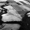
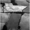
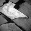
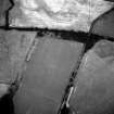
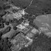
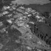
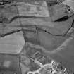
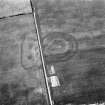
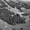
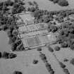
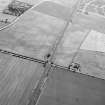
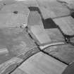
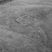
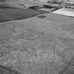
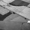
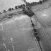
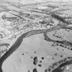
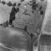
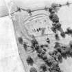
On the recommendation of the Committee for Rescue Archaeology set up by the Scottish Ancient Monuments Board a grant was made to the Commission in 1976 to allow it to carry out an extensive aerial survey programme. Climatic conditions during the period June-August were exceptionally favourable in much of eastern Scotland and more than 600 monuments were recorded, the majority being identified by means of crop-markings, a large number of which were new discoveries. The most interesting sites included Dark Age or Medieval timber halls on Deeside (NO 737967 [NO79NW 18], 733959 [NO79NW 16]) and west of Brechin (NO 509585 [NO55NW 40]); new Roman temporary camps at Ford, Midlothian (NT 384638 [NT36SE 18]) and Millside Wood [sic], Roxburghshire (NT 690270); double pit-alignments at Kinnell and Kinalty, Angus (NO 605494 [NO64NW 27], 356512 [NO35SE 32]); and a number of small, square-ditched enclosures, possibly barrows of the later Iron Age, in the Lunan valley, Angus (NO 626491 [NO64NW 95], 618494 [NO64NW 41] and 687509 [NO65SE 18]). A summary list of all these sites has been compiled and the prints will shortly be available for inspection in the National Monuments Record of Scotland.
RCAHMS (DES 1976, 84)
Ordnance Survey licence number AC0000807262. All rights reserved.
Canmore Disclaimer.
© Bluesky International Limited 2025.
|
Boysack
Barrow(S) (Prehistoric), Linear Feature(S) (Period Unknown), Ring Ditch(S) (Prehistoric)(Possible), Square Barrow(S) (Iron Age), Unenclosed Settlement (Prehistoric)
Canmore ID 35476 |
|
|
Red Castle
Barrow(S) (Prehistoric), Square Barrow(S) (Iron Age)
Canmore ID 35800 |
|
|
Balbridie
Timber Hall (Neolithic)
Canmore ID 36669 |
|


SC 357763
Oblique aerial view of Bridgehill-Strageath Roman road, and quarry pits.
RCAHMS Aerial Photography
1976
© Crown Copyright: HES

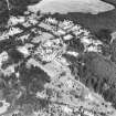
SC 369409
Oblique aerial view including Cathedral from North West.
RCAHMS Aerial Photography
1976
© Crown Copyright: HES


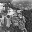
SC 588707
Oblique aerial view of Crathes castle centred on the castle.
RCAHMS Aerial Photography
1976
© Crown Copyright: HES


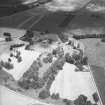
SC 765976
Scanned image of an oblique aerial view.
RCAHMS Aerial Photography
1976
© Crown Copyright: HES


SC 853673
Oblique aerial view of Buchanan Castle
RCAHMS Aerial Photography
1976
© Crown Copyright: HES

SC 909305
Oblique aerial view of Kintore centred on the cropmarks of the SW angle of the Roman temporary camp and several round-houses.
RCAHMS Aerial Photography
1976
© Crown Copyright: HES


SC 1002166
Oblique aerial view centred on Marchmont House, looking E.
RCAHMS Aerial Photography
1976
© Crown Copyright: HES

SC 1002843
Oblique aerial view centred on Traquair House looking NE.
RCAHMS Aerial Photography
1976
© Crown Copyright: HES

SC 1020851
Oblique aerial view centred on Balcaskie House, looking NE.
RCAHMS Aerial Photography
1976
© Crown Copyright: HES

SC 1021748
Oblique aerial view of the cropmarks at Boysack Mills, looking W.
RCAHMS Aerial Photography
1976
© Crown Copyright: HES

SC 1071719
Oblique aerial view centered on the Neolithic timber hall, Crathes. The pit alignment is visible towards the top of the picture.
RCAHMS Aerial Photography
1976
© Crown Copyright: HES


SC 1208155
Oblique aerial view centred on Grassy Walls Roman temporary camp, looking NE.
RCAHMS Aerial Photography
1976
© Crown Copyright: HES


SC 1250772
Oblique aerial view showing the cropmark of a possible enclosure, East Fortune.
RCAHMS Aerial Photography
1976
© Crown Copyright: HES


SC 1293391 S
Newstead, Roman fort: RCAHMS air photograph showing annexe (NT 571 341)
RCAHMS Aerial Photography
1976
© Crown Copyright: HES


SC 1367520
Oblique aerial view of Castle Greg Roman fortlet.
RCAHMS Aerial Photography
1976
© Crown Copyright: HES

SC 1367521
Oblique aerial view of Castle Greg Roman fortlet.
RCAHMS Aerial Photography
1976
© Crown Copyright: HES


SC 1550105
Oblique aerial view of the fort at Birkenside Hill.
RCAHMS Aerial Photography
1976
© Crown Copyright: HES

SC 1552190
Oblique aerial view centred on the remains of the fort.
RCAHMS Aerial Photography
1976
© Crown Copyright: HES

SC 1552191
Oblique aerial view centred on the remains of the fort.
RCAHMS Aerial Photography
1976
© Crown Copyright: HES


SC 1668920
Oblique aerial view centred on village from E.
RCAHMS Aerial Photography
1976
© Crown Copyright: HES

SC 1670178
Oblique aerial view from SE.
RCAHMS Aerial Photography
1976
© Crown Copyright: HES

SC 1670179
Oblique aerial view from NE.
RCAHMS Aerial Photography
1976
© Crown Copyright: HES

SC 1670206
Oblique aerial view of country house from SW.
RCAHMS Aerial Photography
1976
© Crown Copyright: HES

SC 1670207
Oblique aerial view of country house from SE.
RCAHMS Aerial Photography
1976
© Crown Copyright: HES

SC 1670294
Oblique aerial view from E.
RCAHMS Aerial Photography
1976
© Crown Copyright: HES

SC 1673470
Oblique aerial view including Cathedral from North West.
RCAHMS Aerial Photography
1976
© Crown Copyright: HES


SC 1674837
General oblique aerial view.
RCAHMS Aerial Photography
1976
© Crown Copyright: HES

SC 1674838
Oblique aerial view from South East of Gordon Castle estate (after demolitions), including house, tower, farm, laundry cottages and cropmarks
RCAHMS Aerial Photography
1976
© Crown Copyright: HES

SC 1674839
Oblique aerial view from North West of Gordon Castle estate (after demolitions), including house, tower, home farm, laundry cottages and cropmarks
RCAHMS Aerial Photography
1976
© Crown Copyright: HES




























First 100 images shown.


