|
Digital Files (Non-image) |
TM 002166 |
RCAHMS Eastern Dumfriesshire Survey Area outline |
1997 |
Item Level |
|
Digital Files (Non-image) |
TM 002340 |
Survey data relating to the RCAHMS survey of Eastern Dumfriesshire. Includes shapefile, geojson and metadata form. |
1990 |
Item Level |
 |
On-line Digital Images |
SC 1239704 |
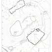
Map of the earthworks in the landscape around Burnswark: publication drawing for Inventory of Eastern Dumfriesshire, generated from computer file 5BURNSW.PM6. Unattributed, [1996]. |
1996 |
Item Level |
 |
On-line Digital Images |
SC 337186 |
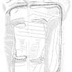
Publication drawing; Plan of Raeburnfoot Roman Fort and annexe. |
14/8/1996 |
Item Level |
 |
On-line Digital Images |
SC 372195 |
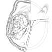
Publication drawing; Plan of fort and other structures on Camp Hill, Bailiehill. |
1996 |
Item Level |
 |
On-line Digital Images |
SC 371459 |
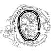
Publication drawing; Phased plan (Phase IV) of palisaded settlement at Gibb’s Hill. |
1996 |
Item Level |
 |
On-line Digital Images |
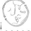
SC 381965 |
Publication drawing; Plan of Stanshiel Rig (A) settlement. |
1996 |
Item Level |
 |
On-line Digital Images |
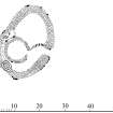
SC 381966 |
Publication drawing; Plan of Stanshiel Rig (B) settlement. |
1996 |
Item Level |
 |
On-line Digital Images |
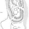
SC 381967 |
Publication drawing; Plan of Beattock Hill fort and adjacent unenclosed settlement. |
1996 |
Item Level |
 |
On-line Digital Images |
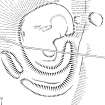
SC 381968 |
Publication drawing; Plan of Knockhill (Knock Hill) fort. |
1996 |
Item Level |
 |
On-line Digital Images |
SC 381969 |
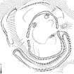
Publication drawing; Plan of Stidriggs fort (NY 061 994). |
1996 |
Item Level |
 |
On-line Digital Images |
SC 381970 |
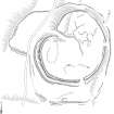
Publication drawing; Plan of Parks (Park Hill) fort. |
31/8/1994 |
Item Level |
 |
On-line Digital Images |
SC 381971 |
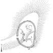
Publication drawing; Plan of Beattock Hill settlement (NT 0664 0254). |
1996 |
Item Level |
 |
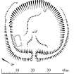
On-line Digital Images |
SC 381972 |
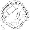
Publication drawing; Plan of Raehills (Floshlands Wood) scooped settlement. |
9/1994 |
Item Level |
 |
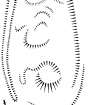
On-line Digital Images |
SC 381973 |
Publication drawing; Plan of Beattock Hill scooped settlement and building. |
1996 |
Item Level |
 |
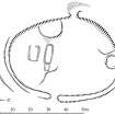
On-line Digital Images |
SC 381974 |
Publication drawing; Plan of Park Hill (Hillhead) scooped settlement and enclosure. |
4/1994 |
Item Level |
 |
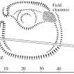
On-line Digital Images |
SC 381975 |
Publication drawing; Plan of Stidriggs settlement. |
1996 |
Item Level |
 |
On-line Digital Images |
SC 381976 |
Publication drawing; Plan of Mollin scooped settlement. |
|
Item Level |
 |
On-line Digital Images |
SC 381977 |
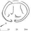
Publication drawing; Plan of Mollin scooped settlement and building. |
4/1994 |
Item Level |
 |
On-line Digital Images |
SC 381978 |
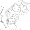
Publication drawing; Plan of Easter Earshaig settlements and building. |
9/1995 |
Item Level |
 |
On-line Digital Images |
SC 381979 |
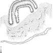
Publication drawing; Plan of Tanner's Linn fort. |
1996 |
Item Level |
 |
On-line Digital Images |
SC 381980 |
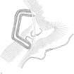
Publication drawing; Plan of Nether Minnygap (Ogle Linn) earthwork. |
1996 |
Item Level |
 |
On-line Digital Images |
SC 381981 |
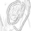
Plan of Castle O'er fort and adjacent lengths of linear earthwork, redrawn for publication from DC 32458. |
8/9/1995 |
Item Level |
 |
On-line Digital Images |
SC 381982 |
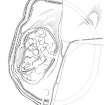
Publication drawing; Plan of fort and other structures on Camp Hill, Bailiehill. |
1996 |
Item Level |


