|
Photographs and Off-line Digital Images |
E 10304 |
Publication drawing; Plan of Downey Hill farmstead. |
1996 |
Item Level |
|
Photographs and Off-line Digital Images |
E 10306 |
Publication drawing; Plan of the Girdlestanes stone circle, indicating edge of river bank. |
19/10/1995 |
Item Level |
|
Photographs and Off-line Digital Images |
E 10303 |
Plan of Tanlawhill tower-house, buildings and enclosures, redrawn for publication from DC 32428. |
1996 |
Item Level |
|
Photographs and Off-line Digital Images |
E 10305 |
Publication drawing; Plan of fort and other structures on Camp Hill, Bailiehill. |
1996 |
Item Level |
|
Photographs and Off-line Digital Images |
E 10307 |
Publication drawing; Plan of the Loupin' Stanes stone circle. |
1996 |
Item Level |
|
Photographs and Off-line Digital Images |
E 10444/1 |
Photographic copy of tracing of cross-shaft. |
22/5/1991 |
Item Level |
|
Photographs and Off-line Digital Images |
E 10444/2 |
Photographic copy of rubbing of carved stone. |
28/9/1990 |
Item Level |
|
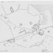
Prints and Drawings |
DC 44711 |
Plan |
1990 |
Item Level |
 |
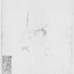
On-line Digital Images |
DP 053135 |
Publication drawing; Plan of Urchin Knowe buildings and field-system. Photographic copy. |
14/8/1996 |
Item Level |
 |
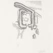
On-line Digital Images |
DP 051908 |
Survey drawing; Plan of Gillesbie Cottages enclosure, indicating vegetation. Photographic copy. |
18/10/1991 |
Item Level |
 |
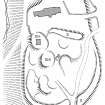
On-line Digital Images |
DP 077624 |
Publication illustration; Plan of Burnswark Roman fortlet. |
28/8/1996 |
Item Level |
 |
On-line Digital Images |
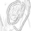
SC 1243796 |
Publication drawing; Craigieburn fort and settlement. |
13/12/1995 |
Item Level |
 |
On-line Digital Images |
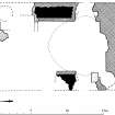
SC 381981 |
Plan of Castle O'er fort and adjacent lengths of linear earthwork, redrawn for publication from DC 32458. |
8/9/1995 |
Item Level |
 |
On-line Digital Images |
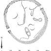
SC 382032 |
Publication drawing; First floor plan of Torthorwald tower (indicating phases of construction). |
1996 |
Item Level |
 |
On-line Digital Images |
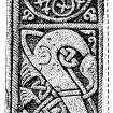
SC 381965 |
Publication drawing; Plan of Stanshiel Rig (A) settlement. |
1996 |
Item Level |
 |
On-line Digital Images |
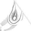
SC 382760 |
Publication drawing; Details of Wamphray incised cross. |
|
Item Level |
 |
On-line Digital Images |
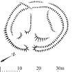
SC 381997 |
Publication drawing; Plan of (S end of) Neolithic bank barrow at Tom's Knowe (Raeburnfoot). |
1996 |
Item Level |
 |
On-line Digital Images |
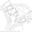
SC 381977 |
Publication drawing; Plan of Mollin scooped settlement and building. |
4/1994 |
Item Level |
 |
On-line Digital Images |
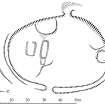
SC 382042 |
Publication drawing; Plan of Tanlawhill tower-house, buildings and enclosures. |
6/8/1996 |
Item Level |
 |
On-line Digital Images |
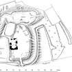
SC 381975 |
Publication drawing; Plan of Stidriggs settlement. |
1996 |
Item Level |
 |
On-line Digital Images |
SC 382028 |
Publication drawing; Plan of Torthorwald motte and tower-house: publication drawing for Inventory of Eastern Dumfriesshire. |
1996 |
Item Level |
 |
On-line Digital Images |
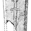
SC 382756 |
Publication drawing; Detail of Wauchope 5 incised cross. |
1996 |
Item Level |
 |
On-line Digital Images |
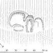
SC 381987 |
Publication drawing; Plan of Downey Hill farmstead. |
1996 |
Item Level |
 |
On-line Digital Images |
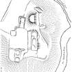
SC 382038 |
Publication drawing; Plan of Wamphray Place motte and earthworks. |
|
Item Level |


