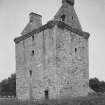
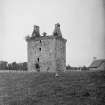
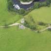
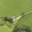
Gilnockie Tower
Carved Stone (Period Unknown), Tower House (Medieval)
Site Name Gilnockie Tower
Classification Carved Stone (Period Unknown), Tower House (Medieval)
Alternative Name(s) Hollows Tower; Holehouse Tower; Armstrong's Tower; Gillknocky Tower; Gilnocky Tower
Canmore ID 67509
Site Number NY37NE 3
NGR NY 38231 78559
Datum OSGB36 - NGR
Permalink http://canmore.org.uk/site/67509
- Council Dumfries And Galloway
- Parish Canonbie
- Former Region Dumfries And Galloway
- Former District Annandale And Eskdale
- Former County Dumfries-shire
NY37NE 3 38231 78559
(NY 3823 7856) Gilnockie Tower (NR)
(Remains of)
OS 6" map (1957)
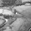
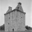
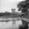
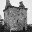
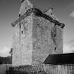
(Attributed to the third period). Hollows Tower. This typical Border keep was the residence of the famous Johnnie Armstrong, whose fate at the hands of James V is the subject of many Border songs and laments. It is picturesquely situated in the valley of the Esk between Canonbie and Langholm. The N end of the tower stands on the edge of a steep bank which slopes down to the haughs by the river. The bank slopes more gradually along the W end, where the entrance to the tower is situated.
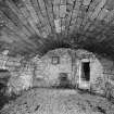
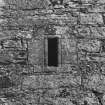
The building measures 33 ft 5 1/2 ins (10.2m) from N to S by 25 ft 4 ins (7.7m) from E to W, and from the ground to the lowest level of the parapet walk it measures 40 ft (12.2m) and about 16 ft (4.9m) additional to the highest part of the ruined beacon. It contains a vaulted ground floor 10 ft 5 ins (3.2m) high with shot-holes to the N, S and W. There was probably a courtyard on the E side, which may account for the absence of shot-holes there. Above the basement there are three storeys and an attic.
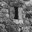
The entrance-door leads directly into the staircase, which is constructed in the SW corner and partly projects into the rooms inside; the mouldings round the door consist of three flat beads separated by fillets. and the entrance was evidently secured by an outer door of wood and an iron yett. Each floor contains only one apartment, measuring 25 ft 10 ins (15.5m) by 16 ft 5 ins (5m). The first floor has two windows, about 2 ft (0.6m) wide by 4 ft (1.2m) high, with stone seats and a small window, about 14 ins (0.36m), wide high up from the floor in the S end. In the opposite end is the fireplace, the projecting jambs of which have a bead-moulding around them. The joists of the upper floors were supported on projecting corbels, placed unusually close together, being only about 2 ft (0.6m) apart. The apartments on the floors are all very similar, that on the second floor only having a fireplace. There are thus only two fireplaces in the tower.
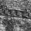
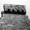
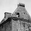
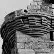
The corbelling along the top is continuous and consists of five projections, the three upper courses of which are treated as a series of alternating projecting and receding portions of a band. Above these is a cable moulding which was wrought to go round the gargoyles which projected at this level.
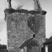
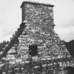
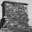
The chief peculiarity of Hollows is its beacon lantern perched like a church belfry on the apex of the S gable. Built beacons like this were undoubtedly frequent adjuncts of Border keeps, and although most have disappeared, a few such as Elchieshields (NY08NE 3) and the Tower of Repentance (NY17NE 2) still exist.
The Armstrongs first appeared in the district early in the 16th century when the redoubtable Johnnie Armstrong or 'Gilnockie' settled on the church lands at Canonbie and erected this tower at the place called the Hollws.
D MacGibbon and T Ross 1887-92.
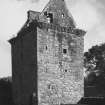
Hollows Tower, sometimes mistakenly called Gilnockie Tower, is a roofless, but otherwise well-preserved 16th century tower. It is oblong on plan, measuring about 23 ft 2 ins by 15 ft 3 ins within 6 ft thick walls, and has four storeys beneath the parapet, and a garret above. Splayed gunloops defend all except the E wall, suggesting there was a courtyard on that side. It was a stronghold of the Armstrongs, and its predecessor, built in 1518, was burnt down by Lord Dacre in 1528.
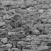
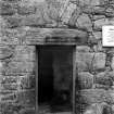
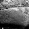
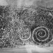
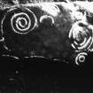
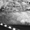
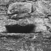
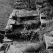
The sandstone still of the doorway into the vaulted chamber in the basement is incised with spiral and other markings. It is likely that it came with the stone for the tower from Whita beside Langholm.
N Tranter 1965; RCAHMS 1920, visited 1912; A E Truckell 1963
On a sandstone slab, built into the sill (floor-slab) of doorway into the vaulted chamber. 2 spirals (1 of 2 1/2 turns) and other incised patterns and lines. Possibly a later carving.
R W B Morris and D C Bailey 1967.
The tower, generally as described, is known as Gilnockie or Hollows Tower. Contrary to Tranter, gunloops defend all sides but there is no trace of a courtyard. The inscribed stone is as described.
Visited by OS (RD) 21 December 1970
No change to the previous field report.
Visited by OS (JP) 20 February 1973
Sometimes called Hollows Tower, a tower house beside the Esk, built for the Armstrongs probably in the mid 16th century. After many years of dereliction, it was reroofed in 1979-80 by W G Dawson and the interior was subsequently made habitable. It is a rubble-built rectangle, c. 10m by 7.6m, with four stories and an attic, Immediately above the projecting base, in each of the W and S walls, a rectangular gunloop; two gunloops, one above the other, in the N wall. Rioll-and-hollow moulded door at the W wall's S end. Roll-moulded windows to the upper floors. Slit stair windows at the S wall's W end. The parapet (now missing, its place taken by a rail) was originally projected on rows of corbelling, the lower ones continuous, the two upper with alternately recessed and projecting moulded corbels. Immediately under the parapet, a rope-moulded stringcourse which has jumped up at the centre of each of the four round angle turrets. Rising within the parapet is the crowstep-gabled attic. Chimney at its N gable. Corbelled out from the S gable is a stone stand on which a warning beacon could be lit in the event of an English invasion.
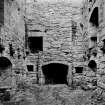
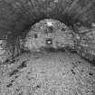
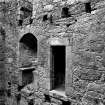
Inside, each floor was originally filled by a single room, the turnpike stair nudging into its SW corner. Ground-floor store covered by an ashlar tunnel-vault and lighted by a high-set window in the N gable. The sill of the door into this room is a re-used sandstone slab, incised, probably in the second millennium BC, with carving (now worn) of spirals and a key-like symbol. The first-floor hall has windows to E and W in round-arched embrasures; their stone seats have been restored. A third much smaller window high in the S gable. In the N gable, a fireplace with moulded jambs (the lintel missing) flanked by aumbries. The second floor probably contained the principal bedchamber. Windows like that of the floor below in the side walls, their stone seats original. At the N gable's E end, a plain fireplace. In the E wall, a garderobe, with the stone seating in place. The room's S end has been partitioned off as a bathroom. On the third floor, rectangular E and W window embrasures, their slabbed tops sloped towards the exterior. Window seats again. No visible evidence of a fireplace. The S end was again partitioned off in the 1980's. Featureless attic; its floor was raised in the 1980's when the door lintel was removed.
J Gifford 1996.
NMRS REFERENCE
Miss I.H.K. Beattie, architect, Dumfries: plans, elevations and sections, photographs.
Field Visit (18 July 1912)
Hollows Tower.
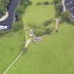
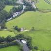
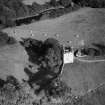
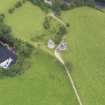
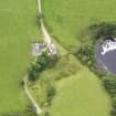
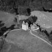
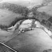
This tower (fig. 26 [SC 11568211]) is situated on the right bank of the river Esk, midway between Langholm and Canonbie. It has been completely defended by the river bank to the north and partly by the sloping marshland to the west. On the eastern side, where the ground is level and unprotected by nature, the tower was probably enclosed originally by the walls of an outer courtyard.
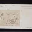
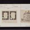
On plan (fig. 27 [DFD 71/1]) the building is oblong and measures some 23 feet 2 inches by 15 feet 3 inches within walls averaging 6 feet in thickness, and the total height from the step at the entrance to the top of the corbel-course measures nearly 40 feet. The doorway is at the south end of the west wall and gives access to the wheel-stair, which has communicated directly with the upper floors and with the parapet walk. Originally it was equipped with a strong outer door and an iron yett, neither of which now remains. The wheel-staircase projects on the interior floor space. The ground floor is vaulted and lighted by narrow shot-holes, the north wall having two such openings, one above the other.
On the first-floor level is the hall, measuring about 24 feet 2 inches by 16 feet 3 inches and having a window with stone seats in the east and west walls. A wide fireplace with moulded jambs is formed in the north wall, with an aumbry on each side, and there is a narrow opening to the south. The two upper floors and the attics have each also consisted of a single apartment. The stone corbels for carrying the floors remain. There are no fireplaces above the level of the second floor. The corbel-table, which has supported the stone parapet, is of the ornate type characteristic of the 16th century. The upper member consists of a bold cable-moulding, returned at intervals where gargoyles have occurred. Below this is a continuous band decorated with a series of projecting and sunk. enrichments, and the lowest member takes the form of a simple double roll. A circular turret, resting on corbelled projections, is constructed at each angle.
A feature of this tower is a watch or beacon stand corbelled out at the apex of the south gable: cf. the analogous structure at Elshieshields (RCAHMS 1920, p. 155).
A house was built at Hollows (Hole-house, Hollace, Hollas, Hollis, are some other forms) in or soon after 1518 by one of the migrating Armstrongs (see Introd., p. xxxv.), and burnt by Dacre in 1528. The present building, however, in its upper portion at least, seems to be of later date. It requires only a roof to assure its preservation.
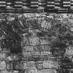
SPIRAL-MARKED SLAB. The sill of the doorway into the vaulted chamber in the basement of Hollows Tower is a slab of sandstone (illustrated in the Introduction, fig. 2 [DFD 71/2]), measuring 3 feet in length by 1 foot 7 inches in breadth at the centre, which is incised on its surface with spiral and other markings. At the upper and slightly narrower end of the stone, and towards the outside, is a spiral figure, consisting of two complete turns and half of a third, the line thereafter passing divergently across the stone to the other side, being surmounted near the middle of its course by a single key-like symbol or ornament. Between the free end and the spiral is a single incised line which may have been connected with it. Immediately below the spiral there is visible a semicircular incised line, and at the lower end of the stone, partially hidden by the architrave of the door, is another and smaller spiral with certain indefinite markings springing from it at one side. The stone is much worn, and the figures are now probably incomplete. The marks on the lower corner, opposite to that on which the spiral appears, are natural inequalities of the surface.
RCAHMS 1920, visited 18 July 1912.
Field Visit (November 1980)
Gilnockie Tower NY 382 785 NY37NE 3
The sill-stone of the doorway to the ground floor of Gilnockie Tower bears incised decoration which includes fragments of a triple ring and at least three spirals.
RCAHMS 1981, visited November 1980.
(Hardy 1884, 346-7; R CAHMS 1920, pp. I, 27, No. 43; Morris and Bailey 1966, 159, no. 18).
Field Visit (November 1980)
Gilnockie NY 382 785 NY37NE 3
This oblong tower-house of 16th-century date stands to a height of four storeys and a garret, and bears a beacon-stance on the SSW gable. Attributed to the Armstrongs and formerly known as Hollows tower, it was restored for domestic use in 1978-9.
RCAHMS 1981, visited November 1980.
(Armstrong 1883, i, 211, 227-8, 245-6; MacGibbon and Ross 1887-92, iii, 217-20; RCAHMS 1920, pp. 26-7, No. 43; NMRS, DFR/7/1).
Note (1997)
NY 3823 7856 NY37NE 3
Listed as tower and cup-and-ring markings.
RCAHMS 1997.


