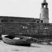
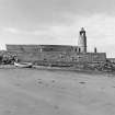
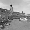
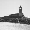
Port Logan, Harbour
Harbour (19th Century), Pier (19th Century)
Site Name Port Logan, Harbour
Classification Harbour (19th Century), Pier (19th Century)
Alternative Name(s) Port Nessock Harbour; Port Logan Pier; Port Logan Mole And Lighthouse
Canmore ID 60493
Site Number NX04SE 15
NGR NX 09470 40565
Datum OSGB36 - NGR
Permalink http://canmore.org.uk/site/60493
- Council Dumfries And Galloway
- Parish Kirkmaiden
- Former Region Dumfries And Galloway
- Former District Wigtown
- Former County Wigtownshire
NX04SE 15.00 09470 40565
Pier [NAT]
OS 1:2500 map, 1975.
NX04SE 15.01 NX 09464 40562 Beacon ('Lighthouse')
For nearby and competitor Portpatrick Harbour (centred NW 99878 54102), see NW95SE 9.00.
EXTERNAL REFERENCE:
Scottish Records Office GD 51/5/581
Building a harbour at Portnessock.
Letter from Andrew McDouall of Logan.
He advocates the construction of the harbour as recommended by Thomas Telford's report.
He is prepared to pay half the cost of £8,392.
1811
(Undated) information in NMRS.
(Location cited as NX 094 405). Port Logan harbour. Built 1818, largely at the expense of Col. Andrew McDowall. The remains of a substantial pier of coursed rubble, protecting a natural harbour. The most distinctive feature of the harbour is the fine granite and sandstone light-tower, which is well-preserved.
J R Hume 1976.
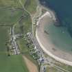
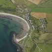
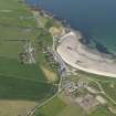
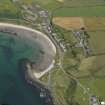
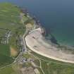
(Location cited as [NX] 094 405). Port Logan. Port Nessock, or Port Logan, Bay is a stretch of tidal sand about a mile in length and facing W, the harbour works lying at its S horn. By contrast with the difficulties and dangers attaching to other possible harbour-sites on this exposed and inhospitable coast, this bay possesses some attractions, and the development of port Logan harbour has been largely due to the defects of Portpatrick (NW95SE 9.00) as a terminal for traffic to Ireland. The idea of superseding Portpatrick has evidently lain behind all measures of improvement from their outset, as appears clearly from the language of Robert McDouall's 'supplication' to the Privy Council in 1682 for help in the building of a harbour on his land. Of Portpatrick, he writes '...it being impossible to make or have a harbour there, so that that passadge, albeit there runes many impetuous tyds from the Mule [Mull] of Galloway betwixt Scotland and Ireland, can only be served by small boats that must be drawen up to high water, which has occasioned the loss of many lives and obstructs trade and commerce betwixt the kingdoms'. This same idea, of making Port Logan the chief terminal for the Irish traffic, and in particular the station for the official cross-Channel packets, evidently underlay all the later planning; and in 1820 a still more ambitious scheme was ventilated, for the construction of an offshore breakwater covering the whole of the bay, on the lines of the one at Plymouth, though this seems never to have gone beyond the stage of Parliamentary petitions.
A number of records exist which bear on the harbour's history, and these may be considered first. To go back to 1682, McDouall was duly authorised to receive voluntary contributions to the building of his harbour, but whether he actually secured any funds in this way, or whether, if he did, he spent them on building a harbour, nowhere appears. Symson, writing two years later, describes the place as 'very convenient for a harbour' but gives no further information. Roy's Map of Scotland, prepared between 1747 and 1755, marks a projection from the land at the S end of the bay, which in spite of the small scale of the map, may be taken with considerable confidence to represent a pier, as it compares well enough with the same map's marking of the pier at Isle of Whithorn (NX43NE 27). In 1791 it was noted that there had once been a harbour in Port Nessock Bay, but that at that date it was in ruins. In 1813 there comes a report by the engineer John Rennie, entitled 'On forming a small harbour on McFerrand's Isles'; this supplies a great deal of information but it contains proposals only, not a record of action taken, and it is clear that by no means all these proposals were actually carried out. One of them, for example, was that a tidal sluice should be provided in the new pier, and this was certainly not done, as in 1840, another advisor J Linn, was still recommending it; while another suggestion, the building a 'breastwall', seems likewise to have been passed over. Rennie had himself pointed out that both these items could be dropped from his scheme, along with a 'parapet' and some excavation of the foreshore, as measures of economy, if the harbour was only to be used for local coastwise trade and not as a station for packets. In 1847 Port Logan had a pier 'extending 180 yards [164.6m] offshore in an easterly direction, built by the proprietors of the adjoining estate, under an Act of Parliament obtained in 1818'; and with this record the Third Statistical Account [1965] agrees, giving 1820 as the date when the 'quay' was built by Col McDouall of Logan.
Conspicuous remains of structure survive at the S horn of the Bay, and if these are considered in the light of Rennie's report they are seen at once to correspond with at least the chief of his proposals. They consist, toughly speaking, of a feature which projects from the shore to the NNE, forming as it were a long and wide jetty, largely covered with boulders and debris from the sea, with the pier proper, or perhaps more accurately a pier-head, attached to its outer end. It seems safe to conclude that McFerrand's Isles, which appear nowhere on the maps, have simply been overbuilt by the jetty and pier in the manner suggested by Rennie, who moreover locates them by stating that stating that the Great McFerrand's Isle lies 300 yds [274.4m] from the head of the bay at low [water] springs and about 30 yards [27.4m] from the shore opposite to it. On this showing they were probably formations similar to the Manxman's Rock, which lies just offshore a short distance to the W.
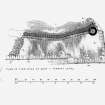
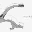
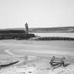
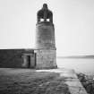
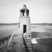
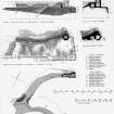
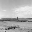
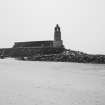
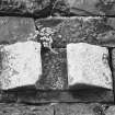
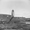
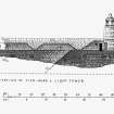
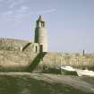
Examination of the pier-head was prevented by a rising tide, but the 25-inch OS map shows it as rectangular in shape, about 120ft [36.6m] and 150ft [45.7m] in length on its NW and SE sides respectively, and bounded on the NE by a wall 55ft [16.8m] long, which overlaps the NW face. A stair descends to the water on the SE side, and another is shown at the SW end apparently making connection with the outer end of the jetty. The N corner carries a remarkable light-tower with a decorative stone lantern, which recalls, on a larger scale, a type of bell-cote common on country churches of the early 19th century, and may well perpetuate their tradition. Details regarding the size and appearance of the jetty are difficult to state with confidence, on account of the heavy accumulation of upcast boulders; but its length may have been approximately 300ft [91.5m], while the breadth of the boulder-strewn strip above the level of low water, which must greatly exceed that of the original structure, was shown in 1894 as varying from about 80ft [24.4m] to 150ft [45.7m]. A stretch of the inner face, however, preserves the aspect of a quay, being composed of large squared blocks, well coursed, and supported by sawn timber uprights, widely spaced. The feet of these timbers have been fitted into stone blocks cut out to serve as sockets, and of the five of these blocks that were not hidden by debris two still retained their timbers. At least one round stone bollard survives on the top of the quay. The area of the pocket protected by the jetty and pier might have been in the order of 3 acres [1.2ha]. The seaward slope of the block of dry land adjoining the root of the jetty has a flared base which carefully profiled and pitched, a precaution most necessary on view of the prevailing scale of storm-damage; huge blocks lie piled up close by, and among them there even appears a lump of masonry still held together by its mortar.
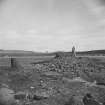
In addition to the pier and jetty, however, the bay contains another set of ruins of a much less obvious character. At a point about 100yds [91.5m] ESE of the pier-head, there may be seen, at low tide, a massive block of weed-covered masonry, largely engulfed in the sand, but showing, on close examination, an area of level surface, now tiled seawards, together with 26yds [23.8m] of unbroken arris. This can hardly be other than part of the ruin of a pier, and evidence for its landward end may be seen in an accumulation of large tumbled stones at and above high-water mark, faced on the W by a row of closely-set vertical timbers, 25 in number. The gap between these stones and the tilted block of masonry may be due to the fact that works in this kind of position regularly suffer most damage in the zone where the waves break; and it is also possible that an older pier might have been robbed of material for a new one. The function of this pier would presumably have been to enclose a more or less triangular tidal pocket with a northerly exposure, extending perhaps to something over an acre [0.4ha]. These remains can be identified, with much confidence, as those of the 'old pier' that Rennie mentions more than once in the course of his report. The mere fact that he does so shows that the passage from the Old Statistical Account quoted above must not be taken to mean that no harbour-works of any kind existed in 1791, but only that they were no longer fit for use. Nor should the identification be questioned on the ground that Rennie twice alludes to the new harbour being 'near' the old one, whereas a critic might maintain that the pier was not near the ruins in the sand but in fact well clear of them; this criticism collapses if Rennie's field of choice is thought of as covering the whole of the mile-long beach, as was probably the case, and not simply its S extremity. No doubt the end of the old pier was shortened, as Rennie advised, to secure a sufficient width for the new harbour's entrance, and its W face suitably profiled to receive any seas which entered from the WNW; but no evidence exists for any further work having been done, and in particular no connection should be seen with the supposed 'breastwall' for the reason, already suggested, that this latter was in fact never built.
No basis exists for any theory regarding the old harbour's origin - whether, for example, it was built by Robert McDouall in 1682 or was an ordinary piece of estate improvement, dating from early enough in the 18th century to have gone to ruin by 1791. That such an episode should have escaped mention in any published record need cause no particular surprise. In this case, no account can be given of McDouall's harbour, supposing always that he built one; but if it was on Roy's site at the horn of the bay its remains would no doubt have disappeared, along with McFerrand's Isles, in the operations of 1820.
The new harbour does not seem to have been a successful venture. In 1839 the village and harbour receive only cursory mention in the New Statistical Account. The Third Statistical Account (1965) states that 'the boats that were to repay the laird's investment never tied up at that quay, and only a handful of rowing boats now shelter behind it.'
A Graham 1979 (visited 1978).
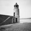
The first pier built in this bay dates from c 1680, the work of Robert McDowall of Logan. By the 1790s this was in ruins. Improvements suggested in a report by Thomas Telford (1809) were implemented in 1818, largely at the expense of Col Andrew McDowall. The remains are derelict but impressive. The pier is 180 yds long, the landward end consisting of massive rubble remains. The seaward end is fairly complete with a fine granite and sandstone light-tower 25ft [7.6m] high and 10ft [3m] in diameter. It has an ornamental light chamber and doors at ground and first-floor levels. Access to the light was by ladder.
OSA 1791; I Donnachie 1971; J R Hume 1976; D B Hague 1977; A Graham 1979.
Port Logan Harbour. Built in 1818-22 under the superintendence of John Young, its main features corresponding with proposals made by John Rennie in 1813.
J Gifford 1996.
This harbour is situated to the W of Port Logan village (NX04SE 17). It is apparently largely of natural formation, having only a single short pier ('mole'), and dries at low water.
Information from RCAHMS (RJCM), 10 March 2006.
Construction (1820)
The pier or mole, extending 540 ft in an easterly direction was built by Colonel McDoull of Logan and the
remains of a jetty structure at the South arm of the bay.
Paxton and Shipway 2007
Publication Account (1986)
Being the only comparatively safe natural anchorage on this exposed western coast, Port Logan or Port Nessock, as it is sometimes known, was a serious rival to Portpatrick as a possible terminal for Irish traffIc. Efforts on the part of the McDouall owners to develop a harbour here were first recorded in 1682, but the existing remains correspond with the chief proposals made by John Rennie in a report of 1813. These were put into effect between 1818 and 1820 at the expense of Colonel Andrew McDouall of Logan. It was even intended to have an offshore breakwater covering the whole bay, but this, and the hopes for the harbour, were never realised. For a few decades Port Logan was used for a trade in Irish cattle and local produce, but it was unable to oust Portpatrick when this in turn was being over taken by Stranraer.
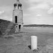
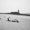
Even today, the Port Logan jetty is an impressive witness to its builder's ambitions. It extends in a broad arc some 185m into the bay, and is constructed of large stone blocks. At the pier-head there is a sturdy built lighthouse-tower with a stone-slabbed conical roof. The light-chamber has had wooden-framed windows and was reached by a ladder from the first floor, but there is no clear evidence of the actual method of lighting. A latrine with a mural chute was contrived under the outside stair. There are a few granite bollards, and the projecting socketed stones on the face of the inner quayside were designed to clasp upright wooden fenders.
Information from ‘Exploring Scotland’s Heritage: Dumfries and Galloway’, (1986).
Publication Account (1986)
The ruins of this jetty extend in a broad arm some 185m across the SW horn of Port Logan Bay, terminating at the seaward end in a more complete pier-head and small stone-bui lt lighthouse tower. Efforts on the part of the McDouall proprietors to develop Port Nessock or Port Logan into a harbour were first recorded in 1682, but the existing remains correspond with the chief proposals made by John Rennie, engineer, in a report of 1813, and carried into effect between 1818 and 1820 largely at the expense of Colonel Andrew McDouall of Logan, who hoped thereby to benefit from the Irish cattle trade.
The pier-head is protected by a pitched sea-wall rising to a parapet backed by a stepped wall-walk, and the inner quayside, which has a stair to water-level, has been faced with widely spaced wooden fenders clasped in position by socketed stones. This surviving portion is impressively constructed of coursed sandstone rubble masonry employing large stone blocks, and the slabbed and cobbled paving incorporates two granite bollards. The parapet terminates in a sturdy circular light-tower with a latrine annexe built under the adjacent forestair to the first-floor entry. The tower, which is ashlar built throughout, measures 11 ft 2 in (3.40m) in overall diameter and 32ft 2 in (9.80m) in height. The turret has a stone-slabbed conical roof of concave profile carried on four plain square monolithic pillars, rebated presumably to receive a frame for glazed panels. An iron bar is fixed to the apex of the roof for holding the lamp, but otherwise there is no surviving evidence of the actual method of lighting. The light-chamber was evidently reached by a ladder from the first floor; the ground floor contains a small fireplace and a shelved recess.
Information from ‘Monuments of Industry: An Illustrated Historical Record’, (1986).
Publication Account (2007)
Roy’s map of Scotland ca.1755 indicates a small pier at the south arm of Port Logan Bay, but by 1791 the harbour was in ruins. In 1813 John Rennie reported favourably on the site in preference to Portpatrick as a harbour for the Irish packet traffic.
In 1820, a pier or mole extending 540 ft in an easterly direction was built by Colonel McDoull of Logan and the
remains of a jetty structure at the south arm of the bay correspond to the proposals in Rennie’s report. There is a pier head and a light tower with a lantern and a bell-cote roof. The area enclosed by the jetty and the pier is about three acres.
The three storey lighthouse is about 25 ft high, circular in plan and 10 ft diameter. The mole and lighthouse were repaired and refurbished in the 1980s.
Paxton and Shipway 2007
Reproduced from 'Civil Engineering Scotland - Lowlands and Borders' with kind permission from Thomas Telford Publishers.
Project (2007)
This project was undertaken to input site information listed in 'Civil engineering heritage: Scotland - Lowlands and Borders' by R Paxton and J Shipway, 2007.


