
The Ord North


Chambered Cairn (Neolithic), Food Vessel Urn (Bronze Age)
Site Name The Ord North
Classification Chambered Cairn (Neolithic), Food Vessel Urn (Bronze Age)
Alternative Name(s) The Ord
Canmore ID 4984
Site Number NC50NE 16
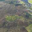
NGR NC 57330 05605
Datum OSGB36 - NGR
Permalink http://canmore.org.uk/site/4984


- Council Highland
- Parish Lairg
- Former Region Highland
- Former District Sutherland
- Former County Sutherland
NC50NE 16 57330 05605
(NC 5733 0560) Chambered Cairns (NR) (includes NC50NE 17)
OS 1:10,000 map, (1970)
The Ord, North. Formerly thought to be a short, horned cairn (Henshall 1963), this well preserved chambered tomb, on excavation by Corcoran in 1967 proved to be circular though flattened on the SE side. It is 82ft in diameter, edged by dry-walling and upright stones. Outside this a level stone platform extends for 10ft to 20ft. The entrance is on the SE, through a low, narrow passage 14ft long. The chamber and ante-chamber are built of orthostats linked by dry-walling, with corbelled roofs 8ft to 10ft high which have partly collapsed. After the excavation the chamber was covered with polythene and the cairn material was replaced.
Visited by OS (W D J) 20 June 1963.
A S Henshall 1963; J Corcoran 1967; Current Archaeol 1972; A S Henshall 1972.
This well preserved chambered cairn is as described by Henshall and Corcoran.
Resurveyed at 1:10 000.
Visited by OS (N K B) 21 July 1976.
Surveyed at 1/2500.
Visited by OS (J B) 16 March 1979.
Account of Corcoran's excavation and analysis of the finds with C 14 dates. Mention is made of an intrusive Early Bronze Age cremation burial associated with a Food Vessel.
N M Sharples 1981.
Scheduled with NC50NE 13-14, 17, 19, 22, 38-9, 46, 54-6 and 81-2 as The Ord, chambered cairns, cairns, settlements and field systems.
Information from Historic Scotland, scheduling document dated 14 February 2002.
Excavation (1967)
Excavated by Corcoran in 1967.
Sources: A S Henshall 1963; J Corcoran 1967; Current Archaeol 1972; A S Henshall 1972.
Ground Survey (22 February 2010 - 18 March 2010)
NC 575 050 A topographic survey of the scheduled area and a 100m buffer zone around the The Ord was carried out 22 February–18 March 2010. The area contains a high density of archaeological monuments, including Neolithic funerary monuments and remains of Bronze Age settlements and agriculture. Although the distribution of the major features was known, this survey added detail and increased the accuracy of information obtained in previous surveys. The survey also identified several previously unrecorded features. In total over 450 individual archaeological features were recorded including a burnt mound, c35 hut circles, 14 rectangular buildings and over 300 clearance cairns.
Archive: RCAHMS
Funder: The Forestry Commission Scotland

