
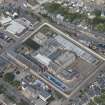
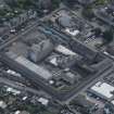
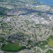
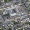
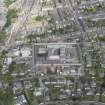
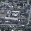
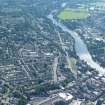
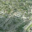
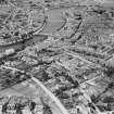
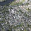
Inverness, Argyle Terrace, Hm Prison Porterfield


Prison (19th Century) - (20th Century)
Site Name Inverness, Argyle Terrace, Hm Prison Porterfield
Classification Prison (19th Century) - (20th Century)
Alternative Name(s) Duffy Drive; Mitchell's Lane; Porterfield Bank; Porterfield Prison
Canmore ID 287312
Site Number NH64NE 800
NGR NH 66845 44920
NGR Description Centred NH 66845 44920
Datum OSGB36 - NGR
Permalink http://canmore.org.uk/site/287312


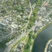


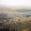

- Council Highland
- Parish Inverness And Bona
- Former Region Highland
- Former District Inverness
- Former County Inverness-shire
NH64NE 800.00 centred 66845 44920
HM Prison
Porterfield [NAT]
OS (GIS) MasterMap, November 2009.
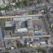
NH64NE 800.01 Centred 66833 44878 Wall

