Glasgow, Stobcross, Queen's Dock Entrance, Hydraulic Power Station
Hydraulic Power Station (19th Century)
Site Name Glasgow, Stobcross, Queen's Dock Entrance, Hydraulic Power Station
Classification Hydraulic Power Station (19th Century)
Alternative Name(s) River Clyde; 100 Stobcross Road; Yorkhill Quay; Lower Harbour; Sv Glenlee, Museum Building
Canmore ID 171660
Site Number NS56NE 88.02
NGR NS 56355 65618
Datum OSGB36 - NGR
Permalink http://canmore.org.uk/site/171660
- Council Glasgow, City Of
- Parish Glasgow (City Of Glasgow)
- Former Region Strathclyde
- Former District City Of Glasgow
- Former County Lanarkshire
NS56NE 88.02 56355 65618
Formerly entered as NS56NE 2150.
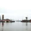
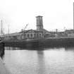
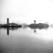
Hydraulic Pumping Station, Queen's Dock, built 1877-8 for the Clyde Navigation Trust, J Carrick, architect. A single storey, 2- by 3-bay building, with pedimented gables and round headed windows. Adjacent to the north is a similar flat-roofed building and a four storey accumulator tower with a clock, built in the style of an Italian campanile.
This station powered cranes and a swing bridge (NS56NE 88.01).
J R Hume 1974.
On the W edge of the car park for the Scottish Exhibition Centre, the dock's former hydraulic pumping station of 1877 by John Carrick (City Engineer), tiny beside its spreading neighbour, but with its Italian facade and accumulator tower disguised as a campanile, happliy distinctive. Converted to a restaurant, with a conservatory-like extension by the Miller Partnership, 1988.
E Williamson, A Riches and M Higgs 1990.
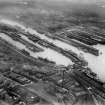
This building is situated on the N side of the entrance to Queen's Dock; it is depicted (but not noted) on the 1969 edition of the OS 1:1250 map. Following conversion, it is open to the public as a museum building associated with the display of the SV Glenlee, berthed immediately downstream (to the NW) at Yorkhill Quay.
Information from RCAHMS (RJCM), 15 February 2006.


