
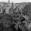
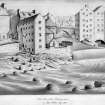
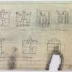
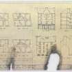
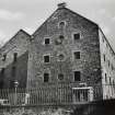
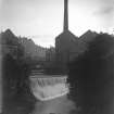
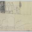
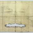
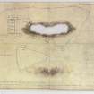
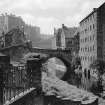
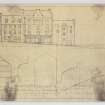
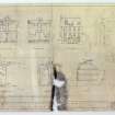
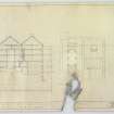
Edinburgh, Dean Village, Dean Path, West Mill


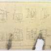
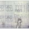
Mill (19th Century), Warehouse (19th Century)
Site Name Edinburgh, Dean Village, Dean Path, West Mill
Classification Mill (19th Century), Warehouse (19th Century)
Alternative Name(s) West Mill Lane; Water Of Leith; Warehouse
Canmore ID 119795
Site Number NT27SW 675
NGR NT 24112 73957
Datum OSGB36 - NGR
Permalink http://canmore.org.uk/site/119795


- Council Edinburgh, City Of
- Parish Edinburgh (Edinburgh, City Of)
- Former Region Lothian
- Former District City Of Edinburgh
- Former County Midlothian

