 |
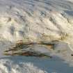
On-line Digital Images |
SC 1906851 |
Oblique aerial view of Loch Ruagaidh, Srath Carnaig, near Golspie, East Sutherland, looking NW. |
2000 |
Item Level |
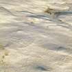 |
On-line Digital Images |
SC 1906897 |
Oblique aerial view of the Loch Ruagaidh hut circle and field system, Srath Carnaig, near Golspie, East Sutherland, looking N. |
2000 |
Item Level |
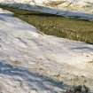 |
On-line Digital Images |
SC 1906899 |
Oblique aerial view of field systems N of Srath Carnaig, near Golspie, East Sutherland, looking NE. |
2000 |
Item Level |
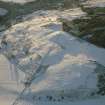 |
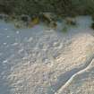
On-line Digital Images |
SC 1906902 |
Oblique aerial view of Torboll Farm, Strath Fleet, East Sutherland, looking SW. |
2000 |
Item Level |
 |
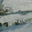
On-line Digital Images |
SC 1906908 |
Aerial view of hut circles at Coille Innis Bhreac, Srath Carnaig, near Golspie, East Sutherland, looking E. |
2000 |
Item Level |
 |
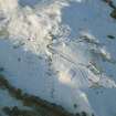
On-line Digital Images |
SC 1906916 |
Aerial view of Muirton Farm, Black Isle, looking S. |
2000 |
Item Level |
 |
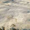
On-line Digital Images |
SC 1906925 |
Near overhead aerial view of Dalnamain, Srath Carnaig, near Golspie, East Sutherland, looking NW. |
2000 |
Item Level |
 |
On-line Digital Images |
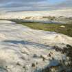
SC 1906896 |
Oblique aerial view of the Loch Ruagaidh hut circle and field system, Srath Carnaig, near Golspie, East Sutherland, looking NE. |
2000 |
Item Level |
 |
On-line Digital Images |
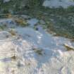
SC 1906898 |
Oblique aerial view of field systems N of Srath Carnaig, near Golspie, East Sutherland, looking NE. |
2000 |
Item Level |
 |
On-line Digital Images |
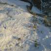
SC 1906905 |
Oblique aerial view of enclosures at Torrboll Farm, Strath Fleet, East Sutherland, looking SE. |
2000 |
Item Level |
 |
On-line Digital Images |
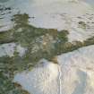
SC 1906906 |
Near overhead aerial view of enclosures and hut circle at Torrboll Farm, Strath Fleet, East Sutherland, looking E. |
2000 |
Item Level |
 |
On-line Digital Images |
SC 1906907 |
Aerial view of hut circle at Coille Innis Bhreac and hut circles, field systems and depopulated township at Achinael, looking E. |
2000 |
Item Level |
 |
On-line Digital Images |
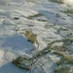
SC 1906921 |
Oblique aerial view of the area around Culdrain, Rogart, East Sutherland, looking SE. |
2000 |
Item Level |
 |
On-line Digital Images |
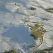
SC 1906922 |
Oblique aerial view of Culdrain and Blairmore, Rogart, East Sutherland, looking SE. |
2000 |
Item Level |
 |
On-line Digital Images |
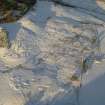
SC 1906900 |
Near overhead aerial view of Thor's Field, Torboll Farm, Strath Fleet, East Sutherland, looking N. |
2000 |
Item Level |
 |
On-line Digital Images |
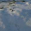
SC 1906901 |
Oblique aerial view of hut circles and field systems at Cnoc-an-t-Sidhean, Rogart, East Sutherland, looking NW. |
2000 |
Item Level |
 |
On-line Digital Images |
SC 1906909 |
Oblique aerial view of hut circles, field systems and depopulated township at Achinael, Srath Carnaig, near Golspie, East Sutherland, looking E. |
2000 |
Item Level |
 |
On-line Digital Images |
SC 1906910 |
Oblique aerial view of Cuthill Links, Dornoch Firth, looking NE. |
2000 |
Item Level |
 |
On-line Digital Images |
SC 1906911 |
Oblique aerial view of Glenmorangie Distillery, near Tain, Easter Ross, looking NE. |
2000 |
Item Level |
 |
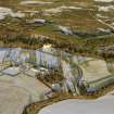
On-line Digital Images |
SC 1906852 |
Oblique aerial view of Loch Ruagaidh hut circle and field system, Srath Carnaig, near Golspie, East Sutherland, looking W. |
2000 |
Item Level |
 |
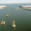
On-line Digital Images |
SC 1906913 |
Oblique aerial view of Balnagown Castle and policies, near Kildary, Easter Ross, looking NE. |
2000 |
Item Level |
 |
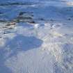
On-line Digital Images |
SC 1906914 |
Oblique aerial view down the Cromarty Firth to the North Sutor and Sutors of Cromarty, looking SE. |
2000 |
Item Level |
 |
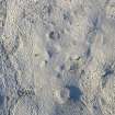
On-line Digital Images |
SC 1906912 |
Oblique aerial view of settlements and field systems between Achork and Cnoc-an-t-Sidhean, Rogart, East Sutherland, looking NW. |
2000 |
Item Level |
 |
On-line Digital Images |
SC 1906853 |
Oblique aerial view of Loch Ruagaidh hut circle and field system, Srath Carnaig, near Golspie, East Sutherland, looking W. |
2000 |
Item Level |


