
Fort William - Fort Augustus - Inverness Military Road


Military Road (18th Century)
Site Name Fort William - Fort Augustus - Inverness Military Road
Classification Military Road (18th Century)
Canmore ID 85529
Site Number NH64SE 57
NGR NH 6575 4200
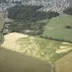
NGR Description NH 6512 4000 to NH 6666 4495
Datum OSGB36 - NGR
Permalink http://canmore.org.uk/site/85529


- Council Highland
- Parish Inverness And Bona
- Former Region Highland
- Former District Inverness
- Former County Inverness-shire
NH64SE 57.00 6512 4000 to 6666 4495
The minor road from Drumashie Moor is on the line of the 1726 Wade road to its junction with the 1732 road on the southern outskirts of Inverness. Re-alignment of the road at NH 6555 4096 isolates a 130m length of the old road on the E side, crossing the Holm Burn. The road ends at the castle, Inverness (NH64NE 9).
Visited by OS, March 1962.
The military road heads N into Inverness on the line now followed by the B862.
M Logie (Highland Council) 1997; NMRS, MS/1007/3.

