New Abbey, Monksmill
Watermill (18th Century)
Site Name New Abbey, Monksmill
Classification Watermill (18th Century)
Alternative Name(s) Meal Mill; New Abbey Mill; New Abbey Corn Mill
Canmore ID 68555
Site Number NX96NE 47
NGR NX 96229 66249
Datum OSGB36 - NGR
Permalink http://canmore.org.uk/site/68555























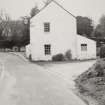


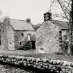




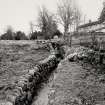












First 100 images shown. See the Collections panel (below) for a link to all digital images.
- Council Dumfries And Galloway
- Parish New Abbey
- Former Region Dumfries And Galloway
- Former District Nithsdale
- Former County Kirkcudbrightshire
NX96NE 47.00 96229 66249
Corn Mill [NAT] (at NX 96236 66224)
OS (GIS) MasterMap, July 2009.
NX96NE 47.01 NX 96160 66196 Mill Pond
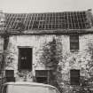
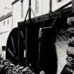
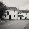
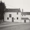
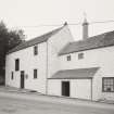
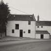
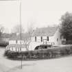
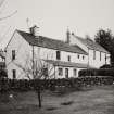
(Location cited as NX 962 663). Monksmill, probably late 18th century. A picturesque two-storey and attic rubble building with kiln and house adjoining. An 8-spoke, pitch-back wheel with wooden axle, buckets and spokes, and iron rings and hubs, 5ft (1.52m) wide by 14ft 6ins (4.42m) diameter drove 3 pairs of stones (dated 1851). The kiln has a circular vent with a fish wind-vane. Being restored in 1974.
J R Hume 1976.
NX 962 662 A watching brief was carried out during 1997 and 1998 on the construction of a new sewage pumping station near the North Bridge, New Abbey, and associated sewers through the village. The programme of works included some disturbance of the Scheduled area adjacent to the Corn Mill, thought to be on or near the site of the monastic mill, and further E the new sewers extended some 70m within the abbey precinct.
A clay-bonded granite-built footing for the N pier of the W gateway of the abbey precinct was encountered beneath the southbound carriageway of the A710, demonstrating the gateway to have been approximately 5.2m wide.
The SE corner of a substantial structure, with walls in excess of 1m thick built of granite, was encountered below the grass verge of the southbound carriageway of the A710, 15m NNE of the existing Corn Mill. The interior of the structure lies beneath the modern road and was not exposed. No dating evidence for it was found, but its position adjacent to the New Abbey Pow makes it a candidate for the monastic mill.
Sponsor: West of Scotland Water Authority.
M L Brann 1998.
NX 962 662 Archaeological monitoring was undertaken in February 2006 during the excavation of a drainage track, tree holes and gate posts in advance of new car parking facility currently being constructed opposite the Corn Mill. The archaeological monitoring of the drainage track suggested that this area, beside the ceramic drain, has seen little or no disturbance, but this area may have been significantly altered when the fishpond and its associated workings were constructed. It is likely that the watercourses were redirected to serve the mechanisms of the pond and mill, possibly indicated by a buried gravel deposit.
Archive to be deposited in NMRS.
Sponsor: Historic Scotland.
Claire Shaw, 2006.
Photographic Survey (October 1962)
Photographic survey of buildings in New Abbey, Kirkcudbrightshire, by the Scottish National Buildings Records in October 1962.
Photographic Survey (1967)
Photographic survey by the Scottish National Buildings Record in November 1967.
Publication Account (1986)
This range of buildings has been described as 'a classic example of the Galloway country mill'. Indeed, it may be regarded as representative of the numberless water powered grain mills that have done service throughout
Scotland since about 1750, although every mill, like every miller and almost every owner, had its own particular way of getting the work done.
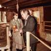
A mill probably stood on or near this site in the Middle Ages serving the nearby Cistercian monastery (no. 71), hence the name 'Monksmill' by which it is stIll known. The existing building, however, dates only from the late 18th century, and was erected by the Stewart family ofShambellie (no. 22), heirs to part of the medieval monastic estate. It was altered and heightened to three storeys during the 19th century, and continued in commercial use until the Second World War. Afterwards maintained as a precious relic by Mr Charles Stewart of Shambellie, it has more recently been restored with painstaking care by Scottish Development Department. The present condition of the building and its intricate mechanism reflects great credit on the prescient efforts of both these parties.
The restored water-wheel, which is affixed to the rear side-wall, is of a high breastshot or pitchback type, that is, the water drops on to its wooden buckets at a point. Just short of the wheel's vertical centre line, causing it to turn against the natural flow. The volume of water striking the wheel, and hence its speed, can be regulated by a trap-door in the wooden trough which carries the water to the wheel.
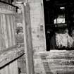
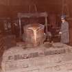
Inside, following usual Scottish practice, the mill is 'underdrift', that is, the pairs of grinding stones (in this case, three) are on an upper floor and driven from below; windmills for instance, are usually 'overdrift' because the power comes from above. The drive mechanisms in this mill are thus on the ground floor directly behind the water-wheel; they are contained within the timber-framed cupboard which confronts the visitor on entering the mill. The main purpose of the gearing is to transmit and convert the power from the slow-speed, large-radius and vertically-set turning motion of the water-wheel outside into a series of high-speed, small-radius and horizontally rotating millstones within. It does this through a system of shafts and gear wheels of different sizes and mesh, some bevelled, some straight-edged, and one with wooden teeth. The small gears (the stone nuts) on the fmal drive to the stones can be raised and disengaged when not required.
On the first floor, the three pairs of millstones are cased in wooden vats, so only the top of the upper stone of each pair (the mobile or runner stone) can be seen; the lower stone (the bedstone) remains static. One set of emery-faced composition stones operated independently to produce animal provender. The other sets of stones were used in succession to obtain oatmeal: the shelling stones separated the husks and the kernels; the finishing stones ground the shelled grain (groats) into fmished meal of different grades. These operations required better quality stones like those lying outside the mill, which have sandstone centres and banded segments of quartz. The wooden hoppers mounted above the stones were fed with dried grain from the loft above.
The grain was dried in the adjacent kiln, laid on a perforated iron-tiled floor above a blick-built furnace. The kiln was fired in a hearth on the ground floor where a passage-vault, possibly to assist internal ventilation, runs around the outside of the flared furnace-stack. The ventilator cowl on the roof-ridge-a tell-tale indicator of a kiln-is here topped with a weather-vane in the shape of a salmon. Unusually, the kiln and the miller's house have been built as one unit.
These primary processes were supported by a number of ancillary operations: on the ground floor, a winnowing machine and fan (for sieving the husks and blowing them through to the kiln for fuel) and an oats bruiser for animal feed), no longer extant, were driven from the pit-wheel; on the fIrst floor, a shaking sieve (for refmed sifting of meal) was belt-driven from an extended millstone drive-shaft; and in the loft, a pulley-operated sack-hoist was driven from an extension of the main upright shaft.
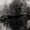
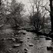
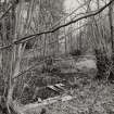
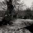
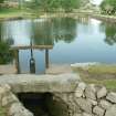
Finally, and most crucially, water to power the mill was conducted from the northern end of Loch Kindar (NX 964648) on a 1km-long lade to the pond which lies just to the south-west of the mill. This too has been restored to working order, placid and complete with its sluice-mechanism, its overflow channel-and its ducks!
Information from ‘Exploring Scotland’s Heritage: Dumfries and Galloway’, (1986).
Standing Building Recording (12 January 2015 - 13 January 2015)
Under the terms of its PIC call-off contract with Historic Scotland, Kirkdale Archaeology was asked to undertake a programme of standing building recording at New Abbey Corn Mill, Dumfries and Galloway. The existing ventilation system was due to be upgraded in order to make it more effective at extracting dust during the milling process and, as part of this process, the wooden tool cupboard in the south-west angle of the ground floor was to have the planks of its base removed, and the floor boards in front of the cupboard were to be lifted in order to expose the existing ventilation pipe. This would provide an opportunity to make a record of those features previously hidden prior to any further works proceeding.
It was apparent that much of the timber used in the creation/re-creation of the tool store was modern, while that timber which was clearly older may not be in-situ. The standing building recording aspect of the work allowed the observation and recording of hitherto un-quantified elements, which has resulted in a better understanding of how the current configuration came about. The excavation had such a minimal impact that nothing of archaeological interest was noted.
Sponsor: Historic Environment Scotland
P Fox 2015
Kirkdale Archaeology
OASIS ID: kirkdale1-311400


