Pricing Change
New pricing for orders of material from this site will come into place shortly. Charges for supply of digital images, digitisation on demand, prints and licensing will be altered.
Upcoming Maintenance
Please be advised that this website will undergo scheduled maintenance on the following dates:
Thursday, 9 January: 11:00 AM - 3:00 PM
Thursday, 23 January: 11:00 AM - 3:00 PM
Thursday, 30 January: 11:00 AM - 3:00 PM
During these times, some functionality such as image purchasing may be temporarily unavailable. We apologise for any inconvenience this may cause.
Cold Chapel
House Platform(S) (Prehistoric), Settlement (Prehistoric)
Site Name Cold Chapel
Classification House Platform(S) (Prehistoric), Settlement (Prehistoric)
Canmore ID 47380
Site Number NS92NW 7
NGR NS 9378 2512
Datum OSGB36 - NGR
Permalink http://canmore.org.uk/site/47380
- Council South Lanarkshire
- Parish Lamington And Wandel
- Former Region Strathclyde
- Former District Clydesdale
- Former County Lanarkshire
Field Visit (20 July 1955)
NS92NW 7 9378 2512.
(NS 93782512) Earthwork (NAT).
OS 6" map (1955)
This settlement was in a similar condition (cf. RCAHMS 1978) when seen in 1955.
Visited by OS (JLD) 20 July 1955
Measured Survey (23 August 1967)
RCAHMS surveyed this settlement by plane-table on 23 August 1967 at a scale of 1mm:1ft. The resultant plan was redrawn in ink in 1974 (traces of later cultivation were removed) and published in the County Inventory of Lanarkshire (RCAHMS 1978) as Fig. 38.
Field Visit (August 1975)
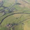
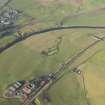
NS 937 251. A settlement is situated 430m NNE of Cold Chapel farmhouse, and at a height of 250m OD, on gently sloping ground near the foot of the W slopes of White Hill. Oval on plan, it is bounded by what has been a massive bank of earth and stones which encloses an area measuring 78m by 69m; there is no trace of a ditch. Although considerably denuded, the bank still stands to a maximum height of 3.7m externally and 2.1m internally. The three gaps in the bank all appear to be original entrances.
The interior, the level of which falls 9.1m from E to W, bears clear indications of later cultivation, especially in the lower (W) half, but in the higher (E) half at least nine crescentic house-platforms can be distinguished.
RCAHMS 1978, visited August 1975
Field Visit (25 July 1978)
NS92NW 7 9378 2512.
A settlement as described above.
Surveyed at 1:2500.
Visited by OS (BS) 25 July 1978
Geophysical Survey (February 1990)
Detailed survey of several sites in the area prior to the M74 motorway.


