Pricing Change
New pricing for orders of material from this site will come into place shortly. Charges for supply of digital images, digitisation on demand, prints and licensing will be altered.
Black Hill, Lesmahagow
Fort(S) (Prehistoric), House Platform(S) (Prehistoric), Settlement (Prehistoric)
Site Name Black Hill, Lesmahagow
Classification Fort(S) (Prehistoric), House Platform(S) (Prehistoric), Settlement (Prehistoric)
Canmore ID 46670
Site Number NS84SW 2
NGR NS 83198 43507
NGR Description NS 83185 43533 and NS83235 43436
Datum OSGB36 - NGR
Permalink http://canmore.org.uk/site/46670
First 100 images shown. See the Collections panel (below) for a link to all digital images.
- Council South Lanarkshire
- Parish Lesmahagow
- Former Region Strathclyde
- Former District Clydesdale
- Former County Lanarkshire
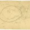
Measured Survey (9 June 1955)
The fort and settlement at Black Hill, Lesmahagow, were surveyed by RCAHMS on 9 June 1955 at a scale of 1": 50ft. Although the survey was led by their archaeologist R W Feachem, the initials 'GM' on the plan indicate that it was later reviewed by Gordon Maxwell, perhaps when the site was revisited by RCAHMS in August 1975. The plan was inked in 1976 before publication at a reduced scale in the 1978 RCAHMS County Inventory.
Reference (1963)
This site is noted in the ‘List of monuments discovered during the survey of marginal land (1956-8)’, published in Vol. 1 of the RCAHMS Inventory of Stirlingshire. The 26 monuments were listed by their name, classification, parish and county, and the list also includes an indication of whether they had been planned (P), whether they were visible only as a cropmark (C), and whether they were worthy of preservation (*).
Information from RCAHMS (GFG) 30 October 2012.
Field Visit (8 August 1966)
NS84SW 2 8318 4350.
(NS 8318 4350) Fort (NR)
OS 6" map (1971)
Surveyed at 1:2500.
Visited by OS (RD) 8 August 1966
Aerial Photography (October 1970)
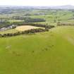
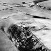
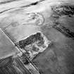
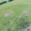
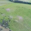
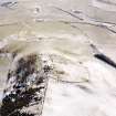
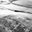
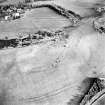
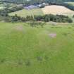
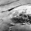
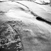
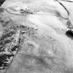
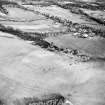
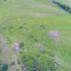
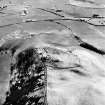
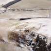
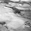
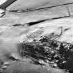
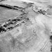
Oblique aerial photographs showing remains of the fort, settlement and cairn, Black Hill, Lesmahagow, taken by John Dewar in October 1970.
Field Visit (August 1975)
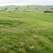
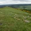
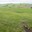
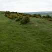
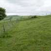
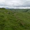
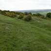
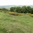
Fort and Settlement, Black Hill: This stone-walled fort and later settlement occupy the summit of Black Hill, a prominent steep-flanked ridge that extends N from Dillar Hill between the Rivers Clyde and Nethan, commanding extensive views in all directions. The ground falls sharply away on the E and W, but easy access may be had along the spine of the ridge from both the N and S.
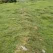
The fort (A on plan) is roughly oval and measures about 155m by 108m within a single stone wall. On the N and W ploughing and stone-robbing have reduced the wall to a band of debris 3.0m in average thickness and a modern farm track has obliterated a short stretch in the E; elsewhere, however, it measures up to 5m in thickness and 0.5m in height. Three outer facing stones have survived in situ as shown on the plan. There is no indication of the position of an original entrance. The interior contains no traces of dwellings, but the highest point of the hill is surmounted by the cairn described on NS84SW 15.
The settlement (B), which is situated on gently sloping ground, adjoins the fort on the SE and measures about 78m by 58m internally. Bounded by the fort wall for part of the circuit, it is otherwise enclosed by double banks of earth and stone with a medial ditch; the banks are best preserved on the N sector on each side of the track already mentioned, where they are 4.6m thick and stand 0.6m above the bottom of the ditch; elsewhere they have been destroyed or survive simply as a low scarp. The entrance is in the SW. Two crescentic scarps lying within the settlement immediately N of the entrance probably indicate the sites of round timber houses about 8m in diameter, and there are at least three other possible sites now too indefinite to plan, in the N half of the interior.
Both the fort and settlement are traversed by ruinous boundary-walls of no great age.
RCAHMS 1978, visited 1975
Publication Account (1985)
This group of monuments lies on the rounded top of Black Hill (290 m OD) from which there are panoramic views over the Clyde Valley. The earliest feature on the hill is a large bronze-age round cairn situated on the highest point; it has been reduced to a grass-grown mound, 18m in diameter by 0.9m in height, with several kerbstones visible on the west. Surmounting the cairn there is an Ordnance Survey triangulation pillar which is used as a control point in the preparation of OS maps. These pillars are normally situated in prominent positions and so are frequently found associated with hilltop archaeological sites.
Many of the forts described in this book are multiperiod with the ramparts of the various phases piled up on one another; in this case, however, the earliest fort has been built to enclose the entire summit of the hill, while the later settlement has been tacked on to the south side of the fort, so the interiors of the two sites do not overlap. The oval fort is comparatively large, measuring I55m by 108m (1.67 ha) within a single stone wall which is now so mined that it is no longer possible to detect any original entrances. Abutting the south side of the fort there is a settlement, defended for the most part by double banks with a medial ditch but, on the north, the wall of the fort has been incorporated into the circuit. There are at least two round-house sites in the interior, lying on the west immediately north of the entrance, and what may be others just to the south of the fort wall.
Without excavation it is impossible to tell how long a gap (if any) existed between the occupation of the fort and that of the settlement but it is possible that the fort belongs to the earlier part of the iron age, while the settlement is likely to date to its later phases. The reason for the shift away from the summit, however, is not hard to guess, and must be related to the exposed nature of the hilltop and a desire to live on a slightly more sheltered section of the hill.
Information from ‘Exploring Scotland’s Heritage: The Clyde Estuary and Central Region’, (1985).
Note (19 August 2014 - 23 May 2016)
On the SE flank of the fort on Black Hill, at the southern end of its elongated summit, its rampart has been incorporated into the circuit of an oval settlement earthwork measuring 78m from NE to SW by 58m transversely (0.35ha) within twin ramparts about 4.6m in thickness and standing 0.6m in height above the bottom of a medial ditch; two crescentic scarps on the W are probably the remains of house platforms and the entrance is on the SW. While the curious junction with the neighbouring fort on the NW appears on plan at least to disrupt its defensive integrity, its hilltop position and the character of its perimeter qualify for inclusion as a fort in its own right.
Information from An Atlas of Hillforts of Great Britain and Ireland – 23 May 2016. Atlas of Hillforts SC1577
Note (19 August 2014 - 23 May 2016)
This fort stands on the summit of Black Hill, which forms part of a prominent ridge rising up on the W side of the Clyde Valley. Oval on plan, it measures 155m from NW to SE by 108m transversely (1.22ha) within a single stone rampart spread between 3m and 5m in thickness. Planted with trees in the 19th century, the only feature visible within the interior is a Bronze Age cairn measuring 18m in diameter by 0.9m in height on the summit. No entrance has been identified.
On the SE the rampart of the fort has been incorporated into the circuit of an oval settlement earthwork measuring 78m from NE to SW by 58m transversely (0.35ha) within twin ramparts about 4.6m in thickness and standing 0.6m in height above the bottom of a medial ditch; two crescentic scarps on the W are probably the remains of house platforms and the entrance is on the SW. Despite the curious junction with the fort on the NW, this earthwork in its hilltop position qualifies as a fort in its own right. See Atlas No. 1577.
Information from An Atlas of Hillforts of Great Britain and Ireland – 23 May 2016. Atlas of Hillforts SC1576
Excavation (5 July 2017 - 25 August 2017)
NS 8318 4350 and NS 8739 4491 (NS84SW 2 and NS84SE 1) An excavation was undertaken, 5 July – 25 August 2017, at two hilltop enclosures close to Lanark - Castle Qua and Black Hill. The work formed part of CAVLP’s Investigating the Past project, which focused on the archaeology and landscape of the first millennia in the Clyde and Avon Valleys. The excavations involved members of local community groups, volunteers, service users from Phoenix Futures and volunteers from Clydesdale Community Initiatives as well as students and staff from the University of Glasgow’s Department of Archaeology.
At Castle Qua, one trench outside the large earthwork that defines the site revealed a substantial outer ditch, while a second trench inside the enclosure found the substantial stone foundations of a structure. Very few artefacts were discovered during the excavations and it is hoped that post-excavation analysis will identify suitable dating evidence.
Five trenches were excavated across key features on Black Hill, revealing detailed evidence for ramparts and earthworks. A trench was also excavated on top of the cairn that provides the NTS viewing point, confirming the supposition that it is a large and very substantial Bronze Age monument. A number of artefacts were recovered from Black Hill, including prehistoric pottery from beneath the rampart, which should allow for dating of this enigmatic hilltop site.
Archive: NRHE
Funder: Heritage Lottery Fund, LEADER and Historic Environment Scotland
Paul Murtagh – Northlight Heritage
(Source: DES, Volume 18)


