Following the launch of trove.scot in February 2025 we are now planning the retiral of some of our webservices. Canmore will be switched off on 24th June 2025. Information about the closure can be found on the HES website: Retiral of HES web services | Historic Environment Scotland
Date 1950 - 1958
Event ID 918872
Category Project
Type Project
Permalink http://canmore.org.uk/event/918872
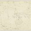
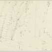
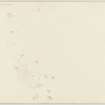
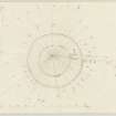
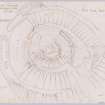
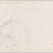
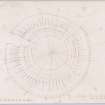
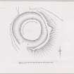
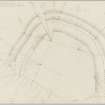
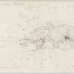
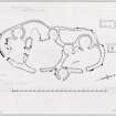
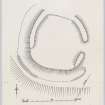
In the years following the Second World War, the British government wrought a number of changes aimed at improving our self-sufficiency, whether in foodstuffs, timber or energy. The combination of schemes of subsidy and improvements in technology brought with it an increasing threat to monuments that had survived virtue of the fact that they were sited in marginal land. In response, the Royal Commission on the Ancient and Historical Monuments of Scotland (RCAHMS) halted its national programme of County Inventories to undertake a rescue project that used newly available aerial photography to identify threatened unrecorded prehistoric monuments, such as brochs, forts, palisaded settlements and earthworks. After eight years, the two archaeologists, with some help from other professionals and volunteers, had recorded more than 678 sites and prepared 190 measured surveys. While rescue was initially achieved though record, excavation and communication with the Ordnance Survey (OS), about 50% are now protected by Scheduling. The results of the project went further, helping to underpin Stuart Piggott’s development of a regional Iron Age synthesis in the 1960s. Now online for the first time, the information that was produced is the most detailed that exists for more than 90% of the sites, and, as with any documentary source, it is incumbent upon us to understand its strengths and weaknesses when we use it to understand, manage or protect the sites we care value.
[Abstract from Geddes 2013, Proc Soc Antiq Scot v143, pp363-391]

| Event | Type | Subtype | Notes | Date |
|---|---|---|---|---|
| 920371 | RECORDING | FIELD VISIT | This site was included within the RCAHMS Marginal Land Survey (1950-1962), an unpublished rescue project. Site descriptions, organised by county, are available to view online - see the searchable PDF in 'Digital Items'. These vary from short notes, to lengthy and full descriptions. Contemporary plane-table surveys and inked drawings, where available, can be viewed online in most cases - see 'Digital Images'. The original typecripts, notebooks and drawings can also be viewed in the RCAHMS search room. [...] | 30 August 1950 |
| 920383 | RECORDING | FIELD VISIT | This site was included within the RCAHMS Marginal Land Survey (1950-1962), an unpublished rescue project. Site descriptions, organised by county, are available to view online - see the searchable PDF in 'Digital Items'. These vary from short notes, to lengthy and full descriptions. Contemporary plane-table surveys and inked drawings, where available, can be viewed online in most cases - see 'Digital Images'. The original typecripts, notebooks and drawings can also be viewed in the RCAHMS search room. [...] | 6 August 1950 |
| 920373 | RECORDING | FIELD VISIT | This site was included within the RCAHMS Marginal Land Survey (1950-1962), an unpublished rescue project. Site descriptions, organised by county, are available to view online - see the searchable PDF in 'Digital Items'. These vary from short notes, to lengthy and full descriptions. Contemporary plane-table surveys and inked drawings, where available, can be viewed online in most cases - see 'Digital Images'. The original typecripts, notebooks and drawings can also be viewed in the RCAHMS search room. [...] | 30 August 1950 |

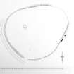
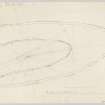
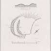
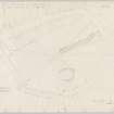
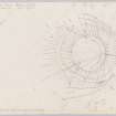
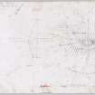
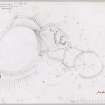
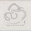
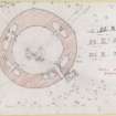
SC 343846
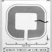
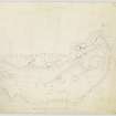
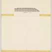
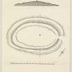
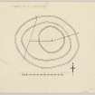
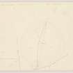
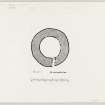
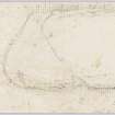
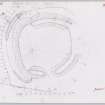
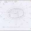
Inked plan and section: Lurg Moor.
Records of the Royal Commission on the Ancient and Historical Monuments of Scotland (RCAHMS), Edinbu
c. 1952
© Crown Copyright: HES

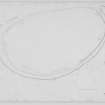
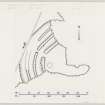
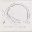
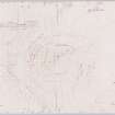
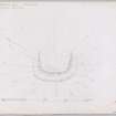
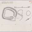
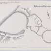
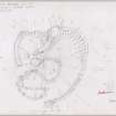
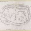
SC 697227
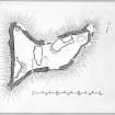
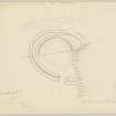
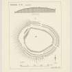
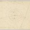
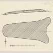
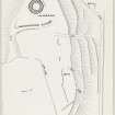
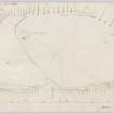
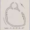
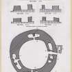
Inked plan: fort at Dun-da-Lamh. Based on 1956 survey.
Records of the Royal Commission on the Ancient and Historical Monuments of Scotland (RCAHMS), Edinbu
5/9/1974
© Crown Copyright: HES

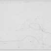
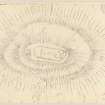
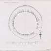
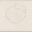
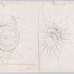
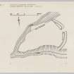
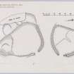
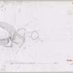
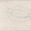
DP 023786
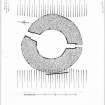
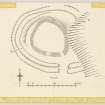
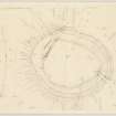
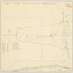
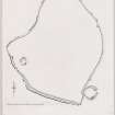
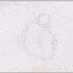
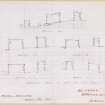
Inked plan; broch, Doon Castle, Ardwell Point.
Records of the Royal Commission on the Ancient and Historical Monuments of Scotland (RCAHMS), Edinbu
c. 1955
© Crown Copyright: HES

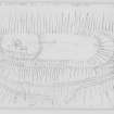
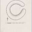
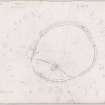
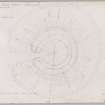
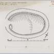
SC 1098663
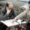
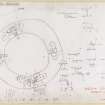
Ian Scott and Alastair MacLaren at The Dunion, Jedburgh.
Records of the Royal Commission on the Ancient and Historical Monuments of Scotland (RCAHMS), Edinbu
1961
© Crown Copyright: HES

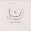
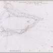
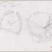
DP 043065
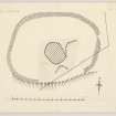
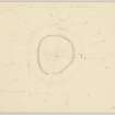
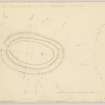
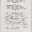
Plane-table survey: earthwork at Bargain Hill.
Records of the Royal Commission on the Ancient and Historical Monuments of Scotland (RCAHMS), Edinbu
c. 1954
© Crown Copyright: HES

DP 043066
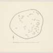
Inked plan; Bargain Hill Earthwork.
Records of the Royal Commission on the Ancient and Historical Monuments of Scotland (RCAHMS), Edinbu
c. 1954
© Crown Copyright: HES

DP 044251
Plane-table survey (1 of 2); Little Conval, fort.
Records of the Royal Commission on the Ancient and Historical Monuments of Scotland (RCAHMS), Edinbu
17/8/1956
© Crown Copyright: HES

DP 044252
Plane-table survey (2 of 2); Little Conval, fort and field system (NJ 295 391).
Records of the Royal Commission on the Ancient and Historical Monuments of Scotland (RCAHMS), Edinbu
17/8/1956
© Crown Copyright: HES

DP 044253
Plane-table survey: fort, Knock of Alves.
Records of the Royal Commission on the Ancient and Historical Monuments of Scotland (RCAHMS), Edinbu
17/4/1957
© Crown Copyright: HES

DP 045681
Plane-table survey: fort at Pitcairnfield.
Records of the Royal Commission on the Ancient and Historical Monuments of Scotland (RCAHMS), Edinbu
21/2/1958
© Crown Copyright: HES

DP 053137
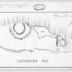
Ink drawing: fort and homestead at Glenduckie Hill.
Records of the Royal Commission on the Ancient and Historical Monuments of Scotland (RCAHMS), Edinbu
c. 1952
© Crown Copyright: HES

DP 094926
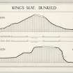
Inked drawing: fort at King's Seat.
Records of the Royal Commission on the Ancient and Historical Monuments of Scotland (RCAHMS), Edinbu
c. 1957
© Crown Copyright: HES

DP 094927
Inked drawing: fort at King's Seat.
Records of the Royal Commission on the Ancient and Historical Monuments of Scotland (RCAHMS), Edinbu
c. 1957
© Crown Copyright: HES

DP 137276
Plane-table survey (redrawn): North Berwick Law prehistoric settlement and field system.
Records of the Royal Commission on the Ancient and Historical Monuments of Scotland (RCAHMS), Edinbu
12/5/1954
© Crown Copyright: HES

DP 147297
Unpublished section: Maiden Castle.
Records of the Royal Commission on the Ancient and Historical Monuments of Scotland (RCAHMS), Edinbu
c. 1957
© Crown Copyright: HES

DP 147298
Plane-table survey: Maiden Castle.
Records of the Royal Commission on the Ancient and Historical Monuments of Scotland (RCAHMS), Edinbu
15/8/1956
© Crown Copyright: HES

DP 147299
Unpublished plan: Maiden Castle.
Records of the Royal Commission on the Ancient and Historical Monuments of Scotland (RCAHMS), Edinbu
c. 1959
© Crown Copyright: HES

DP 147345
Unpublished plan: Wheedlemont.
Records of the Royal Commission on the Ancient and Historical Monuments of Scotland (RCAHMS), Edinbu
c. 1956
© Crown Copyright: HES

DP 147300
Unpublished plan: Barra Hill.
Records of the Royal Commission on the Ancient and Historical Monuments of Scotland (RCAHMS), Edinbu
c. 1959
© Crown Copyright: HES

DP 147301
Plane-table survey: Barra Hill.
Records of the Royal Commission on the Ancient and Historical Monuments of Scotland (RCAHMS), Edinbu
22/5/1957
© Crown Copyright: HES

DP 147302
Unpublished plan: Mortlich.
Records of the Royal Commission on the Ancient and Historical Monuments of Scotland (RCAHMS), Edinbu
c. 1956
© Crown Copyright: HES

DP 147303
Plane-table survey: Mortlich.
Records of the Royal Commission on the Ancient and Historical Monuments of Scotland (RCAHMS), Edinbu
15/8/1956
© Crown Copyright: HES

DP 147305
Unpublished plan: Hill of Christ's Kirk.
Records of the Royal Commission on the Ancient and Historical Monuments of Scotland (RCAHMS), Edinbu
c. 1956
© Crown Copyright: HES

DP 147306
Plane-table survey (and reduction): Hill of Christ's Kirk.
Records of the Royal Commission on the Ancient and Historical Monuments of Scotland (RCAHMS), Edinbu
4/8/1956
© Crown Copyright: HES

DP 147307
Plane-table survey: Newton Hill.
Records of the Royal Commission on the Ancient and Historical Monuments of Scotland (RCAHMS), Edinbu
18/4/1957
© Crown Copyright: HES

DP 147308
Plane-table survey: fort at Barmkyn of North Keig.
Records of the Royal Commission on the Ancient and Historical Monuments of Scotland (RCAHMS), Edinbu
19/8/1956
© Crown Copyright: HES

DP 147309
Plane-table survey: Cairnmore.
Records of the Royal Commission on the Ancient and Historical Monuments of Scotland (RCAHMS), Edinbu
16/8/1956
© Crown Copyright: HES

DP 147310
Unpublished plan: Newton Hill, Cairnborrow.
Records of the Royal Commission on the Ancient and Historical Monuments of Scotland (RCAHMS), Edinbu
c. 1957
© Crown Copyright: HES

DP 147346
Plane-table survey: Wheedlemont.
Records of the Royal Commission on the Ancient and Historical Monuments of Scotland (RCAHMS), Edinbu
3/8/1956
© Crown Copyright: HES

DP 147348
Unpublished plan: Tillymuick.
Records of the Royal Commission on the Ancient and Historical Monuments of Scotland (RCAHMS), Edinbu
c. 1957
© Crown Copyright: HES

DP 147349
Plane-table survey: Tillymuick.
Records of the Royal Commission on the Ancient and Historical Monuments of Scotland (RCAHMS), Edinbu
20/5/1957
© Crown Copyright: HES

DP 147371
Plane-table survey: fort and broch at Laws of Monifeith (sheet 1 of 2).
Records of the Royal Commission on the Ancient and Historical Monuments of Scotland (RCAHMS), Edinbu
23/4/1957
© Crown Copyright: HES

DP 147372
Plane-table survey: fort and broch at Laws of Monifeith (sheet 2 of 2).
Records of the Royal Commission on the Ancient and Historical Monuments of Scotland (RCAHMS), Edinbu
23/4/1957
© Crown Copyright: HES

DP 147373
Inked plan; Laws of Monifieth, broch. Based on 1957 survey.
Records of the Royal Commission on the Ancient and Historical Monuments of Scotland (RCAHMS), Edinbu
26/2/1974
© Crown Copyright: HES

DP 147374
Plane-table survey (sheet 1 of 4); Craig Hill, fort and broch.
Records of the Royal Commission on the Ancient and Historical Monuments of Scotland (RCAHMS), Edinbu
19/4/1957
© Crown Copyright: HES

DP 147375
Plane-table survey (sheet 2 of 4); Craig Hill, fort and broch.
Records of the Royal Commission on the Ancient and Historical Monuments of Scotland (RCAHMS), Edinbu
20/4/1957
© Crown Copyright: HES

DP 147376
Plane-table survey (sheet 3 of 4); Craig Hill, fort and broch.
Records of the Royal Commission on the Ancient and Historical Monuments of Scotland (RCAHMS), Edinbu
20/4/1957
© Crown Copyright: HES

DP 147377
Plane-table survey (sheet 4 of 4); Craig Hill, fort and broch.
Records of the Royal Commission on the Ancient and Historical Monuments of Scotland (RCAHMS), Edinbu
19/4/1957
© Crown Copyright: HES

DP 147378
Ink plan: broch at Craig Hill (based on 1957 survey),
Records of the Royal Commission on the Ancient and Historical Monuments of Scotland (RCAHMS), Edinbu
18/2/1974
© Crown Copyright: HES

DP 147379
Inked plan (based on 1957 survey); broch and fort, Craig Hill.
Records of the Royal Commission on the Ancient and Historical Monuments of Scotland (RCAHMS), Edinbu
18/2/1974
© Crown Copyright: HES

DP 147380
Plane-table survey; St Bride's Ring, settlement.
Records of the Royal Commission on the Ancient and Historical Monuments of Scotland (RCAHMS), Edinbu
22/4/1957
© Crown Copyright: HES

DP 147381
Inked plan, based on 1957 survey. St Bride's Ring, settlement.
Records of the Royal Commission on the Ancient and Historical Monuments of Scotland (RCAHMS), Edinbu
14/2/1974
© Crown Copyright: HES

DP 147382
Plane-table survey; West Mains of Ethie, promontory fort.
Records of the Royal Commission on the Ancient and Historical Monuments of Scotland (RCAHMS), Edinbu
6/5/1957
© Crown Copyright: HES

DP 147383
Inked plan (based on 1957 survey); West Mains of Ethie.
Records of the Royal Commission on the Ancient and Historical Monuments of Scotland (RCAHMS), Edinbu
6/3/1974
© Crown Copyright: HES

DP 147522
Plane-table survey: Dunnideer.
Records of the Royal Commission on the Ancient and Historical Monuments of Scotland (RCAHMS), Edinbu
5/1957
© Crown Copyright: HES

DP 147565
Plane-table survey: fort at Dechmont Law.
Records of the Royal Commission on the Ancient and Historical Monuments of Scotland (RCAHMS), Edinbu
20/5/1954
© Crown Copyright: HES

DP 147566
Plane-table survey: fort at Beinn Freiceadain (1 of 3).
Records of the Royal Commission on the Ancient and Historical Monuments of Scotland (RCAHMS), Edinbu
21/10/1955
© Crown Copyright: HES

DP 147567
Plane-table survey: fort at Beinn Freiceadain (2 of 3).
Records of the Royal Commission on the Ancient and Historical Monuments of Scotland (RCAHMS), Edinbu
c. 21/10/1955
© Crown Copyright: HES

DP 147574
Plane-table survey: fort at Beinn Freiceadain (3 of 3).
Records of the Royal Commission on the Ancient and Historical Monuments of Scotland (RCAHMS), Edinbu
21/10/1955
© Crown Copyright: HES

DP 147575
Unpublished plan: fort at Beinn Freiceadain
Records of the Royal Commission on the Ancient and Historical Monuments of Scotland (RCAHMS), Edinbu
c. 1955
© Crown Copyright: HES

DP 147576
Plane-table survey: fort at Cnoc An Ratha (1 of 2).
Records of the Royal Commission on the Ancient and Historical Monuments of Scotland (RCAHMS), Edinbu
22/10/1955
© Crown Copyright: HES

DP 147577
Plane-table survey: fort at Cnoc An Ratha (2 of 2).
Records of the Royal Commission on the Ancient and Historical Monuments of Scotland (RCAHMS), Edinbu
22/10/1955
© Crown Copyright: HES

DP 147578
Plane-table survey: fort at Garrywhin (1 of 3).
Records of the Royal Commission on the Ancient and Historical Monuments of Scotland (RCAHMS), Edinbu
20/10/1955
© Crown Copyright: HES

DP 147581
Plane-table survey: fort at Garrywhin (2 of 3)
Records of the Royal Commission on the Ancient and Historical Monuments of Scotland (RCAHMS), Edinbu
20/10/1955
© Crown Copyright: HES

DP 147582
Plane-table survey: fort at Garrywhin (3 of 3).
Records of the Royal Commission on the Ancient and Historical Monuments of Scotland (RCAHMS), Edinbu
20/10/1955
© Crown Copyright: HES

DP 147595
Inked plan; Riccarton Earthwork.
Records of the Royal Commission on the Ancient and Historical Monuments of Scotland (RCAHMS), Edinbu
c. 1953
© Crown Copyright: HES

DP 147608
Inked drawing: Earthwork at Dunduff.
Records of the Royal Commission on the Ancient and Historical Monuments of Scotland (RCAHMS), Edinbu
c. 1955
© Crown Copyright: HES

DP 147609
Inked plan (draft); High Letterpin.
Records of the Royal Commission on the Ancient and Historical Monuments of Scotland (RCAHMS), Edinbu
c. 1954
© Crown Copyright: HES

DP 147610
Inked drawing; Guiltreehill.
Records of the Royal Commission on the Ancient and Historical Monuments of Scotland (RCAHMS), Edinbu
c. 1953
© Crown Copyright: HES

DP 147611
Inked plan; Loans Earthwork.
Records of the Royal Commission on the Ancient and Historical Monuments of Scotland (RCAHMS), Edinbu
c. 1953
© Crown Copyright: HES

DP 147612
Plane-table survey: Duniewick Fort.
Records of the Royal Commission on the Ancient and Historical Monuments of Scotland (RCAHMS), Edinbu
1/9/1954
© Crown Copyright: HES

DP 147613
Survey drawing (and half size reduction in red); Dunduff earthwork.
Records of the Royal Commission on the Ancient and Historical Monuments of Scotland (RCAHMS), Edinbu
8/9/1955
© Crown Copyright: HES

DP 147614
Survey drawing (redrawn); inner enclosure, Harpercroft.
Records of the Royal Commission on the Ancient and Historical Monuments of Scotland (RCAHMS), Edinbu
c. 16/3/1953
© Crown Copyright: HES

DP 147615
Plane-table survey: inner enclosure, Harpercroft.
Records of the Royal Commission on the Ancient and Historical Monuments of Scotland (RCAHMS), Edinbu
16/3/1953
© Crown Copyright: HES

DP 147616
Plane-table survey (with half size reduction in red); Howmoor, dun.
Records of the Royal Commission on the Ancient and Historical Monuments of Scotland (RCAHMS), Edinbu
5/9/1955
© Crown Copyright: HES

DP 147617
Plane-table survey (redrawn); High Letterpin, settlement.
Records of the Royal Commission on the Ancient and Historical Monuments of Scotland (RCAHMS), Edinbu
30/8/1954
© Crown Copyright: HES

DP 147618
Plane-table survey (and half size reduction in red); Guiltreehill, earthwork.
Records of the Royal Commission on the Ancient and Historical Monuments of Scotland (RCAHMS), Edinbu
28/5/1953
© Crown Copyright: HES

DP 147619
Inked plan; Laighpark, enclosure.
Records of the Royal Commission on the Ancient and Historical Monuments of Scotland (RCAHMS), Edinbu
c. 1953
© Crown Copyright: HES

DP 147620
Plane-table survey; Laighpark, earthwork.
Records of the Royal Commission on the Ancient and Historical Monuments of Scotland (RCAHMS), Edinbu
28/5/1953
© Crown Copyright: HES

DP 147621
Plane table survey drawing (redrawn); Loans, earthwork.
Records of the Royal Commission on the Ancient and Historical Monuments of Scotland (RCAHMS), Edinbu
17/3/1953
© Crown Copyright: HES

DP 147622
Inked plan: earthwork at Kelburne park.
Records of the Royal Commission on the Ancient and Historical Monuments of Scotland (RCAHMS), Edinbu
c. 1953
© Crown Copyright: HES

DP 147626
Plane-table surveys: dun at Boydston, earthwork at Kelburne Park.RCAHMS pencil plane table survey drawings.
Records of the Royal Commission on the Ancient and Historical Monuments of Scotland (RCAHMS), Edinbu
26/5/1953
© Crown Copyright: HES

DP 147627
Plane-table survey (and half size reduction); Riccarton, earthwork.
Records of the Royal Commission on the Ancient and Historical Monuments of Scotland (RCAHMS), Edinbu
17/3/1953
© Crown Copyright: HES

DP 148031
Plane-table survey: fort at Creag A'Ghiubhais.
Records of the Royal Commission on the Ancient and Historical Monuments of Scotland (RCAHMS), Edinbu
9/10/1957
© Crown Copyright: HES

DP 148032
Plane-table survey: settlement at Cockburn Law.
Records of the Royal Commission on the Ancient and Historical Monuments of Scotland (RCAHMS), Edinbu
25/6/1953
© Crown Copyright: HES

DP 148034
Ink drawing: settlement at Cockburn Law.
Records of the Royal Commission on the Ancient and Historical Monuments of Scotland (RCAHMS), Edinbu
c. 1953
© Crown Copyright: HES

DP 148036
Inked drawing: settlement at Fairnylees.
Records of the Royal Commission on the Ancient and Historical Monuments of Scotland (RCAHMS), Edinbu
c. 1952
© Crown Copyright: HES

DP 148038
Plane-table survey: settlement at Fairneylees.
Records of the Royal Commission on the Ancient and Historical Monuments of Scotland (RCAHMS), Edinbu
26/2/1952
© Crown Copyright: HES

DP 148039
Inked plan: enclosures at Haud Yards.
Records of the Royal Commission on the Ancient and Historical Monuments of Scotland (RCAHMS), Edinbu
c. 1952
© Crown Copyright: HES

DP 148040
Plane-table survey: enclosures at Haud Yards.
Records of the Royal Commission on the Ancient and Historical Monuments of Scotland (RCAHMS), Edinbu
29/7/1952
© Crown Copyright: HES

DP 148041
Inked plan and sections: earthwork at Harelaw.
Records of the Royal Commission on the Ancient and Historical Monuments of Scotland (RCAHMS), Edinbu
c. 1952
© Crown Copyright: HES

DP 148042
Plane-table survey: earthwork at Harelaw.
Records of the Royal Commission on the Ancient and Historical Monuments of Scotland (RCAHMS), Edinbu
14/8/1952
© Crown Copyright: HES

DP 148047
Inked drawing: enclosure at Over Hartside.
Records of the Royal Commission on the Ancient and Historical Monuments of Scotland (RCAHMS), Edinbu
1955
© Crown Copyright: HES

DP 148087
Ink drawing: settlement at Lylestone Plantation.
Records of the Royal Commission on the Ancient and Historical Monuments of Scotland (RCAHMS), Edinbu
c. 1952
© Crown Copyright: HES

DP 148088
Plane-table survey: settlement at Lylestone Plantation.
Records of the Royal Commission on the Ancient and Historical Monuments of Scotland (RCAHMS), Edinbu
30/8/1952
© Crown Copyright: HES

DP 148089
Plane-table survey: fort at Lowries Knowe.
Records of the Royal Commission on the Ancient and Historical Monuments of Scotland (RCAHMS), Edinbu
29/7/1952
© Crown Copyright: HES

DP 148090
Inked plan: fort at Lowries Knowe.
Records of the Royal Commission on the Ancient and Historical Monuments of Scotland (RCAHMS), Edinbu
c. 1952
© Crown Copyright: HES

DP 148091
Inked plan: settlements at Mountmill Burn.
Records of the Royal Commission on the Ancient and Historical Monuments of Scotland (RCAHMS), Edinbu
c. 1952
© Crown Copyright: HES

DP 148092
Plane-table survey: settlements at Mountmill Burn.
Records of the Royal Commission on the Ancient and Historical Monuments of Scotland (RCAHMS), Edinbu
30/8/1952
© Crown Copyright: HES

DP 148093
Ink plan: settlement at Hog Hill.
Records of the Royal Commission on the Ancient and Historical Monuments of Scotland (RCAHMS), Edinbu
1952
© Crown Copyright: HES

DP 148094
Plane-table survey: settlement at Hog Hill.
Records of the Royal Commission on the Ancient and Historical Monuments of Scotland (RCAHMS), Edinbu
14/8/1952
© Crown Copyright: HES

DP 148095
Plane-table survey: enclosure at Over Hartside.
Records of the Royal Commission on the Ancient and Historical Monuments of Scotland (RCAHMS), Edinbu
26/2/1952
© Crown Copyright: HES

DP 148096
Ink drawing: settlement at Tollishill Dod.
Records of the Royal Commission on the Ancient and Historical Monuments of Scotland (RCAHMS), Edinbu
28/2/1952
© Crown Copyright: HES

DP 148097
Plane-table survey: settlement at Tollishill Dod.
Records of the Royal Commission on the Ancient and Historical Monuments of Scotland (RCAHMS), Edinbu
28/2/1952
© Crown Copyright: HES

DP 148098
Ink plan and sections: broch at Edin's Hall.
Records of the Royal Commission on the Ancient and Historical Monuments of Scotland (RCAHMS), Edinbu
c. 1950
© Crown Copyright: HES

DP 148099
Sections (redrawn): broch at Edin's Hall.
Records of the Royal Commission on the Ancient and Historical Monuments of Scotland (RCAHMS), Edinbu
c. 1950
© Crown Copyright: HES

DP 148100
Plane-table survey (redrawn): broch at Edin's Hall.
Records of the Royal Commission on the Ancient and Historical Monuments of Scotland (RCAHMS), Edinbu
c. 1950
© Crown Copyright: HES

DP 148101
Plane-table survey: broch at Edin's Hall.
Records of the Royal Commission on the Ancient and Historical Monuments of Scotland (RCAHMS), Edinbu
12/9/1950
© Crown Copyright: HES

DP 148103
Plane-table survey (redrawn): settlement and broch at Edin's Hall.
Records of the Royal Commission on the Ancient and Historical Monuments of Scotland (RCAHMS), Edinbu
c. 1950
© Crown Copyright: HES

DP 148150
Plane-table survey: fort at Avielochan.
Records of the Royal Commission on the Ancient and Historical Monuments of Scotland (RCAHMS), Edinbu
1/7/1958
© Crown Copyright: HES





First 100 images shown.

Survey of Marginal Lands
Perthshire surveys
Aberdeenshire surveys


