Pricing Change
New pricing for orders of material from this site will come into place shortly. Charges for supply of digital images, digitisation on demand, prints and licensing will be altered.
Upcoming Maintenance
Please be advised that this website will undergo scheduled maintenance on the following dates:
Thursday, 9 January: 11:00 AM - 3:00 PM
Thursday, 23 January: 11:00 AM - 3:00 PM
Thursday, 30 January: 11:00 AM - 3:00 PM
During these times, some functionality such as image purchasing may be temporarily unavailable. We apologise for any inconvenience this may cause.
Murrayshall Lime Works
Lime Kiln(S) (19th Century), Tramway (Modern)
Site Name Murrayshall Lime Works
Classification Lime Kiln(S) (19th Century), Tramway (Modern)
Alternative Name(s) Murrayshall 2; Murrayshall Ii; Cambusbarron Limeworks
Canmore ID 46272
Site Number NS79SE 84
NGR NS 77049 93053
Datum OSGB36 - NGR
Permalink http://canmore.org.uk/site/46272
- Council Stirling
- Parish St Ninians
- Former Region Central
- Former District Stirling
- Former County Stirlingshire
NS79SE 84 77049 93053
NS79SE 83 77331 90865 Murrayshall Lime Works (1)
NS79SE 166 76557 90684 Craigend Lime Works
Murrayshall Lime Works (disused) [NAT]
OS 1:10,000 map 1982.
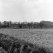
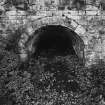
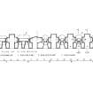
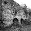
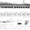
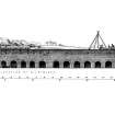
(Location cited as NS 770 930 and name as Cambusbarron Limeworks). Built c. 1850. An unusually long range of six limekilns, of which four are circular in plan, 3-draw, and the other 2 are oval in plan, 4-draw. Of the 15 draw arches, 10 give direct access to drawholes, the others are entrances to tunnels from which pairs of draw arches open. Disused since 1909.
J R Hume 1976.
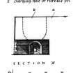
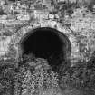
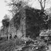
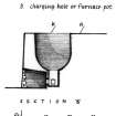
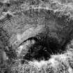
All the surviving stone-built kilns occupy the customary bankside positions for ease of loading at the kiln head. The impressive 182-ft (55.47m) long frontage of the kilns at Murrayshall II has front openings of uniform height refined with rusticated red sandstone voussoirs. The range evidently erected in two phases, the earlier (W) half being built in coursed rubble with arches of red sandstone, and the other in squared random rubble with grey sandstone dressings. It incorporates six kilns of two different types: the four W kilns are of the three-draw variety with circular charging-holes of inverted cone shape; the two E kilns are of a larger four-draw type, each with a pair of front draw-arches and a round-ended rectangular charging-hole. All draw-arches have single draw-hole points. The wall-head is reinforced by a prominent row of oval iron wall-ties, and the kiln-pots are lined with header-course brickwork.
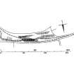
The works evidently enjoyed the commercial advantages of being connected with the neighbouring Forth and Clyde Junction Rly to the N by means of a tramway which it shared with Hayford Mills (NS79SE 161), situated a short distance to the E.
G D Hay and G P Stell 1986.
Publication Account (1986)
Abundant limestone deposits in the area to the SW of Stirling have been extensively wrought by opencast and mmmg operations at Murrayshall and Craigend, and, according to an account written in 1841 , 'the stones,brought out in carts, are prepared and burned in kilns close at hand'. In 1860 Murrayshall Limeworks was described as having 'three kilns in good working order' whilst Craigend had 'three kilns in good working order and one in ruins', the coal in each case coming from Bannockburn. Both limeworks were disused by 1896-9, when the name Murrayshall Limeworks was being applied to a post-1860 establishment further N.
All the surviving stone-built kilns occupy the customary bank side positions for ease of loading at the kiln head. Murrayshall I (NS 773908) has a continuous NW frontage about 18 ft (5.5m) high built of coursed rubble masonry and partly buttressed. It has a bank of three circular charging-holes, or pots, and at the base of each there are three segmental draw-arches, or vents, one in front and one in each side, reached by taller segmental-arched access-tunnels. Each draw-arch was equipped with two draw-holes, or eyes, for running off the quicklime. The heavily overgrown bank of four kilns at Craigend (NS 761905) is of similar construction, scale and layout with front draw-arches and much higher tunnel-mouths occupying alternate positions in the main NE frontage. The impressive 182 ft-long (55·47m) N frontage of the kilns at Murrayshall II (NS 770930) has front openings of uniform height refined with rusticated red sandstone voussoirs . The range was evidently erected in two phases, the earlier W half being built in coursed rubble with arches of red sandstone, and the other in squared random rubble with grey sandstone dressings. It incorporates six kilns of two different types: the four W kilns are of the three-draw variety with circular charging-holes of inverted cone shape; the two E kilns are of a larger four-draw type, each with a pair of front draw-arches and a round-ended rectangular charging-hole. All draw-arches have single draw-hole points. The wallhead is reinforced by a prominent row of oval iron wall-ties, and the kiln-pots are lined with header-course brickwork. The works evidently enjoyed the commercial advantage of being connected with the neighbouring Forth & Clyde Junction Railway to the N by means of a tramway which it shared with Hayford Mills, situated a short distance to the E.
Information from ‘Monuments of Industry: An Illustrated Historical Record’, (1986).


