Muirkirk Ironworks
Iron Works (18th Century) - (20th Century) (1787)-(1923)
Site Name Muirkirk Ironworks
Classification Iron Works (18th Century) - (20th Century) (1787)-(1923)
Canmore ID 44728
Site Number NS62NE 17
NGR NS 696 269
Datum OSGB36 - NGR
Permalink http://canmore.org.uk/site/44728
- Council East Ayrshire
- Parish Muirkirk
- Former Region Strathclyde
- Former District Cumnock And Doon Valley
- Former County Ayrshire
NS62NE 17.00 696 269.
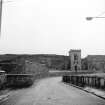
see also: NS62NE 17.01 6963 2694 Muirkirk Ironworks, Wagonway Bridge
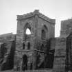
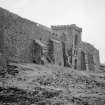
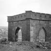
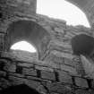
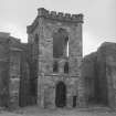
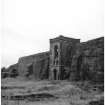
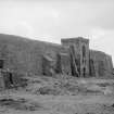
The first ironworks in Ayrshire, at Muirkirk, was founded in 1787 and continued in production until 1921. The remains of the blowing-engine house, furnace bank and foundations of three furnaces are spectacular. There are also considerable remains of the works canal.
J Butt 1967
Field Visit (February 1991 - November 1991)
The Ironworks at Muirkirk was established in 1787, a year after the founding of a Tarworks at Kames (NS62NE 16.0). As a by-product of the manufacturing process, the Tarworks produced large quantities of coke and this acted as an added incentive to the ironmasters. Coal, limestone, ironstone and iron ore were all to be found in abundance in the area, and the cheapness of the minerals more than offset the disadvantages posed by the remoteness of this part of Ayrshire. Good communication routes were necessary to distribute the minerals and finished goods across the country, and several new roads were constructed prior to the arrival of the railway in the 1840's. The quality of the iron produced at Muirkirk was a key factor in the success of the Ironworks throughout the 19th century, allowing the Ironworks to survive changes in ownership and many periods of recession. With the exhaustion of the blackband ironstone seams in 1901, the fate of the Ironworks was sealed, and while imported iron ore from Spain sustained operations until 1915, the ironworks finally closed in 1923. Coal continued to be mined at Kames until 1968, the same year in which the remains of the Ironworks were demolished.
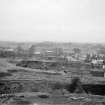
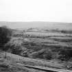
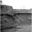
Nothing can now be seen on the site of the Ironworks, but the layout and details of the structures have been recorded on the early editions of the OS maps, and likewise on several estate plans and illustrations.
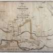
The earliest of these, a set of four estate plans (SRO, RHP 3675/1-4), date from 1796-1802, and show the location of two blast furnaces a short distance to the W of the canal basin (NS72NW 7). By 1837, three were in operation (NSA 1845).
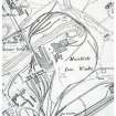
A sketch of the Ironworks, dating to around 1840, provides a three dimensional view looking S across the River Ayr (Butt, Donnachie and Hume 1968). Each building and its function is indicated - the furnaces, the forges, the rolling mill, the ironstone kiln and the coking oven - and they can all be identified on the 1st ed OS 25-inch map (Ayrshire, Sheet xxxi.5, 1856) dating from about fifteen years later. The four furnaces occupy the N part of the site and are set side-by-side in a row, with the Gothic-style crenallated furnace set at the W end. To the E, an embankment retained a large reservoir which was fed by an outflow from the canal basin. To the SE of the row of furnaces lay the forges, powered by water led from a sluice in the NW bank of the canal basin. Just beyond the terminal of the canal basin lay the bank of kilns. The sketch also shows a horse pulling a barge along the canal, while two strings of horse-drawn trolleys can be seen on the tramroads. The short row of cottages built to the S of the Ironworks (NS 6973 2660), and the rows at Linkieburn and Linkieburn Square to the SW, all of which were built to house the miners, are visible in the distance (centred NS 6960 2640; see also NS72NW 11.02).
By the time the 1st ed OS map was surveyed (Ayrshire, Sheet xxxi.5, 1856) the railway had arrived (NS62NE 32) and several sidings linked the furnaces and the forges with the main line to the E. This railway was a branch of the Glasgow and South Western Railway and linked the Ironworks at Muirkirk with the port of Ayr to the W. The bank of five kilns, annotated as limekilns, is shown with a tramway connection which crossed the railway by a bridge, and brought the limestone down from the mines and quarries at Bankend (NS72NW 11.00).
By the date of publication of the 2nd ed OS 25-inch map the Ironworks had undergone several changes (Ayrshire, Sheet xxxi.5, 1896). The Caledonian Railway had opened a new branch linking Muirkirk with Lanark (NS72NW 6) and William Baird and Company, owners of the Ironworks, had constructed two mineral railways providing them with a direct link into their mineral fields which lay to the E and W. Within the complex of the Ironworks itself, the lower reservoir had been demolished and a range of buildings constructed on the site. These buildings were part of the chemical works, built in 1883 to utilise the waste gases generated in the furnaces; one of the buildings is identified as a gasometer on the map. A rail connection from the site, crossed the River Ayr to the Gasworks (NS62NW 13), the latter having been built in 1880 to provide lighting in the miners' rows to the S. A row of six furnaces were in operation, compared with the three shown on the 1st ed OS map, and the boiler house remained in use. The limekilns which lay in the S half of the area, however, had fallen out of use and are annotated as such on the map.
Visited by RCAHMS (ARW, SPH), February-November 1991.
NMRS MS 731/6.
Note (September 2017)
‘Nothing can Induce us to go into such a Desart and Inland place as Muirkirk but the Absolute Certainty of having The Coal, Ironstone and Limestone, very cheap.’
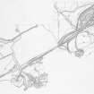
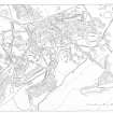
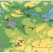
This quotation expresses the sentiments of the Glasgow entrepreneurs who were attracted to Muirkirk by the abundance and accessibility of the area’s mineral resources at the end of the 18th century. Over 200 years later I was confronted with a very similar emotional response, arriving in this remote moorland parish in 1991 as part of the RCAHMS field team. On this occasion however, our remit was to undertake an archaeological survey of the industrial landscape these entrepreneurs had exploited and then abandoned. In all, we mapped 9 square kilometres in detail at a working scale of 1:2500, for the first time allowing the full extent and complexity of this important industrial landscape to be understood. This remains the largest detailed landscape survey RCAHMS has ever undertaken.
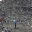
The establishment of the Tar Works was central to the development of the mineral field and this was the first area we surveyed on the ground. While now reduced to rubble footings, the bank of 34 tar kilns can still be seen, surviving as a string of shallow circular bowl-shaped depressions, together with the foundations of the still house and workers’ cottages. These buildings are recorded and annotated on a series of four estate plans held in the National Records of Scotland and dating from 1796 to 1802. The plans also reveal the extent of the initial operations and detail the position and depth of the early coal mines, indicating the limits of the coal seams and the location of some of the levels that were driven to drain and ventilate the mines.
From Tar Works to tarmacadam
From the outset, Lord Dundonald and his brother were assisted by John Loudon MacAdam who at first acted as their agent in Ayr, but by 1789 MacAdam had taken over the position of manager and by 1790 he had acquired the lease. This venture almost brought financial ruin to MacAdam and by the end of 1798 he had left Muirkirk and was later to find fame as a road engineer. His son William remained in charge until 1809 when, despite attempts to offer the site for sale, the Tar Works was abandoned.
MacAdam is best known for the process ‘macadamisation’ and was a great pioneer of road building at a time when modern industrial society was beginning to take shape. He is also renowned for introducing modern methods of professional road management into turnpike roads. He died in Moffat in 1836 after what his son James described as a ‘useful and honourable life’. To commemorate MacAdam’s achievements, a cairn was erected in 1931 on the ruins of the still house opposite the tar works. The stones forming the cairn are said to have come from the tar kilns themselves.
Today, few people driving through Muirkirk will cast an eye south across the River Ayr and perhaps fewer still will recognise the area’s rich industrial past. But far from being a landscape of neglect, of abandoned mines, quarries and spoil dumps, the story told by this landscape is one that celebrates the remarkable achievements of the miners, quarriers and entrepreneurs at the forefront of the Industrial Revolution. As I came to appreciate during the course of our survey many moons ago, this is a landscape worthy of recording and one I would certainly be sad to lose.
Further Reading:
Butt, J 1967 The industrial archaeology of Scotland, The industrial archaeology of the British Isles series, 147-8, 228, Newton Abbot
Findlay, T 1986 Muirkirk - A miscellany, 73-95
Hume and Butt, J R and J 1966 Muirkirk 1786-1802: the creation of a Scottish industrial community', Scot Hist Rev, vol. 45, 1966, 160-183
Reader, W J 1980 Macadam: the McAdam family and the turnpike roads 1798-1861, 27-8, London
Angela R Gannon, Archaeological Field Investigator


