Pricing Change
New pricing for orders of material from this site will come into place shortly. Charges for supply of digital images, digitisation on demand, prints and licensing will be altered.
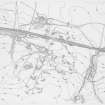
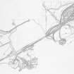
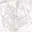
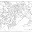
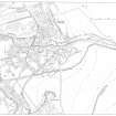
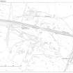
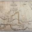
RCAHMS Afforestable Land Survey, Muirkirk (1:2500)


Date February 1991 - November 1991
Event ID 550866
Category Project
Type Project
Permalink http://canmore.org.uk/event/550866
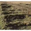
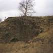
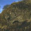
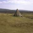
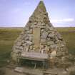
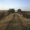
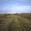
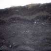
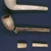
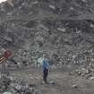
The 1:2500 survey of industrial remains lying to the south of the village was carried out between spring and autumn 1991. About 8km2 have been recorded, revealing a complex pattern of industrial activity spanning 135 years and initiated by the establishment of the ironworks in the late 18th century; it is manifested by the remains of mining for coal, limestone and iron ore, interwoven with the embankments and cuttings of tramroads and railways. In amongst the spoil tips are the ruins of the tarworks established by Lord Dundonald prior to the foundation of the ironworks and of interest for its connection with Macadam of tarmac fame.
RCAHMS (DES 1991, 80)