Pricing Change
New pricing for orders of material from this site will come into place shortly. Charges for supply of digital images, digitisation on demand, prints and licensing will be altered.
Bute, St Blane's Church
Burial Ground (Period Unassigned), Church (12th Century), Font (Period Unassigned), Monastic Settlement (Period Unassigned)
Site Name Bute, St Blane's Church
Classification Burial Ground (Period Unassigned), Church (12th Century), Font (Period Unassigned), Monastic Settlement (Period Unassigned)
Alternative Name(s) Kingarth; Saint Mary's Chapel, Saint Blane's Chapel
Canmore ID 40292
Site Number NS05SE 5
NGR NS 09491 53446
Datum OSGB36 - NGR
Permalink http://canmore.org.uk/site/40292

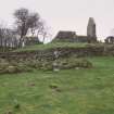
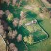
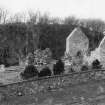
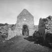
































First 100 images shown. See the Collections panel (below) for a link to all digital images.
- Council Argyll And Bute
- Parish Kingarth
- Former Region Strathclyde
- Former District Argyll And Bute
- Former County Buteshire
NS05SE 5 09491 53446
(NS 0949 5343) St Blane's Church (NR) (Remains of)
(NS 0948 5340) The Nunnery (NR)
(NS 0943 5335) Ancient Dwellings (NR)
(Name: NS 0930 5367) Wall (NR)
OS 6" map (1924)
NS05SE 5.00 Burial ground; monastic settlement; church; font
NS05SE 5.01 Cross incised stone; early medieval
NS05SE 5.02 Cross incised stone; early medieval
NS05SE 5.03 Cross slab; early medieval
NS05SE 5.04 Cross slab; early medieval
NS05SE 5.05 Cross; early medieval
NS05SE 5.06 Cross; early medieval
NS05SE 5.07 Cross; early medieval
NS05SE 5.08 Cross; early medieval
NS05SE 5.09 Cross; early medieval
NS05SE 5.10 Cross; grave slab; early medieval
NS05SE 5.11 Cross; early medieval
NS05SE 5.12 Cross; early medieval
NS05SE 5.13 Cross base; socketed stone; early medieval
NS05SE 5.14 Cross; gravestone; early medieval
NS05SE 5.15 Cross; gravestone; early medieval
NS05SE 5.16 Cross; gravestone; early medieval
NS05SE 5.17 Cross; gravestone; early medieval
NS05SE 5.18 Cross; gravestone; early medieval
NS05SE 5.19 Cross; gravestone; early medieval
NS05SE 5.20 Cross; gravestone; early medieval
NS05SE 5.21 Cross; gravestone; early medieval
NS05SE 5.22 Cross; early medieval
NS05SE 5.23 Cross; early medieval
NS05SE 5.24 Gravestone; early medieval
NS05SE 5.25 Grave slab; medieval
NS05SE 5.26 Burial enclosure; 20th century
NS05SE 5.27 Chapel
NS05SE 5.28 NS 09410 53559 Building
NS05SE 5.29 NS 09434 53508 Building
NS05SE 5.30 NS 09440 53487 Structure; Building (Possible)
NS05SE 5.31 NS 09454 53589 Building
NS05SE 5.32 NS 09531 53354 Building; Quarry
NS05SE 5.33 NS 09454 53296 Quarry
NS05SE 5.34 NS 09530 53454 Quarry
NS05SE 5.35 NS 09444 53569 Quarry
NS05SE 5.36 NS 09425 53601 Quarry
NS05SE 5.37 NS 09524 53558 Quarry
NS05SE 5.38 NS 09518 53575 Quarry
NS05SE 5.39 NS 09513 53610 Quarry
NS05SE 5.40 NS 09435 53369 Farmstead; Manse
NS 094 534 A shallow hole, caused by the collapse of a mature tree, was recorded prior to back-fill. An alignment of four large water-washed boulders was recorded, which probably reflect a structure built against the inside face of the outer precinct wall of the pre-12th century Monastic enclosure, located c12m W of the N entrance.
Sponsor: Historic Scotland.
G Ewart 1995.
NS 094 534 A watching brief was undertaken by Kirkdale Archaeology during masonry works on a small Early Christian chapel situated 25m to the SW of the main chapel of St Blane's. The walls and general area were photographed, and plans were made. No finds were removed from the site.
A fuller report has been lodged with the NMRS.
Sponsor: Historic Scotland
G Ewart and D Stewart 1997
An excavation was carried out in 1997 which found the traces of the trenches (and associated spoil) dug in 1896 by Charles Weir Schultz for the Marquess of Bute. The excavations carried out in 1997 were intended to act as a reconnaissance exercise to determine the potential of the site for further investigation. It was concluded that the Victorian investigations dug down and into natural clay. Their spoil was bulldozed in the mid 1980s when imported material was dumped on the site to build up and level the site.
L Laing and D Longley 1997
NS 095 534 Site 7 St Blane’s
This site is in the care of Historic Scotland. Apart from the chapel, there are features of settlement interest. The mortared footings of a large strictly rectangular 3-celled are interpreted as those of the 16th century manse. Rather tumbled remains of several small oval structures survive under the cliff 50m north> a corn kiln was excavated north of the church (Milligan 1963, 53-61).
Proudfoot and Hannah 2000
NS 09491 53446 Monastic site and medieval church: Several buildings located SW/W of church, under the cliff. There are the footings of a large, strictly rectangular 3-celled building, c. 15 x 7m. The possible remains of 17th century manse. Rather tumbled remains of several small oval buildings c. 50m N.
Information from Bute Natural History Society Deserted Settlement Survey (1991-9)
(RCAHMS WP000273)
The monastery of Kingarth was supposedly founded by St Blane in the 6th century, and he was commemorated as 'fair Blaan of Cenn Garad' in the 9th-century Martyrology of Oengus (a). The death of Daniel, bishop of Kingarth, was recorded about 659 and subsequent bishops, abbots and a 'religious priest' were named in the annals at intervals up to 790 (b). The later history of the monastery is not known, but the carved stones described below show its importance as a burial-place until the 12th century, when a parish church serving the S half of Bute was erected (c).
The monastery was situated in a small valley 1.8km from the extreme S point of Bute, and 1km E of Dunagoil Bay and the adjacent hill-fort. The site is bounded to the SW by wooded cliffs, and to E and S by curving drystone walls, much restored in 1895-6. The more massive of these walls, up to 1.5m in width, encloses a roughly oval area measuring about 200m from NW to SE by 120m, and an annexe extends for 190m to the NW. In the NW angle of the main area there is a massive circular enclosure, 10m in diameter within a wall 2.5m thick, known locally as 'the Cauldron', which may have been a secular residence pre-dating the monastery (d). St Blane's Well is situated near the foot of the cliff W of the church.
The highest ground at the centre of the main enclosure is occupied by the 12th-century church, a nave-and-chancel building with Romanesque ornament (e). It stands in an oval burial-ground which is linked by steps to a lower S churchyard, traditionally reserved for the burial of women. Extensive conservation-work on the church and enclosures was carried out in 1895-6 for the 3rd Marquis of Bute by the London architect R W Schultz (f), who also excavated two groups of structures. One of these, situated to the SW and locally identified as the manse, was of L-plan and was probably of post-medieval date. The amorphous structures to the S of the churchyard included hearths and curving wall-footings, and most of the early medieval artefacts preserved in the Museum of Scotland were found in this area. They include pottery, whetstones and polishing stones, partly-worked rings of shale, an ingot-mould and crucibles and a series of motif-pieces. Some of these are incised on broken roofing-slates, and the motifs comprise groups of letters, interlaced and spiral ornament, and animals (g). A hoard of 12th-century coins and gold ornaments was found about 350m SE of the church in 1863 (h).
Both churchyards contain numerous graveslabs and markers, most of them much worn, including several early and later medieval stones (i). Other early stones were found in 1895-6, re-used in the walls of the 12th-century church, but their present location is unknown. The socket cut into a flat-topped boulder outside the NE enclosure-wall is of uncertain date (j).
Footnotes:
(a) Anderson 1922, 1, 176-7; Stokes, Oengus, 175, 184-5, where in the later notes he is identified as a bishop with his chief seat at Dunblane.
(b) Anderson 1922, 1, 176, 198, 228, 236, 248, 254; Macdonald, A D S, in Laing, L and J and Longley 1998, 553-5.
(c) Origines Parochiales, 2, part 1, 210-12; Cowan, Parishes, 112.
(d) Hewison 1893, 1, 167-222, pls opp.p.166; Schultz album, pl.1 (in Bute Museum, photographic copies in NMRS); Radford 1968, 116 and fig.18 on p.115. For 'the Cauldron' see NMRS database NS05SE 8.
(e) MacGibbon, D and Ross, T, The Ecclesiastical Architecture of Scotland (1896-7), 1, 292-8, and 3, 625-7; Galloway, W, in Archaeologia Scotica, 5 (1890), 317-35.
(f) Stamp, G, Robert Weir Schultz, architect, and his work for the Marquesses of Bute (1981), 41-2 and passim.
(g) Schultz album; Anderson, J, in PSAS, 34 (1899-1900), 307-25; Laing, 'Sketches', 131, 133-4. Re-excavation in 1997 showed that early features in this area had been obscured by modern landscaping (Laing, L and J and Longley, D, in PSAS, 128 (1998), 551-65).
(h) PSAS, 5 (1862-4), 214-15, 372-84; NMRS database NS05SE 6.
(i) For drawings of medieval stones see ibid., figs.28, 32-5. Allen (Allen and Anderson 1903, 3, 409, no.5) classified as Early Christian a slab whose ornament was sketched by Hewison (1893, 1, 219), but it appears to be of later date. Hewison (loc.cit.) also refers to 'a fragment of a small Latin cross-head'. This may be the cross with tenoned base, probably a medieval gable-finial, which was sketched by Schultz at Mount Stuart in 1894 (sketchbook in NMRS).
j) Hewison 1893, 1, 192-3; NMRS database NS05SE 10. The socket measures 0.3m by 0.1m.
(k) An almost identical creature appears on the stone at Fairlie, Ayrshire (Allen and Anderson 1903, 3, 475).
Fisher 2001, 73-7.
The site is as described previously. On the date of visit a stone font was identified at NS 09457 53426.
Visited by RCAHMS (AGCH, IP) 18 March 2009.
NS05SE 5 09491 53446
St Blane's Church and Monastery (S Cruden 1960): St Blane's Monastery was built at an unknown date prior to 574. There is clear evidence of Christian burial there in the 6th and 7th centuries, also that the monastery became a cultural centre around that time. Its list of abbots extends to 790, when the Viking raids began.
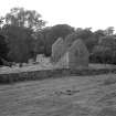
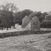
St Blane's Church, in use as the parish church of Kingarth until the early 18th century is a fine 12th century Romanesque building consisting of a nave and chancel; the E end of the chancel appears to be of inferior masonry and may be a later rebuild, and the nave was extended to the W in the 15th century. The partly restored walls stand to eaves level, on what was probably a natural eminence, artificially made up to provide a more level surface for the cemetery, which is in two parts. The lower part is traditionally known as the women's burial ground. Within it is a small oblong building, oriented E-W which could have been a Celtic oratory. Extensive excavations by the Marquess of Bute in the late 19th century revealed a wall, apparently dry-built, some 3-4ft wide, now standing 2-3ft high, enclosing an area of 2 or 3 acres. In good condition, it was repaired in 1896.
Traces of further walls running out to the N may not be early. The church and graveyards stood near the centre of the enclosed area. Below the churchyard and still within the enclosure much-ruined irregular lines of stones suggest groups of cells like those found at Tintagel. There are further traces of buildings above the churchyard at the foot of the western outcrop.
Both graveyards are filled with lines of graves marked by cover-stones, mostly of 12th-13th century date. Others may be early, as are some of the stones found during the excavations; they date to the 8th or even 7th century. Excavations at NS 095 534, immediately outside the cashel wall, revealed a corn kiln; 12th-13th century pottery was found (I D Milligan 1963). Much of what is now visible dates from the re-Christianisation of Bute during the period of Norse rule, probably in the 11th century, but some of the sculptures and possibly the enclosure wall and parts of the ruined buildings should be ascribed to the pre-Norse period (C A R Radford 1967).
E W MacKie 1975; J K Hewison 1893; I S Munro 1973; W J Watson 1926;
C Thomas 1971; J Anderson 1900
Centred NS 0942 5353. St Blane's Church (name verified) and monastic settlement occupies a level site which is tucked away in the hills above Dunagoil farm. The occupation area of two hectares is bounded on the W by a near vertical 70ft high rock face and enclosed on the other sides by a restored cashel wall fromw hich another wall (now traceable merely as footings) branches off to enclose a further 0.5 hectares of level ground. The relationship of these two walls cannot now be ascertained. The ruined church and its two graveyards are as described. The walling of the Celtic cell (published as The Nunnery on OS 25") in the lower graveyard is up to 0.6m high and nearby are two gravestones with incised cross designs, and a flat topped earthfast socket stone 0.9m in diameter with a socket 0.4m by 0.1m.
The remains of excavated buildings with walling up to 0.5m high lie to the SW and NW of the church; those to the SW (Ancient Dwellings on OS 25") are almost certainly cells while the latter, two rectangular structures 7.0m by 6.0m and 7.0m by 5.0m are of unknown date and purpose. A crude stone basin, possibly a font, rests near the well (NS05SE 9).
Two circular 'platforms' which are 0.2m high, 6.0m in diameter and probably represent the footings of small buildings are the only traceable features within the outer enclosure wall. The origin of these features however is uncertain. The excavated corn drying kiln is now only recognisable as a 4.0m diameter, 0.2m high bank and lies just outside the main entrance in the cashel wall at NS 0950 5351.
The finds from this site are in Rothesay Museum.
Surveyed at 1:10 000.
Visited by OS (BS) 10 November 1976.
Reference (1854)
Field Visit (1856)
Measured Survey (1872)
Photographic Record (1880)
Photographic Record (1895)
Measured Survey (1895 - 1896)
Excavation (1896)
Reference (1905)
Reference (1922)
Reference (1926)
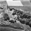
Aerial Photography (1935 - 1938)
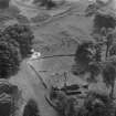
An collection of aerial photographs taken by Andrew P Hunter from 1935 to 1938. Digitised by Andrew B Wilson in 2008.
Field Visit (25 May 1943)
This site was recorded as part of the RCAHMS Emergency Survey, undertaken by Angus Graham and Vere Gordon Childe during World War 2. The project archive has been catalogued during 2013-2014 and the material, which includes notebooks, manuscripts, typescripts, plans and photographs, is now available online.
Information from RCAHMS (GF Geddes) 2 December 2014.
Photographic Record (11 June 1953)
Photographic Record (September 1958)
Aerial Photography (1970)
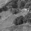
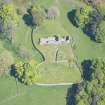
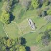
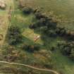
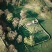
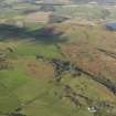
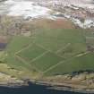
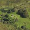
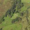
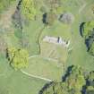
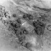
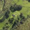
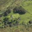
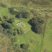
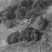
Oblique aerial photographs of the remains of St Blane's Church and burial ground, Bute, taken by John Dewar in 1970.
Reference (1971)
Reference (1973)
Aerial Photography (1973)
Oblique aerial photographs of St Balne's Church and burial ground, Bute, by Mr John Dewar in 1973.
Photographic Record (13 August 1975)
Desk Based Assessment (8 August 1976)
St Blane's Church and Monastery (S Cruden 1960): St Blane's Monastery was built at an unknown date prior to 574. There is clear evidence of Christian burial there in the 6th and 7th centuries, also that the monastery became a cultural centre around that time. Its list of abbots extends to 790, when the Viking raids began.
St Blane's Church, in use as the parish church of Kingarth until the early 18th century is a fine 12th century Romanesque building consisting of a nave and chancel; the E end of the chancel appears to be of inferior masonry and may be a later rebuild, and the nave was extended to the W in the 15th century. The partly restored walls stand to eaves level, on what was probably a natural eminence, artificially made up to provide a more level surface for the cemetery, which is in two parts. The lower part is traditionally known as the women's burial ground. Within it is a small oblong building, oriented E-W which could have been a Celtic oratory. Extensive excavations by the Marquess of Bute in the late 19th century revealed a wall, apparently dry-built, some 3-4ft wide, now standing 2-3ft high, enclosing an area of 2 or 3 acres. In good condition, it was repaired in 1896.
Traces of further walls running out to the N may not be early. The church and graveyards stood near the centre of the enclosed area. Below the churchyard and still within the enclosure much-ruined irregular lines of stones suggest groups of cells like those found at Tintagel. There are further traces of buildings above the churchyard at the foot of the western outcrop.
Both graveyards are filled with lines of graves marked by cover-stones, mostly of 12th-13th century date. Others may be early, as are some of the stones found during the excavations; they date to the 8th or even 7th century. Excavations at NS 095 534, immediately outside the cashel wall, revealed a corn kiln; 12th-13th century pottery was found (I D Milligan 1963). Much of what is now visible dates from the re-Christianisation of Bute during the period of Norse rule, probably in the 11th century, but some of the sculptures and possibly the enclosure wall and parts of the ruined buildings should be ascribed to the pre-Norse period (C A R Radford 1967).
Information from OS (IF) 8 August 1976
Field Visit (10 November 1976)
Centred NS 0942 5353. St Blane's Church (name verified) and monastic settlement occupies a level site which is tucked away in the hills above Dunagoil farm. The occupation area of two hectares is bounded on the W by a near vertical 70ft high rock face and enclosed on the other sides by a restored cashel wall fromw hich another wall (now traceable merely as footings) branches off to enclose a further 0.5 hectares of level ground. The relationship of these two walls cannot now be ascertained. The ruined church and its two graveyards are as described. The walling of the Celtic cell (published as The Nunnery on OS 25") in the lower graveyard is up to 0.6m high and nearby are two gravestones with incised cross designs, and a flat topped earthfast socket stone 0.9m in diameter with a socket 0.4m by 0.1m.
The remains of excavated buildings with walling up to 0.5m high lie to the SW and NW of the church; those to the SW (Ancient Dwellings on OS 25") are almost certainly cells while the latter, two rectangular structures 7.0m by 6.0m and 7.0m by 5.0m are of unknown date and purpose. A crude stone basin, possibly a font, rests near the well (NS05SE 9).
Two circular 'platforms' which are 0.2m high, 6.0m in diameter and probably represent the footings of small buildings are the only traceable features within the outer enclosure wall. The origin of these features however is uncertain. The excavated corn drying kiln is now only recognisable as a 4.0m diameter, 0.2m high bank and lies just outside the main entrance in the cashel wall at NS 0950 5351.
The finds from this site are in Rothesay Museum.
Surveyed at 1:10 000.
Visited by OS (BS) 10 November 1976.
Photographic Record (October 1980)
Reference (1984)
Reference (1985)
Publication Account (1985)
Standing in one of the most beautiful settings of all the medieval churches in western Scotland, St Blane's Church is dedicated to a saint and missionary of the Early Christian church, who was born in Bute in the 6th century. The medieval church reflects the siting of an Early Christian foundation, possibly an offshoot from some larger establishment, and several early crosses have been found and are still visible here. Excavations in 1896 also uncovered several pieces of slate with interlace and animal designs, comparable to those from Dunadd (no. 54), now in NMAS. The crosses apart, perhaps the main surviving feature is to the north and east of the church where there is an arc of the enclosure wall, now about 0.8m high and 1.5m wide. An enigmatic circular stone-built foundation, known as 'The Cauldron', is situated to the north-west of the church at the base of the cliff. It measures about 10m by 9.3m within an unusually thick wall (2.5m overall) which is still almost 2m in height; there is a well-built entrance on the south-east side. This is unlikely to be a defensive structure because of its overlooked position, but it finds no ready parallel among early monastic buildings. Other foundations to the north and south have been interpreted as monastic cells, but this is not certain.
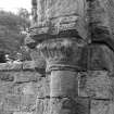
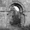
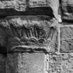
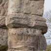
The church comprised a nave and a small chancel, with the elaborate decoration of the chancel arch in true Romanesque style suggesting a date in the later 12th century. The chevron pattern which forms the main element of the arch (with a small Greek Cross in a circle at its apex) and the decoration of the capitals of the supporting columns are particularly fine.
Information from ‘Exploring Scotland’s Heritage: Argyll and the Western Isles’, (1985).
Field Visit (1991 - 1999)
NS 09491 53446 Monastic site and medieval church: Several buildings located SW/W of church, under the cliff. There are the footings of a large, strictly rectangular 3-celled building, c. 15 x 7m. The possible remains of 17th century manse. Rather tumbled remains of several small oval buildings c. 50m N.
Information from Bute Natural History Society Deserted Settlement Survey (1991-9)
(RCAHMS WP000273)
Excavation (1991)
Kirkdale Archaeology was called out to investigate uprooted stones prior to reinstatement of fallen tree root mat. The stone aligment is most likely a structural fragment of a building - a wall line which circles a low entrance around a core of large stones. The general character of the feature suggests association with pre-12th century activity of this site, although whether 5th century or 7th century is not clear. The feature apparently respects the outer entrance wall and is likely to be part of monastic occupation. Its construction and general eroded quality its suggests an early date.
G Ewart 1991
Sponsor: Historic Scotland
Kirkdale Archaeology
Excavation (4 July 1995 - 4 August 1995)
NS 094 534 A shallow hole, caused by the collapse of a mature tree, was recorded prior to back-fill. An alignment of four large water-washed boulders was recorded, which probably reflect a structure built against the inside face of the outer precinct wall of the pre-12th century Monastic enclosure, located c12m W of the N entrance.
Sponsor: Historic Scotland
G Ewart 1995
Kirkdale Archaeology
Watching Brief (1995)
NS 094 534 A shallow hole, caused by the collapse of a mature tree, was recorded prior to back-fill. An alignment of four large water-washed boulders was recorded, which probably reflect a structure built against the inside face of the outer precinct wall of the pre-12th century Monastic enclosure, located c12m W of the N entrance.
Sponsor: Historic Scotland.
G Ewart 1995.
Reference (1996)
Reference (1996)
Watching Brief (27 August 1997 - 28 August 1997)
NS 094 534 A watching brief was undertaken by Kirkdale Archaeology during masonry works on a small Early Christian chapel situated 25m to the SW of the main chapel of St Blane's. The walls and general area were photographed, and plans were made. No finds were removed from the site.
A fuller report has been lodged with the NMRS.
Sponsor: Historic Scotland
G Ewart and D Stewart 1997
Excavation (1997)
An excavation was carried out in 1997 which found the traces of the trenches (and associated spoil) dug in 1896 by Charles Weir Schultz for the Marquess of Bute. The excavations carried out in 1997 were intended to act as a reconnaissance exercise to determine the potential of the site for further investigation. It was concluded that the Victorian investigations dug down and into natural clay. Their spoil was bulldozed in the mid 1980s when imported material was dumped on the site to build up and level the site.
L Laing and D Longley 1997
Reference (1997)
Reference (2000)
Field Visit (18 March 2009)
The site is as described previously. On the date of visit a stone font was identified at NS09457 53426.
Visited by RCAHMS (AGCH, IP) 18 March 2009.
Measured Survey (12 October 2010)
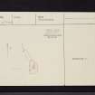
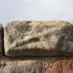
Measured drawing of the font.
Measured Survey (March 2012)
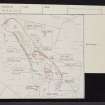
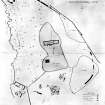
In March, RCAHMS undertook a 1:500 survey of the monastery and church complex at St Blane’s at the south end of the Isle of Bute. Undertaken in partnership with the Discover Bute Landscape Partnership Scheme (DBLPS) and with the co-operation and permission of Historic Scotland who manage the site, the survey sought to record all the features within the scheduled area prior to proposed excavation. In addition to recording a number of previously unrecorded features, including buildings, enclosures, quarries and cultivation remains, the survey brought to light several issues concerning existing interpretation. A summary report on the survey is available as a pdf attached to the Canmore records for the site.
Watching Brief (17 March 2015)
NS 0947 5343 A watching brief was undertaken on 17 March 2015 during the excavation of a shallow trench to hold the footings for a new bench, located to the SW of the upper graveyard boundary wall of St Blane’s Church. The results of the excavation reflect the backfill or dumping of excavated/disturbed soils and rubble. The presence of six-inch nails may indicate this ‘fill’ was the result of an earlier (20th century) shallow archaeological excavation in the area. The abundance of slate fragments probably either reflect roofing material from the various medieval buildings in the area, or the extensive use of slate ‘pinners’ within the (much restored) upper graveyard boundary wall.
G Ewart 2015
Sponsor: Historic Scotland
Kirkdale Archaeology
Note (June 2017)
What is Cenn Garah and how has it changed over time?
A Google view of the monastic site shows that it sits in a green glen, with a wooded cliff on the west side and is surrounded by a thick wall around the north and east sides. This wall is known as the ‘cashel’. This wall would have separated the spiritual ground from the everyday, secular world. Within the spiritual space are a series of buildings, walled burial grounds and other features that can help us construct a story of the life of Cenn Garah.
If you get the chance to visit St Blane’s you will approach the site from the southern end, whereas the monastic population would have used a gateway through the cashel wall on the east side. A carved stone was found next to this gateway, which is believed to have been the base of a tall carved stone cross that would have welcomed the members to the monastic community.
Today the main features of the site, within the cashel, are the 12th century, roofless church, which sits inside an oval burial ground. The burial enclosure walls are at least 2m high above the ground, presumably as a result of the accumulation of burials. The burial ground is built over two levels: the upper level was traditionally used for male burials where the lower ground level was used for females. The upper burial ground was still being used until the 12th century church was built.
To the north of the church are a number of features tucked in at the foot of the cliff. To the south is a later building, which was initially the manse and subsequently used as a farm building.
As you wander around the quiet location, which is sheltered from the south-westerly weather by the landscape, you begin to see bits of walling built into the foot of the cliff. Perhaps some of these are the remains of the monastic settlement?
Towards the north end of the site is a circular building, known as the ‘Cauldron’. This very unusual structure may have been a part of an earlier period of occupation, before Christianity came to Bute. One suggestion is that it was an Iron Age building that was later re-used and modified by the monastic settlers. Perhaps it was a space designated for contemplation and retreat?
The re-creation of St Blane’s since the 1890s
The third Marquess of Bute was interested in history and spent time and money conserving some of Bute’s ancient sites, including St Blane’s. Under the guidance of the architect R.W.Schultz, the Marquess’s gardeners and estate labourers rebuilt much of the cashel wall, parts of the church and the enclosing walls of the burial ground. The present day remains of St Blane’s is as a result of this period of re-building, conserving and tidying up of the landscape within the cashel.
Today, this landscape is cared for by Historic Environment Scotland. The grass is regularly mowed, there is signage to help the casual visitor understand some of the features and the stonework of the various buildings and structures is maintained. So the landscape is one which has undergone many changes and is quite different from when the monastery was first established. But if you do get to visit, you may get a glimpse of why such a secluded, tranquil place was chosen as the place to establish a monastery for quiet, contemplation; something that perhaps we all aspire to occasionally, to take us away from our 24 hour, social media-driven lives.
Dr Alex Hale - Archaeology Projects Manager
Photographic Record
Photographic Record


