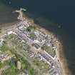
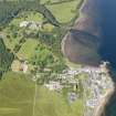
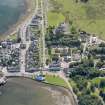
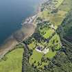
Inveraray, General
Town (18th Century)
Site Name Inveraray, General
Classification Town (18th Century)
Alternative Name(s) Inveraray Castle, Estate Village
Canmore ID 23360
Site Number NN00NE 24
NGR NN 0953 0846
NGR Description Centred NN 0953 0846
Datum OSGB36 - NGR
Permalink http://canmore.org.uk/site/23360
First 100 images shown. See the Collections panel (below) for a link to all digital images.
- Council Argyll And Bute
- Parish Inveraray
- Former Region Strathclyde
- Former District Argyll And Bute
- Former County Argyll
NN00NE 24 centred 0953 0846
Not to be confused with Inveraray, old Village (centred NN 097 090, within Inveraray Castle Policies), for which see NN00NE 13.
Erected burgh of barony in 1474; royal burgh, 1648.
G S Pryde 1965.
Architect: Willaim Adam c.1747 and John Adam, 1756.
REFERENCE:
Plans:
I.G.Lindsay Collection, W/363/1
Town Contract I
I.G.Lindsay Collection, W/363/2
Town Contract II
I.G.Lindsay Collection, W/363/3
I.G.Lindsay Collection, W/188
I.G.Lindsay Collection, W/363/18
Inveraray, Pert's Tea Rooms
Unlocated at time of upgrade, 15.3.2000
I.G.Lindsay Collection, W/463 and W/542.
Inveraray, Turnbull's Garage
Unlocated at time of upgrade, 15.3.2000
I.G.Lindsay Collection, W/151
Inveraray, Blyth's House
Unlocated at time of upgrade, 15.3.2000
Print missing at time of upgrade, 15.3.2000
I.G.Lindsay Collection, W/363/13
Inveraray, Glenaray Corn Mill.
Copies of drawings in possession of the Duke of Argyll, 1759
Location of mill uncertain at time of upgrade, 15.3.2000
Print missing at time of upgrade, 15.3.2000
Inveraray, Howton House
Location of house uncertain at time of upgrade, 15.3.2000.
Print missing at time of upgrade, 15.3.2000.
Plans: I.G.Lindsay Collection, W/497.
Inveraray, Glenaray, Kilmun.
Copies of plan in posession of Duke of Argyll, 1757 - photograph of sketch of the line.
Precise location uncertain at time of upgrade, 15.3.2000
Print missing at time of upgrade, 15.3.2000
Inveraray, Porter's Lodge.
Unexecuted.
Inveraray, Railway.
Proposals to Duke refused. Railway unexecuted.
Inveraray, Watch Tower.
Precise location of Tower uncertain at time of upgrade, 10.3.2000
Architect: William Douglas, 1748.
Inveraray, Deer Park.
Plans: Copy of plan in possession of the Duke of Argyll, 1747.
Copy missing at time of upgrade, 15.3.2000
Inveraray, Kilbride Dairy.
Architect: Robert Mylne, 1775.
Plans:Copies of plans in possession of Duke of Argyll - photographic copies of plans, elevations and sections
Precise location at time of upgrade, 15.3.2000.
Prints missing at time of upgrade, 15.3.2000
Inveraray, Limekiln Cottage.
Plans: I G Lindsay Collection, W/473
Precise location of cottage uncertain at time of upgrade, 15.3.2000
Prints missing at time of upgrade, 15.3.2000
Inveraray, Arrochar Road, Old Bakehouse.
Location uncertain at time of upgrade, 15.3.2000
Inveraray, Arrochar Road, Old Smiddy.
Location uncertain at time of upgrade, 15.3.2000
EXTERNAL REFERENCE:
National Library, RIAS Quarterly No. 102 Nov. 1955 - Survey of Inveraray Architecture by J.W.Hill.
NMRS/ Simpson and Brown photographs
Box 3 Album no.26
1980 ten street and facade views
Inveraray, Lighthouse, Stron Point - not executed
Architect: Alexander Nasmyth, 1801.
Miscellaneous:
Inveraray Castle Muniments: Miscellaneous; July 24th, 1801 - letter from AN re-painting of lighthouse and intended building on Stron.
The town of Inveraray fell into disrepair after the First World War, but in 1957 the then Duke of Argyll handed over the property to the Ministry of Works and it was completely with the aid of grants from the Scottish Development Department and the Historic Buildings Council for Scotland. The Ministry then handed over the properties to the town council.
Between 1958 and 1963, Ian Lindsay was involved in the renovation of 64 houses in the town.
Photographic Record (1906)
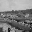
Photographs taken during a visit by the Churches Commission in July 1906.
The photographs are available in PA 71.
Photographic Survey (October 1965)
Photographic survey by the Scottish National Buildings Record/Ministry of Work in October 1965.
Publication Account (1985)
The creation ofInveraray as we know it today stems from the determination of Archibald, 3rd Duke of Argyll, who succeeded to the title in 1743. His vision of a new castle and the building of a modem town on a site a little distance away took shape with the advice of the distinguished architect Roger Morris. The Castle is a symmetrical neo-castellated mansion planned by Morris, much of the later interior decoration being to the designs of Robert Mylne for the 5th Duke. The addition of the third (dormer) storey to the main quadrangle and of the conical turrets to the corner towers was the result of the redesigning of the upper part after a fire in 1877. The Castle, for which there is an excellent official guide-book, has many spectacular rooms with collections of tapestries and paintings and displays of weapons. The woodland walk to the summit of Duniquaich offers a panoramic view over the policies and the Town.
There are two important pieces of West Highland sculpture in Inveraray; at the foot of Main Street, the Inveraray cross was moved to its present position as part of the planning of the New Town. Belonging to the Iona School of carving, the cross probably dates to the later 15th century. Like the Campbeltown cross, several figural scenes, including the Crucifix, were removed at the time of the Reformation; the inscription (along one edge and in two lines at the base) reads: 'This is the cross of noble men, namely, Duncanus MacCowan, Patricius, his son, and Mael Moire, son of Patricius, who caused this cross to be made.'
The second cross, situated in the Castle Gardens (open only on selected weekends), comes originally from Kirkapoll, Tiree. The cross and plinth, which are probably of early 15th century date, are unusual in several respects; it is the best-surviving socket stone from the West Highland series and the inscription, to one side of an attractive leafy design, is carved with unusual clarity. It reads: 'This is the cross of Abbot Fingonius and of his sons Fingonius and Eage'. The crucifIxion scene on the front of the cross is surmounted by the fIgure ofSt Michael; the hunting scene on the back of the cross, an interlocking design of stag and hunting dogs, forms the central part of the roundel.
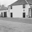
The elegant facade on Front Street links several important groups of buildings including the hotel and the Town House; its headland situation means that the unifying arcades provide a dramatic vista of the New Town on its northern approaches. The Main Street has at its focus the twin church of the Highland (Gaelic speaking) and Lowland (English-speaking)communities; the church was designed by Robert Mylne. The northern part of the church (the Lowland) remains in use for services, while the Highland half is now used as a church hall. The major residential blocks to the south-west of the church are also to designs by Mylne, as are several to the north-east; John Adam was responsible for the Argyll Arms Hotel and the main block between the arcading and Main Street.
In 1747 many aspects of the legal jurisdiction that had been hereditary were abolished, and a system of Circuit Courts established; Inveraray remained, however, an important seat for a court The Argyll Arms Hotel has its origins in providing a base for the judges themselves as well as the court officials and lawyers. The Courthouse and prison were originally among the buildings designed by John Adam on Front Street; repeated complaints about the inadequacy of the accommodation led to the building of a new Courthouse between 1816-20 to designs by James Gillespie Graham. The building and its two attendant prison-blocks are now the headquarters of the department of the District Archivist The bridges of Inveraray fonn such an important part of the architectural setting that they are here listed briefly in chronological order. The Garron Bridge, at the head of the loch, was designed by Roger Morris and built under the direction of John Adam between 1747-9. Adam designed the Garden Bridge, constructed between 1759-61, with a single shallow arch with a span of some 18.3m. The bridge over the River Aray was designed by Robert Mylne between 1773-6 to replace one that collapsed in 1772. The bridges are among the architectural jewels of Inveraray and help to epitomise its place in 18th century landscape planning.
As tourists in Inveraray today, we owe the preservation and restoration of the castle and town to the combined energies of the 11th Duke of Argyll and to his architect, Ian Lindsay.
Information from ‘Exploring Scotland’s Heritage: Argyll and the Western Isles’, (1985).
Field Visit (April 1989)
No. 200 The Topography of Inveraray Town
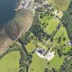
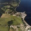
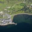
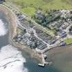
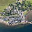
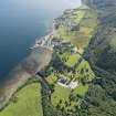
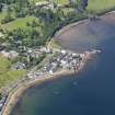
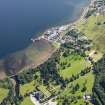
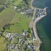
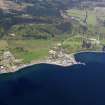
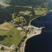
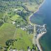
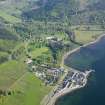
The new town of Inveraray was established by the 3rd Duke of Argyll on the low headland then known as Gallows Foreland, 0.6km S of the old town and castle (Nos. 184, 199).The site was bounded on the WNW by the 17th-century beech avenue (see No. 185), where a high wall was built in 1757, and on the other sides by Loch Fyne. It measures about 250m from NNE to SSW by 150m in maximum width, narrowing at the S to a point where the avenue wall bounds the A83 as it runs along the shore. It rises to a maximum height of about7m OD at Church Square, and substantial breastworks front Loch Fyne to N and E. Some land has been reclaimed from the foreshore as public recreation ground N of the W half of Front Street, and the bastioned court-house enclosure of 1816-21 (No. 205) extends into the Loch.
The first proposal of 1744, drawn up by the Duke and Lord Milton, envisaged the transfer of the old town with its churches, tolbooth, substantial tacksmens' houses set on long leases, and tenants' dwellings, and the addition of a great inn and industrial buildings. This scheme showed the inn, with commercial and industrial buildings, ranged along the sea-front looking N up Loch Fyne, and an axial N-S street, set parallel to the avenue, with a central market-place. William Adam's design of about 1747 brought the double church into the central square, and proposed to introduce bastions fronting Loch Fyne to the E, but John Adam's drawings of 1750, recording his own proposals and those of the Duke, show that there was still no fixed plan for that area although the inn (No. 203) was already under construction on the estate side of the avenue, soon to be followed by the Town House (No. 209). The first private tack, granted in 1753, was for a house which is now the Fernpoint Hotel (No. 207), buil near Loch Fyne on the oblique street-alignment shown on John Adam's drawings, but in 1756 the first tack was granted on the axial main street (No. 202), and the subsequent construction of Factory Land and Ferry Land (No. 206) fronting E to Loch Fyne was parallel to that axis. A pier (No.208) was also built in 1759 to Adam's design, at the E end of Front Street.
At this period building was being carried out according to a feuing plan prepared by John Adam, which does not survive, but progress was slow until the succession of the 5thDuke in 1770. Thereafter the tacksmens' houses and two manses in Front Street (No. 201) and further private houses in North Main Street were completed, and South Main Street was formed by two tenement blocks designed by Robert Mylne. During the 1780s Mylne prepared several schemes for unifying the NNE front of the town, the view which greeted travellers arriving by the military road and approaching over his Aray Bridge (Nos. 255, 264). These schemes included proposed alterations to existing houses and an ornamental gateway to Main Street, but the parts completed were an arcaded screen and lodge at the avenue, and a single arch at the entrance to the Dalmally road. The double church (No.37) was built to Mylne's design in Church Square, in the position first proposed by William Adam, in 1795-1802. Anew court-house and jail were under discussion from 1807, to be built on the loch side at the E side of Church Square, and they were completed in 1821 (No. 205).
Thereafter there were few substantial alterations to the fabric of the town, although individual mid-19th-centuryhouses were built in Church Square and at the NE loch side. The most substantial addition, significantly altering the visual balance of the N front, was the tall bell-tower built near All Saints' Episcopal Church (No. 3) in 1923-32, and in1941 the parish church spire, the original focal point of the town, was demolished. The need for extensive repairs to the houses in the burgh in the 1950s led to their transfer by the Argyll Trustees to the ownership of the Town Council and the then Ministry of Works. A thorough programme of renovation was carried out, funded by the Scottish Development Department and supervised by lan G Lindsay and Partners, architects. The town remained a royal burgh until 1975 (en.1). Except where stated below, the buildings of the town are two-storeyed, varying considerably in height, with walls of harled and whitewashed rubble, sash-and-case windows, and roofs covered with Easdale slates. Many of the windows have black-painted margins, and the window-dressings commonly have round arrises. Few internal features remain, and references below to former stairs and furnishings are derived mainly from Lindsay's survey-drawings (en.2). There is no uniform system of house-numbering, the existing means of identification combining present and former owners, and the letters used below for individual blocks are intended merely as a key to the accompanying elevation-drawings (en.3*).
The following descriptions cover all secular buildings earlier than about 1820 in the town and the suburb of Newton (No. 210), except for some granite garden-walls and stables in the back-lands. The principal streets (Front Street and Main Street) are described first, followed by public buildings(Argyll Arms Hotel, Court-house and jail, Pier, and Town House) and detached blocks (Crombie's Land, Factory Land with Ferry Land, and Fernpoint Hotel) in alphabetical order, and then the suburb of Newton. All Saints' Episcopal Church (No. 3), the Parish Church (No. 37) and the Inveraray Cross (No. 36) are described separately. A full historical narrative is given in I G Lindsay and M Cosh, lnveraray and the Dukes of Argyll, to which reference should be made in conjunction with the descriptions.
RCAHMS 1992, visited April 1989


