Pricing Change
New pricing for orders of material from this site will come into place shortly. Charges for supply of digital images, digitisation on demand, prints and licensing will be altered.
Upcoming Maintenance
Please be advised that this website will undergo scheduled maintenance on the following dates:
Thursday, 9 January: 11:00 AM - 3:00 PM
Thursday, 23 January: 11:00 AM - 3:00 PM
Thursday, 30 January: 11:00 AM - 3:00 PM
During these times, some functionality such as image purchasing may be temporarily unavailable. We apologise for any inconvenience this may cause.
Garrion Mill
Mill (19th Century)
Site Name Garrion Mill
Classification Mill (19th Century)
Alternative Name(s) Dalserf
Canmore ID 201959
Site Number NS75SE 64
NGR NS 79488 50906
Datum OSGB36 - NGR
Permalink http://canmore.org.uk/site/201959
- Council North Lanarkshire
- Parish Cambusnethan
- Former Region Strathclyde
- Former District Motherwell
- Former County Lanarkshire
'Garrion Mill' is depicted on the OS 2nd Edition map (Lanarkshire, sheet XVIII 15, 1936). It has since been demolished. Information from RCAHMS (KD), December 2001.
Desk Based Assessment (10 August 2017)
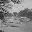
Nothing now remains of Garrion (Garion) Mill, which was situated 170m upstream from the Garrion Bridge (NS75SE 65) on the east bank of the River Clyde. It is first depicted on the 1st edition of the OS 25-inch map (Lanark 1859, Sheet XVII.11), but the mill dated to at least the 1830s with the Baptismal Records of Wishaw Relief Church recording the birth of James Bryce in 1832 with the parents residence recorded as ‘Garion Mill’. In 1859 it is depicted as an ‘L’ shaped building measuring 26m from NE to SW by 16m transversely, with a weir 180m upstream controlling the flow of water to the grain mill. The 2nd edition map (Lanarkshire 1897, Sheet 018.15), which specifies the mill as a corn mill, shows that it has expanded with several other buildings built parallel to the river. Professor Hume photographed the mill in 1969 shortly before its closure after it was badly damaged in a fire in March 1970. It was the last of the water-powered grain mills in the Clyde Valley to close. Today only the weir survives and a residential building now occupies the site of the mill.
Information from HES Survey and Recording (AMcC) 10 August 2017.


