
Thor's Tower, Torboll


Broch (Iron Age)(Possible)
Site Name Thor's Tower, Torboll
Classification Broch (Iron Age)(Possible)
Alternative Name(s) Thor's Field
Canmore ID 14791
Site Number NH79NE 6
NGR NH 75 99
Datum OSGB36 - NGR
Permalink http://canmore.org.uk/site/14791


- Council Highland
- Parish Dornoch
- Former Region Highland
- Former District Sutherland
- Former County Sutherland
NH79NE 6 75 99
'Ruins of Druid Temple'.
Information from 'Survey of Skelbo' 1788, No. 13
About 1833 a very fine broch, Thor's Tower stood on the farm of Torboll, or Thor's Field.
L Tait 1870.
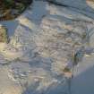
Mr Vass (Duncan Vass, Torboll) indicated the point at NH 7537 9920 where in dry summers he has observed a circular green mark in pasture or a dark mark in crops. He estimates the diameter of the circle at 10 to 12 yards. (see NH79NE 40)
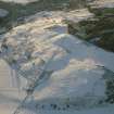
There were no surface indications of antiquity in this position at the time of investigation, nor could any crop marks be seen on the available air photographs. The situation, however, is a good one for a broch, being on the summit of a low ridge overlooking a wide expance of low-lying cultivated land.
An alternative site is a small area of uncultivated land at NH 7530 9930. This is much disturbed and very strong, but has more the appearance of an old quarry that has been used for dumping stones from field clearance. All the stones appear to be small and undressed. Mr Vass has no knowledge of the names "Thor's Tower" or "Thor's Field".
Visited by OS (R D L), 11 April 1964.
There is no trace and no local knowledge of a broch.
Visited by OS (N K B), 25 November 1969.
Publication Account (2007)
NH79 3 THOR'S TOWER ('Thor's Field’, 'Torboll')
NH/7537 9920
Site of a probable broch in Dornoch, Sutherland, reported as the “ruins of Druid temple” in 1788 [2]. In about 1833 a fine broch, known as Thor's Tower, is said to have stood on the farm of Torboll, in 'Thor's field' [3]. Nothing can be seen now, although the situation is a good one for a broch, being on the summit of a low ridge and overlooking a wide expanse of cultivated land [1].
In 1964 Mr Duncan Vass of Torboll pointed out the spot where in dry summers he has observed a circular green mark in pasture or a dark mark in crops. He estimated the diameter of the circle at 10 to 12 yards. No crop marks could be seen on the available air photographs. Mr Vass had no knowledge of the names 'Thor's Tower' or 'Thor's Field' [1].
Sources: 1. NMRS site no. NH 79 NE 6: 2. Survey of Skelbo, 1788, no. 13: 3. L. Tait 1868, 528.
E W MacKie 2007

