
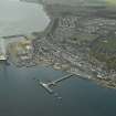
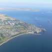
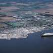
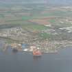
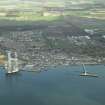
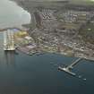
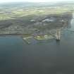
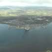
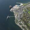
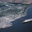
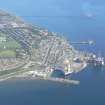
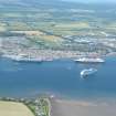
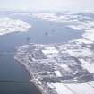
Invergordon, Shore Road, Harbour


Harbour (Period Unassigned), Pier(S) (Period Unassigned)
Site Name Invergordon, Shore Road, Harbour
Classification Harbour (Period Unassigned), Pier(S) (Period Unassigned)
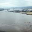
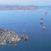
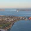
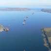
Alternative Name(s) Invergordon Harbour; Cromarty Firth; Firth Of Cromarty
Canmore ID 14499
Site Number NH76NW 21
NGR NH 70848 68299
NGR Description Centred NH 70848 68299
Datum OSGB36 - NGR
Permalink http://canmore.org.uk/site/14499


- Council Highland
- Parish Rosskeen
- Former Region Highland
- Former District Ross And Cromarty
- Former County Ross And Cromarty
NH76NW 21 centred 70848 68299
Pier [NAT]
OS (GIS) MasterMap, June 2009.
Location formerly entered as NH 7085 6825.
See also:
NH76NW 22 NH 70791 68362 37 Shore Road, Warehouse
NH76NW 23 NH 71007 68420 Ramped ferry pier (Slipway)
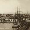
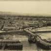
(Location cited as NH 708 683). Invergordon Harbour, part built 1828. A rectangular basin enclosed [on the E] by a straight masonry pier with a wooden extension, and [on the W] by an L-plan masonry pier.
J R Hume 1977
Seen, stable condition.
CFA/MORA Coastal Assessment Survey 1998.

