
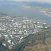
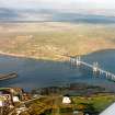
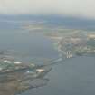
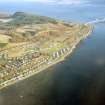
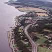
North Kessock, East Pier


Pier (Period Unassigned)
Site Name North Kessock, East Pier
Classification Pier (Period Unassigned)
Alternative Name(s) Kessock Roads; Old Ferry Pier; Beauly Firth
Canmore ID 13364
Site Number NH64NE 151
NGR NH 65585 47831
Datum OSGB36 - NGR
Permalink http://canmore.org.uk/site/13364


- Council Highland
- Parish Knockbain
- Former Region Highland
- Former District Ross And Cromarty
- Former County Ross And Cromarty
NH64NE 151 65585 47831
East Pier - Good condition.
19th Century AD.
CFA/MORA Coastal Assessment Survey 1998.
Field Visit (2013 - 2014)
This pier has protected status and is a listed building (C(S)) 13464 and is called the Old Ferry Pier Kessock by Historic Scotland.
Visited by Scotland's Coastal Heritage at Risk (SCHARP) 2013

