Pricing Change
New pricing for orders of material from this site will come into place shortly. Charges for supply of digital images, digitisation on demand, prints and licensing will be altered.
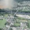
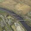
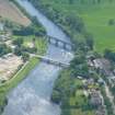
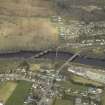
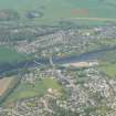
Conon Bridge, Railway Bridge
Railway Viaduct (19th Century)
Site Name Conon Bridge, Railway Bridge
Classification Railway Viaduct (19th Century)
Alternative Name(s) Maryburgh; Conon Railway Bridge; Conon Viaduct; Railway Viaduct, Conon Bridge; Conon Bridge Viaduct; Cononbridge Railway Bridge; River Conon
Canmore ID 12806
Site Number NH55NW 32
NGR NH 53996 55726
Datum OSGB36 - NGR
Permalink http://canmore.org.uk/site/12806
- Council Highland
- Parish Fodderty
- Former Region Highland
- Former District Ross And Cromarty
- Former County Ross And Cromarty
NH55NW 32 53996 55726
Location formerly cited as NH 53995 55724, and as from NH 53972 55809 to NH 54015 55667
For corresponding road bridge and footbridge (downstream, to the E), see NH55NW 39 and NH55NW 188 respectively.
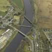
(Location cited as NH 540 557). Railway viaduct, Conon Bridge, opened 1862 by the Inverness and Ross-shire Rly, engineer Joseph Mitchell. A 4-arch viaduct built on the skew. Most unusually, skewing is achieved by having each span built as four seperate, staggered narrow arches.
J R Hume 1977.
The foundation stone of this bridge was laid, by Miss MacKenzie of Seaforth, as early as November 1860 but it was the last of the major works of the Inverness and Ross-shire Rly to be completed; the section of the line between Inverness and Dingwall was opened on 11 June 1862. At the time of its completion, Mitchell believed it to have the largest arches of any skew bridge so far constructed.
H A Vallance 1985.
This stone viaduct was built (at a cost of £11,391) by Joseph Mitchell (designer) and Deakin & Co (contractors) to carry the Inverness and Ross-shire Rly across the River Conon on the skew, at an angle of 45 degrees. It measures 540 ft (164.6m) in total length and comprises five spans of 73 ft (22.3m) at a greatest height of 45 ft (13.7m). Stone construction was used in preference to the originally-intended iron on account of its local availability. The line opened on 11 June 1862 and is still in use.
M Smith 1994.
This viaduct carries the Inverness - Wick and Thurso ('Far North') line of the former Highland Rly over the River Conon, to the S of Maryburgh (NH55NW 41) and N of Conon Bridge (NH55NW 185). Although the entire span of the structure over the river falls within Fodderty parish, the S end of the structure falls within that of Urquhart and Logie Wester.
This viaduct is depicted, but not noted, on the 1992 edition of the OS 1:10.000 map. The location assigned to this record defines the centre of the structure, but the available map evidence indicates that it extends from NH c. 53972 55809 to NH c. 54015 55667.
Information from RCAHMS (RJCM), 5 April 2006.
Publication Account (2007)
Conon Bridge (Railway)
(Institute Civil Engineers Historic Engineering Works no. HEW 2543)
A substantial single-track skew viaduct on the former Highland Railway at Conon Bridge, built in 1862. The structure, which is still operational, is of five segmental arches, each of 73 ft span on a skew of 458 to the river. Each arch is composed of four ribs 334 ft wide, 4 ft deep at the springing and 3 ft deep at the crown. Unlike a common skew arch these ribs spring from haunches perpendicular to their spans and not their pier lines.
The keystones at the centre of each arch are bonded to the adjacent arch, as are the arch-rings at the haunches. Iron cramps were also inserted occasionally in the arch-ring joints to connect the ribs. The height of the deck is 45 ft from the bed of the river, which is rock, and made an excellent foundation. When the centring supporting the archstones until the keystone was placed was removed, it is recorded that there was no settlement of the ribs.
The designer and builder of the bridge was Joseph Mitchell, engineer to the Highland Railway. He at first favoured an iron-girder bridge at this site, but chose a masonry arch bridge on the grounds of durability.
R Paxton and J Shipway, 2007.
Reproduced from 'Civil Engineering heritage: Scotland - Highlands and Islands' with kind permission from Thomas Telford Publishers.


