
Cromarty Bridge


Road Bridge (20th Century)
Site Name Cromarty Bridge
Classification Road Bridge (20th Century)
Alternative Name(s) Cromarty Firth; Firth Of Cromarty; Ardullie Point; Findon Point
Canmore ID 119760
Site Number NH56SE 37
NGR NH 5896 6119
NGR Description NH 5878 6201 to NH 5921 6063
Datum OSGB36 - NGR
Permalink http://canmore.org.uk/site/119760


- Council Highland
- Parish Kiltearn
- Former Region Highland
- Former District Ross And Cromarty
- Former County Ross And Cromarty
NH56SE 37 5896 6119 (From NH 5878 6201 to NH 5921 6063)
Cromarty Bridge [NAT]
OS 1:10,000 map, 1987.
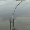
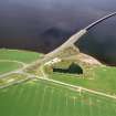
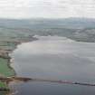
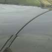
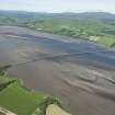
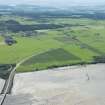
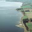
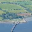
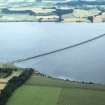
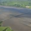
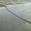
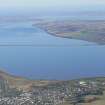
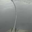
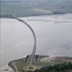
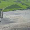
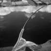
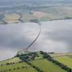
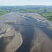
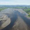
This bridge carries the A9(T) public road across the head of the Cromarty Firth and was built in conjunction with the Kessock Bridge (NH64NE 153) across the Beauly Firth. It spans the firth between Ardullie Point (in Kiltearn parish, Easter Ross) and Findon Point (Urquhart and Logie Wester parish, Black Isle), and is approached over lengthy embankments at both ends.
Information from RCAHMS (RJCM), 23 July 1997.
Bridge - see, stable condition.
CFA/MORA Coastal Assessment Survey 1998.

