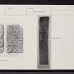
Canna, A' Chill, St Columba's Chapel
Burial Ground (Medieval), Chapel (Medieval), Grave Slab (Medieval)
Site Name Canna, A' Chill, St Columba's Chapel
Classification Burial Ground (Medieval), Chapel (Medieval), Grave Slab (Medieval)
Alternative Name(s) Keill, St. Columba's Chapel; Canna House; Canna 2
Canmore ID 10694
Site Number NG20NE 1
NGR NG 2692 0553
Datum OSGB36 - NGR
Permalink http://canmore.org.uk/site/10694
- Council Highland
- Parish Small Isles
- Former Region Highland
- Former District Lochaber
- Former County Inverness-shire
A’ Chill 15 (St Columba), Canna, Skye & Lochalsh, carved stone
Measurements:
Stone type:
Place of discovery: NG 2691 0540
Present location: lost.
Evidence for discovery: this stone was in the early burial ground close to cross no 12 in the mid nineteenth century. After the island was cleared of tenants in 1851, a farm manager is said ‘to have broken up carved stones from the old graveyard at Keill and used them in building; two particularly fine ones were hidden by local patriots who buried them in some spot that is now unfortunately forgotten’ (Campbell 1994, 161).
Present condition:
Description
Details unknown
Date range: seventh or eighth century.
Primary references: Campbell 1994, 161.
Compiled by A Ritchie 2016
A’ Chill 16 (St Columba), Canna, Skye & Lochalsh, carved stone
Measurements:
Stone type:
Place of discovery: NG 2692 0553
Present location: lost.
Evidence for discovery: this stone was in the early burial ground close to cross no 12 in the mid nineteenth century. After the island was cleared of tenants in 1851, a farm manager is said ‘to have broken up carved stones from the old graveyard at Keill and used them in building; two particularly fine ones were hidden by local patriots who buried them in some spot that is now unfortunately forgotten’ (Campbell 1994, 161).
Present condition:
Description
Details unknown.
Date range:
Primary references: Campbell 1994, 161.
Desk-based information compiled by A Ritchie 2016
Field Visit (3 July 1925)
Sculptured Cross and Slabs, A'Chill.
The site of St Columba's Chapel is marked by the finely-sculptured free standing sandstone cross [See NG20NE 2] of unusual type which stands by the graveyard in a valley rather less than ¼ mile north of Canna post office.
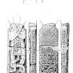
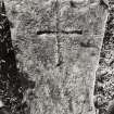
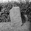
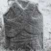
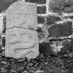
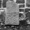
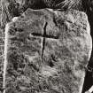
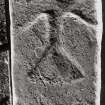
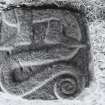
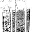
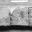
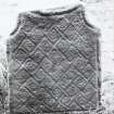
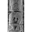
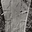
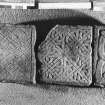
CARVED SLAB. Within the churchyard, close to the west boundary wall, is a slab of micaceous schist, covering a modern grave, sculptured with a heterogeneous assemblage of objects (Fig. 301.) It is 5 feet 8½ inches in length, 3½ inches thick, and has an average breadth of 1 foot. Filling the upper dexter corner is a small patera, and the remainder of the top is occupied by a figure holding in the left hand a large sword, the hilt of which he is hammering, the hammer being held with the right hand; beside the hammer, but not connected with it, is an object resembling a short gun. Below the patera is a long-bladed tool with a spade handle, rather like a peat spade, and below this what may be a saw or perhaps a harrow. Below the figure is an object unidentified and beside this an arrowhead of flint and not metal type. Terminating the upper group of sculptures is a bird, probably an eagle, carved back-down athwart the stone; separating the two groups is a plain panel uncarved, possibly intended for an inscription. The lower group starts with a representation of two conventional trees, but to read these in proper position the stone must be reversed. There is a rectangular object on the dexter side resembling a mason's square. Thereafter follows an interlaced pattern based on a cross saltire, and the group is terminated with a snake (?) arranged like the letter M. Apparently two people are commemorated by this slab, the symbols beginning at either end.
RCAHMS 1928, visited 3 July 1925.
OS map: Islands of Canna and Sanday (Inverness-shire)lix.
Photographic Survey (August 1965)
Photographic survey by the Scottish National Buildings Record in August 1965.
Field Visit (30 May 1972)
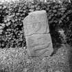
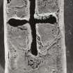
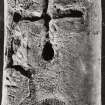
St Columba's Chapel and burial ground were destroyed in the mid 19th century during land improvements, and the present burial ground at NG 2690 0544 was inaugurated about 90.0m to the S. The sculptured grave slab, probably from the old burial ground, is still within the W half of the modern burial ground, but lies loose. The fragments of the cross shaft are preserved at Canna House. A third piece has been found by Mr Campbell.
Visited by OS (A A), 30 May 1972.
Desk Based Assessment (1972)
NG20NE 1 2692 0553
(NG 2692 0553) St Columba's Chapel (NR)
(Site of) Burial Ground (NR)
OS 6" map, Inverness-shire, 2nd ed., (1903).
See also NG20NE 2, NG20NE 13 and NG20NE 45.
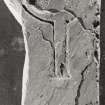
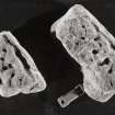
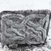
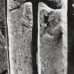
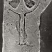
St Columba's Church, Canna, is mentioned by Archdeacon Monro in 1549, but was in ruins when noticed by Pennant in 1772 (OPS 1855). Within the churchyard close to the W boundary wall is a sculptured slab of micaceous schist covering a modern grave. It is 5'8 1/2" x 3 1/2 x 1' (RCAHMS 1928). A fragment of a cross-shaft was found c.1900 in a wall not far from the free-standing cross, (NG20NE 2) and presumably also in the churchyard. It is in two pieces (together 2' x 1' x 3") and features a design of human legs and entwined serpent (J R Allen and J Anderson 1903). It was preserved within the modern Memorial church (RCAHMS 1928) but appears to have been since removed by J L Campbell (the laird) to Canna House (NG20NE 24), where it was seen by Rivet in 1961
(OS 6"map annotated by A L F Rivet, 26 June 1961).
Lethbridge suggests that the cross may be of the 7th century.
(Private 6" map of T C Lethbridge, 1953)
T Pennant 1790; Orig Paroch Scot 1855; D Monro 1884; J R Allen and J Anderson 1903; RCAHMS 1928.
Information from OS.
Field Visit (20 August 1996)
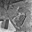
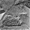
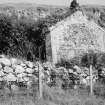
(Location amended to NG 2695 0553). Nothing is now visible of the chapel and burial-ground which once stood at A'Chill. Dedicated to St Columba, the chapel was recorded in ruinous condition by Pennant in the early 1770's and likewise in a report by the British Fisheries Society (cited by Campbell) in 1788, where reference is made to the overgrown nature of the ruins in which 'the shape of a window' could be made out. This report also mentions a cross (NG20NE 2) and burial-ground, all of which lay at the heart of the township known as Keill (NG20NE 45). The buildings and enclosures of Keill are shown on an estate map of 1805, together with what may be a depiction of a cross; the area was cleared of tenants in 1851 and no trace of the township or chapel can now be seen.
In 1994, a geophysical survey of this area was carried out by a team led by John Hunter of Bradford University. This was followed up by selective trial trenching to confirm the identification of a rectangular structure located to the WNW of the free-standing cross NG20NE 2. On excavation, the mortared foundations of the N and W walls of the structure were seen to overlie a flagged stone surface, while the interior revealed a dark, compressed floor surface containing evidence of burials. Although by no means conclusive, the form of construction is suggestive of an important building such as a chapel. A further wall running parallel to the N wall of the structure was interpreted by Hunter and Roberts as the boundary wall of the churchyard.
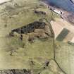
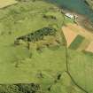
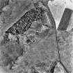
The site of the chapel and burial-ground lie centrally within a natural amphitheatre, created by ridges of outcrop to the E and W, and steep sloping ground to the N. The fragments of the cross shaft and the sculptured grave slab are as described by the OS in 1972.
Visited by RCAHMS (ARG), 20 August 1996
T Pennant 1790; J L Campbell 1984; J Hunter and C Roberts 1994.
Reference (2001)
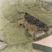
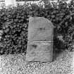
The medieval parish church occupied the centre of a natural amphitheatre some 350m NW of the harbour, bounded on the S by a rocky ridge and on the N by steep hill-slopes. Until about 1850 this was also the principal area of farming settlement on the island (i), and there are no visible early remains except for the free-standing cross (no.12), which may mark the position of an Early Christian monastery. The footings of the church were identified by excavation in 1994, about 10m W of the cross (ii). Some 100m to the SSW, on the W slope of the rocky ridge, there is a small rectangular burial-ground bounded by a stone wall of late 19th-century date (iii). A knoll situated 60m W of the cross is surmounted by a wedge-shaped standing stone of uncertain age.
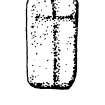
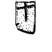
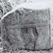
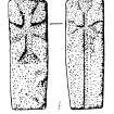
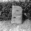
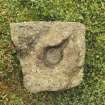
The burial-ground contains five early stones (nos.1, 4, 6, 7, 10) and a crudely-carved graveslab of late 16th or early 17th-century type (iv). Other carved stones which were found in this burial-ground or in nearby field-walls have been removed for safe-keeping to Canna House (v).
(1) Burial-ground. NG20NE 1.01 Slab of Torridonian sandstone
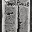
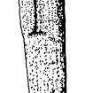
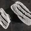
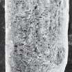
(2) Canna House. NG20NE 1.02 Upper part of a small pillar of orange/buff silicious flagstonegrooves.
(3) Canna House, (NG20NE 1.03) found on the shore near Tarbert (NG c.240 053) (vi) Fragment of a small pillar of Torridonian sandstone.
(4) Burial-ground. (NG20NE 1.04) Upright gravemarker.
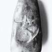
(5) Canna House. (NG20NE 1.05) Small pillar of buff Torridonian sandstone.
(6) Burial-ground. (NG20NE 1.06) Waterworn pillar of Torridonian sandstone.
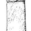
(7) Burial-ground. (NG20NE 1.07) Pillar of Torridonian flagstone.
(8) Found during ploughing at A' Chill in 1947; now at Canna House. ( (NG20NE 1.08) Slab of buff Torridonian flagstone.
(9) Canna House. (NG20NE 1.09) Slab of grey Torridonian flagstone.
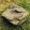
(10) Burial-ground. Slab of Torridonian sandstone (NG20NE 1.10).
(11) Canna House. Rough boulder of basalt (NG20NE 1.11).
(12) THE CANNA CROSS - see NG20NE 2.
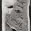
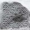
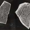
(13) Two fragments of a cross-shaft were discovered in the wall of the burial-ground (NG20NE 1.12).
I Fisher 2001.
Project (16 April 2015 - 23 April 2015)
As part of on-going work by the National Trust for Scotland four sites on Canna were investigated, 16–23 April 2015, using a variety of geophysical techniques. NG 2444 0625 Beinn Tighe Souterrain A substantial grass mound encompasses a souterrain on its S flank. The mound, which lies on the crest of a rise on the E side of an old field wall, is c15m in diameter and has been extensively damaged by rabbit burrowing. The souterrain is aligned N/S
and survives in at least two sections with modern breaks providing access through the roof. The upper section is 6m long and the lower 3.8m. Internally, the souterrain varies between 0.8–1.3m in width. Its sides are rock-cut, but in places stretches of stone walling survive. The rabbit burrowing has previously uncovered many fragments of coarse pottery, but also some slag, flint, and bone. Ground Penetrating Radar (GPR) and resistance survey was carried out over the souterrain to confirm its full extent and to map any potential structures associated with it.
Although a wealth of anomalies was detected by the GPR survey, interpretation is cautious. Several coherent responses are evident within the data, but whether these are due to potentially significant in situ structures or rabbit burrows is not clear. The situation is further complicated by the fact that rabbit burrows could be utilising any possible structural remains, as was observed with the ‘walling’ of the souterrain. The resistance survey showed well defined high resistance anomalies which suggest buried stone, a more definitive interpretation is limited by the later ridge and furrow cultivation and, again, by the extensive rabbit burrows. NG 2441 0593 Beinn Tighe Neolithic Site The known Neolithic site in Beinn Tighe is a low mound, which is
overridden by lazy bed cultivation. The terrace forms part of the floor of a rocky amphitheatre, and the mound lies towards its leading edge. As an assemblage of Neolithic pottery and flint flakes had been recovered as a result of rabbit damage to the mound, the site was excavated in 2006–7 as part of a programme to assess the nature and extent of rabbit damage to archaeological structures. Two trenches were excavated across the site and produced quantities of pot sherds and some lithics. Well-stratified charcoal from the lower archaeological layer was also recovered. To better understand the extent and nature of the site a resistance survey was undertaken.
Although well defined high resistance anomalies were detected, which suggest the presence of buried stone beneath the surface, a more definitive interpretation is limited by the later ridge and furrow cultivation and the extensive rabbit burrows within the area. However, the resistance data shows good correlation with the previous excavation and test pitting results suggesting the limits of the resistance anomalies are archaeologically significant rather than simply the product of later agricultural activity.
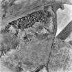
NG 2692 0553 A’ Chill, St Columba’s Chapel A’ Chill is reputedly a monastic site established by St Columba, or possibly a monastery established at the site of a Columban chapel. Nothing is now visible of the chapel and burial ground which once stood at A’ Chill although the site is marked by a finely carved Celtic Cross. Until about 1850 this was also the principal area of farming settlement on the island. The area was cleared of tenants in 1851 and little trace of the township can now be seen. The resistance survey was undertaken over a c1ha area and detected a wealth of anomalies of likely archaeological significance. The presumed chapel previously detected and evaluated by Bradford University has been detected in this survey, although it is not very well defined. However, this data set suggests possible internal and external responses associated with the main structure suggesting the potential
for a more substantial complex. One of the clearest anomalies within this data set is a rectilinear anomaly to the N of the postulated chapel and on the same alignment. Anomalies apparently associated with the outcropping rock and suggestive of the remnants of structures ‘built in’ to the outcrops have also been detected. Numerous additional linear and rectilinear anomalies have been detected throughout the survey area suggesting a potential network of field systems. In addition, anomalies thought to be associated with the culvert have also been noted. The data set is extremely complex, and it has to be remembered that geophysics cannot date features and it is possible that some apparently associated anomalies are not contemporary and the data is detecting a palimpsest of potential archaeological remains. In addition rabbit activity in the area may be creating spurious anomalies.
NG 278 056 Coroghon Township The British Fisheries map of Canna Harbour of 1788 shows nine houses above Coroghon Bay in a valley called Lag a’ Bhaile (the dell of the township) in the E of the island. The township is also shown in a sketch, probably drawn from memory by Lt Peirce in 1787. However, by the time of the Clanranald map of 1805 there is no sign of the township. It was decided in consultation with the National Trust for Scotland to undertake a limited survey of the field. Unfortunately the resistance survey failed to identify any anomalies of archaeological significance. Time permitted only limited survey in this area and it is possible the survey did not cover the area of the former township. The survey was positioned based on the 1787 sketch and it is possible, based on British Fisheries map that the survey block was too far to the E. However, it is also possible that no buried remains associated with the township survive either due to the nature of construction within the township, or because subsequent intensive ploughing has destroyed any ephemeral deposits. It is also feasible that any potential surviving remains are buried under colluvium beyond the depth resolution of the technique.
Archive: Rose Geophysical Consultants
Funder: The National Trust for Scotland
Susan Ovenden - Rose Geophysical Consultants
(Source: DES, Volume 16)
Earth Resistance Survey (16 April 2015 - 23 April 2015)
NG 2444 0625
NG 2441 0593
NG 2692 0553
NG 278 056
As part of on-going work by the National Trust for Scotland, resistance surveys took place at four sites on Canna.
Archive: Rose Geophysical Consultants
Funder: The National Trust for Scotland
Susan Ovenden - Rose Geophysical Consultants
(Source: DES, Volume 16)


