Pricing Change
New pricing for orders of material from this site will come into place shortly. Charges for supply of digital images, digitisation on demand, prints and licensing will be altered.
Castle Law, Glencorse Souterrain
Boundary Stone(S) (20th Century), Cultivation Terrace(S) (Medieval), Cup Marked Stone (Neolithic), Fort (Prehistoric), Rig And Furrow (Medieval), Souterrain (Iron Age)
Site Name Castle Law, Glencorse Souterrain
Classification Boundary Stone(S) (20th Century), Cultivation Terrace(S) (Medieval), Cup Marked Stone (Neolithic), Fort (Prehistoric), Rig And Furrow (Medieval), Souterrain (Iron Age)
Alternative Name(s) Castlelaw
Canmore ID 51871
Site Number NT26SW 2
NGR NT 22948 63886
Datum OSGB36 - NGR
Permalink http://canmore.org.uk/site/51871
First 100 images shown. See the Collections panel (below) for a link to all digital images.
- Council Midlothian
- Parish Glencorse
- Former Region Lothian
- Former District Midlothian
- Former County Midlothian
NT26SW 2.00 22900 63870 Fort, Settlement, Souterrain, Cupmarks, Cultivation Terraces.
NT26SW 2.01 22978 63878 Boundary Marker
NT26SW 2.02 22960 63926 Boundary Marker
NT26SW 2.03 22918 63935 Boundary Marker
NT26SW 2.04 22872 63921 Boundary Marker
NT26SW 2.05 22833 63887 Boundary Marker
NT26SW 2.06 22821 63859 Boundary Marker
NT26SW 2.07 22838 63821 Boundary Marker
NT26SW 2.08 22878 63796 Boundary Marker
NT26SW 2.09 22949 63807 Boundary Marker
(NT 2290 6387) Camp (NR)
OS 6" map, (1957).
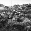
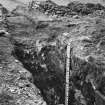
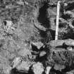
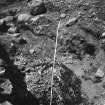
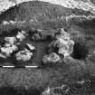
Fort and settlement (R W Feachem 1965) Castle Law. Excavations here in 1931-2, and in 1948 showed the single palisade trench of the earliest structure was succeeded by a single rampart reinforced internally with timber beams, at least near the gate. The course of the rampart differed slightly from the palisade, so that on one side of the entrance in the former the palisade was found outside it, and on the other, inside it. In the third phase a pair of ramparts and ditches was added outside the singleton to produce a standard multi-vallate fort of the period immediately before the local arrival of the Roman armies in AD 79 or 80. (R W Feachem 1963). A well- preserved souterrain, dating perhaps to the 3rd century AD, was also found, built into the ditch of the inner rampart near the old entrance to the settlement. Numerous finds were made, which are listed by V G Childe in 1933. They include sherds of Samian pottery, native pottery, a bloom of iron, and a buckle with apparently Celtic ornament, which Curle states is probably from provincial Germany, such buckles being common on Roman sites there. They were presented to the National Museum of Antiquities of Scotland (NMAS) in 1939. (Accession Nos. HH 425-63, 574-5.)
RCAHMS 1929; V G Childe 1933; Proc Soc Antiq Scot 1939 (Donations); S Piggott and C M Piggott 1954.
Generally as described and planned by above authorities. No trace of the palisade trench survives.
Resurveyed at 1/2500.
Visited by OS (RD) 2 February 1970.
Roman finds,all 2nd century, include an enamelled bronze brooch, glass bottle fragments and Samian. A Romano-Celtic mounting was also found. All are in NMAS.
A S Robertson 1970.
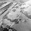
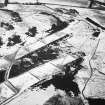
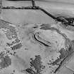
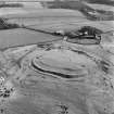
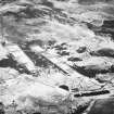
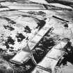
Photographed by the RCAHMS in 1980 (colour transparencies).
RCAHMS AP catalogue 1980.
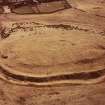
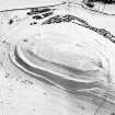
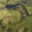
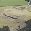
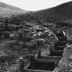
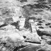
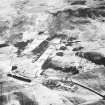
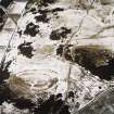
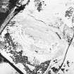
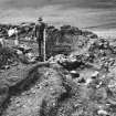
This multivallate fort, a guardianship monument in the care of Historic Scotland, occupies a spur on the SE flank of Castlelaw Hill, about 150m NNW of Castlelaw farmsteading (NT26SW 66). Oval on plan, the fort measures about 82m from ENE to WSW by 35m transversely within the innermost rampart, which barely rises more than 0.5m in height internally, but is at least 1.5m in external height around most of its circuit. The outer defences comprise an earthen rampart accompanied externally by a deep ditch and a counterscarp bank, and internally by a broad quarry-ditch. These defences are best-preserved on the N, and elsewhere they have been reduced by the cultivation of rig-and-furrow (NT26SW 119) that almost completely surrounds the fort. On the NW, the rigs override the outer ditch and the counterscarp bank, and one rig appears to have been cultivated the length of the N side between the innermost rampart and the internal quarry ditch of the outer defences. On the S side, rigs measuring about 5m in breadth run uphill onto the lip of the counterscarp bank, but above this the defences have been transformed into a series of cultivation terraces at right-angles to the axis of the rig. The interior has also been extensively cultivated (on three separate alignments), but heavily-worn tracks extend up the slope through well-defined entrances on the WSW and SSE. A third entrance, on the ENE, is heavily disturbed, partly as a result of excavations carried out here by Childe (1933) and the Piggotts (1952).
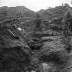
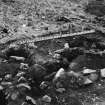
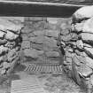
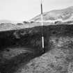
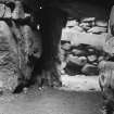
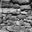
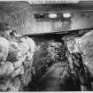
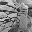
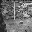
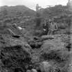
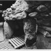
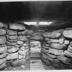
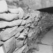
This entrance was also disturbed by the insertion of a souterrain into the quarry-ditch of the outer rampart. This was also excavated by Childe and is now capped by a concrete roof. The visible fabric of the passage and a side-chamber on the W appears to be largely as excavated by Childe. The passage measures about 21m in length from N to S and gradually widens from 0.9m at the entrance at the N end to about 1.6m at the slightly rounded terminal on the S. The wall also increases in height from 1.3m at the entrance to 1.7m at the terminal and in places it is slightly corbelled. A cupmarked stone is built into the top of the E wall at the terminal. The full dimensions of the stone cannot be determined, but it measures about 0.45m in width by 0.25m in thickness, and its slightly convex upper surface bears five cupmarks (two of them oval) up to 50mm in diameter by about 12mm in depth. The souterrain passage curves to the SSW about half way along its length, at which point a short length of passage leads off to a roughly circular chamber on the W. This chamber measures about 3.6m in diameter and up to 1.95m in height.
The fort and souterrain are enclosed by a fence, but the guardianship area is also defined by nine boundary markers (see NT26SW 2.01-09).
(CDTA 95-103, 269)
Visited by RCAHMS (JRS) 8 June 2005
Field Visit (26 August 1913)
Fort, Castle Law.
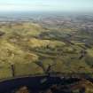
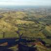
On the summit of Castle-Knowe, a small hill on the southeastern slope of the Pentland Hills, on the northern side of the glen through which the Glencorse Burn issues from the hills, is the Castle Law fort (Fig. 103). It lies some 200 yards north of Castle Law farm, at an elevation of 1000 feet above sea-level, commanding a view of Lawhead fort [NT26SW 7], which lies about 1 ¼ miles to the south-west. The approach is steep on all sides except towards the north, where there is a dip of only a few feet into a hollow about 100 yards wide, which separates the hill from the main mass of the Pentlands.
The fort is oval on plan, the main axis running east-north-east and west-south-west, along which it measures internally some 270 feet, the breadth being on an average about 120 feet. It is surrounded by a series of earthen ramparts and ditches, the arrangement of which is not regular for the entire periphery, and it is provided with three entrances, one at either end and the third near the centre of the southern flank. The two outer defences are well preserved along the northern flank, but at all other parts the construction is now much broken down. The enceinte has been surrounded by a rampart, which for the greater part has been almost entirely obliterated. At an interval of approximately 50 feet from this a second earthen wall entirely encircles the fort, and a third line of defence has been constructed on the north and the south-western sides at a further interval of 35 feet. At most these ramparts do not rise to a height of more than 2 feet on the inside and 4 feet on the outside. The entrance in the south-western corner of the fort is 10 feet broad at the inner rampart, where the passage is excavated below the level of the interior. On emerging from the inner defence it swings to the right and is carried through the outer defences in a north-westerly direction. The entrance on the southern flank has likewise cut through the outer defences, in a slightly oblique and north-easterly direction, and it has been similarly excavated below the level, where it enters the enceinte in the form of a bifurcated passage. The north-eastern entrance makes a gap 12 feet broad in the inner rampart, and breaks the line of the second defence for approximately 35 feet, where a low-lying ridge or mound thrown across the opening on the outside may be the remains of an outer traverse to protect the passage. In front of this entrance is a pear-shaped mound or bastion, which has no hollow in the centre to suggest that it was a guard-chamber. Between the outer and inner ramparts, immediately to the south-east of the roadway, is a low, narrow, curved enclosure,65 feet in length, with a bulbous outline in the centre of its western flank and open at its northern end, where it approaches the northeastern entrance to the fort.
RCAHMS 1929, visited 26 August 1913.
OS map: vii S.W.
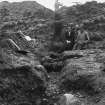
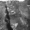
Excavation (May 1931 - June 1931)
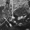
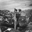
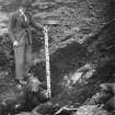
To test the nature of the defences two sections, 4 feet wide, N.I and N. II, were dug across the ramparts on the north during May and June 1931 by members of the Edinburgh League of Prehistorians.
V G Childe 1933
Note (1988)
Castle Law NT 2290 6387 NT26SW 2
This multivallate fort occupies a spur on the SE side of Castlelaw Hill, 150m NNW of Castlelaw Steading. The fort measures about 90m by 45m internally and its defences comprise a low inner rampart set about 9m within two ditches accompanied by counter scarp banks. Both of the counterscarp banks are much denuded but the, crest of the inner stands up to 1.7m above the bottom of the outer ditch. There are entrances on the E, Sand W. Excavations were carried out in the fort in 1931-2 and again in 1948, principally on the E. In 1948 re-excavation of the innermost rampart on the N side of the E entrance revealed that its clay core had been reinforced with layers of brushwood, vertical stakes and horizontal timbers; a palisade trench was also found near the back of the rampart, its posts rising through the clay core. The earlier excavations had uncovered a palisade trench at the front of this rampart, on the opposite side of the entrance, but there is no evidence that either belongs to an earlier enclosure; on the other hand there are clear indications that at one point the inner counterscarp bank overlay a post-trench, which probably formed part of an independent timber defence line. At the E entrance, on the line of both the inner and outer defences, traces of a complex sequence of gate-structures were uncovered, indicating of themselves that the full structural history of the fort's defences cannot be understood without further excavation. The nature of the later occupation of the site is not in doubt, however. After the abandonment of the outer defences a souterrain was constructed within the hollow of the inner ditch on the S side of the entrance. It measures 17m in length and varies from 1m to 2m in breadth, terminating in a corbelled apse at the Send. The entrance is at the N end, and halfway along its W side a short passage, its roofing slabs still in position, leads into a beehive chamber about 3.5m in diameter. Finds from the souterrain include an enamelled brooch, a Romano-Celtic mounting, fragments of blue green bottle-glass and five sherds of Samian, all of second century AD date (RMS, HH 425-45). The 1931-2 excavations also recovered a few sherds of coarse pottery, fragments of lignite artefacts, a lignite finger-ring, some small stone balls, an upper stone from a rotary quern and a sherd of Samian (RMS, HH 446-63) from the area of the outer gateway at the E entrance. Finds from the later excavation were restricted to one sherd of pottery and a small stone ball (RMS, HH 574-5).
RCAHMS 1988
(RCAIVIS 1929, 74, no. 102; Childe 1933; Piggott and Piggott 1952, 191-4; Feachem 1977, 136)
Field Visit (8 June 2005)
This multivallate fort, a guardianship monument in the care of Historic Scotland, occupies a spur on the SE flank of Castlelaw Hill, about 150m NNW of Castlelaw farmsteading (NT26SW 66). Oval on plan, the fort measures about 82m from ENE to WSW by 35m transversely within the innermost rampart, which barely rises more than 0.5m in height internally, but is at least 1.5m in external height around most of its circuit. The outer defences comprise an earthen rampart accompanied externally by a deep ditch and a counterscarp bank, and internally by a broad quarry-ditch. These defences are best-preserved on the N, and elsewhere they have been reduced by the cultivation of rig-and-furrow (NT26SW 119) that almost completely surrounds the fort. On the NW, the rigs override the outer ditch and the counterscarp bank, and one rig appears to have been cultivated the length of the N side between the innermost rampart and the internal quarry ditch of the outer defences. On the S side, rigs measuring about 5m in breadth run uphill onto the lip of the counterscarp bank, but above this the defences have been transformed into a series of cultivation terraces at right-angles to the axis of the rig. The interior has also been extensively cultivated (on three separate alignments), but heavily-worn tracks extend up the slope through well-defined entrances on the WSW and SSE. A third entrance, on the ENE, is heavily disturbed, partly as a result of excavations carried out here by Childe (1933) and the Piggotts (1952).
This entrance was also disturbed by the insertion of a souterrain into the quarry-ditch of the outer rampart. This was also excavated by Childe and is now capped by a concrete roof. The visible fabric of the passage and a side-chamber on the W appears to be largely as excavated by Childe. The passage measures about 21m in length from N to S and gradually widens from 0.9m at the entrance at the N end to about 1.6m at the slightly rounded terminal on the S. The wall also increases in height from 1.3m at the entrance to 1.7m at the terminal and in places it is slightly corbelled. A cupmarked stone is built into the top of the E wall at the terminal. The full dimensions of the stone cannot be determined, but it measures about 0.45m in width by 0.25m in thickness, and its slightly convex upper surface bears five cupmarks (two of them oval) up to 50mm in diameter by about 12mm in depth. The souterrain passage curves to the SSW about half way along its length, at which point a short length of passage leads off to a roughly circular chamber on the W. This chamber measures about 3.6m in diameter and up to 1.95m in height.
The fort and souterrain are enclosed by a fence, but the guardianship area is also defined by nine boundary markers (see NT26SW 2.01-09).
(CDTA 95-103, 269)
Visited by RCAHMS (JRS) 8 June 2005
Measured Survey (16 November 2005)
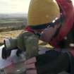
RCAHMS surveyed Castlelaw fort, Glencorse with plane-table and self-reducing alidade on 16 November 2005 at a scale of 1:500. Control points were established by differential GPS. The resultant plan was redrawn in vector graphics software at a scale of 1:1000.
Publication Account (2006)
THE FORT
The Castlelaw fort (fig 3), which is a Guardianship monument in the care of Historic Scotland, is the only fort within the CDTA, and, like other categories of settlement from the 1st millennium BC, it forms part of a larger distribution of broadly similar sites, some of which survive as upstanding monuments and some as cropmarks. Despite two small-scale excavations (Childe 1933; Piggott & Piggott 1952), the exact nature of the defences of the fort is not fully understood. The excavations revealed a complexity of timber features, including palisade trenches, but the sequence of events can only be resolved by further excavation. If the fort follows the pattern of other sites for which there is dating evidence, then it is likely to have been occupied in the second half of the first millennium BC and gone out of use before the end of the millennium.
The Commission’s first association with the fort was a survey undertaken in 1915, with the resulting plan (fig 5) appearing in the Inventory of Midlothian and West Lothian (RCAHMS 1929). Although this plan records most of the major features of the fort, it does not acknowledge the presence of the later cultivation remains. Nor does it appear to recognise the devastating effect that this cultivation has had on the fort, especially on the south side, where the ramparts and ditches have been converted into cultivation terraces.
The survey of the fort (fig 6), which was carried out by the Commission in November 2005, was undertaken using a selfreducing alidade and planetable, with control provided by a series of pegs, the positions of which were recorded by Global Positioning System (GPS) equipment. As well as obtaining new information about the monument, the survey recognized that the lack of contemporary remains within the fort was probably as a result of cultivation in the interior. While this may have seemed a reasonable conclusion to draw beforehand, no cultivation remains were recorded in the interior of the fort until they were spotted during the course of survey. It is somewhat ironic that the very slight remains of that cultivation, in the form of very low scarps, were not detected by either aerial photography or by sophisticated survey techniques, but by the investigators seeing the features in perfect conditions - in late afternoon when the sun was very low in the south-western sky.
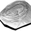
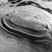
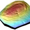
As part of the Commission’s ongoing assessment of the practical uses of GPS technology, a terrain model of the fort (fig 7a) was achieved as a result of taking approximately 17,000 height measurements across and around the site. The exact role of terrain modelling in archaeological recording has yet to be determined, but, in the meantime, one of the benefits is being able use software to examine, on screen, monuments in three dimensions, either in isolation or in wider topographical contexts.
Another useful tool, the potential of which is still to be fully explored, is that which allows a hachured plan derived from an alidade survey to be draped over the terrain model (fig 8).
THE SOUTERRAIN
The souterrain at Castlelaw, which is built into one of the disused ditches of the fort, is one of relatively few souterrains south of the River Forth. Like a number of its southern counterparts, it shares many of the architectural traits commonly present in the main concentration of souterrains in eastern Perthshire, Angus and northern Fife. It has a curving drystone-built passage, with an entrance at one end and a rounded terminal at the other, nd there is a subsidiary chamber opening off the main passage. Roman material found during its excavation (Childe 1933) indicates it was in use in the second half of the second century AD. Thus it appears to be contemporary with most of the other souterrains in eastern Scotland, including the one at Crichton Mains, some 20km to the east, where Roman masonry, datable to before or about AD 160, is built into the walls and roof of the passage.
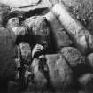
A cupmarked boulder, probably dating to the period between 4000 and 2000BC, appears to form part of the top of the passage wall of the souterrain close to the south end of the east side. However, the stone is not mentioned in any previous accounts of the site, including the excavation report, and the circumstances of its discovery remain unknown. The full dimensions of the stone cannot be determined, but five cupmarks (two of them oval) are visible on its upper surface.
BOUNDARY MARKERS
An unexpected aspect of the archaeology of Castlelaw was the presence of nine boundary markers, which define the Guardianship area around the fort and souterrain. These markers include three distinct forms, reflecting different periods in the definition of the boundary.
The earliest markers probably date to about 1924, when the site first came under State protection, and comprise two short sandstone blocks, measuring only 0.14m square in section, which stand on the east and west-southwest sides of the fort respectively. Each stone bears an incised arrow symbol on its flat top, pointing towards the centre of the fort.
Four of the other seven markers in the circuit are cast concrete pillars, measuring 0.23m square in section, and varying in height up to 0.38m (fig 9). The upper surfaces again bear arrow symbols, this time impressed,pointing to the centre of the fort. These markers may have been in place by 1937, when the Guardianship area was consolidated following the transfer of the land from the War Department to the Ministry of Works (RHP 319). They must have still been in place when the Ministry of Works planned the fort in 1955 (RCAHMS MS: MLD/13/5), though only two markers, one of them displaced are shown at the east end of the fort.
When the Guardianship area was enlarged in the mid 1950s three of the boundary stones at the west end of the fort were retained in their existing positions and three at the east end were simply moved to their new positions. Two new markers, little more than crude blocks of concrete barely rising above the level of the surrounding turf, were inserted to mark angles in the new fence-line on the north side. For some reason it appears that the existing marker on the south-south-west could not be re-used, and a third new crude concrete block has been used in its place. A MOW plan demonstrates that all of the markers that are visible today were in place by 1958.
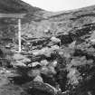
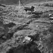
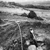
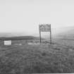
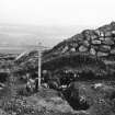
Though not boundary markers in the traditional sense, the two star-signs, on poles immediately east of the present fence-line around the uardianship area, are a form of demarcation. They were erected by the military some time before 1955, and they basically instruct troops that no digging is allowed beyond the line defined by the signs
Information from 'The Royal Commission on Ancient and Historical Monuments of Scotland: Field Guide 2006'.
Watching Brief (18 October 2008)
NT 229 638 A watching brief was maintained on 18 October 2008 during the removal of vegetation in and around the site. The work was undertaken because dense areas of gorse had become established, particularly to the SE of the fort, and were threatening the monument. There were no finds or features of archaeological significance.
Archive: RCAHMS (intended)
Funder: Historic Scotland
David Murray – Kirkdale Archaeology
OASIS ID: kirkdale1-249663
Resistivity (21 March 2012 - 23 March 2012)
NT 22900 63870 Gradiometer and resistivity surveys over the interior of the fort and its defences. The survey was carried out within the context of the Royal Commission for Ancient and Historical Monuments of Scotland (RCAHMS) study of the ancient monuments in the Castlelaw and Dreghorn Training Area in Midlothian (RCAHMS 2006). Some evidence for the palisade along the northern side of the fort was obtained. A trackway leading into the fort from the large southern entrance was detected.
R. Jones & C. Nelson - University of Glasgow
Source: (OASIS ID: universi22-517506)
Note (5 November 2015 - 25 October 2016)
The fort at Castle Law, which has been in Guardianship since 1924, stands on a low summit forming part of the SE spur of Castlelaw Hill. Oval on plan, its defences comprise an inner enclosure defended by a single rampart, and an eccentric outer enclosure with at least two. The inner encloses an area measuring about 82m from ENE to WSW by 35m transversely (0.25ha), and the outer, almost certainly representing a separate phase of construction, an area about 105m by 55m (0.48ha). Not only is the outer enclosure much larger, but its defences are more complex, comprising twin ramparts with a medial ditch around most of the circuit, though subsequent cultivation has distorted the outer lines on the SSE flank, to the extent that it is unclear on the S whether the various scarps visible represent a berm between the inner rampart and the medial ditch or the insertion of an additional rampart. This circuit is also accompanied by an internal quarry ditch, which was exploited by the builders of the souterrain sunk into the rear of the rampart on the S side of the entrance at the ENE end of the fort. This entrance is one of three, the others being on the SSE and WSW and marked by deeply worn hollows mounting the slope through the rampart of the inner enclosure into the interior. The relationship between the inner and outer enclosures is uncertain, despite two campaigns of excavation, the first by Gordon Childe in 1931-2 (1933), and the second by Stuart and Margaret Piggott in 1948 (1952). The Piggott's concentrated on the rampart of the inner enclosure at the ENE entrance, where Childe had previously uncovered the posts of a timber gateway. While their work did little to clarify the character of the gateway, they uncovered evidence of transverse beam channels within the rampart and a foundation trench at the rear holding upright timbers that rose through the clay core. In the light of the excavations at Hownam Rings, their working assumption was that the outer ramparts were a later addition to this inner circuit, though there is no stratigraphic observation from either survey or excavation to confirm or deny such a sequence, and the heavy wear that is visible in the SSE and SSW entrance could have as easily formed if the inner enclosure was a later insertion. In any case, the sequence was almost certainly more complex than any simple expansion or contraction model, as can be seen in the pattern of post-holes, foundation-trenches, ramparts and ditches uncovered by Childe in the outer part of the ENE entrance. Clearly multi-period, possibly including an earlier palisade trench and apparently showing elements of the inner rampart of the outer enclosure overlying the fill of the internal quarry ditch, the stratigraphy cannot be unpicked without further excavation, but at some stage there appears to have been a timber-lined entrance passage turning in obliquely through the causeway across the ditches to expose the visitor's left side; the inner end was possibly provide with timber-lined inturns. Most of the finds from Childe's excavation came from the souterrain, including a range of Roman goods, but by its very position this implies that the defences were already abandoned by the early centuries AD.
Information from An Atlas of Hillforts of Great Britain and Ireland – 25 October 2016. Atlas of Hillforts SC3710
Note (31 March 2019)
Date Fieldwork Started: 31/03/2019
Compiled by: ELF
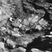
Location Notes: The panel is within the Castlelaw souterrain, which lies on a roughly N-S axis on the eastern edge of the hillside about 110m from the Castlelaw car park. The souterrain was originally part of a roundhouse that lies within one of the ditches surrounding the Castlelaw hillfort, near its main entrance. The stone has been built into the E drystone wall of the souterrain, and lies 1.7m from the terminal (S) end of the main passage, within the top layer of drystone walling 1.4m above what is now ground level. A side cell is located 12.5m to the N on the W side of the passage, and around 23m away from the souterrain entrance.
Panel Notes: This roughly rectangular sandstone boulder measures about 0.4 x 0.3m and 0,2m thick. There are 5 cupmarks positioned on the top of the stone on its convex surface and a further cupmark lower down the stone.


