Scheduled Maintenance
Please be advised that this website will undergo scheduled maintenance on the following dates: •
Tuesday 3rd December 11:00-15:00
During these times, some services may be temporarily unavailable. We apologise for any inconvenience this may cause.
Antonine Wall: Castlecary - Seabegs - Rough Castle
Frontier Defence (Roman)
Site Name Antonine Wall: Castlecary - Seabegs - Rough Castle
Classification Frontier Defence (Roman)
Alternative Name(s) Bonnybridge; Dalnair; Bonnyside House; Antonine Primary School; Milnquarter
Canmore ID 46786
Site Number NS87NW 32
NGR NS 8250 7981
NGR Description NS 8000 7876 to NS 8499 7993
Datum OSGB36 - NGR
Permalink http://canmore.org.uk/site/46786
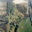
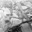
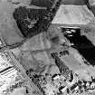
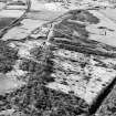
First 100 images shown. See the Collections panel (below) for a link to all digital images.
- Council Falkirk
- Parish Falkirk
- Former Region Central
- Former District Falkirk
- Former County Stirlingshire
NS87NW 32.00 8000 7876 to 8499 7993
NS87NW 32.01 NS 8181 7956 Seabegs Place, Antonine Wall, Excavation
NS87NW 32.02 From NS 8000 7875 to NS 8500 7984 Antonine Wall, Military Way
Site from 8000 7876 to 8464 8000 and from 8489 8000 to 8500 7993
See also NS87NW 6 and NS88SW 57.
NS 837 798 An old section of the Wall, first cut in c.1895, was reopened and recorded (A S Robertson 1970). The stone base was 4.4m wide and the overlying turfwork was visibly laminated.
A S Robertson 1971; D R Wilson 1972.
NS 8181 7956
An area 16' x 12' near the boundary of Seabegs Place farm revealed the stone base of the Antonine Wall, 14' wide, cut by a culvert inclining slightly eastwards. The dressed stone kerbs of the base were intact but the southern 7' of the filling of heavy cobbles had disappeared. The culvert had survived undamaged apart from a slight collapse at the southern end. Its total width was 2'10" - 3', and that of the channel circa 10". Finds included a small flint scraper and a few pieces of mediaeval ware.
K Docherty, E J and G J Price 1972.
NS 818 795 Seven km W of Falkirk, the stone base of the Antonine Wall was uncovered, 4.3m wide. It was crossed by a culvert with a channel 250mm wide.
D R Wilson 1973.
The Antonine Wall and two culverts and the S lip of the ditch were found. The berm is 18' wide.
A trench under the old farmhouse revealed a 3" thick layer of quarry tiles below which was an 8" thick layer of wood ash which contained an iron hook, several square iron nails and an iron bolt threaded at one end for a nut. A stone built into this farmhouse was dated 1682.
In the garden of the farm a 4' wide stone wall base cemented with lime mortar ran N from the kerbs of the Antonine Wall which it overlapped. Associated with it were several large, hewn blocks of masonry jointed with mortar.
The S kerbs of the Antonine Wall were replaced at a point by an in situ natural boulder. A flint was found nearby. The N part of the wall at this point was covered with a layer of ash and vitrified matter. Elsewhere, areas of cobbling and boulder strewn area were uncovered. Finds of medieval pottery were made. The position of two wells was noted.
E J and G J Price 1973; D R Wilson 1974.
NS 824 798 The course of the Wall and ditch was examined over a distance of 45m. The N kerb and part of the rubble core of the Wall base were located at one point. The S lip of the ditch was seen and the berm was 8.4m wide; the N lip was masked by the Motte (NS87NW 2) but the course of the lip was plotted.
R Goodburn 1978; L J F Keppie 1977; L J F Keppie & D J Breeze 1982.
NS 8000 7875 to NS 8066 7900 East of Woodend the Ditch and Military Way 'appear in great perfection' 2 chains apart, and continue so to the Nether-town of Seabeg (Horsley 1732).
NS 8000 7875 to NS 8004 7876 Ditch and Outer Mound well defined, though the latter is being reduced by ploughing. Published survey correct.
NS 8004 7876 to NS 8032 7886 The course of the Wall has been overlaid by a substantial refuse tip. Published line resurveyed from projected extant detail and slopes shown on 2nd edition of the OS 2 and a half inch map (Stirlingshire 1898, sheet 29/8).
NS 8037 7884 to NS 8066 7900 Published survey (OS 25 inch 1962) revised. In the E the south scarp of the 10m broad Ditch is 1.5m high and the counter-scarp and Outer Mound up to 0.7m high. In the W, the Ditch is a broad 14m depression; the S scarp is 1.6m high.
NS 8066 7900 to NS 8100 7914 Horsley states, 'the Ditch, which is very large and deep, is for the most part hereabout filled with water.' (Horsley 1732).
NS 8066 7900 to NS 8075 7904 The spread S scarp of Ditch is visible across field. Detail resurveyed .
NS 8075 7904 to NS 8100 7914 All traces have been destroyed by the canal (NS87NW 55). Published course (OS 25 inch 1962) resurveyed. (Largely guage adjustment).
NS 8100 7914 to NS 8117 7923 Only a vague depression of the Ditch shows in cultivated field. Published course resurveyed from excavation evidence at fortlet (NS87NW 10), surviving ground detail and aerial photographic information.
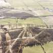
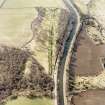
NS 8117 7923 to NS 8155 7940 Published course resurveyed. Rampart, Ditch and Outer Mound are exceptionally well preserved apart from one quarried area and old excavation trenches (NS 8149 7935 and NS 8130 7926) that are conspicuous. Average dimensions: Rampart c.1.3m high, Ditch c.13m wide and 1.5m deep, Outer Mound c.13m broad and 1.5m high. Extant remains under Scottish Development Department (Inspectorate of Ancient Monuments) guardianship.
NS 8155 7940 to NS 8168 7950 No surface trace across ploughed field; course resurveyed on evidence of NS 8172 7950 .
NS 8168 7950 to NS 8184 7959 The spread scarp of the S lip of the Ditch shows in garden and pasture field. Survey revised.
NS 8184 7959 to NS 8200 7965 Published course (OS 25 inch 1962) resurveyed on evidence of 1977 excavation (see NS 8279) and extent course shown on 1st edition of the OS 2 and a half inch map (Stirlingshire 1860, sheet 29/8).
NS 8200 7965 to NS 8250 7981 Published course resurveyed. No surface trace across developed area. Resurveyed based on extent course shown on 1st edition of the OS 2 and a half inch map (Stirlingshire 1860, sheet 29) and the evidence of NS 8242 7978 and NS 8225 7972. (Excavation plans for NS 8225 7972 provided).
NS 822 797 A watching brief was carried out on behalf of Scottish Development Department (Inspectorate of Ancient Monuments), during the laying of services for a new industrial estate. Previous excavations (Keppie 1979) had located the Antonine Wall ditch in the W half of the development zone, despite extensive industrial disturbance of the whole site. During this current watching brief, the Antonine Ditch was further recorded, 138m E of the position notes in 1979 in approximately the same alignment. It measured 8m across the definable top of the ditch, and had a depth of at least 3.5m (it was not bottomed by the machine trench), and had a V-shaped profile. The bottom layer of the ditch fill (c 1m) was rich in damp organic material; many small branches and pieces of wood were perfectly preserved.
A 2.5m deep trench cut to a point 88m E of this recorded ditch section, and running approximately 10m S of the line of the Wall base found in 1979 did not reveal any evidence of the missing Seabegs fort at this point (Murray 1982).
NS 8225 7972 The line of the Wall was located by excavation over a distance of about 300m in 1979. The Ditch was also located at one point (Keppie 1979; Keppie and Breeze 1982).
NS 8250 7980 Wall base between branch railway and angle in Wall destroyed by allotment work (Journal of the British Archaeological Association 1917).
NS 8250 7981 to NS 8300 7972 Published course (OS 25 inch 1961) resurveyed. No surface trace across developed area. Resurveyed based on extant course shown on 1st edition of the OS 2 and a half inch map (Stirlingshire 1860, sheet 29/8) an the evidence of NS 8263 7977 with which it concurs.
NS 8263 7977 Ditch and Wall base discovered during house building about 1935 (Smith 1935).
NS 8300 7972 to NS 8400 7984 Published course (OS 25 inch 1961) resurveyed. Rampart, Ditch and Outer Mound are generally well preserved; a typical cross section shows the Rampart c. 1.3m high, Ditch c. 2m deep and Outer Mound c. 1.6m high. Under Scottish Development Department (Inspectorate of Ancient Monuments) Guardianship from sheet edge to NS 8355 7982.
No original features of the Military Way survive; it underlies a track and is then utilized as a path around Elf Hill. It was not traced further west.
NS 8347 7982 Rampart, Ditch and Outer Mound sectioned in c. 1890 (Glasgow Archaeological Society 1899).
NS 8376 7981 Rampart sectioned in c. 1890 (Glasgow Archaeological Society 1899).
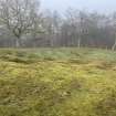
NS 8400 7984 to NS 8464 8000 Published survey revised. Rampart, Ditch and Outer Mound are generally well defined, although the state of preservation varies greatly. Under Scottish Development Department (Inspectorate of Ancient Monuments) Guardianship west of NS 8452 7995.
NS 8406 7984 Rampart reconstruction experiment and trenching of Rampart, Ditch and Outer Mound in c. 1895. Trench re-excavated in 1970 (Glasgow Archaeological Society 1899; Roberston 1970).
NS 8430 7995 For details of 'lilia' excavations see NS87NW 6.
NS 8436 7991 For details of Rampart excavations on the N side of Rough Castle fort see NS87NW 6 .
NS 8489 8000 to NS 8500 7993 Published course (OS 25 inch 1961) resurveyed. Rampart, Ditch and Outer Mound generally well defined; Rampart c. 1.5m high, and Ditch from 1m to 3m deep and c. 12m wide.
Information from OS 1980
P H W Briscoe and J K Thomson 1968; Glasgow Archaeological Society 1899; J Horsley 1732; Journal of the British Archaeological Association 1917; L J F Keppie 1979; L J F Keppie and D J Breeze 1982; J F Murray 1982; K, E J Docherty, Price and G J Price 1972; E J Price and G J Price 1973; A S Roberston 1970; Smith 1935
NS 822 797 to NS 825 798 Excavation demonstrated that the Wall lay on a line some 6m to the S of that shown on large-scale OS maps. The kerbs of the stone base had been robbed away, but a sufficient amount of the rubble core survived to suggest that the original width was not less than 4.57m. No trace of the superstructure remained. The ditch was found to be much destroyed by recent levelling. Trial-trenching aimed at locating the missing Seabegs fort (NS87NW 32.01) proved unsuccessful.
F O Grew 1980; J F Murray 1982.
NS 816 794 A low mound attached to the rear of the Antonine Wall within the Guardianship Area was examined, in case it should prove too conceal an 'expansion' of the type known elsewhere on the Wall. Some evidence was obtained for habitation and cooking in the lee of the turf rampart, but no structures were encountered, and how the mound came to be formed was not established.
L J F Keppie and J J Walker 1981; N B Rankov 1982.
NS 822 797 In observation during building work, the Antonine ditch was traced 138m W of the point located in 1979 and approximately on the same alignment. The ditch was 8m wide and its fill yielded much organic material. A trench 80m E of the point sectioned and running c.10m S of the wall-line found no evidence of Seabegs fort (NS87NW 10).
S S Frere 1983.
RRX 505 822 797.
See also NS87NW 29.
In the redevelopment of this site a drain trench cut the upper fill of the Antonine Wall Ditch. Both the N and S sides of the ditch were visible at depths of, respectively, 0.90m and 1.40m below modern ground surface and between these the upper 0.60m of the fill was visible. Allowing for the angle of cut, the width of the Ditch here was 9.00m, with the sides sloping at a 30 degree angle to the horizontal. The uniform nature of the fill suggested deliberate infilling, probably immediately prior to the initial development of the site in 1900. There was no evidence of the wall itself. The central line of the ditch is approximately 7.00m north of the line suggested by the Ordnance Survey (first edition).
D F Devereux 1984.
RRX 505 805 789.
An average of 30cm of topsoil was removed from the area between the S lock wall and the B816 (Seabegs Road) as preparation for the construction of a car park. To the W and E the line of the Wall Ditch is clearly visible as a pronounced hollow, but no sign of it appeared in the redevelopment area due to earlier disturbance associated with the construction of the lock. Watching brief.
G B Bailey 1985.
NS 804 789 In May 1988, a trench that traversed the scheduled area of the Antonine Wall was dug at Lochpark Cottage, Allandale. The true dimensions of the Ditch here are not known, but it may be estimated at 5m wide and 2.4m deep, considerably less than the average width of 12m in this Wall section. It had been deliberately infilled and used as a drain at a later date.
G B Bailey 1988; L J F Keppie, B Bailey, A Duwnell, J McBrien and K Speller 1995
NS 8038 7887
Drainage work by Central Regional Council destroyed part of the scheduled monument without record. Subsequent work revealed part of the much-disturbed ditch, which appeared to be no more than 5m wide and 2.5m deep with an upcast mound to the N. The position of the Wall-base was no longer establishable.
S S Frere 1989
NS 8035 7885 An archaeological evaluation and watching brief were carried out between the B618, the Forth Clyde Canal, and E of Allandale Cottages. The aim of the works was to recommend the route for an access road with least archaeological impact, and monitor the laying and uplift of the temporary road. The upper sediment fill of the Antonine ditch was revealed; this surface dated to the 18th-19th century. The remnants of an upcast bank were revealed at the western end of the site.
Sponsor: Edmund Nuttal Ltd.
C Ellis 1999
The length of the Antonine Wall from Seabegs Pend to Seabegs Place [NS 8163 7944 to NS 8183 7957] is scheduled under serial no. 7744.
The length of the Antonone Wall and Military Way within Seabegs Wood [NS 8118 7923 to NS 8155 7940] is scheduled under serial no. 90014.
Information from Historic Scotland, scheduling documents dated 3 June 1999.
At NS 8031 7886 and at NS 8047 7889 Due to the replacement of an existing sewer in April 1999, two trenches were dug for an archaeological assessment of the condition and extent of the remains of the Antonine Wall. In Trench 1, the uppermost Ditch fill was found to be 7.1m wide. No trace of the any Rampart footings were unearthed, indicating the complete truncation of the Rampart in this area.. However the presence of the Outer Mound was confirmed, albeit in a heavily denuded state. In Trench 2, the northern edge of the existing sewer trench was found to cut the Ditch fill, the exposed surface of which was found to be 7.75m wide (its width at the original Roman ground surface could not be measured in this case).
J W Gooder 2002
A Dunwell, G Bailey, A Leslie, A Smith 2002.
(Scheduling no. 8207). The length of the Antonine Wall (NS87NW 32.00) between Park Street [NS 8299 7973] and a point 800m W of Rough Castle [NS 8356 7983] has been scheduled.
Information from Historic Scotland, scheduling document dated 27 January 2005.
(Scheduling no. 7742). The length of the Antonine Wall (NS87NW 32.00) between Dalnair and Seabegs Wood [NS 8095 7908 to NS 8118 7922] has been scheduled, together with Dalnair temporary camp (NS87NW 9) and Seabegs fortlet (NS87NW 10).
Information from Historic Scotland, scheduling document dated 10 February 2005.
(Scheduling no. 7871). Lengths of the Antonine Wall from a point E of Roman Road to Broomhil Road have been scheduled, with Seabegs motte (NS87NW 2).
[The location map attached to the scheduling document indicates the following portions as being scheduled:
E of Seabegs Crescent, around NS 82315 79683
Seabegs motte (NS87NW 2) and adjacent length of Antonine Wall, around NS 82449 79787
S of Broomhill Road, around NS 82672 79739
E of Broomhil Road, NS c. 82698 7955 to NS c. 82790 79732]
Information from Historic Scotland, scheduling document dated 3 May 2005.
(Schedule no. 8244). The Antonine Wall from Rough Castle to Lime Road, Tamfourhill, Falkirk isscheduled, together with the Rough Castle Roman fort and multi-period field-system.
Information from Historic Scotland, scheduling document dated 4 March 2005.
(formerly described under NS87NW 28 8300 7971.)
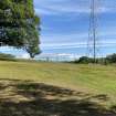
Archaeological monitoring was undertaken on 10 July 1995 of the cutting of the foundations of a dismantled electricity tower which had stood directly on the line of the Antonine Wall rampart still visible as a prominent earthwork at this location. Four small trenches, c. 0.5m by 0.5m in area and 0.5m deep were excavated by hand around each leg foundation, and the tower foundations cut. No in situ archaeological remains were identified, as all the trenches were cut through ground previously disturbed by the erection and/or maintenance of the tower. Fromn the disturbed backfill of the SE trench were recovered one dressed sandstone block and three sandstone chunks, probably derived from the kerb and core respectively of the stone base of the rampart. Chunks of sandstone were also removed from the NW trench.
Adherence to a Methods Statement for the removal of the tower, agreed in advance between Historic Scotland and Scottish Power, ensured that no damage occured to the site.
Full details are in a report lodged with the NMRS.
Sponsor: Scottish Power plc.
A Dunwell and B Finlayson 1995; NMRS MS/726/73.
[NS 82994 79736 to NS c. 83509 79820]. Length scheduled as 'Antonine Wall, [between] 495m WSW and 125m SE of Bonnyside House...'
(Scheduling number 8207).
Information from Historic Scotland, scheduling document dated 26 November 2009.
[NS 82419 79779 to NS 82514 79802]. Length scheduled with Bonnybridge (Seabegs) Motte [NS87NW 2] as 'Antonine Wall and motte, 75m SW of Antonine Primary School [NS87NW 73]...'
(Scheduling number 12373).
Information from Historic Scotland, scheduling document dated 26 November 2009.
[NS 82100 79675 to NS 82163 79692]. Length scheduled as 'Antonine Wall, 300m NW of Milnquarter...'
(Scheduling number 12374).
Information from Historic Scotland, scheduling document dated 26 November 2009.
[NS 82799 79714 to NS 82883 79718]. Length scheduled as 'Antonine Wall, 160m ENE to 155m NW of St Joseph's Church [NS87NW 45]...'
(Scheduling number 12606).
Information from Historic Scotland, scheduling document dated 26 November 2009.
Antiquarian Observation (1732)
NS 8000 7875 to NS 8066 7900 East of Woodend the Ditch and Military Way 'appear in great perfection' 2 chains apart, and continue so to the Nether-town of Seabeg (Horsley 1732).
Antiquarian Observation (1732)
NS 8066 7900 to NS 8100 7914 Horsley states, 'the Ditch, which is very large and deep, is for the most part hereabout filled with water.' (Horsley 1732).
Excavation (1890)
NS 8347 7982 Rampart, Ditch and Outer Mound sectioned in c. 1890 (Glasgow Archaeological Society 1899). (Bonnyside no. 1)
NS 8376 7981 Rampart sectioned in c. 1890 (Glasgow Archaeological Society 1899). (Bonnyside no. 2)
NS 8416 7987 Rampart sectioned in c. 1890 (Glasgow Archaeological Society 1899). (Bonnyside no. 3)
Excavation (1890)
NS 8130 7926 Wall sectioned in c.1890 (Glasgow Archaeological Society 1899).
NS 8149 7935 Wall sectioned in c.1890 (Glasgow Archaeological Society 1899).
Excavation (1890)
NS 8436 7991 For details of Rampart excavations on the N side of Rough Castle fort see NS87NW 6 . 1 of 3 sections at Rough Castle.
Excavation (1890)
NS 8130 7926 Wall sectioned in c.1890 (Glasgow Archaeological Society 1899).
Excavation (1890)
NS 8149 7935 Wall sectioned in c.1890 (Glasgow Archaeological Society 1899).
Excavation (1890)
NS 8347 7982 Rampart, Ditch and Outer Mound sectioned in c. 1890 (Glasgow Archaeological Society 1899).
Excavation (1895)
NS 8406 7984 Rampart reconstruction experiment and trenching of Rampart, Ditch and Outer Mound in c. 1895. (Glasgow Archaeological Society 1899). (Bonnyside no. 2A)
Salvage Record (1916)
NS 8250 7980 Wall base between branch railway and angle in Wall destroyed by allotment work (Journal of the British Archaeological Association 1917).
Excavation (1932)
NS 8436 7991 For details of Rampart excavations on the N side of Rough Castle fort see NS87NW 6 . Several cross-sections cut across Antonine Wall (Macdonald, George).
Excavation (1933)
NS 8244 7981 Area of trenching; 1 of at least 2, section through Antonine Wall, Ditch 42' wide and 12' deep. Area of trenching; 2 of at least 2, section through Antonine Wall, Ditch 50' wide, Berm 18' wide, stone Rampart 14' wide, superstructure almost entirely disappeared. Mound is a Motte.
Publication Account (1934)
NS 814 793 In one of the OS sections the Ditch is about 9 feet deep and 44 feet broad (Macdonald 1934). (Seabegs)
Salvage Record (1935)
NS 8263 7977 Ditch and Wall base discovered during house building about 1935 (Smith 1935).
Excavation (1958)
NS 8436 7991 For details of Rampart excavations on the N side of Rough Castle fort see NS87NW 6 . 1 of 2 trenches across Antonine Wall; 10 trenches total in Fort (MacIvor, Iain).
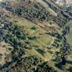
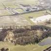
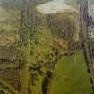
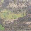
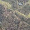
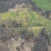
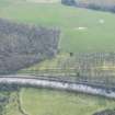
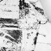
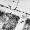
Aerial Photography (17 July 1961)
Aerial Photography (26 July 1962)
Publication Account (1963)
NS 760 770 Ministry of Public Buildings and Works, Antonine Wall Base 14' 6" wide (MOPBW 1964).
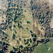
Aerial Photography (26 July 1964)
Excavation (1968)
NS 8172 7950 Wall sectioned at three points in 1968 (Briscoe and Thomson 1968).
Excavation (1968)
NS 8172 7950 Wall sectioned at three points in 1968 (Briscoe and Thomson 1968).
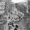
Aerial Photography (29 July 1969)
Excavation (1970)
NS 8406 7984 Rampart reconstruction experiment and trenching of Rampart, Ditch and Outer Mound in c. 1895. Trench re-excavated in 1970 (Glasgow Archaeological Society 1899; Roberston 1970).
Excavation (1970)
NS 837 798 An old section of the Wall, first cut in c.1895, was reopened and recorded (A S Robertson 1970). The stone base was 4.4m wide and the overlying turfwork was visibly laminated.
A S Robertson 1971; D R Wilson 1972.
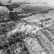
Aerial Photography (1971)
Excavation (1972)
NS 8178 7954 Wall sectioned in 1972 (Docherty, Price and Price 1972; Price and Price 1973).
Aerial Photography (4 August 1974)
Aerial Photography (20 July 1977)
Excavation (1977 - 1978)
NS 812 792. A Roman fortlet attached to the Antonine Wall was discovered in June 1977 on the farm of Dalnair, at the west end of Seabegs Wood, in a field from which numerous fragments of Roman pottery have been recovered in recent years. The Antonine Wall makes a northward detour to include the plateau on which the fortlet is set, and itself forms the north rampart. The excavation, carried out under the auspices of the Hunterian Museum, revealed that the fortlet measured 21.8m N-S by 18m E-W internally and was defended by a rampart set on a stone base 3m wide and by two ditches. Parts of the east and south rampart base had been removed by ploughing. Examination of the NE and NW corners of the fortlet established that it and the Wall were of one build. The ditches on the east side were identified as being 3m (inner) and 1.6m wide, but they merged together and terminated close to the SE corner of the fortlet. The western ditches are assumed to have done the same. The lack of cover for the south rampart may be ascribed to the proximity of the Military Way, whose presumed line was sectioned as it emerged from Seabegs Wood. Only scattered cobbles and a possible drainage ditch were observed. There were gateways in both the north and south walls of the fortlet, each 3m wide and flanked by post holes. A roadway of rammed pebbles and small stones passed through the south gate to join the Military Way, and a similar road passed through the north gate, but examination failed to reveal evidence of its having crossed the Antonine Wall ditch. There was evidence of a second phase of occupation which involved changes which may have included the blocking of the north gate, but there was no evidence of re-cutting of the ditches. The interior of the fortlet was not examined.
L J F Keppie and J J Walker 1977; 1979; R Goodburn 1978.
Excavation (1977)
NS 8242 7978 Ditch and remains of Wall located by excavation in 1977 (Keppie 1977; Keppie and Breeze 1982).
R Goodburn 1978; L J F Keppie 1977; L J F Keppie & D J Breeze 1982.
Excavation (March 1979)
NS 8225 7972 The line of the Wall was located by excavation over a distance of about 300m in 1979. The Ditch was also located at one point (Keppie 1979; Keppie and Breeze 1982).
Excavation (1980 - 1982)
NS 822 797 to NS 825 798 Excavation demonstrated that the Wall lay on a line some 6m to the S of that shown on large-scale OS maps. The kerbs of the stone base had been robbed away, but a sufficient amount of the rubble core survived to suggest that the original width was not less than 4.57m. No trace of the superstructure remained. The ditch was found to be much destroyed by recent levelling. Trial-trenching aimed at locating the missing Seabegs fort (NS87NW 32.01) proved unsuccessful.
F O Grew 1980; J F Murray 1982.
NS 822 797 In observation during building work, the Antonine ditch was traced 138m W of the point located in 1979 and approximately on the same alignment. The ditch was 8m wide and its fill yielded much organic material. A trench 80m E of the point sectioned and running c.10m S of the wall-line found no evidence of Seabegs fort (NS87NW 10).
S S Frere 1983.
Field Visit (1980)
NS 8066 7900 to NS 8075 7904 The spread S scarp of Ditch is visible across field. Detail resurveyed .
Information from OS 1980
Field Visit (1980)
NS 8037 7884 to NS 8066 7900 Published survey (OS 25 inch 1962) revised. In the E the south scarp of the 10m broad Ditch is 1.5m high and the counter-scarp and Outer Mound up to 0.7m high. In the W, the Ditch is a broad 14m depression; the S scarp is 1.6m high.
Information from OS 1980
Field Visit (1980)
NS 8004 7876 to NS 8032 7886 The course of the Wall has been overlaid by a substantial refuse tip. Published line resurveyed from projected extant detail and slopes shown on 2nd edition of the OS 2 and a half inch map (Stirlingshire 1898, sheet 29/8).
Information from OS 1980
Field Visit (1980)
NS 8000 7875 to NS 8004 7876 Ditch and Outer Mound well defined, though the latter is being reduced by ploughing. Published survey correct.
Field Visit (1980)
NS 8075 7904 to NS 8100 7914 All traces have been destroyed by the canal (NS87NW 55). Published course (OS 25 inch 1962) resurveyed. (Largely guage adjustment).
Information from OS 1980
Field Visit (1980)
NS 8100 7914 to NS 8117 7923 Only a vague depression of the Ditch shows in cultivated field. Published course resurveyed from excavation evidence at fortlet (NS87NW 10), surviving ground detail and aerial photographic information.
Information from OS 1980
Field Visit (1980)
NS 8117 7923 to NS 8155 7940 Published course resurveyed. Rampart, Ditch and Outer Mound are exceptionally well preserved apart from one quarried area and old excavation trenches (NS 8149 7935 and NS 8130 7926) that are conspicuous. Average dimensions: Rampart c.1.3m high, Ditch c.13m wide and 1.5m deep, Outer Mound c.13m broad and 1.5m high.
Information from OS 1980
Field Visit (1980)
NS 8155 7940 to NS 8168 7950 No surface trace across ploughed field; course resurveyed on evidence of NS 8172 7950 .
Information from OS 1980
Field Visit (1980)
NS 8168 7950 to NS 8184 7959 The spread scarp of the S lip of the Ditch shows in garden and pasture field. Survey revised.
Information from OS 1980
Field Visit (1980)
NS 8184 7959 to NS 8200 7965 Published course (OS 25 inch 1962) resurveyed on evidence of 1977 excavation (see NS 8279) and extent course shown on 1st edition of the OS 2 and a half inch map (Stirlingshire 1860, sheet 29/8).
Information from OS 1980
Field Visit (1980)
NS 8200 7965 to NS 8250 7981 Published course resurveyed. No surface trace across developed area. Resurveyed based on extent course shown on 1st edition of the OS 2 and a half inch map (Stirlingshire 1860, sheet 29) and the evidence of NS 8242 7978 and NS 8225 7972.
Information from OS 1980
Field Visit (1980)
NS 8250 7981 to NS 8300 7972 Published course (OS 25 inch 1961) resurveyed. No surface trace across developed area. Resurveyed based on extant course shown on 1st edition of the OS 2 and a half inch map (Stirlingshire 1860, sheet 29/8) an the evidence of NS 8263 7977 with which it concurs.
Information from OS 1980
Field Visit (1980)
NS 8300 7972 to NS 8400 7984 Published course (OS 25 inch 1961) resurveyed. Rampart, Ditch and Outer Mound are generally well preserved; a typical cross section shows the Rampart c. 1.3m high, Ditch c. 2m deep and Outer Mound c. 1.6m high. No original features of the Military Way survive; it underlies a track and is then utilized as a path around Elf Hill. It was not traced further west.
Information from OS 1980
Field Visit (1980)
NS 8400 7984 to NS 8464 8000 Published survey revised. Rampart, Ditch and Outer Mound are generally well defined, although the state of preservation varies greatly.
Information from OS 1980
Field Visit (1980)
NS 8489 8000 to NS 8500 7993 Published course (OS 25 inch 1961) resurveyed. Rampart, Ditch and Outer Mound generally well defined; Rampart c. 1.5m high, and Ditch from 1m to 3m deep and c. 12m wide.
Information from OS 1980
Excavation (May 1981)
NS 816 794 A low mound attached to the rear of the Antonine Wall within the Guardianship Area was examined, in case it should prove too conceal an 'expansion' of the type known elsewhere on the Wall. Some evidence was obtained for habitation and cooking in the lee of the turf rampart, but no structures were encountered, and how the mound came to be formed was not established.
L J F Keppie and J J Walker 1981; N B Rankov 1982.
Watching Brief (1982)
NS 822 797 A watching brief was carried out on behalf of Scottish Development Department (Inspectorate of Ancient Monuments), during the laying of services for a new industrial estate. Previous excavations (Keppie 1979) had located the Antonine Wall ditch in the W half of the development zone, despite extensive industrial disturbance of the whole site. During this current watching brief, the Antonine Ditch was further recorded, 138m E of the position notes in 1979 in approximately the same alignment. It measured 8m across the definable top of the ditch, and had a depth of at least 3.5m (it was not bottomed by the machine trench), and had a V-shaped profile. The bottom layer of the ditch fill (c 1m) was rich in damp organic material; many small branches and pieces of wood were perfectly preserved. A 2.5m deep trench cut to a point 88m E of this recorded ditch section, and running approximately 10m S of the line of the Wall base found in 1979 did not reveal any evidence of the missing Seabegs fort at this point (Murray 1982).
Watching Brief (March 1984)
NS87NW RRX 505 822 797.
See also NS87NW 29.
In the redevelopment of this site a drain trench cut the upper fill of the Antonine Wall Ditch. Both the N and S sides of the ditch were visible at depths of, respectively, 0.90m and 1.40m below modern ground surface and between these the upper 0.60m of the fill was visible. Allowing for the angle of cut, the width of the Ditch here was 9.00m, with the sides sloping at a 30 degree angle to the horizontal. The uniform nature of the fill suggested deliberate infilling, probably immediately prior to the initial development of the site in 1900. There was no evidence of the wall itself. The central line of the ditch is approximately 7.00m north of the line suggested by the Ordnance Survey (first edition).
D F Devereux 1984.
Watching Brief (1985)
NS87NW RRX 505 805 789.
An average of 30cm of topsoil was removed from the area between the S lock wall and the B816 (Seabegs Road) as preparation for the construction of a car park. To the W and E the line of the Wall Ditch is clearly visible as a pronounced hollow, but no sign of it appeared in the redevelopment area due to earlier disturbance associated with the construction of the lock. Watching brief.
G B Bailey 1985.
Salvage Record (May 1988)
NS 804 789 In May 1988, a trench that traversed the scheduled area of the Antonine Wall was dug at Lochpark Cottage, Allandale. The true dimensions of the Ditch here are not known, but it may be estimated at 5m wide and 2.4m deep, considerably less than the average width of 12m in this Wall section. It had been deliberately infilled and used as a drain at a later date.
G B Bailey 1988; L J F Keppie, B Bailey, A Duwnell, J McBrien and K Speller 1995
NS 8038 7887
Drainage work by Central Regional Council destroyed part of the scheduled monument without record. Subsequent work revealed part of the much-disturbed ditch, which appeared to be no more than 5m wide and 2.5m deep with an upcast mound to the N. The position of the Wall-base was no longer establishable.
S S Frere 1989
Resistivity (June 1989)
NS 818 794 In June 1989, a resistivity survey was conducted as part of an archaeological assessment in a field S of Seabegs Place, Bonnybridge in advance of house development.
Excavation (1 March 1993 - 1 October 1993)
NS 8430 7995 For details of 'lilia' excavations see NS87NW 6.
Magnetometry (April 1994 - June 1994)
Area A. Magnetometry survey for 94/48 M80 motorway extension. Part of a wider evaluation, 1994.
Watching Brief (10 July 1995)
NS87NW 28 8300 7971.
Archaeological monitoring was undertaken on 10 July 1995 of the cutting of the foundations of a dismantled electricity tower which had stood directly on the line of the Antonine Wall rampart still visible as a prominent earthwork at this location. Four small trenches, c. 0.5m by 0.5m in area and 0.5m deep were excavated by hand around each leg foundation, and the tower foundations cut. No in situ archaeological remains were identified, as all the trenches were cut through ground previously disturbed by the erection and/or maintenance of the tower. Fromn the disturbed backfill of the SE trench were recovered one dressed sandstone block and three sandstone chunks, probably derived from the kerb and core respectively of the stone base of the rampart. Chunks of sandstone were also removed from the NW trench.
Adherence to a Methods Statement for the removal of the tower, agreed in advance between Historic Scotland and Scottish Power, ensured that no damage occured to the site.
Full details are in a report lodged with the NMRS.
Sponsor: Scottish Power plc.
A Dunwell and B Finlayson 1995; NMRS MS/726/73.
Excavation (April 1999)
At NS 8031 7886 and at NS 8047 7889 Due to the replacement of an existing sewer in April 1999, two trenches were dug for an archaeological assessment of the condition and extent of the remains of the Antonine Wall. In Trench 1, the uppermost Ditch fill was found to be 7.1m wide. No trace of any Rampart footings were unearthed, indicating the complete truncation of the Rampart in this area. However the presence of the Outer Mound was confirmed, albeit in a heavily denuded state. In Trench 2, the northern edge of the existing sewer trench was found to cut the Ditch fill, the exposed surface of which was found to be 7.75m wide (its width at the original Roman ground surface could not be measured in this case).
J W Gooder 2002
A Dunwell, G Bailey, A Leslie, A Smith 2002.
Watching Brief (1999)
NS 8035 7885 An archaeological evaluation and watching brief were carried out between the B618, the Forth Clyde Canal, and E of Allandale Cottages. The aim of the works was to recommend the route for an access road with least archaeological impact, and monitor the laying and uplift of the temporary road. The upper sediment fill of the Antonine ditch was revealed; this surface dated to the 18th-19th century. The remnants of an upcast bank were revealed at the western end of the site.
Sponsor: Edmund Nuttal Ltd.
C Ellis 1999
Magnetometry (7 July 2008 - 10 July 2008)
NS 841 798 (approximate centre of fort) and NS 844 798 (approximate centre of field system).
Over the Fort complex, good correlation has been found between the geophysical datasets and the features recorded through excavation, aerial photography and documentary research. However, given the relatively extensive investigations carried out since the turn of the 20th century, limited additional archaeological information has been gleaned from the geophysics. The results indicate a general lack of geophysical evidence for further Lilia ever having been dug, though it remains debatable whether such features would produce detectable geophysical anomalies. On a more positive note the present survey has identified a possible workshop in the Annexe along with other structures, possibly timber-framed.
The Military Way, often difficult to locate geophysically, has been clearly detected running through the Fort. However, to the southeast, in the vicinity of the field system, little of definite archaeological potential was found; the majority of responses were likely to be natural in origin and the results did not help to resolve the function of the features.
J. Adcock
Ground Penetrating Radar (7 July 2008 - 10 July 2008)
NS 841 798 (approximate centre of fort) and NS 844 798 (approximate centre of field system).
Over the Fort complex, good correlation has been found between the geophysical datasets and the features recorded through excavation, aerial photography and documentary research. However, given the relatively extensive investigations carried out since the turn of the 20th century, limited additional archaeological information has been gleaned from the geophysics. The results indicate a general lack of geophysical evidence for further Lilia ever having been dug, though it remains debatable whether such features would produce detectable geophysical anomalies. On a more positive note the present survey has identified a possible workshop in the Annexe along with other structures, possibly timber-framed.
The Military Way, often difficult to locate geophysically, has been clearly detected running through the Fort. However, to the southeast, in the vicinity of the field system, little of definite archaeological potential was found; the majority of responses were likely to be natural in origin and the results did not help to resolve the function of the features.
J. Adcock
Magnetometry (7 July 2008 - 10 July 2008)
NS 841 798 (approximate centre of fort) and NS 844 798 (approximate centre of field system).
Over the Fort complex, good correlation has been found between the geophysical datasets and the features recorded through excavation, aerial photography and documentary research. However, given the relatively extensive investigations carried out since the turn of the 20th century, limited additional archaeological information has been gleaned from the geophysics. The results indicate a general lack of geophysical evidence for further Lilia ever having been dug, though it remains debatable whether such features would produce detectable geophysical anomalies. On a more positive note the present survey has identified a possible workshop in the Annexe along with other structures, possibly timber-framed.
The Military Way, often difficult to locate geophysically, has been clearly detected running through the Fort. However, to the southeast, in the vicinity of the field system, little of definite archaeological potential was found; the majority of responses were likely to be natural in origin and the results did not help to resolve the function of the features.
J. Adcock
Test Pit Survey (26 January 2016)
AOC Archaeology Group undertook an archaeological watching brief on behalf of RSK Environmental Ltd ahead of the laying of a electric cable across the line of the Antonine Wall at Bonnybridge, Falkirk. Test pits were excavated along the line of the cable route where it crosses the route of the Antonine Wall. The test pits were excavated to the depth required for the cable installation. All four trenches revealed a similar sequence of modern deposits comprising dumps of spent foundry casting sands, redeposited natural clays and made ground deposits. The excavation of the test pits suggest that the topography of the area has been altered significantly in the recent past and that the proposed cable installation will have no effect on Roman archaeological deposits. No significant archaeological features or deposits were identified in any of the test pits and natural subsoil was not reached in any test pit.
Information from Jamie Humble (AOC Archaeology Group) 26 January 2016. OASIS ID: aocarcha1-240428
Test Pit Survey (27 September 2018)
A series of five trial pits were excavated within the Scheduled Monument covering a section of the Antonine Wall at Chattan Works, Bonnybridge to identify the nature of ground that was impacted by the erection of a steel palisade fence. These test pits showed that these construction works did not generate an adverse physical impact on significant archaeological features or artefacts associated with the Antonine Wall.
Further, the information gathered does not contradict the inferred site history of this location being a clay-capped landfill site with any remains associated with the Antonine Wall being at depth beneath this landfill.
Information from Thomas Rees and Jack Portwood (Rathmell Archaeology Ltd) 9 October 2018.
OASIS ID: rathmell1-330534
Excavation (6 April 2021 - 14 April 2021)
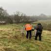
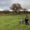
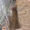
An archaeological excavation was undertaken on behalf of Falkirk Council by Clyde Archaeology between the 6th and 14th April 2021. Topsoil was stripped across the proposed work area which was located within a scheduled section of the Antonine Wall (SM12606). Although traces of the Antonine Wall ditch are visible in the neighboring wood no significant archaeological features or deposits were noted during topsoil stripping.
Information from Steven Black, (Clyde Archaeology), April 2021
OASIS ID: clydearc1-419778


