St Kilda, Hirta, Village Bay
Cleit(S) (19th Century) - (20th Century), Consumption Dyke(S) (19th Century), Village (19th Century) - (20th Century)
Site Name St Kilda, Hirta, Village Bay
Classification Cleit(S) (19th Century) - (20th Century), Consumption Dyke(S) (19th Century), Village (19th Century) - (20th Century)
Alternative Name(s) St Kilda Village And Related Structures
Canmore ID 9668
Site Number NF19NW 21
NGR NF 1010 9930
NGR Description Centred on NF 1010 9930 and NF 100 994
Datum OSGB36 - NGR
Permalink http://canmore.org.uk/site/9668
First 100 images shown. See the Collections panel (below) for a link to all digital images.
- Council Western Isles
- Parish Harris
- Former Region Western Isles Islands Area
- Former District Western Isles
- Former County Inverness-shire
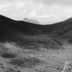
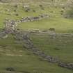
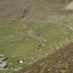
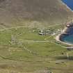
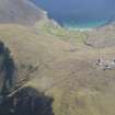
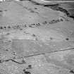
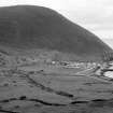
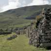
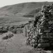
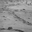
The arrangement of St Kilda Village along a curving street is the result of mid-19th century improvement. Each house had an allocated strip of cultivable land to front and rear, beyond which lay common grazing. Distinctive drystone storage structures, known as cleitan, are scattered throughout the landscape. There are over 1,400 cleitan known throughout the St Kilda archipelago, but they are concentrated in the area around the village.
The population of St Kilda declined throughout the later 19th and early 20th centuries, the final thirty-six inhabitants leaving in 1930. There is now a small military base and seasonal occupation by National Trust for Scotland staff, volunteers and other visitors.
Information from RCAHMS (SC) 8 August 2007
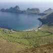
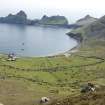
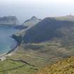
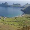
HIRTA is the largest island and the focus of human occupation. Its defining characteristic is the hundreds of drystone structures - walls, beehive-like cells and enclosures - that spill down from the heights of Conchair and Oiseval to the grassy amphitheatre encircling the bay on the island's south side. These stand in stark juxtaposition to the 20th century infrastructure of the MOD, which is concentrated in the vicinity of the slipway/jetty of 1901.
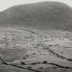
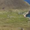
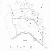
The main settlement of Village Bay is an excellent survival of a planned crofting development, its ordered layout reflecting the changes introduced in the 1830s by the improving landlord and the Rev. Neil MacKenzie. The old village further up the hill was replaced by a crescent of blackhouses built end on to a paved street, their individual cultivation plots defined by an enclosed fan of field boundaries running down from a head dyke. From 1861, following a hurricane, 16 new dwellings replaced the blackhouses, which were relegated to byres. These standard threeroomed 'white houses' were built by Skye masons of harled, lime-mortared stone with gable end chimneys and roofs of zinc (later replaced with tarred felt). In recent years six have been restored for basic accommodation, with No 3 displayed as a small museum.
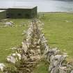
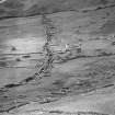
Strewn across the slopes in every direction are the unique St. Kildan cleitean or small storehouses that the islanders built to store and dry their seabirds, crops and fishing gear. Well ventilated, with corbelled drystone walls and stone slabbed roofs originally covered in turf, these beehive-like structures number at least 1,260 on Hirta alone. At the lower end of the street, the factor's house, late 1860s, is now the home of the ranger.
Standing consciously apart from the village, and now absorbed with the glebe into the MOD base, are the kirk and manse by Robert Stevenson, 1826, the plain, two-bay church, with the schoolroom added to its north west in 1898, restored as they might have appeared in the 1920s. Further round the bay, the store, late 18th century, is a two-storey gabled structure in which feathers and other produce paid in lieu of rent were stored. Badly damaged by a shell from a German U-boat in the First World War (which also affected the church), it has been much rebuilt. The naval gun and ammunition store of 1918 was built in response to the U-boat attack.
Taken from "Western Seaboard: An Illustrated Architectural Guide", by Mary Miers, 2008. Published by the Rutland Press http://www.rias.org.uk
NF19NW 21.00 1010 9930 (Centred).
NF19NW 21 will be a synopsis of the history, of the Kilda Village followed by brief descriptions of selected structures numbered NF19NW 21.01 - 21.45
See also NF19NW 15 (NF c. 101 995) Medieval Village and NF19NW 7 for souterrain.
Extends onto map sheet NF09NE.
Scheduled as 'St Kilda village and related structures... the core area of human occupation on St Kilda, in the area around Village Bay'. [Scheduling order also includes various monuments within sub-numbered series].
Information from Historic Scotland, scheduling document dated 21 May 2002.
NF 101 993 Fieldwork has identified the site of the clachan which pre-dates and was not totally destroyed by the familiar 1830s 'improvement' layout of crofts and blackhouses set along a 'street'. Thirteen possible or probable structures are identifiable, centring around the present House 9; sometimes they partly underlie 1830s structures, elsewhere they take the form of sub-rectangular or slightly boat-shaped hollows or platforms. At the S end of the clachan is a 'dished area', evidently a public space which compares well in detail with the drawing made by Acland in 1812.
Sponsor: University of Wales Lampeter - Dept of Archaeology
A Fleming 2002
NF 101 991 (centre) Scheduled Monument Consent required watching briefs of various works at the MoD base on Hirta in 2001. The replacement of more than 200m of the fuel pipeline across the croftlands S of the road led to the recovery of residual artefacts from the disturbed ground. These include about 80 sherds of hand-made pottery (Iron Age or later), as well as some 19th/20th-century artefacts. Work at the septic tank revealed previously disturbed ground and no archaeological features or finds.
Report to be deposited in the NMRS.
Sponsor: NTS.
M Taylor 2002a
NF 101 991 (centre) As part of the Management Agreement with Historic Scotland, the monuments within Village Bay were recorded and monitored, and certain cleits, dykes and enclosures were repaired in 2001 under supervision by members of the two volunteer work parties. Detailed work included the completion of the identification of around 300 cleits for active management, and the production of a report on cleit preservation, as well as rapid assessments of coastal erosion and the deposition of builders' debris within some of the roofless structures along the village street.
Report to be deposited in the NMRS.
Sponsors: HS, NTS.
M Taylor 2002b
NF 101 991 (centre) As part of the Management Agreement with Historic Scotland, the monuments within Village Bay were recorded and monitored, and certain cleits, dykes, drains and enclosures were repaired under supervision by members of the volunteer work parties which went out to St Kilda in 2002.
A photographic survey of the coastline in Village Bay was carried out and compared to images taken in 1999. The survey indicated erosion along the NE side of the bay. Two sherds of hand-made pottery were recovered and a layer of burning noted in an exposed section.
The annual monitoring of cleits across the island was carried out and the photographic survey of them continued.
Report to be deposited in the NMRS.
Sponsors: HS, NTS.
S Bain 2002
NF 101 993 (centre) Standing structures in the Village Bay area, mostly of 19th and early 20th-century date, were searched for artefacts and manuports in July 2003. Finds include: numerous beach pebble manuports of varying size, some exhibiting a variety of damage; stone pestle/hammers based on beach pebbles; fire-cracked stones in two main concentrations, with general thin scatter; fragments of flat querns; and fragments of rotary quern, including three in cleit 84.
Report lodged with Western Isles SMR.
Sponsor: Society of Antiquaries of Scotland.
A Fleming 2003
NF 101 991 As part of the Management Agreement with Historic Scotland, the monuments in Village Bay were recorded and monitored. Stretches of the head dyke were photographed, as were a number of cleits. Sections of walling, cleits and cleit roofs were repaired, and drains cleaned out under archaeological supervision by members of volunteer work parties.
Coastal erosion was monitored, which indicated progressive erosion along the NE section of Village Bay.
A small exploratory excavation to determine the method of build was carried out within Blackhouse X.
Report to be lodged with the NMRS.
Sponsors: HS, NTS.
S Bain 2003
NF 101 991 A watching brief was carried out in August and September 2003 during the re-excavation of a water pipe trench across Village Bay. The trench was excavated for a distance of approximately 360m through previously disturbed deposits, except in two small sections. This revealed a deep cultivated soil. No artefacts were noted in situ.
Report to be lodged with the NMRS.
Sponsors: HS, NTS.
S Bain 2003
NF 101 991 (centre) A survey of the coastline in Village Bay was carried out to assess the impact of erosion on possible archaeological deposits. The survey indicated minimal erosion along the NE side of the bay.
The annual monitoring of cleits across the island was carried out and the photographic survey of them continued. A photographic survey of the head dyke was also progressed.
A small excavation around House 6, Main Street, Hirta, was carried out in advance of a new drain. A large number of late 19th/early 20th-century artefacts were recovered, suggesting that the area behind and to the W side of the house had been used as a midden.
A portion of thatch, including surviving heather rope, was noted within the wall core of Blackhouse F.
Archive to be deposited in the NMRS.
Sponsors: HS, NTS.
S Bain 2004
St Kilda Artefacts and Manuports Project
Survey
NF 101 993 (centre) Standing structures in the Village Bay area, mostly of 19th- and 20th-century date, were searched for artefacts and manuports in June and July 2004. Finds include pounder/grinders, Skaill knives, flaked cobbles, cores and fire-cracked stones; also rotary quern fragments and half a trough quern.
Report lodged with Western Isles SMR.
A Fleming 2004
A coastal erosion study carried out on the island between 2003 and 2005 revealed that there had been a metre of erosion in the 3 year time period and many structures on the coast were in danger of being completely destroyed.
S Dennis 2005
A survey was carried out by the National Trust for Scotland on over 300 cleitean (singular cleit) on St Kilda. They are double-walled, drystone-built oval or rectangular structures, used primarily for storage of food and fuel resources. Many have survived well after being abandoned in 1930 when the islands were evacuated. The survey recorded their condition, construction and location.
M Taylor 2001
See also :
NF19NW 21.01 St. Kilda Village, Storehouse
NF19NW 21.02 St. Kilda Village, Church; School; Manse
NF19NW 21.03 St. Kilda Village, The Bull's House
NF19NW 21.04 St. Kilda Village, House 8 and Blackhouse I
NF19NW 21.05 St. Kilda Village, Blackhouse C
NF19NW 21.06 St. Kilda Village, Blackhouse E
NF19NW 21.07 St. Kilda Village, Blackhouse G
NF19NW 21.08 St. Kilda Village, Blackhouse, K
NF19NW 21.09 St. Kilda Village, Blackhouse, L
NF19NW 21.10 St. Kilda Village, Blackhouse O
NF19NW 21.11 St. Kilda Village, Blackhouse W; Corn Drying Kiln,
NF19NW 21.12 St. Kilda Village, Cleit 32
NF19NW 21.13 St. Kilda Village, Cleit 57
NF19NW 21.14 St. Kilda Village, Cleit 61
NF19NW 21.15 St. Kilda Village, Cleit 68
NF19NW 21.16 St. Kilda Village, Cleit 75
NF19NW 21.17 St. Kilda Village, Lady Grange’s House
NF19NW 21.18 St. Kilda Village, Cleitean 122-3
NF19NW 21.19 St. Kilda Village, Cleit 137
NF19NW 21.20 St. Kilda Village, Cleit 142
NF19NW 21.21 St. Kilda Village, Cleit 144-5
NF19NW 21.22 St. Kilda Village, Cleit 155
NF19NW 21.23 St. Kilda Village, Cleit 70
NF19NW 21.24 St. Kilda Village, Underground Cell
NF19NW 21.25 St. Kilda Village, House 6
NF19NW 21.26 St. Kilda Village, House 12
NF19NW 21.27 St. Kilda Village, Blackhouse B
NF19NW 21.28 St. Kilda Village, Blackhouse D
NF19NW 21.29 St. Kilda Village, Blackhouse F
NF19NW 21.30 St. Kilda Village, Blackhouse H
NF19NW 21.31 St. Kilda Village, Blackhouse J
NF19NW 21.32 St. Kilda Village, Blackhouse Z
NF19NW 21.33 St. Kilda Village, House 2
NF19NW 21.34 St. Kilda Village, House 1
NF19NW 21.35 St. Kilda Village, House 3
NF19NW 21.36 St. Kilda Village, House 4
NF19NW 21.37 St. Kilda Village, House 5
NF19NW 21.38 St. Kilda Village, House 7
NF19NW 21.39 St. Kilda Village, House 9
NF19NW 21.40 St. Kilda Village, House 10
NF19NW 21.41 St. Kilda Village, House 11
NF19NW 21.42 St. Kilda Village, House 13
NF19NW 21.43 St. Kilda Village, Blackhouse A
NF19NW 21.44 St. Kilda Village, Burial Ground
NF19NW 21.45 St. Kilda Village, Factor’s House
NF19NW 21.46 St. Kilda Village, Blackhouse I
NF19NW 21.47 St. Kilda Village, Blackhouse M
NF19NW 21.48 St. Kilda Village, Blackhouse N
NF19NW 21.49 St. Kilda Village, Blackhouse P
NF19NW 21.50 St. Kilda Village, Blackhouse Q
NF19NW 21.51 St. Kilda Village, Blackhouse X
NF19NW 21.52 St. Kilda Village, Blackhouse Y
See also:
NF09NE 13.00 St. Kilda Village, House 16
NF09NE 18.00 St. Kilda Village, Blackhouse S
NF09NE 18.01 St. Kilda Village, House 14
NF09NE 18.02 St. Kilda Village, House 15
NF09NE 39.00 St. Kilda Village, Blackhouse R
NF09NE 40.00 St. Kilda Village, Blackhouse T
NF09NE 41.00 St. Kilda Village, Blackhouse U
NF09NE 42.00 St. Kilda Village, Blackhouse V
REFERENCE:
National Library of Scotland: Map Collection
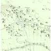
Robert Stevenson. MS 448.82 ( 5862 No 10 ), Map of St Kilda giving some idea of the pre-1835 village.
See also: 'St Kilda' by Bill Lawson (not available to the public without written permission of Mr B Lawson, The Old School House, Northton, Harris, Outer Hebrides'. Stored in Limited Access file.
See also: ' St Kilda evacuated : islanders leave homes of their ancestors', from 'The Glasgow Herald', 30 August, 1930. ( Photographs of the island and the people before and during departure).
D5/IN (p). Acc. No. 14369(P).
Photographic Record (1880)
Photographic Record (1880)
Field Visit (23 August 1927)
Photographic Record (August 1930)
Field Visit (1950 - 1960)
Measured Survey (1983 - 1987)
A survey of the main areas of historic settlement on St Kilda was carried out by the Commission in 1983-6 at the invitation of the National Trust for Scotland.
Condition Survey (1996)
Condition Survey (1998)
Geomorphological Survey (1999)
Watching Brief (2001)
NF 101 991 (centre) Scheduled Monument Consent required watching briefs of various works at the MoD base on Hirta in 2001. The replacement of more than 200m of the fuel pipeline across the croftlands S of the road led to the recovery of residual artefacts from the disturbed ground. These include about 80 sherds of hand-made pottery (Iron Age or later), as well as some 19th/20th-century artefacts. Work at the septic tank revealed previously disturbed ground and no archaeological features or finds.
Report to be deposited in the NMRS.
Sponsor: NTS.
M Taylor 2002a
Condition Survey (2001)
A survey was carried out by the National Trust for Scotland on over 300 cleitean (singular cleit) on St Kilda. They are double-walled, drystone-built oval or rectangular structures, used primarily for storage of food and fuel resources. Many have survived well after being abandoned in 1930 when the islands were evacuated. The survey recorded their condition, construction and location.
Conservation (2001)
NF 101 991 (centre) As part of the Management Agreement with Historic Scotland, the monuments within Village Bay were recorded and monitored, and certain cleits, dykes and enclosures were repaired in 2001 under supervision by members of the two volunteer work parties. Detailed work included the completion of the identification of around 300 cleits for active management, and the production of a report on cleit preservation, as well as rapid assessments of coastal erosion and the deposition of builders' debris within some of the roofless structures along the village street.
Report to be deposited in the NMRS.
Condition Survey (2001)
NF 101 991 (centre) As part of the Management Agreement with Historic Scotland, the monuments within Village Bay were recorded and monitored, and certain cleits, dykes and enclosures were repaired in 2001 under supervision by members of the two volunteer work parties. Detailed work included the completion of the identification of around 300 cleits for active management, and the production of a report on cleit preservation, as well as rapid assessments of coastal erosion and the deposition of builders' debris within some of the roofless structures along the village street.
Report to be deposited in the NMRS.
Ground Survey (2002)
NF 101 993 Fieldwork has identified the site of the clachan which pre-dates and was not totally destroyed by the familiar 1830s 'improvement' layout of crofts and blackhouses set along a 'street'. Thirteen possible or probable structures are identifiable, centring around the present House 9; sometimes they partly underlie 1830s structures, elsewhere they take the form of sub-rectangular or slightly boat-shaped hollows or platforms. At the S end of the clachan is a 'dished area', evidently a public space which compares well in detail with the drawing made by Acland in 1812.
Sponsor: University of Wales Lampeter - Dept of Archaeology
A Fleming 2002
Condition Survey (2002)
NF 101 991 (centre) As part of the Management Agreement with Historic Scotland, the monuments within Village Bay were recorded and monitored, and certain cleits, dykes, drains and enclosures were repaired under supervision by members of the volunteer work parties which went out to St Kilda in 2002.
A photographic survey of the coastline in Village Bay was carried out and compared to images taken in 1999. The survey indicated erosion along the NE side of the bay. Two sherds of hand-made pottery were recovered and a layer of burning noted in an exposed section.
The annual monitoring of cleits across the island was carried out and the photographic survey of them continued.
Report to be deposited in the NMRS.
Conservation (2002)
NF 101 991 (centre) As part of the Management Agreement with Historic Scotland, the monuments within Village Bay were recorded and monitored, and certain cleits, dykes, drains and enclosures were repaired under supervision by members of the volunteer work parties which went out to St Kilda in 2002.
A photographic survey of the coastline in Village Bay was carried out and compared to images taken in 1999. The survey indicated erosion along the NE side of the bay. Two sherds of hand-made pottery were recovered and a layer of burning noted in an exposed section.
The annual monitoring of cleits across the island was carried out and the photographic survey of them continued.
Report to be deposited in the NMRS.
Photographic Survey (2002)
NF 101 991 (centre) As part of the Management Agreement with Historic Scotland, the monuments within Village Bay were recorded and monitored, and certain cleits, dykes, drains and enclosures were repaired under supervision by members of the volunteer work parties which went out to St Kilda in 2002.
A photographic survey of the coastline in Village Bay was carried out and compared to images taken in 1999. The survey indicated erosion along the NE side of the bay. Two sherds of hand-made pottery were recovered and a layer of burning noted in an exposed section.
The annual monitoring of cleits across the island was carried out and the photographic survey of them continued.
Report to be deposited in the NMRS.
Sponsors: HS, NTS.
S Bain 2002
Watching Brief (August 2003 - September 2003)
NF 101 991 A watching brief was carried out in August and September 2003 during the re-excavation of a water pipe trench across Village Bay. The trench was excavated for a distance of approximately 360m through previously disturbed deposits, except in two small sections. This revealed a deep cultivated soil. No artefacts were noted in situ.
Report to be lodged with the NMRS.
Field Visit (July 2003)
NF 101 993 (centre) Standing structures in the Village Bay area, mostly of 19th and early 20th-century date, were searched for artefacts and manuports in July 2003. Finds include: numerous beach pebble manuports of varying size, some exhibiting a variety of damage; stone pestle/hammers based on beach pebbles; fire-cracked stones in two main concentrations, with general thin scatter; fragments of flat querns; and fragments of rotary quern, including three in cleit 84.
Report lodged with Western Isles SMR.
Condition Survey (2003)
NF 101 991 As part of the Management Agreement with Historic Scotland, the monuments in Village Bay were recorded and monitored. Stretches of the head dyke were photographed, as were a number of cleits. Sections of walling, cleits and cleit roofs were repaired, and drains cleaned out under archaeological supervision by members of volunteer work parties.
Coastal erosion was monitored, which indicated progressive erosion along the NE section of Village Bay.
A small exploratory excavation to determine the method of build was carried out within Blackhouse X.
Report to be lodged with the NMRS.
Sponsors: HS, NTS.
S Bain 2003
Geomorphological Survey (2003 - 2005)
A coastal erosion study carried out on the island between 2003 and 2005 revealed that there had been a metre of erosion in the 3 year time period and many structures on the coast were in danger of being completely destroyed.
Conservation (2003)
NF 101 991 As part of the Management Agreement with Historic Scotland, the monuments in Village Bay were recorded and monitored. Stretches of the head dyke were photographed, as were a number of cleits. Sections of walling, cleits and cleit roofs were repaired, and drains cleaned out under archaeological supervision by members of volunteer work parties.
Coastal erosion was monitored, which indicated progressive erosion along the NE section of Village Bay.
A small exploratory excavation to determine the method of build was carried out within Blackhouse X.
Report to be lodged with the NMRS.
Field Visit (June 2004 - July 2004)
St Kilda Artefacts and Manuports Project
Survey
NF 101 993 (centre) Standing structures in the Village Bay area, mostly of 19th- and 20th-century date, were searched for artefacts and manuports in June and July 2004. Finds include pounder/grinders, Skaill knives, flaked cobbles, cores and fire-cracked stones; also rotary quern fragments and half a trough quern.
Report lodged with Western Isles SMR.
Condition Survey (2004)
NF 101 991 (centre) A survey of the coastline in Village Bay was carried out to assess the impact of erosion on possible archaeological deposits. The survey indicated minimal erosion along the NE side of the bay.
The annual monitoring of cleits across the island was carried out and the photographic survey of them continued. A photographic survey of the head dyke was also progressed.
A small excavation around House 6, Main Street, Hirta, was carried out in advance of a new drain. A large number of late 19th/early 20th-century artefacts were recovered, suggesting that the area behind and to the W side of the house had been used as a midden.
A portion of thatch, including surviving heather rope, was noted within the wall core of Blackhouse F.
Archive to be deposited in the NMRS.
Photographic Survey (2004)
NF 101 991 (centre) A survey of the coastline in Village Bay was carried out to assess the impact of erosion on possible archaeological deposits. The survey indicated minimal erosion along the NE side of the bay.
The annual monitoring of cleits across the island was carried out and the photographic survey of them continued. A photographic survey of the head dyke was also progressed.
A small excavation around House 6, Main Street, Hirta, was carried out in advance of a new drain. A large number of late 19th/early 20th-century artefacts were recovered, suggesting that the area behind and to the W side of the house had been used as a midden.
A portion of thatch, including surviving heather rope, was noted within the wall core of Blackhouse F.
Archive to be deposited in the NMRS.
Excavation (2004)
NF 101 991 (centre) A survey of the coastline in Village Bay was carried out to assess the impact of erosion on possible archaeological deposits. The survey indicated minimal erosion along the NE side of the bay.
The annual monitoring of cleits across the island was carried out and the photographic survey of them continued. A photographic survey of the head dyke was also progressed.
A small excavation around House 6, Main Street, Hirta, was carried out in advance of a new drain. A large number of late 19th/early 20th-century artefacts were recovered, suggesting that the area behind and to the W side of the house had been used as a midden.
A portion of thatch, including surviving heather rope, was noted within the wall core of Blackhouse F.
Archive to be deposited in the NMRS.
Excavation (February 2005)
Unspecified Geophysical Survey Technique (June 2005 - July 2005)
19th-century crofting village; prehistoric remains NF 100 994 (centre) In June and July 2005, a survey and limited excavation were carried out in the Village (NF19NW 21). The surveys consisted of mainly geophysical survey over five
croftlands centred on the burial ground. Trenches were opened over areas where geophysical anomalies had been detected in 2004 (DES 2004, 136), in order to establish whether these anomalies related to in situ archaeological deposits.
The geophysical surveys this year identified a number of anomalies that may represent structures, enclosures, trackways and terraces. The limited excavation identified possible structural remains, along with numerous sherds of coarse, hand-made pottery and stone tools that were recovered from the topsoil. No in situ archaeological deposits were excavated. The work was carried out with the assistance of NTS Work Parties.
Report lodged with Western Isles SMR and NMRS.
Sponsor: NTS.
R Will, I Shearer and D Maguire 2005
Excavation (June 2005 - July 2005)
19th-century crofting village; prehistoric remains NF 100 994 (centre) In June and July 2005, a survey and limited excavation were carried out in the Village (NF19NW 21). The surveys consisted of mainly geophysical survey over five
croftlands centred on the burial ground. Trenches were opened over areas where geophysical anomalies had been detected in 2004 (DES 2004, 136), in order to establish whether these anomalies related to in situ archaeological deposits.
The geophysical surveys this year identified a number of anomalies that may represent structures, enclosures, trackways and terraces. The limited excavation identified possible structural remains, along with numerous sherds of coarse, hand-made pottery and stone tools that were recovered from the topsoil. No in situ archaeological deposits were excavated. The work was carried out with the assistance of NTS Work Parties.
Report lodged with Western Isles SMR and NMRS.
Sponsor: NTS.
R Will, I Shearer and D Maguire 2005
Geophysical Survey (June 2006 - July 2006)
NF 100 994 The work involved a geophysical survey within the Village, undertaken in June and July 2006, centered on the graveyard, and trial trenching of geophysical anomalies identified in 2005. In addition, two trenches were excavated in areas that had produced no geophysical anomalies. The excavation method used was 'reveal and record', which involves removing topsoil to the first archaeological horizon and recording what is revealed, without further excavation. A number of features were exposed, including possible structural remains and stone-capped drains. Artefacts were recovered, including a possible spindle whorl and a large amount of coarse hand made pottery and stone tools. No in situ archaeological deposits were excavated. The geophysical surveys completed a transect from the head dyke to the sea shore, an area behind Cottages 3-5 and a small area of the Glebe behind the MoD base; a number of anomalies were detected.The work was carried out with the assistance of NTS work party volunteers.
Archive to be deposited in NMRS. Report lodged with Western Isles Council SMR and NMRS.
Sponsor: The National Trust for Scotland.
R Will, K G McLellan and D McGuire 2006
Field Visit (5 September 2007 - 8 May 2009)
The settlement and cultivation remains within Village Bay are currently recorded under NF19NW 21, together with NF09NE 11-13 and 18. This area also includes cleits, cellular buildings and related structures (Hirta 1-111, 113-70, 916, 1074-82, 2110-15, 2226, 2229-30, 2232-3, 2237, 2250)
Visited by RCAHMS (ARG,JRS,SPH) 8 May 2009
External Reference
National Library of Scotland: Map Collection
Robert Stevenson. MS 448.82 ( 5862 No 10 ), Map of St Kilda giving some idea of the pre-1835 village.


