Following the launch of trove.scot in February 2025 we are now planning the retiral of some of our webservices. Canmore will be switched off on 24th June 2025. Information about the closure can be found on the HES website: Retiral of HES web services | Historic Environment Scotland
Glasgow, Hutchesontown - Gorbals
Tower Block (20th Century)
Site Name Glasgow, Hutchesontown - Gorbals
Classification Tower Block (20th Century)
Alternative Name(s) Queen Elizabeth Square; Area A; Area B; Area C; Area D; Area E
Canmore ID 70581
Site Number NS56SE 178
NGR NS 59471 63832
Datum OSGB36 - NGR
Permalink http://canmore.org.uk/site/70581
First 100 images shown. See the Collections panel (below) for a link to all digital images.
- Council Glasgow, City Of
- Parish Govan (City Of Glasgow)
- Former Region Strathclyde
- Former District City Of Glasgow
- Former County Lanarkshire
OLD GORBALS
Gorbals in the 1840s was such a hotbed of quarrels and disturbance that it became known as 'Little Ireland'. In the 1870s Glasgow City Improvement Trust demolished the old Gorbals village, Elphinstone's Tower and St Ninian's Chapel, building new tenements, designed by Alexander Thomson, around a new Gorbals Cross. They also provided a central clock tower and underground public toilets. Population had grown rapidly, reaching 40,000 in the combined areas by 1890 and, with the arrival of vast numbers of destitute immigrants, 'made down' or subdivided tenements became the norm, alongside 'back to back' building on back lands. The population in the 1930s reached 90,000. Redevelopment, following slum clearance in the 1960s, was not successful; much of that has also gone, and with it much of the population
HUTCHESONTOUN & NEW GORBALS
Hutchesontoun was the largest portion of the old Elphinstone Barony. Several streets were laid out to a feuing plan of 1793, the first buildings erected in St Ninian Street by the next year. Such severe restrictions were imposed on feuars that, in ten years, only five streets around the principal thoroughfare, Hospital Street, had buildings on them. Crown Street became the commercial centre, lined up with the new bridge in 1805, now replaced by Albert Bridge. In 1820, the Trustees changed their policy: abandoning ideas of grandeur, they now permitted mills and factories. By 1840, working-class flats were allowed within the four-storey stone tenements. Industry was also encouraged, later encroaching on much of the housing. The biggest works were Govan Iron Works, 1839 and the United City Bakeries Society at 12 McNeil Street, 1886. The New Gorbals, begun on site about 1990, continues to grow in this area, after the old names were blurred in the 1960s. Great enthusiasm has been shown by New Gorbals Housing Association tenants and house purchasers alike.
Queen Elizabeth Square Project: Masterplan, 2000, Hypostyle
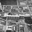
The second part of the Gorbals Regeneration Project, for 500 housing units, built on the site of the award-winning High Flats, 1960, Basil Spence. More sophisticated designs by more mature and confident architects, a decade after phase one. Queen Elizabeth Gardens, 2003, Elder & Cannon. A delightful four-storey block of flats at the Cumberland Street end of the Gardens, in their own distinctive precisely detailed style.
Taken from "Greater Glasgow: An Illustrated Architectural Guide", by Sam Small, 2008. Published by the Rutland Press http://www.rias.org.uk
Building Notes
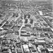
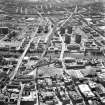
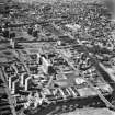
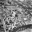
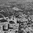
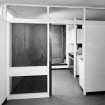
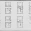
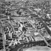
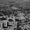
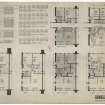
By the 1950s Glasgow's Hutchesontown/Gorbals area had some of the worst housing conditions in Europe. To combat this problem Glasgow Corporation created the Hutchesontown/Gorbals Comprehensive Development Area. Their aim was to replace 62 acres of slums with new low and high density housing, schools and shops. In 1959 Basil Spence was commissioned to design a 15-acre development as part of this major scheme. His brief was to provide a community centre, police station, shops, and 400 dwellings; a mix of maisonettes and one- to four-bedroom apartments.
Spence carried out initial designs in London but all working drawings were done at his Edinburgh office Sir Basil Spence Glover & Ferguson. Peter Ferguson was responsible for the contracts, supervision and progressing of the work on site. Ove Arup & Partners were the Structural Engineers.
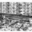
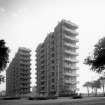
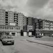
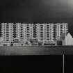
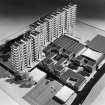
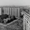
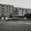
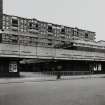
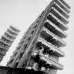
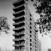
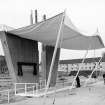
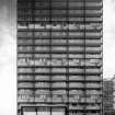
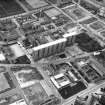
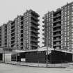
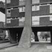
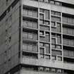
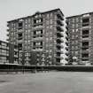
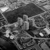
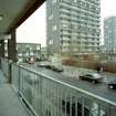
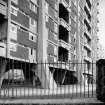
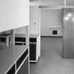
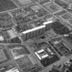
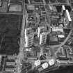
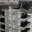
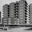
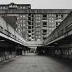
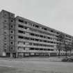
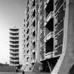
The completed block became known to locals as 'Hutchie C' and consisted of ten tower modules connected by drying green areas and arranged in two large slabs. Spence's practice designed light industrial units nearby but the proposed shopping precinct and police station were designed by other architects.
The first residents arrived in June 1965. Over the next three decades the accommodation became difficult for the Corporation to maintain and their condition deteriorated. After harsh criticism they were demolished in 1993.
Archive Details
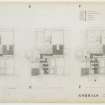
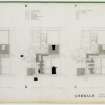
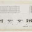
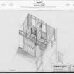
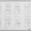
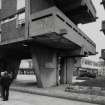
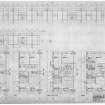
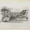
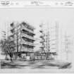
Drawings in the Spence Glover & Ferguson Collection, also held at RCAHMS, include early proposals for the scheme showing an alternative arrangement of blocks and a different style of concrete legs to the splayed ones that were built to support the accommodation. The drawings show Spence's idea that the balconies were to be large and like gardens.
One surviving correspondence folder on the Gorbals is held in the Sir Basil Spence Archive and includes facts, figures and quotes for publication. These detail Spence's aim to 'humanise high-rise living', and show that he wanted his blocks to resemble a 'great ship dressed overall' on Monday, the traditional day that everyone did their washing. Many of the letters inform Spence of the project's progress, and one dated October 1964 mentions that the Sunday papers were bothering the practice as Glasgow housing had very much become a hot election issue.
Also included are pamphlets written by Lady Allen of Hurtwood, a landscape architect, advocate of childrens' welfare, and a campaigner for good playground facilities in the 1950s high-rise developments of Britain's cities.
Archive Summary
The Sir Basil Spence Archive contains 53 drawings, two photographs and two manuscript files including press cuttings. The Spence Glover & Ferguson Collection contains 226 drawings and 139 photographs, some of which show Queen Elizabeth visiting the site and unveiling a foundation plaque. In 1993 RCAHMS made a video record of the demolition.
This text was written as one of the outputs of the Sir Basil Spence Archive Project, supported by the Heritage Lottery Fund, 2005-08.
Architect: Sir Basil Spence, Glover and Ferguson
Demolished 1993.
Publication Account (1997)
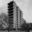
The centrepiece of the architecturally prestigious redevelopment of the Gorbals: two dramatic 20-storey slabs, whose inset communal drying areas were intended as a multi-storey re-enactment of the tenement 'community' they replaced. Rugged external modelling combined with intricate split-level internal planning. Following intractable management and structural difficulties, the blocks were dynamited on 12 September 1993. (Fig. 4.54).
Information from 'Rebuilding Scotland: The Postwar Vision, 1945-75', (1997).


