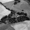
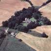
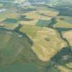
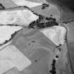
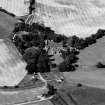
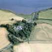
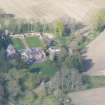
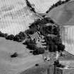
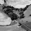
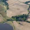
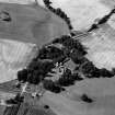
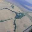
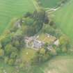
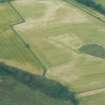
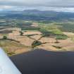
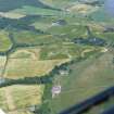
Accessibility

Font Size

100% 150% 200%

Background Colour

Default Contrast
Close Reset

Tarradale

Motte (Medieval)(Possible)

Site Name Tarradale

Classification Motte (Medieval)(Possible)

Canmore ID 68543

Site Number NH54NE 19

NGR NH 553 487

NGR Description NH c. 553 487

Datum OSGB36 - NGR

Permalink http://canmore.org.uk/site/68543

Ordnance Survey licence number AC0000807262. All rights reserved.
Canmore Disclaimer. © Bluesky International Limited 2025. Public Sector Viewing Terms

Toggle Aerial | View on large map

Digital Images

Oblique aerial view of Tarradale House with the cropmarks adjacent, looking to the ESE.
Oblique aerial view of Tarradale House with the cropmarks adjacent, looking to the ESE.Aerial view of Tarradale House, base of the Black Isle, looking NE.Aerial view of Tarradale House and fields, Muir of Ord, Easter Ross, looking NW.Oblique aerial view of Tarradale House with the cropmarks adjacent, looking to the ESE.Oblique aerial view of Tarradale House with the cropmarks adjacent, looking to the N.An oblique aerial view of Tarradale House, Beauly Firth, Easter Ross, looking SSE.Oblique aerial view of Tarradale House, near Muir of Ord, Ross-shire, looking NE.Oblique aerial view of Tarradale House with the cropmarks adjacent, looking to the NNW.Oblique aerial view of Tarradale House with the cropmarks adjacent, looking to the NNE.Aerial view of Tarradale on the Black Isle, looking NW.Aerial view of Tarradale House, and the site of the barrow cemetery, Black Isle, looking NW.An oblique aerial view of Tarradale, near Muir of Ord, Black Isle, looking SSE.Oblique aerial view of Tarradale House with the cropmarks adjacent, looking to the NW.An oblique aerial view of Tarradale, near Muir of Ord, Black Isle, looking SEAn almost aerial view of Tarradale House, near Muir of Ord, looking N.Aerial view of site of barrow cemetery in fields, west of Tarradale House, near Muir of Ord, Easter Ross, looking N.Aerial view of Tarradale on the Black Isle, looking NW.Oblique aerial view of the Bellevue and Tarradale Mains area, N shore of Beauly Firth, looking NE.

Administrative Areas

  • Council Highland
  • Parish Urray (Ross And Cromarty)
  • Former Region Highland
  • Former District Ross And Cromarty
  • Former County Ross And Cromarty

Archaeology Notes

NH54NE 19 c. 553 487

Site of motte.

P A Yeoman 1988.

Motte site (alleged) - outside study area.

Medieval (alleged)

CFA/MORA Coastal Assessment Survey 1998

References

MyCanmore Image Contributions


Contribute an Image

MyCanmore Text Contributions