Scheduled Maintenance
Please be advised that this website will undergo scheduled maintenance on the following dates: •
Tuesday 3rd December 11:00-15:00
During these times, some services may be temporarily unavailable. We apologise for any inconvenience this may cause.
Cnoc Dail-chairn
Cairn (Prehistoric)
Site Name Cnoc Dail-chairn
Classification Cairn (Prehistoric)
Canmore ID 6644
Site Number NC82NE 17
NGR NC 8540 2886
Datum OSGB36 - NGR
Permalink http://canmore.org.uk/site/6644
- Council Highland
- Parish Kildonan
- Former Region Highland
- Former District Sutherland
- Former County Sutherland
Field Visit (30 May 1961)
NC82NE 17 8540 2886
See also NC82NE 16.
(NC 8540 2886) Cairn (NR)
OS 6" map, 1962.
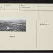
A cairn, 14m in diameter and 1.3m high, partly heather-grown, found during field investigation.
Visited by OS (E G C) 30 May 1961
Field Visit (17 January 1977)
This cairn as described is prominently situated on a natural terrace on the undulating north slope of Cnoc Dail-chairn within a minor field system associated with a hut circle (See NC82NE 16). Kerbstones are visible intermittently on the perimeter; on the east side the kerb is particularly well-preserved, where there is a straight line of boulders up to 0.8m high and 7.5m long in the manner of a facade, though there is no break for an entrance passage. The centre of the cairn is disturbed revealing a content of rubble stones.
Visited by OS (J B) 17 January 1977
Field Visit (2 May 1991)
This cairn is situated on a natural terrace on the N flank of Cnoc Dail-chairn within the area of an extensive field-system (NC82NE 16). It measures 13.7m from N to S by 13m transversely and 1m in height. The mound is surrounded by the remains of an orthostatic kerb with stones up to 0.75m high; on the E there is a straight stretch of kerb 7.5m in length and elsewhere there are what appear to be facets within the kerb, suggesting that the cairn may be an octagonal on plan. A hut has been built in the disturbed stonework on top of the cairn. The straight stretch of kerbing on the E suggests that the cairn may be chambered. (KILD91 220)
Visited by RCAHMS (DCC) 2 May 1991.


