RCAHMS Afforestable Land Survey, Strath of Kildonan


Date March 1991 - July 1991
Event ID 550859
Category Project
Type Project
Permalink http://canmore.org.uk/event/550859
An area of some 95 square kilometres of the Strath of Kildonan, forming a transect across the River Helmsdale and including the catchment of the Suisgill Burn in the east and the lower and middle reaches of the Abhainn na Frithe in the west, was surveyed between March and July 1991.
The area is dominated by the broad valleys of the Abhainn na Frithe and the River Helmsdale, which are both fed by a series of burns cutting through open, rolling moorland, bounded by a series of hills rising relatively steeply to 300m and higher. The solid geology is dominated by granulites of the Moine Series (Read 1931); along the water-courses, however, there are narrow, discontinuous bands of intensively reworked alluvium and gravels, while much of the higher ground is covered by extensive deposits of peat.
Although the majority of the prehistoric and later monuments survive on the gently-rolling valley sides, there is a thin scatter of sites on the haughlands, and these may represent a fragment of a once extensive pattern of valley-floor settlement. At Upper Suisgill, excavations (Barclay 1987) revealed evidence of settlement activity, extending over much of the 1st millennium BC, which had been buried under considerable deposits of hillwash, and the Statistical Account records problems of flooding associated with more recent use of the haughlands. Hillwash has evidently been a major factor in the development of the Kildonan landscape and, although its effects will have been felt on the higher ground, destroying a number of hut circles and burnt mounds, its principal consequences will have been concentrated in the valley floors, where it is possible that alluvial and colluvial deposits mask much of the early settlement remains.
Building on the work of the Royal Commission, carried out by A O Curle in 1909 (RCAHMS 1911), the field staff of the Ordnance Survey established an extensive archaeological record for Kildonan during their remapping of the area in the late 1970s and early 1980s. The OS written record showed a bias towards the prehistoric material, but much of the medieval and later settlement had previously been depicted on the 1 st edition of the Ordnance Survey 6-inch map (1879).
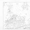
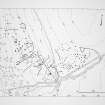
At the outset of the present survey there was already, therefore, a relatively large number of sites known in the area, and fieldwork was directed towards visiting them and prospecting for unrecorded sites in the intervening gaps. All the surviving structures were recorded on a Husky Hunter portable computer, and the database created in this way (available in the NMRS) forms the primary survey-archive from which the written descriptions of sites or landscapes have been produced. Most mapping involved established techniques, including offsets and sight-lines, but the application of EDM survey techniques has allowed a number of large areas to be surveyed, many of them (e.g. Learable, Fig.21), containing extensive areas of cultivation remains.
An appreciation of the wider patterns of settlement and land use in the strath has been gained by an examination of the NMRS record card holdings for an area defined by the catchment of the River Helmsdale, and this information, although at a lower level of intensity of coverage than that within the field survey area, has been used as the basis for the distribution maps.
RCAHMS 1993, 5
(See also DES 1991, 79 and Annual Reports)
Project Code: KILD91
Area: 55km2
Structures database: MS731/1 (manuscript), DX001419 (database)
Linework: non-digital