Pricing Change
New pricing for orders of material from this site will come into place shortly. Charges for supply of digital images, digitisation on demand, prints and licensing will be altered.
Kirkmaiden, Old Parish Church And Burial-ground
Burial Ground (Medieval), Church (Medieval), Cross Slab (Early Medieval)(Possible)
Site Name Kirkmaiden, Old Parish Church And Burial-ground
Classification Burial Ground (Medieval), Church (Medieval), Cross Slab (Early Medieval)(Possible)
Alternative Name(s) Mull Of Galloway Farm, Kirkmaiden Church, St Catherine's Croft
Canmore ID 61095
Site Number NX13SW 7
NGR NX 13856 32432
NGR Description Centre
Datum OSGB36 - NGR
Permalink http://canmore.org.uk/site/61095
- Council Dumfries And Galloway
- Parish Kirkmaiden
- Former Region Dumfries And Galloway
- Former District Wigtown
- Former County Wigtownshire
Kirkmaiden 1, Wigtownshire, cross-slab fragments
Measurements: H 0.68m, W 0.42m tapering to 0.30m, D 0.09m
Stone type:
Place of discovery: NX 3655 3997
Evidence for discovery: recorded at Kirkmaiden in 1864 by Muir, and taken to Whithorn sometime after 1985.
Present location: in Whithorn Museum.
Present condition: in three conjoining fragments.
Description:
This is the lower part of a cross-slab bearing a panel of simple interlace on face A, using median-incised cords and carved in low relief. The plain face C bears the relatively modern letters AMC, indicating re-use as a gravestone.
Date range: early medieval.
Primary references: Muir 1864, 32-3; Craig 1992, vol 3, 148-50, vol 4, pl128.
Desk-based information compiled by A Ritchie 2019.
Kirkmaiden 2, Wigtownshire, cross-slab fragment
Measurements: H 0.90m, W 0.35m, D 0.08m
Stone type:
Place of discovery: NX 3655 3997
Evidence for discovery: recorded at Kirkmaiden in 1911 by RCAHMS, and taken to Whithorn sometime after 1985.
Present location: in Whithorn Museum.
Present condition: in three conjoining fragments.
Description:
This is the lower part of a cross-slab bearing a panel of simple interlace on face A, using median-incised cords and carved in low relief. The plain face C bears the relatively modern letters AMC, indicating re-use as a gravestone.
Date range: early medieval.
Primary references: Muir 1864, 32-3; Craig 1992, vol 3, 1501-2, vol 4, pl128.
Desk-based information compiled by A Ritchie 2019.
NX13SW 7 13853 32437
(NX 1385 3243) Kirkmaiden Church (NR)
(Site of)
OS 6" map (1957)
For successor church (NX 12450 36920), see NX13NW 16.
Only the foundation remains of the pre-Reformation parish church of Kirkmaiden, which was dedicated to St Medana. It was replaced in 1638 by the church at NX 1245 3692 (see NX13NW 16). A small churchyard was attached to it. The ONB states that while burials were taking place, the horses were loosed to graze in Maitland's Croft (the area outlined by pecks on OS 6"), which is called St Catherine's Croft on the 1850 6" edition. Scott, following this, states that a chapel, dedicated to St Catherine, existed here. Thomas has a plan showing possible cells.
Name Book 1848; H Scott 1917; W J Watson 1926; C Thomas 1971 .
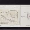
The church, which is set into the hillside, measures internally c. 14.5m E-W by c. 6.0m transversly between the remains of a grass-covered wall c. 0.3m high externally with occasional faces visible. The entrance is in the S side. The enclosure wall consists of grass-covered tumble overlain, except in the E, by a modern dyke. There is no ground evidence for the possible cells indicated on Thomas's plan. Name confirmed.
Surveyed at 1:2500.
Visited by OS (DWR) 7 February 1972
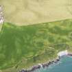
The former parish church of Kirkmaiden stood within its burial-ground 500m N of Mull farmhouse. It has been reduced to its wall-foundations and measures about 15.5m by 6m internally. Elsewhere within the burial-ground there are three other rectangular structures, of unknown date and purpose, the largest of which, situated on the S and measuring 15m in length overall, may be a building. The church comes on record in 1386 and was abandoned about 1639 when a new church was built at Kirkmaiden (NX13NW 16).
A cross-incised slab of Early Christian date, now in the Royal Museum of Scotland (IB 33), is said to have come either from this church, or from Kildonan church (NX13NW 7).
OSA 1791; NSA 1845; Name Book 1848; W Todd 1854; A Mitchell 1872; G Chalmers 1887-1902; J R Allen and J Anderson 1903; P H M'Kerlie 1906; H Scott 1915-61; I B Cowan 1967; A C Thomas 1971; RCAHMS 1912; RCAHMS 1985, visited July 1984.
Kirkmaiden Church (remains of)
Graveyard [NAT]
OS (GIS) MasterMap, July 2009.
Note (10 December 2021)
The location, classification and period of this site have been reviewed and changed from BURIAL GROUND (PERIOD UNASSIGNED), CHURCH (PERIOD UNASSIGNED), CROSS SLAB (EARLY MEDIEVAL)(POSSIBLE).


