Following the launch of trove.scot in February 2025 we are now planning the retiral of some of our webservices. Canmore will be switched off on 24th June 2025. Information about the closure can be found on the HES website: Retiral of HES web services | Historic Environment Scotland
HES Rhins and New Luce Project


Date November 2021 - March 2023
Event ID 1131824
Category Project
Type Project
Permalink http://canmore.org.uk/event/1131824
The survey of the Rhins and New Luce area (497km2) was undertaken by the Archaeological Survey team of Historic Environment Scotland between November 2021 and March 2023, with fieldwork carried out in March 2022. The main aim of the project was to develop processes and procedures for the rapid enhancement of National Record of the Historic Environment (NRHE) site records that relate to scheduled monuments, capitalising on the availability of Airborne Laser Scanning (ALS) data. The project was managed by Dr Kirsty Millican and the project executive was Dr Dave Cowley.
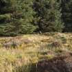
The survey area encompassed the Rhins of Galloway Peninsula, the Stranraer isthmus, extending to the hills and moorland above New Luce and most of the catchment of the Cross Water of Luce and the lower reaches of the Water of Luce. The NE of the survey area is principally moorland, while the remainder of the area is largely given over to farmland with small pockets of moorland.
The project made use of Airborne Laser Scanning (ALS) data initially captured by Fugro for Scottish Power Energy Network in 2015 and 2016 to assist with monitoring overhead power lines. With a point density of about 30 last returns per m², the project made use of the full ALS dataset whose point density is significantly higher than the Phase 3 data available through Scottish Remote Sensing Portal (4 points per m²). The point cloud data was processed by Dr Łukasz Banaszek (HES) to generate a digital terrain model (DTM) with a resolution of 0.5m. Visualisations were subsequently produced using the Relief Visualisation Toolbox ((RVT) | ZRC SAZU (zrc-sazu.si)).
Within the overall study area, the project dealt mainly with existing NHRE archaeological records that lay within 100m of a Scheduled Monument area, with the specific exclusion of finds. No specific effort was made to locate new features, though a relatively small number were discovered when they fell in or near a Scheduled Monument. In addition to ALS-derived visualisations, other datasets were used where appropriate, all in a QGIS environment. These included vertical aerial photographs (supplied by Getmapping plc), successive iterations of OS Historic maps at 6-inch and smaller scales (supplied by the National Library of Scotland), current OS raster and digital mapping, and material held in the HES archive. The last of these includes oblique aerial photographs and the 1:10,000 Record Sheets maintained by the OS Archaeology Division and subsequently RCAHMS. Terminology for the classification and date of archaeological sites was drawn from published HES thesauri while site-area polygons were created using the Historic Environment Polygonisation Standards (Scotland) technical guidance.
The first phase of the project included the desk-based revision of 615 site records, with checks made to classification, location and period. Site records were compared to the scheduled monument documentation. Records which differed in interpretation to the scheduled monument description and scheduled monument areas that were displaced or too small were noted for later dissemination to HES Designations. Text descriptions were written where there was no existing description, or the existing description was considered inadequate. The second phase involved visits to those sites where questions remained, and to a small number of newly identified features. Fieldwork was undertaken during one week in March 2022 by a team that included Łukasz Banaszek, Georgina Brown, Angela Gannon, John Sherriff, Craig Stanford and Adam Welfare.
In total, the survey took in 643 archaeological sites. This comprised the revision of 615 pre-existing site records (67 of which benefited from a field visit) and 28 previously unrecorded sites, including 9 that were subsequently visited and four that were identified during fieldwork. The classification and / or period of some 450 site records were revised and 105 new text descriptions written, of which 77 relate to existing sites and 28 to new sites. Of the 28 new sites, four intersected with the area of a scheduled monument polygon, and a further ten were found within 100m of a scheduled monument. Half of these are of prehistoric and medieval date and include hut circles and roundhouse as well as one previously unidentified barrow (NX13SW 90). Most of the remainder of the new sites are post medieval in date. All sites were provided with a site area polygon, 496 of which were digitally defined for the first time. The survey noted some 124 issues relating either to the location or size of the scheduled monument area or to differences of interpretation between the scheduled monument record and the NRHE site record. These issues were passed to HES Designations for consideration. The survey successfully reviewed all NRHE site records relating to a scheduled monument within the survey area. This will provide the basis for any future consideration of the designation of these sites.
The project archive includes the spatial data created during desk-based mapping and subsequent stages of the survey (TM002215, TM002216, TM002217), tracks from fieldwork recorded by hand-held GPS (TM002218), metadata for the ALS processing and visualisations (WP007932), and the extent of the survey area (TM002219). Some 45 ground photographs were taken during fieldwork and six cropmarked sites were mapped (transcribed) from rectified oblique aerial photographs. Quality assurance and review was undertaken in the summer and autumn of 2022 and the project dataset was entered into the NRHE in March 2023.
Information from HES Archaeological Survey (K. Millican), 23 March 2023