Pricing Change
New pricing for orders of material from this site will come into place shortly. Charges for supply of digital images, digitisation on demand, prints and licensing will be altered.
Duns Law
Fort (Prehistoric), Redoubt (17th Century)
Site Name Duns Law
Classification Fort (Prehistoric), Redoubt (17th Century)
Alternative Name(s) Duns Law, Fort And Covenanter's Camp
Canmore ID 58640
Site Number NT75SE 2
NGR NT 78507 54678
NGR Description Centre
Datum OSGB36 - NGR
Permalink http://canmore.org.uk/site/58640
- Council Scottish Borders, The
- Parish Duns
- Former Region Borders
- Former District Berwickshire
- Former County Berwickshire
NT75SE 2 7850 5468.
NT75SE 2.01 NT 7847 5472 Covenanters' Stone
(NT 7850 5468) Duns Law (Fort) (NR) Camp (NR)
(NT 7847 5472) Covenanters Stone (NR)
OS 25"map, Berwickshire, (1906).
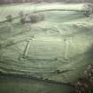
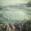
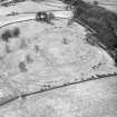
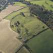
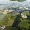
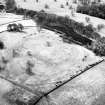
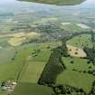
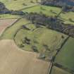
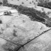
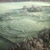
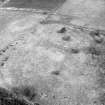
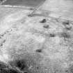
On the summit of Duns Law, 700' above sea level, are the partially obliterated remains of a large fortified enclosure, surrounded by two concentric oval ramparts, and measuring some 700' by 550' over all. In the interior there are numerous circular and irregular foundations. The entrance appears to have been from the E.
A small redoubt, 200' square, with diminutive bastions at the angles, formed of earth with a small trench in front, is considered to have been thrown up by General Leslie in 1639.
RCAHMS 1915, visited 1908.
Generally as described above, with evidence of at least three phases of occupation - an Iron Age fort, two Roman Iron Age settlements, a 17th century fort, and cultivation terraces.
The Iron Age fort has been extensively mutilated by the cultivation terraces on the S and E, and by the two settlements which overlie the defences of the fort on the NE and S and therefore post-date it. The NE settlement comprises some 4 circular stone-walled houses and associated enclosures; that on the S, 2 houses and an enclosure.
Re-surveyed at 1:2500.
Visited by OS(RD) 3 September 1968.
Listed. Photographed.
RCAHMS 1980; CUCAP AP Catalogue.
Additional aerial photographs taken by the RCAHMS in 1980.
(Undated) information in RCAHMS.
Scheduled as Duns Law, fort and Covenanter's Camp.
Information from Historic Scotland, scheduling document dated 23 February 1996.
Field Visit (21 October 1908)
119. Fort, Duns Law.
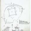
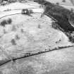
On the summit of Duns Law, to the north of the town of Duns, 700 feet above sea-level, are the partially obliterated remains of a large fortified enclosure (fig. 65 [DP 225501]) surrounded by two concentric oval ramparts and measuring some 700 feet by 550 feet over all. Towards the south the lines are effaced. In the interior there are numerous circular and irregular foundations. The entrance appears to have been from the eastwards.
A small redoubt 200 feet square with diminutive bastions at the angles, formed of earth with a small trench in front, is considered to have been thrown up by General Leslie in 1639.
Along the upper end of the field that lies below the plantation, some 375 feet to the west of the enclosure and extending for several hundred yards, is a substantial mound about 5 feet high, the object of which is not apparent.
See Antiquaries, xxix. p. 154; Ber. Nat. Club, 1892-93, p. 75.
RCAHMS 1915, visited 21st October 1908.
OS Map: Ber., xvi, NE.
Note (30 January 2016 - 21 October 2016)
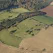
This fort is situated on the rounded summit of Duns Law immediately overlooking the town from the N. Elliptical on plan, it measures 193m from NE to SW by 162m transversely (2.5ha) within the remains of two ramparts, though these have been severely reduced by subsequent occupation and extensive ridged cultivation both within the interior and around the periphery. Within the interior, the most obvious feature is a 17th-century military field work measuring about 60m square internally and equipped with bastions at each of the corners, but a series of rectilinear courts and yards can also be seen overlying the defences on the ENE and S, within which at least eight rectangular building platforms are visible. In addition there are at least three stone-founded round-houses and several other platforms, which probably relate to a late Iron Age occupation of the fort. The only possible entrance into the fort lies amongst the yards on the ENE.
Information from An Atlas of Hillforts of Great Britain and Ireland – 21 October 2016. Atlas of Hillforts SC4055
Note (20 January 2020)
The location, classification and period of this site have been reviewed.
Sbc Note
Visibility: This is an upstanding earthwork or monument.
Information from Scottish Borders Council
Sbc Note
Adjacent to '05 [NT75SE 2] are at least 8 cultivation terraces.
04/06/96: Well defined.
Information from Scottish Borders Council


