Pricing Change
New pricing for orders of material from this site will come into place shortly. Charges for supply of digital images, digitisation on demand, prints and licensing will be altered.
Gamelshiel
Tower House (Medieval)
Site Name Gamelshiel
Classification Tower House (Medieval)
Alternative Name(s) Gamelshiel Castle; Millknowe Farm; Hall Burn
Canmore ID 57537
Site Number NT66SW 14
NGR NT 64982 64801
Datum OSGB36 - NGR
Permalink http://canmore.org.uk/site/57537
- Council East Lothian
- Parish Stenton (East Lothian)
- Former Region Lothian
- Former District East Lothian
- Former County East Lothian
NT66SW 14 64982 64801
NT 6498 6480 Gamelshiel Castle (NR)
(Remains of)
OS 6" map (NG)
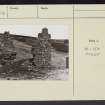
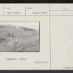
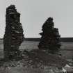
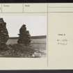
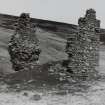
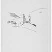
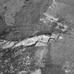
Gamelshiel Castle. The ruin of this building is situated 1/2 mile north of Millknowe Farm, on the left bank of the Hall Burn. The site is level, and the portions of building upon it consist of parts of the north and south walls of a small tower. The external width of the structure is 22 feet 6 inches; its length is indeterminable. The walls now standing are 20 feet high and some 4 feet thick, built mainly of whinstone in narrow courses. The basement floor has been vaulted.
Historical Note. - in 1505 John Forrest succeeded his father John Forrest in the lands of 'Gamelshields'. (Inquisit Spec Hadd, No.392). But in 1679 James Home entered upon the lands of Wester 'Gamelshields' as heir to his father George Home of 'Gamelshields' (Inquisit Spec Hadd, No.344).
RCAHMS 1924, visited 1913
Walls as shown on 6" Sheet. Good condition.
OS Reviser (AEW) 24 July 1952
As described by the RCAHMS.
Visited by OS (WDJ) 14 April 1966.
Field Visit (6 June 1913)
The ruin of this building is situated 1/2 mile north of Millknowe Farm, on the left bank of the Hall Burn. The site is level, and the portions of building upon it consist of parts of the north and south walls of a small tower. The external width of the structure is 22 feet 6 inches; its length is indeterminable. The walls now standing are 20 feet high and some 4 feet thick, built mainly of whinstone in narrow courses. The basement floor has been vaulted.
HISTORICAL NOTE.In 1505 John Forrest succeeded his father John Forrest in the lands of ‘Gamelshields’ (1). But in 1679 James Home entered upon the lands of Wester ‘Gamelshields' as heir to his father George Home of ‘Gamelshields’ (2). The superior of the lands was Hepburn of Hailes (3).
RCAHMS 1924, visited 6 June 1913.
(1) Inquisit. Spec. Hadd. No. 392; (2) Ibid. No. 344; (3) R.M.S. s.a. 1451, No. 513.


