Following the launch of trove.scot in February 2025 we are now planning the retiral of some of our webservices. Canmore will be switched off on 24th June 2025. Information about the closure can be found on the HES website: Retiral of HES web services | Historic Environment Scotland
Melrose Abbey
Abbey (Medieval)
Site Name Melrose Abbey
Classification Abbey (Medieval)
Canmore ID 55738
Site Number NT53SW 30
NGR NT 54848 34177
Datum OSGB36 - NGR
Permalink http://canmore.org.uk/site/55738
First 100 images shown. See the Collections panel (below) for a link to all digital images.
- Council Scottish Borders, The
- Parish Melrose
- Former Region Borders
- Former District Ettrick And Lauderdale
- Former County Roxburghshire
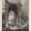
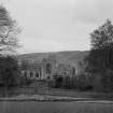
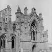
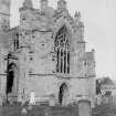
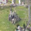
Founded in 1136 by David I, Melrose was the first Cistercian Abbey in Scotland. Following significant damage to the original stone church by English armies in 1322 and 1385, rebuilding produced one of Scotland's most important medieval buildings. The scale of the structure and quality of stonework can still be seen, although the Abbey is now partly ruinous.
Information from RCAHMS (SC) 31 July 2007
Cruft, K, Dunbar, J and Fawcett, R 2006
NT53SW 30 54848 34177
See also:
NT53SW 130 Commendator's House
NT53SW 131 Abbey Burial Ground
(NT 5486 3417) Remains of Abbey (NR)
(Cistercian - founded AD 1136) (NAT)
OS 6" map (1967)
The remains of Melrose Abbey, Cistercian, dedicated to the Virgin Mary, founded in 1136 and secularised in 1609. It suffered greatly during English invasions of the Borders, especially in 1322, 1385 and 1545 and from stone robbers after the Reformation, but enough survives to indicate the high quality of its medieval architecture and sculpture and modern excavations have revealed much of the ground plan.
D E Easson 1957
RCAHMS (1956) and Melrose Abbey Official Guide Book (1949) provide a full description. (J S Richardson and M Wood 1949).
Visited by OS (WDJ) 13 February 1957
The remains of Melrose Abbey are in good condition and in the care of the DoE. (J S Richardson and M Wood 1973)
Surveyed at 1:1250.
Visited by OS (TRG) 4 March 1977
NT 547 342 Two trial trenches were opened to the W of the abbey, trench 1 in the garden of Abbey House and trench 2 in the adjacent car park.
Trench 1 Below turf and topsoil were several areas of metalling, comprising sub-angular and rounded pebbles, these are thought to represent a road or courtyard, the patches of different metalling being repairs.
Trench 2 Below tarmac and c1m of levelling material, comprising mostly large rubble, were further areas of cobbling, including several small iron blooms and slag.
The levels of these various areas of metalling were almost identical and, although the evidence is not conclusive, they are thought to represent the same courtyard or road surface. None of these surfaces were excavated.
A Radley 1991.
NT 5486 3417 A large-scale area excavation was undertaken by Kirkdale Archaeology during August and September 1996 to define the area and extent of the chapter house, to the N of the N transept and sacristy. Previous excavation in the 1920s had uncovered elements of masonry foundations belonging to the E range, in which the chapter house was located, and a geophysical survey had revealed possible wall lines beneath the presently grassed area. The excavation revealed a sequence of three successive chapter houses, from the initial 12th-century example, through a 13th-century rebuilding and culminating in the 14th-century building. The latter two saw the extension of the chapter house eastwards, whereas the initial chapter house probably sat within the E range, and extended no further E than the E edge of the N transept of the 12th-century church.
Rebuilding work within the church nave in 1610 may have seen the total clearance of the chapter house remains, since very little masonry evidence was recorded. This is also due, in part, to the lack of deep foundations ? the chapter house was founded on a level platform of redeposited river clay, on shallow founds. Further, the presence of a series of modern land drains had disturbed and truncated the monastic remains considerably. Due to the extreme lack of masonry evidence, the successive plans of the chapter house were defined by the remains of floor deposits and masonry pillar bases, alongside eaves-drip drains to the exterior of the later two buildings. Evidence for an elaborate tiled floor was recovered, and it would appear that the latter two chapter houses were both furnished with such a floor. Tentative evidence for the form and dimensions of the decorated tiled floor relating to the third and final chapter house was also revealed.
In addition, a number of graves were uncovered, relating to all three of the chapter houses. The sequence of burials and floor levels was extremely difficult to perceive, not least due to the fact that later graves had been interred over the robbed-out remains of earlier inhumations. The Chronica de Mailros reveals that a number of burials were relocated from the W to the E end of the chapter house in 1240. Most of the graves had been disturbed, either by the 1921 excavation or previously, and the human remains were poorly preserved. No skeletal material was removed.
Of much public interest (but of less archaeological significance) was the find of a lead cylinder, containing a medieval, cone-shaped lead casket. Originally uncovered in 1921, this was thought to be the casket containing the heart of King Robert I, whose dying wish was that his heart be taken on Crusade, and thence returned to Scotland, to be buried at Melrose. It is likely that the heart was moved from a more suitable location (at the high altar) to the chapter house during the substantial rebuilding works of the 14th century.
Sponsor: Historic Scotland.
G Ewart and A Dunn 1996
NT 548 341 Further excavations were undertaken at Melrose Abbey in August 1997, following on from work on the chapter house conducted in the summer of 1996 (Ewart and Murray 1996). The intention was to further investigate the area of the chapter house and also two anomalies noted during the geophysical survey conducted in 1996. Five trenches in total were opened. The first trench was opened over a sub-circular anomaly to the W of the lay brothers' range, shown on the 1st edition OS map as the site of a tree. A deep pit, possibly a tree hole, was revealed, cut through 19th-century terracing deposits. A further three trenches were opened over the bank to the S of the site of the chapter house, revealing a monastic roof-shed drain along the line of the former chapter house S wall. Further evidence for the pits revealed in 1996, representing the robbing of the Period I chapter house floor, was also uncovered, confirming their relationship to the monastic, rather than post-monastic, use of the site. The findings have enlarged the understanding of the floor evidence in that a convincing relationship between the drain, defining the S side of the chapter house before the extension of the church, and the 15th-century N transept was revealed. A further trench was opened over a linear anomaly beside the Lavatorium, proving to be a 1920s planting bed.
Sponsor: Historic Scotland
G Ewart and A Dunn 1997.
NT 5486 3417 A trench already excavated by the Historic Scotland squad, to the SW of the abbey, was recorded. A number of architectural fragments and hand-made floor tiles had been reported from this trench.
A surprisingly long sequence was observed in this trench, including a cobbled surface, a wall footing and the wall construction cut. Other deposits, all apparently post-dating the wall, may represent dumps of levelling material.
The architectural fragments are evidently from the abbey, the large number of hand-made floor tiles are likely to be from the same source.
Sponsor: Historic Scotland
D Murray 1998
NT 5486 3417 Excavations were carried out over December 1998 and January 1999 on the site of the presumed Lay Brothers Cloister. Ten trenches in total were excavated, nine within the gardens and a single trench in the area to the E of Abbey Street, against the interior W perimeter wall of the abbey itself. A magnetometer survey had revealed possible wall lines in the area of the gardens to the N of Abbey House. The magnetometer survey also indicated a possible wall line running E-W below the current Abbey Street, indicating a possible continuation further westwards of buildings presently confined to the enclosed abbey grounds.
Excavation around the lawn and flowerbeds of the ornamental garden located potential abbey masonry in one trench, situated on the E edge of the garden against the inside face of the Abbey Street W wall. The other seven trenches exposed a variety of drainage and landscape features, some of which may be early in date. The principal structure on the site was a large, rubble-filled trench running diagonally across the site from SW-NE, which may be a robbed-out wall line backfilled with rubble, but could also be the principal subsoil drain for the ornamental garden. An E-W cut located in two trenches could be the edge of a scarped terrace of monastic period, of which the general level of 86m OD would represent the upper terrace. It was noted that the only early finds were from below the edge of this terrace.
The single trench within the abbey grounds indicated that the 1m of later deposits found W of Abbey Street had been completely cleared away in building clearance works E of Abbey Street, with the result that the turf lies directly on the natural subsoil in this area. It was, however, noted that the level of the subsoil exactly matched the 86m OD found on the possible terrace W of Abbey Street, and appears to be part of the same levelled surface. Additionally it became clear that the column bases found in the chamber adjacent to Abbey Street do not continue to the W and that the late road wall at the W end of the columned chamber sits on the original W wall of the chamber. The range to the W of the abbey did not therefore continue beneath Abbey Street, as the magnetometer survey results may have suggested.
A small trench placed to the E of the gable end of Abbey House located masonry directly below the gravel driveway, indicating that the original guest house extended further W.
Sponsor: Historic Scotland
D Stewart and A Dunn 1999
NT 5486 3417 A watching brief was carried out at Melrose Abbey (NMRS NT53SW 30) in March 2000 during a programme of cable trenching. The work consisted of excavating a narrow, 300mm deep trench over a distance of 91.4m, externally and within the abbey church. The whole of the trench was hand-dug, with archaeological monitoring covering the section of excavations within the church.
It is known that the interior of the church was extensively cleared and landscaped in 1923, and presumably much of the levelling material located in the trench sections would date from that period. A soil layer located throughout the church might be an early natural accumulation of soil over a thin layer of demolition debris, which was in turn sealed over in the 1920s by red sandstone waste material.
Sponsor: Historic Scotland
D Stewart 2000
NT 5486 3417 The excavation of wall foundation trenches was monitored in June 2000 in advance of a new service room extension to the S gable of Orchard Cottage. The general area has seen several episodes of archaeological assessment and recording, none of which have revealed any structural remains associated with the abbey and its assumed precinct buildings. The present Orchard Cottage (dated to 1998) appears to fall within Capt. Steadman's Orchard, as shown on John Wood's 1826 plan of Melrose and Gattonside.
The finds from the upper deposits suggest cultivation towards the end of the 19th century, but the generally clean aspect of the lower fill suggests redeposited natural soils, imported to form the garden once the boundary walls were in place. The walls themselves do not appear to be part of the earliest settlement of the abbey (12th to late 14th century) and may be better regarded as part of a later period of land use, where extensive gardens and orchards were laid out at a time when the 13th-century abbey community had been reduced in size and the abbey plan rationalised.
G Ewart 2000.
NT 548 341 A watching brief was maintained throughout groundbreaking works associated with the installation of a new
gas mains in Melrose between November 2004 and January 2005. The work was conducted within the Scheduled area of Melrose Abbey (NT53SW 30). Excavations for the gas mains took place on Cloisters Road, Abbey Street, St Mary's Road, and within the grounds of Abbey House (Abbey Place).
The excavations on Cloisters Road revealed a number of walls that correspond in plan to the abbey remains on the N and S side of Cloisters Road. These include the great hall, the refectory and the parts of the cloisters complex. As well as these known buildings, two walls that do not relate to any of the visible features in the abbey grounds were uncovered at the W end of Cloisters Road.
Excavations on Abbey Street revealed sections of standing walls and a probable medieval culvert. No archaeological features were uncovered during the excavations on St Mary's Road or Abbey Place.
Archive to be deposited in NMRS.
C O'Connell 2005
EXTERNAL REFERENCE: NATIONAL LIBRARY
'Builder's Journal and Architectural Record'.
May 5th 1897 Plans, elevations, section and details.
EXTERNAL REFERENCE: SCOTTISH RECORD OFFICE
Removal of lead from 'kirk and place' of Melrose.
Letter of arrestment.
1570 GD150/1467
September 2. Letter by [Thomas?] Ogilvie, Chesters, to the Duke of Buccleuch, acknowledging receipt of a gift of venison. Comments on demolition work carried out by the Duke's orders at Melrose Abbey. This has revealed somE fine sculpture previously hidden 'but I think ... you will think you have done enough not to endanger the old building ...'
1811 GD 224/628/40
(Undated) information in NMRS.
Online Gallery (1306 - 1329)
The year 2014 sees the 700th anniversary of the Battle of Bannockburn, in which the army of Robert I of Scotland defeated that of Edward II of England. The battle marked a major turning point in the long, drawn-out struggle of the Wars of Independence.
The Wars have had a lasting influence upon all the nations of the United Kingdom and upon the national story. Each age has seen fit to commemorate the events in its own way: through the perpetuation of the genuine historical associations of buildings and places and also through the endowment of others with improbable or fanciful traditions. Where past generations allowed its historic buildings to decay and disappear, later generations began to value and actively preserve these for their associations. Where an event lacked a tangible reminder, as at Kinghorn where Alexander III was killed in a riding accident, a commemorative monument would be erected to act as a focus. The Wars of Independence predate the fashion for accurate portraiture: the weathered, generic military effigy of Sir James Douglas is one of the few to survive in Scotland. Later centuries saw a need and supplied it by a crowd of images of its historic heroes, William Wallace and Robert the Bruce, each depicted according to contemporary taste and imagination. The opening of the new heritage centre at Bannockburn takes this into a new dimension, through the use of three-dimensional, digital technology.
RCAHMS Collections hold many images of these buildings and locations from battlefields, castles and churches, to the many commemorative monuments erected in later years. This gallery highlights a selection of these, including antiquarian sketches, photographic and drawn surveys, and architectural designs.
Antiquarian Observation (1857 - 1861)
Mason's marks from Scottish churches, abbeys and castles recorded between 1857 and 1861 on 29 drawings in the Society of Antiquaries of Scotland Collection.
Photographic Record (1866)
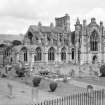
Photographs of Melrose Abbey 1866 likely taken by William Donaldson Clark. Collection held at RCAHMS
Photographic Record (1900 - 1920)
Standing Building Recording (1900 - 1905)
Recording undertaken by the National Art Survey of Scotland.
Development History (1919 - 1947)
Plans and photographs showing the improvement and development of the monastic buildings carried out by the Ministry of Works since 1919 of Melrose Abbey.
Photographic Record (1920)
Excavation (1921)
Field Visit (17 April 1924)
Field Visit (1 September 1925 - 30 September 1925)
Photographic Record (1929)
Measured Survey (1932)
Excavation (1 January 1949 - 31 December 1951)
Project (1952)
Photography and drawing undertaken for the publication of an article in the PSAS.
Field Visit (13 June 1955)
Field Visit (12 October 1955)
Photographic Survey (1955)
Photographic survey by the Scottish National Buildings Record in 1955.
Field Visit (13 February 1957)
Field Visit (29 December 1959)
Photographic Record (1960 - 1970)
Aerial Photography (1968)
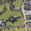
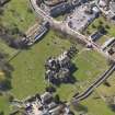
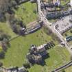
Oblique aerial photographs of Melrose, Scottish Borders, taken by John Dewar in 1968.
Field Visit (4 March 1977)
The remains of Melrose Abbey are in good condition and in the care of the DoE. (J S Richardson and M Wood 1973)
Surveyed at 1:1250.
Publication Account (1985)
The first Cistercian settlement in Scotland was founded here in 1136 by David I for Abbot Richard and his monks from RievauIx in Yorkshire. They sought fertile, open farmland in preference to the bleak and restricted promontory site of Old Melrose (NT 588340), and by 1146 the church was sufficiently complete to be dedicated to the Virgin Mary.
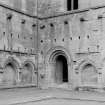
By the end of the 14th century, however, much of the original structure, small and plain in line with Cistercian views on architectural embellishment, had gone-destroyed by the English in the Wars of Independence. Some 12th century masonry survives at the west end, as well as foundations for the narrow-aisled nave and the transepts where, unusually for the Cistercians, the east walls of the latter are stepped in echelon. More or less contemporary is the 'canal', sited beyond the later Commendator's House. Led from the Tweed, it may first have provided drinking water (springs later), and certainly flushed sewers and powered the corn mill. The cloister, completed late in the 12th century and almost identical in size with that once extant in the daughter-house at Newbattle in Midlothian, was sited conveniently close to this water supply-and serviced by the surviving 'main drain'.
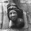
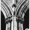
Otherwise the present church post-dates the destruction of 1385. Building continued into the 16th century but the abbey was too impoverished and it was never completed at the west end. By contrast with its predecessor it is far from austere- grandly and lavishly omamented with capitals, bosses and corbels carved with fruit, flowers and foliage, and with numerous statues. There is a most appealing range of humorous human figures around the exterior walls the cook with his ladle, the mason with his mallet, the fat monk. And flying high on a gargoyle-a bagpipe playing pig.
The reconstructed church is comparable only to Roslin Chapel (no. 58) and represents the high point of 15th century Scottish decorated architecture; the Perpendicular tracery of the eastern chapels and of the great east window which dominates the nave also shows considerable English influence, with parallels at York and Beverley. It is a starker, cooler styling than Scotland's more usual curvilinear tracery found, with northern French influence perhaps, in the south transept window.
Though resembling its predecessors in overall plan, the new church incorporated a number of chapels opening off the south aisle of the nave, many of them containing funeral monuments. And outside, the graveyard contains many interesting 17th-18th century stones, covering a wide cross-section of social groups-farmer, weaver, blacksmith, builder, mason,joiner, gardener, nurseryman, merchant, manufacturer, druggist, coal agent, watchmaker, naval lieutenant, minister, writer, surgeon, architect ....
Melrose itself has a 16th century mercat cross; and next to the Abbey, part of Priorwood Gardens (NTS) is given over to species of apple trees panning nearly 2000 years.
Information from 'Exploring Scotland's Heritage: Lothian and Borders', (1985).
Trial Trench (1991)
NT 547 342 Two trial trenches were opened to the W of the abbey, trench 1 in the garden of Abbey House and trench 2 in the adjacent car park.
Trench 1 Below turf and topsoil were several areas of metalling, comprising sub-angular and rounded pebbles, these are thought to represent a road or courtyard, the patches of different metalling being repairs.
Trench 2 Below tarmac and c1m of levelling material, comprising mostly large rubble, were further areas of cobbling, including several small iron blooms and slag.
The levels of these various areas of metalling were almost identical and, although the evidence is not conclusive, they are thought to represent the same courtyard or road surface. None of these surfaces were excavated.
A Radley 1991.
Watching Brief (15 November 1995 - 22 November 1995)
NT 5486 3417 A watching brief was undertaken by Kirkdale Archaeology at Melrose Abbey during the laying of electricity cables in November 1995. Extensive archaeological material was uncovered in the small area affected, possibly including the great abbey drain, and a post-monastic building. All features were sealed by a series of road deposits, the earliest relating to access to the brewery.
Sponsor: Historic Scotland
G Ewart and D Murray 1996
Excavation (9 February 1996 - 9 December 1996)
NT 5486 3417 A large-scale area excavation was undertaken by Kirkdale Archaeology during August and September 1996 to define the area and extent of the chapter house, to the N of the N transept and sacristy. Previous excavation in the 1920s had uncovered elements of masonry foundations belonging to the E range, in which the chapter house was located, and a geophysical survey had revealed possible wall lines beneath the presently grassed area. The excavation revealed a sequence of three successive chapter houses, from the initial 12th-century example, through a 13th-century rebuilding and culminating in the 14th-century building. The latter two saw the extension of the chapter house eastwards, whereas the initial chapter house probably sat within the E range, and extended no further E than the E edge of the N transept of the 12th-century church.
Rebuilding work within the church nave in 1610 may have seen the total clearance of the chapter house remains, since very little masonry evidence was recorded. This is also due, in part, to the lack of deep foundations ? the chapter house was founded on a level platform of redeposited river clay, on shallow founds. Further, the presence of a series of modern land drains had disturbed and truncated the monastic remains considerably. Due to the extreme lack of masonry evidence, the successive plans of the chapter house were defined by the remains of floor deposits and masonry pillar bases, alongside eaves-drip drains to the exterior of the later two buildings. Evidence for an elaborate tiled floor was recovered, and it would appear that the latter two chapter houses were both furnished with such a floor. Tentative evidence for the form and dimensions of the decorated tiled floor relating to the third and final chapter house was also revealed.
In addition, a number of graves were uncovered, relating to all three of the chapter houses. The sequence of burials and floor levels was extremely difficult to perceive, not least due to the fact that later graves had been interred over the robbed-out remains of earlier inhumations. The Chronica de Mailros reveals that a number of burials were relocated from the W to the E end of the chapter house in 1240. Most of the graves had been disturbed, either by the 1921 excavation or previously, and the human remains were poorly preserved. No skeletal material was removed.
Of much public interest (but of less archaeological significance) was the find of a lead cylinder, containing a medieval, cone-shaped lead casket. Originally uncovered in 1921, this was thought to be the casket containing the heart of King Robert I, whose dying wish was that his heart be taken on Crusade, and thence returned to Scotland, to be buried at Melrose. It is likely that the heart was moved from a more suitable location (at the high altar) to the chapter house during the substantial rebuilding works of the 14th century.
Excavation (1 August 1997 - 31 August 1997)
NT 548 341 Further excavations were undertaken at Melrose Abbey in August 1997, following on from work on the chapter house conducted in the summer of 1996 (Ewart and Murray 1996). The intention was to further investigate the area of the chapter house and also two anomalies noted during the geophysical survey conducted in 1996. Five trenches in total were opened. The first trench was opened over a sub-circular anomaly to the W of the lay brothers' range, shown on the 1st edition OS map as the site of a tree. A deep pit, possibly a tree hole, was revealed, cut through 19th-century terracing deposits. A further three trenches were opened over the bank to the S of the site of the chapter house, revealing a monastic roof-shed drain along the line of the former chapter house S wall. Further evidence for the pits revealed in 1996, representing the robbing of the Period I chapter house floor, was also uncovered, confirming their relationship to the monastic, rather than post-monastic, use of the site. The findings have enlarged the understanding of the floor evidence in that a convincing relationship between the drain, defining the S side of the chapter house before the extension of the church, and the 15th-century N transept was revealed. A further trench was opened over a linear anomaly beside the Lavatorium, proving to be a 1920s planting bed.
Watching Brief (18 November 1997)
Kirkdale Archaeology were asked to inspect and record a trench already excavated by the Historic Scotland squad, to the S. W. of the abbey, next to the toilets, the provision of access for which was the reason for the excavation. A number of architectural fragments and hand made floor tiles had been reported from this trench.
A surprisingly long sequence was observed in this trench. Unfortunately the artefacts were from a fairly modern horizon, with (004) sealing surface (005), and probably providing a foundation for surface (001), likely to be related to the construction of the toilet block. Cobbles (005), themselves resurfaced in Tarmac, and so at least exposed into modern times, post date wall (012). As they directly sealed probable wall construction cut (007), this surface may have been built shortly after this wall was constructed. (008), (009), (010) and (011), all apparently post dating wall (013), may represent dumps of levelling material.
Sponsor: Historic Scotland
G Ewart 1997
Kirkdale Archaeology
Watching Brief (21 November 1997)
The project comprised the monitoring of excavation of a service track. The trench was dug as per the specification, and comprised a narrow cutting (500mm wide and up to 600mm deep) which ran for a total distance of c. 26 m immediately W of Cloister House on the raised terrace adjacent. The entire sequence of deposits to the limit of excavation reflected post-Monastic made-up levels for Cloister House access and front garden. One fragment of iron cooking pot was retrieved, along with 19th-century sherds, none of which were retained. It was noteworthy that this terrace comprised redeposited clays at a depth of 300-600 mm below present ground level, and may in part be derived from Monastic terracing. Evidence of more recent renovation work on Cloister House, and for the laying out of the present rose beds etc. was found in the form of a grey sandstone kerb stone marked ‘J Pringle, 1931’. The present ground level is defined by mature yew trees and this horizon is associated with the 18th-century landscaping contemporary with the building of Clositer House. One fragment of moulded stone (pink reddish sandstone) from the Abbey was retrieved, and this has been stored with the stone collection to the rear of Cloister House. Various unmarked services were uncoveredtoward the N of the cutting, including power cable and gas pipe.
Sponsor: Historic Scotland
G Ewart 1997
Excavation (1 December 1998 - 31 January 1999)
NT 5486 3417 Excavations were carried out over December 1998 and January 1999 on the site of the presumed Lay Brothers Cloister. Ten trenches in total were excavated, nine within the gardens and a single trench in the area to the E of Abbey Street, against the interior W perimeter wall of the abbey itself. A magnetometer survey had revealed possible wall lines in the area of the gardens to the N of Abbey House. The magnetometer survey also indicated a possible wall line running E-W below the current Abbey Street, indicating a possible continuation further westwards of buildings presently confined to the enclosed abbey grounds.
Excavation around the lawn and flowerbeds of the ornamental garden located potential abbey masonry in one trench, situated on the E edge of the garden against the inside face of the Abbey Street W wall. The other seven trenches exposed a variety of drainage and landscape features, some of which may be early in date. The principal structure on the site was a large, rubble-filled trench running diagonally across the site from SW-NE, which may be a robbed-out wall line backfilled with rubble, but could also be the principal subsoil drain for the ornamental garden. An E-W cut located in two trenches could be the edge of a scarped terrace of monastic period, of which the general level of 86m OD would represent the upper terrace. It was noted that the only early finds were from below the edge of this terrace.
The single trench within the abbey grounds indicated that the 1m of later deposits found W of Abbey Street had been completely cleared away in building clearance works E of Abbey Street, with the result that the turf lies directly on the natural subsoil in this area. It was, however, noted that the level of the subsoil exactly matched the 86m OD found on the possible terrace W of Abbey Street, and appears to be part of the same levelled surface. Additionally it became clear that the column bases found in the chamber adjacent to Abbey Street do not continue to the W and that the late road wall at the W end of the columned chamber sits on the original W wall of the chamber. The range to the W of the abbey did not therefore continue beneath Abbey Street, as the magnetometer survey results may have suggested.
A small trench placed to the E of the gable end of Abbey House located masonry directly below the gravel driveway, indicating that the original guest house extended further W.
Watching Brief (23 March 1998)
NT 5486 3417 A watching brief was carried out at Melrose Abbey (NMRS NT 53 SW 30) in March 2000 during a programme of cable trenching. The work consisted of excavating a narrow, 300mm deep trench over a distance of 91.4m, externally and within the abbey church. The whole of the trench was hand-dug, with archaeological monitoring covering the section of excavations within the church.
It is known that the interior of the church was extensively cleared and landscaped in 1923, and presumably much of the levelling material located in the trench sections would date from that period. A soil layer located throughout the church might be an early natural accumulation of soil over a thin layer of demolition debris, which was in turn sealed over in the 1920s by red sandstone waste material.
Field Visit (1998)
NT 5486 3417 A trench already excavated by the Historic Scotland squad, to the SW of the abbey, was recorded. A number of architectural fragments and hand-made floor tiles had been reported from this trench.
A surprisingly long sequence was observed in this trench, including a cobbled surface, a wall footing and the wall construction cut. Other deposits, all apparently post-dating the wall, may represent dumps of levelling material.
The architectural fragments are evidently from the abbey, the large number of hand-made floor tiles are likely to be from the same source.
Publication Account (1998)
Melrose is dominated by the buildings of its historic past-the Cistercian abbey and complex figures 5 & 10 (see also area 1). Although partially destroyed by time and human wilfulness, restoration work in the nineteenth and twentieth centuries has not only highlighted the beauty of the ruins, but also brought a clearer understanding of the original functions of the various parts of this fine medieval monastery.
A section of the west wall figure 20.L is all that remains of the first church built by Abbot Richard and his twelve monks, dedicated in 1146. In 1385, Richard II destroyed the twelfth-century church, ‘saving nothing and burning down with the fiery flames God's temples and holy places, to wit the monasteries of Melrose, Dryburgh and Newbattle'.
The work of rebuilding the abbey began within a few years of its destruction probably with the active support of Richard II. Architectural evidence suggests that English masons were participating in this work, but that responsibility for the building work later passed to masons influenced by the European tradition. The tracery in the south transept window and in the south aisle chapels, for example, suggests that the original English masons had been replaced by others influenced by French fashion. Part of the south transept was the responsibility of the French master mason, John Morow. An inscription on the west wall of the south transept, now removed to the Commendator's house for safe-keeping, and another, still in situ, refer to this master-mason. The first reads: '.John Morow sometimes called was I and born in Paris certainly and had in keeping all the mason work of St Andrews, the high kirk of Glasgow, Melrose and Paisley, of Nithsdale and Galloway. I pray to God and Mary both and sweet St John to keep this holy church from harm'; and the second: '.As the compass goes evenly about, so truth and loyalty shall do without doubt. Look to the end quoth John Morow.'
The work of reconstruction continued throughout the fifteenth and into the sixteenth century; and Melrose Abbey re-emerged as one of the most magnificent in Scotland figure 10, even though work petered out inconclusively as it approached the west end, the existing front not being entirely demolished. The western part of the nave was for the use of the lay brothers, who appear to have disappeared from the order sometime in the fifteenth century. It was perhaps for this reason that the necessity to complete the western section had become less urgent.
The other conventual buildings stood to the north of the church, an unusual location for a Cistercian establishment, perhaps determined by the water supply, the River Tweed, to the north. Ruins of these buildings also attest to the splendour of the complex. These consisted of the cloister figure 20.B, which was an open garth, probably laid out as a garden, surrounded by covered walkways. Near the east processional door to the church the surviving walls indicate that they were elaborately arcaded and had stone benches. An east range 20.M, which partially survives, contained the sacristy, immediately to the north of the church. This was where vestments, altar frontals and other pertinents of church service were kept. Next to this was the chapter house 20.N, where the monks met every morning to listen to a chapter of the Rule, discuss monastic business and confess to failings and misdemeanours. It was here, also, that important burials took place figure 9, perhaps the most noted being that of St Waltheof. Other offices abutted, probably the inner parlour, where there was limited conversation, perhaps a novices' day room and a latrine block, all of which were under the monks' dormitory, which ran along the full length of the east range, on the first floor. There is now no evidence of this last.
Information from ‘Historic Melrose: The Archaeological Implications of Development’ (1998).
Archaeological Evaluation (1998)
Kirkdale Archaeology was required to advise on the location of the reburial site in the Chapter House for the Heart of Bruce. Initial plans to rebury the casket close to where it was found in 1996 were abandoned due to the archaeological sensitivity of the area, in favour of one of the shallow floortile beds, previously excavated to primary terrace level. The area was duly marked out and de-turfed in advance of full excavation by Historic Scotland. No finds were retained.
Kirkdale Archaeology, 1998
Watching Brief (13 April 2000 - 15 April 2000)
A watching brief was carried out at Melrose Abbey (NMRS NT53SW 30)while Historic Scotland personnel carried out a programme of cable trenching. The work consisted of excavating a narrow trench 220mm wide and 300mm deep over a distance of 91.4m. The trench consisted of two sections, a section external to the abbey church with a length of 55.4m, and a section within the abbey church with a length of 36m. The whole of the trench was hand dug, with archaeological monitoring covering the section of excavations within the church. The section of trench outside the church had already been excavated prior to the arrival of the supervising archaeologist but could still be examined for exposed structural elements.
It is known that the interior of the church was extensively cleared and landscaped in 1923, and presumably much of the levelling material located in the trench sections would date from that period. A soil layer located throughout the church might be an early natural accumulation of soil over a thin layer of demolition debris, which was in turn sealed over in the 1920s by red sandstone waste material. The absence of graves across most of the church may simply be due to the shallowness of the trench cut assuming the interior of the church was used as a place of inhumation.
Sponsor: Historic Scotland
D Stewart 2000
Kirkdale Archaeology
Watching Brief (26 June 2000)
NT 5486 3417 The excavation of wall foundation trenches was monitored in June 2000 in advance of a new service room extension to the S gable of Orchard Cottage. The general area has seen several episodes of archaeological assessment and recording, none of which have revealed any structural remains associated with the abbey and its assumed precinct buildings. The present Orchard Cottage (dated to 1998) appears to fall within Capt. Steadman's Orchard, as shown on John Wood's 1826 plan of Melrose and Gattonside.
The finds from the upper deposits suggest cultivation towards the end of the 19th century, but the generally clean aspect of the lower fill suggests redeposited natural soils, imported to form the garden once the boundary walls were in place. The walls themselves do not appear to be part of the earliest settlement of the abbey (12th to late 14th century) and may be better regarded as part of a later period of land use, where extensive gardens and orchards were laid out at a time when the 13th-century abbey community had been reduced in size and the abbey plan rationalised.
Sponsor: Historic Scotland
G Ewart 2000
Kirkdale Archaeology
Watching Brief (1 November 2004 - 31 January 2005)
NT 548 341 A watching brief was maintained throughout groundbreaking works associated with the installation of a new
gas mains in Melrose between November 2004 and January 2005. The work was conducted within the Scheduled area of Melrose Abbey (NT53SW 30). Excavations for the gas mains took place on Cloisters Road, Abbey Street, St Mary's Road, and within the grounds of Abbey House (Abbey Place).
The excavations on Cloisters Road revealed a number of walls that correspond in plan to the abbey remains on the N and S side of Cloisters Road. These include the great hall, the refectory and the parts of the cloisters complex. As well as these known buildings, two walls that do not relate to any of the visible features in the abbey grounds were uncovered at the W end of Cloisters Road.
Excavations on Abbey Street revealed sections of standing walls and a probable medieval culvert. No archaeological features were uncovered during the excavations on St Mary's Road or Abbey Place.
Archive to be deposited in NMRS.
Watching Brief (10 September 2007)
NT 548 342 After the excavation of a grave for the burial of the Duke of Buccleuch close to the external NE corner of Melrose Abbey Church, a brief archaeological examination was undertaken on 10 September 2007. Two main layers were visible, suggesting two phases of activity, thought to be building and/or construction, between which was a narrow layer which may have been levelling over the earlier phase.
Archive to be deposited with RCAHMS.
Funder: Historic Scotland.
OASIS Id: kirkdale1-249648
Watching Brief (2008)
NT 54850 34121 A watching brief was kept on the excavation of two burials in the Abbey in 2008. Plot one revealed very shallow interments at 0.5m deep, which limited the depth of the headstone. This area was levelled in 1890 and this probably accounts for the shallowness of the interments. Several pieces of Ploughlands sandstones were recorded, as were pieces of Caithness slab. Three pieces show signs of having been subjected to fire. No significant archaeology was found.
NT 54923 34136 Plot two revealed several pieces of worked Ploughlands sandstone from the Abbey, clearly showing tooling marks, one is from a sculpted piece. One whetstone was recovered from a depth of 0.625m. No significant archaeological features were recorded.
Archive: Artefacts – James Crawford
Funder: Crawford Family, Melrose
James Crawford
Watching Brief (18 May 2009)
NT 548 342 (centred on) Six trenches were excavated in and around Melrose Abbey on 18 May 2009 to allow the installation of new information panels. Although there were no datable finds, some features seen were thought to relate to a period of levelling and landscaping prior to the Abbey’s construction, while others may have been remnants of paths or surfaces associated with the earliest phases of construction and occupation of the Abbey. In addition, more recent deposits and features were seen, probably the result of landscaping and consolidation from the Victorian period onward.
Archive: RCAHMS (intended)
Funder: Historic Scotland
Alan Radley – Kirkdale Archaeology
OASIS Id: kirkdale1-249690
Audits (May 2014)
NT 54848 34177 These stones, which were assessed in May 2014, form a group of additions to the existing carved stone database. Seven of them were excavated by CFA Archaeology Ltd, and were catalogued at their warehouse. The remainder are located in Historic Scotland’s store in Edinburgh. Most of the stones in this group are unremarkable, with cylindrical column shafts and a vault rib included among the collection. One fragment of a column capital is worked in medium grained sandstone, and comes from the upper edge of a waterleaf capital, with just the tip of a fleshy leaf now remaining. This and other inventories of carved stones at Historic Scotland’s properties in care are held by Historic Scotland’s
Collections Unit. For further information please contact
hs.collections@scotland.gsi.gov.uk.
Mary Markus - Archetype
(Source: DES)
Watching Brief (17 November 2014 - 27 November 2014)
Under the terms of its PIC call-off contract with Historic Scotland, Kirkdale Archaeology was asked to undertake an archaeological watching brief at Melrose Abbey during excavations in the western portion of the nave. The work was intended to locate the positions of the original nave piers and their connecting walls ahead of their demarcation with wooden panelling held in place by wooden stakes hammered into the ground. The space created would then be filled with gravel over a geotextile membrane1. The purpose of the archaeological watching brief was to ensure no adverse effect on potential archaeological horizons by the emplacement of the stakes.
G Ewart 2014
Sponsor: Historic Scotland
Kirkdale Archaeology
OASIS Id: kirkdale1-311398
Trial Trench (November 2018)
NT 54885 34204 The excavation of a tree pit for the planting of the new Buccleuch Apple Tree was carried out by CFA Archaeology Ltd at Melrose Abbey, Scottish Borders, as part of the Minor Archaeological Services Call-off Contract. No archaeological features, deposits or artefacts were uncovered during the hand excavation of the tree pit.
Information from J. Musgrove - CFA Archaeology Ltd, 2018.
(Source: DES Vol 20)
OASIS ID: cfaarcha1-336116
Watching Brief (18 November 2020)
NT 54855 34189 A watching brief was conducted during ground- breaking work below four broken sandstone slabs outside the doorway into the North Aisle at Melrose Abbey. The fill of an underlying drain was removed and the drain replaced during this work. No significant archaeological features or deposits were observed or disturbed.
Information from I. Suddaby – CFA Archaeology Ltd, 2020.
(Source: DES Vol 22)
OASIS ID: cfaarcha1-408382
Sbc Note
Visibility: Upstanding structure, which may not be intact.
Information from Scottish Borders Council.


