Pricing Change
New pricing for orders of material from this site will come into place shortly. Charges for supply of digital images, digitisation on demand, prints and licensing will be altered.
Inveresk, Musselburgh, Roman Fort
Roman Fort (Roman), Vicus (Roman)
Site Name Inveresk, Musselburgh, Roman Fort
Classification Roman Fort (Roman), Vicus (Roman)
Canmore ID 53919
Site Number NT37SW 8
NGR NT 342 720
Datum OSGB36 - NGR
Permalink http://canmore.org.uk/site/53919
- Council East Lothian
- Parish Inveresk (East Lothian)
- Former Region Lothian
- Former District East Lothian
- Former County Midlothian
NT37SW 8.00 342 720
See also NT37SW 9 and NT37SW 13.
(NT 342 720) ROMAN FORT (R) (site of)
OS 6" map (1968)
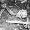
NT37SW 8.01 NT 342 720 Roman pottery; iron chain; quern
The following records have been re-allocated to NT37SW 1235 Inveresk Vicus
NT37SW 1235.02 (formerly NT37SW 8.02) NT 3431 7201 Watching Brief
NT37SW 1235.01 (formerly NT37SW 8.03) NT 343 719 Excavation; watching brief
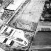
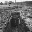
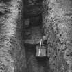
Inveresk Roman fort, known since at least the 18th century, was trenched by Richmond in 1946 and 1947 (OS 25" map annotated by I A Richmond, 20 October 1945) (TS excavation report in Ashmolean Museum, 1946-7).
He established the line of the 22' wide rampart on the N, W, and S, giving external measurements of 480' N-S by 595' to 615' E-W, with the main entrance facing W. The line of the E rampart could be only approximately determined as trenching was not feasible - part of it lay under graves. An external ditch surrounded the fort. Traces of stabling would appear to indicate cavalry.
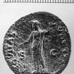
There was clear evidence for two Antonine periods of occupation but nothing to indicate a third phase. An As of Vespasian (69 - 79), found in the garden of Inveresk House in approximately 1931, would also appear to indicate a Flavian occupation. (See NT37SW 13 - Bath-house).
G Macdonald 1918; J Roman Stud 1947; 1948
No trace.
Visited by OS (JLD) 8 December 1953
Two pieces of Samian ware found when digging graves in the W part of St Michael's Kirk graveyard. Now in the National Museum of Antiquities of Scotland [NMAS].
K A Steer 1968
A fragment of a possibly 3rd c mortarium was among material discovered by chance mostly in the W extension of the graveyard.
G S Maxwell 1970
One of the most extensive and possibly the best preserved extramural settlements in Roman Scotland is indicated by the results of a short excavation in 1971 in a paddock lying due S of St Michael's Kirk and 190m E of the Antonine fort. A number of items of Roman material had been discovered just below modern turf-level in the area in 1970. A stretch of road heading for the E gate of the fort was also found.
G S Maxwell 1971
OS (JLD) confirmed.
Visited by OS (BS) 15 August 1975
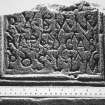
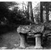
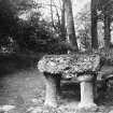
NT 342 721. The lower half of a Roman altar and two carved stones were discovered during grave-digging in the West Kirkyard of St Michael's Inveresk. The find spot lies within the praetentura of the Roman Cavalry Fort located by Sir Ian Richmond. The altar is in good condition, although broken. It bears two inscriptions, one cut on top of the other. The other stones recovered from the grave were fragments of small pillars of pentagonal cross-section, one bearing a simple capital.
G Maxwell 1977
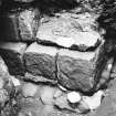
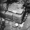
Five small trenches were excavated at NT 345 722 and Roman features were uncovered in three. In one a square-sectioned ditch, possibly a robber trench, was found. The fill was rich in finds including butchered animal bone of both wild and domesticated species and pottery, much of it decorated, including sherds of Samian, Black Burnished ware, amphorae and tile. Also found were fragments of "Opus Signinum" floor plaster. The second area contained the foundations of a substantial stone wall. It was at least 1m wide, although it had been robbed on the east face; it was built of stone blocks 40cm by 15cm by 10cm and had a small foundation buttress. The foundations were covered by rubble either from its demolition or as a base for floor layers. This was capped with an "Opus Signinum" floor layer, broken up by root activity. Built onto this was a wall of thin, square, apparently Roman bricks. Since foundation buttresses are usually on the outside of walls all the other features would seem to have been secondary to a main stone building.
The third area contained an apparent continuation of the stone wall with similar construction except for the top course, which consisted of one massive block 78cm by 64cm by 40cm. The wall terminated here, but since it was robbed on the east side it may well have originally turned a corner in that direction.
Sponsor HBM.
I Rogers 1990.
Two seasons of rescue excavation by GUARD have now taken place at St Michael's Churchyard, Inveresk, on this Roman auxiliary fort site. Work preceded the extension of the cemetery by East Lothian District Council, into the field immediately outside the cemetery wall at its western extremity. Richmond calculated that the western defences of the fort should run obliquely through this field, aligned roughly NE to SW. Both trenches, the first opened in April and May 1991, the second in March 1993, measured c25m by 20m and were located contiguously just within the putative line of the fort defences.
The state of preservation encountered in both seasons complemented and confirmed observations made by Hanson (Hanson 1984) following exploratory trenches opened in this field in 1981. In general, structural remains associated with the occupation of the fort were found to survive in a reasonable state of repair in the northern half of the 1991 trench; the southern half of that trench by contrast contained only scant remains, and these in a poor state of repair; the 1993 trench was found to be largely devoid of remains, save for a series of pits and several patches of rough cobbling plus one roughly flagged area (see further below). This situation may be related to the differences in topsoil depth recorded across the two trenches, being greatest to the N and E where survival is best, and slightest to W and S where survival is poorest. Consequently one might anticipate reasonably good survival in the northern half of the field, which remains unexplored.
The 1991 excavation uncovered a stretch of some 20m of the via praetoria, as it approached the W gate of the fort, together with its junction with the via sagularis and a distance of some 20m of that road. The well-laid cobbled sub-surface of the via praetoria ran across the full width of the trench, bordered in places by dressed kerb stones. It was c7.50m wide and when sectioned was found to survive only to the depth of one or two layers of cobbles towards the E, and two or three layers to the W. The via sagularis by contrast survived poorly, having been completely robbed out or badly disturbed at several points along the exposed length. Consequently its width could only be estimated, at c5m or perhaps a little more, and its depth, where surviving was no more than that of the visible stones. Both it and the via praetoria were disturbed by a large pit which seems likely to have been cut in antiquity (see below) at the point where the two roads meet. Stratigraphic evidence encountered on the via praetoria suggests at least two phases of road building activity, one layer of road cobbling having been found to run under the in situ kerb stones on both sides of the road.
Evidence for two phases of occupation was also provided by the stratigraphic sequence recovered at the W gate. Although only partially revealed during the excavation, the remainder lying outwith the excavation area, traces of mortared stone construction were uncovered on the S side of the road, presumably representing the foundation levels of a gate structure. Also found were two square-cut pits, one adjacent to and S of the road, the other centrally placed within it. Each was filled with carefully-laid alternate layers of clay and cobbles, and though neither pit lay fully within the excavation trench, their dimensions are likely to have been c1.25m by 1.25m. These presumably represent the foundations of a gate superstructure, providing firm bases in the loose sand subsoil to take the weight of large uprights; a third example presumably lay on the N side of the road, again outside the excavated area. The position of the central example, sealed beneath the undisturbed uppermost surviving layer of road cobbling, adds weight to the contention of more than one phase of occupation.
The fort interior, as exposed in both trenches, proved to be largely empty. The adverse effects of past cultivation were evident through the lines of plough marks visible on the cleaned surface and the scarring detectable on numerous pieces of dislodged building masonry, as well as the kerb stones of the via praetoria. No trace of the presence of negative features indicative of the foundations for wooden barrack blocks or other rectangular-plan buildings was evident on the cleaned surfaces and even deep, cross-site sections cut well into the natural subsoil in both seasons failed to reveal any indication of post holes or post-trenches. It is possible that these may have existed as highly-truncated features, which were missed and removed during cleaning (see also Hanson 1984), though the level at which cleaning took place was commensurate with that of the surviving road. It is perhaps more likely that no wooden structures existed in the areas opened. Certainly, the considerable quantities of masonry debris found across the site suggest that building in stone may have been more prevalent here than has previously been supposed.
What little structural evidence there was within the fort interior is all of debatable provenance. One area exposed in the 1991 trench, close to the S edge, and measuring approximately 3.50m E to W by 2.50m N to S, may represent an occupation surface. Here an irregular patch of stone flagging incorporating two quernstones, and possibly associated with a line of three dressed masonry blocks, was found in a heavily disturbed state. Considerable quantities of Roman material were recovered from this area, but mixed in with modern finds and topsoil; no finds came from securely stratified contexts. It is possible that this relates to a post-Roman site occupation. A similar patch of stone flagging was uncovered at the southern end of the 1993 trench; of similar extent, this too had suffered considerable distubance and insecurely stratified finds ranged in date from Roman to modern.
Evidence for the possibly deliberate destruction/demolition of the fort was presented by a large pit which had been cut through both roads (noted above) and which measured up to 3.60m in diameter, and a maximum of 1.70m deep. The upper half of the fill was packed with Roman masonry, and a few sherds of Roman pottery were recovered from different levels throughout the feature, including one from near the bottom. This, coupled with the lack of any modern material from the pit fill, suggests, though does not prove, that it was dug in antiquity. Several smaller pits, on average between 1.50m and 2m in diameter by on average 1m deep were encountered scattered across the area opened in 1993. Some of these also contained quantities of animal bone. All were discrete features cut into the natural sand and lacked any telling stratigraphic relationships.
Small find recovery was high, as would be expected on such a site, though at least half of the material came from the surface or the topsoil. Preliminary examination of the pottery suggests nothing inconsistent with an Antonine occupation date.
Sponsors: East Lothian District Council, Historic Scotland
A Leslie 1993.
Excavation (by Derek Alexander CFA) in advance of house-building, at NT 348 721, revealed a segmental ditch, 1.2-1.3m wide and 0.5-0.8m deep, on an E-W alignment over a distance of 24m; the ditch and adjacent pits yielded samian and coarse wares, together with some prehistoric and medieval pottery.
L J F Keppie 1995
NT 341 720 Excavations previously carried out by Richmond (PSAS 1978), Hanson (1985) and Leslie (unpublished) confirmed the presence of a fort on this site and yielded some details of its position and form. Richmond calculated that the W defences should run obliquely NE-SW through the field to the W of the church where Leslie excavated in 1993. It was in this field in 1996 that geophysical survey using seismic, magnetic and electrical techniques was undertaken.
The seismic survey produced no archaeologically relevant results. The resistivity and magnetic surveys both showed linear anomalies orientated NE-SW across the field which correspond to the postulated position of the defences.
Sponsor: Glasgow University Archaeology Department
L Baker, P Johnson and D Smythe 1996
NT 3430 7197 An archaeological evaluation was carried out in November 1996 within the grounds of St Michaels House in response to a proposal to construct a domestic dwelling across the southern alignment of the rampart and external ditch of the Roman fort. Previous archaeological work had located the ditch some 10-15m W of the current excavations and had suggested that in the evaluation area all upstanding remains of the Roman occupation had been totally removed and that no ditch existed.
Three parallel trenches were opened within and immediately adjacent to the site of the proposed building. No traces of the defences of the Roman fort were identified; the ditch must either not survive (unlikely given its scale), follow a different alignment, or never have been excavated in this area. Three features were identified, comprising a modern pit, a tree stump in a pit, and an alignment of stones.
A full report has been lodged with the NMRS.
Sponsor: Mrs E Raistrick, St Michaels House.
J Hamilton 1997
NT 3425 7201 An archaeological evaluation was undertaken in January 1998 in advance of a proposed development. Previous archaeological work suggested that the study area lies inside Inveresk fort ditch and overlies at least part of the fort rampart and intervallum road (Richmond 1981). Archaeological work carried out in November 1996 within the grounds of St Michael's House, immediately S of the current development, failed to find any trace of the fort (Hamilton 1997).
The study area was defined by the proposed foundation footprint of a double garage and wall within the garden of St Michael's Coach House. An area of rough, intermittent cobbling and a small area of discontinuous paving were recorded. Immediately overlying the cobbled surface a single sherd of Inveresk ware was recovered. At the southern limit of the paving a deposit of coarse orange/brown gravels was revealed. A small rim sherd of plain samian ware was found in the western garage wall foundation trench.
Towards the northern end of the wall foundation trench a test-pit, dug to a depth of 1.3m, encountered no indication of the natural subsoils, possibly indicating a ditched feature here.
Sponsor: Mr J Proudfoot.
J Hamilton 1998
NT 341 720 (centre) In January 1999 a third season of rescue excavations was undertaken in advance of a further extension to the cemetery of St Michael's Church within the site of the Roman auxiliary fort at Inveresk.
The work demonstrated the variable survival, within the field, of the structures which comprised the SW end of the fort, including internal roads and drains, a small portion of the W gate, basal levels of the fort rampart, stone-built ovens and parts of internal buildings (most probably barrack blocks) of different constructional methods.
Evidence exists to demonstrate, beyond doubt, at least two quite distinct constructional phases of the fort, on slightly different internal plans, with further indications which hint at further sub-phases of repair work or modifications. (GUARD 36).
Sponsor: East Lothian Council.
A Leslie and R Will 1999
NT 3410 7218 to NT 3409 7198 Prior to site investigation works, nine 1m2 archaeological test pits were excavated immediately within the western boundary of the Scheduled area of Inveresk Roman fort (NMRS NT37SW 8). The surface of the upper fill of the western ditch was located within one test pit, with possibly an analogous deposit representing an additional negative feature identified in an adjacent test pit. Neither of these features was excavated. No significant archaeological features were encountered elsewhere.
Sponsor: Life Securities Ltd.
J Gooder 2001
NT 341 720 (centre) Between September 2000 and February 2001 a fourth and final season of rescue excavations were undertaken in advance of a further extension to the cemetery of St Michael's Church within the site of the Roman auxiliary fort at Inveresk, near Musselburgh.
In previous seasons only small areas were excavated to allow the modern cemetery to expand; in this instance it was decided to undertake full open excavation of the remaining portion of the field. For logistical reasons the site was divided into two areas: the first area was to the N and measured 40 x 40m; the second area to the S measured 80 x 25m.
The survival of archaeological remains was greater in the first area which included the largest portion of the interior of the fort and was protected by deep topsoil. In the second area, where the topsoil cover was not so great, the archaeological remains had been quite badly damaged by ploughing.
The first area represented the NW corner of the fort and included the ditch, rampart base, intervallum road, and the remains of several buildings and features including stone oven bases and stone-built drains. The second area was largely outside the fort but included part of the intervallum road, rampart base, gateway and ditches. While excavating the gateway a second ditch was discovered that joined to the first ditch with defensive spurs covering the gate and rampart. The western gateway to the fort survived as squared masonry foundations with a stone revetting wall along the front of the rampart.
The buildings in the interior of the fort were represented by post-holes and foundation trenches. Evidence exists for at least two quite distinct constructional phases of the fort, on slightly different internal plans, with further indications which hint at sub-phases of repair work or modifications. The phases were clearly demonstrated by two road surfaces, one on top of the other, but with different widths and alignments. The later road also sealed post-holes and pits relating to buildings from the earlier phase.
Several prehistoric features were also investigated, and pottery and flints were recovered. (GUARD 36).
Sponsor: East Lothian Council.
A Leslie and R Will 2001
Excavation (1946 - 1947)
Trenched by Richmond in 1946 and 1947 (OS 25" map annotated by I A Richmond, 20 October 1945) (TS excavation report in Ashmolean Museum, 1946-7). He established the line of the 22' wide rampart on the N, W, and S, giving external measurements of 480' N-S by 595' to 615' E-W, with the main entrance facing W. The line of the E rampart could be only approximately determined as trenching was not feasible - part of it lay under graves. An external ditch surrounded the fort. Traces of stabling would appear to indicate cavalry.
There was clear evidence for two Antonine periods of occupation but nothing to indicate a third phase. An As of Vespasian (69 - 79), found in the garden of Inveresk House in approximately 1931, would also appear to indicate a Flavian occupation. (See NT37SW 13 - Bath-house).
I A Richmond
Field Visit (8 December 1953)
No trace.
Visited by OS (JLD) 8 December 1953
Field Visit (15 August 1975)
OS (JLD) confirmed.
Visited by OS (BS) 15 August 1975
Excavation (1 January 1976 - 31 December 1976)
Excavations outside the Roman fort at Inveresk revealed an extensive and well-established civilian settlement extending along the ridge to the east of the fort and beneath the present village. Four main phases of activity were identified, the middle two corresponding to the two periods of the Antonine occupation of Scotland. An earlier phase of activity was represented by a characteristic V-profiled ditch for which no direct dating evidence existed but which may indicate the presence of a pre-settlement Roman enclosure in the vicinity. A buried turf-line directly overlying the early deposits suggested a period of abandonment over part of the site at least. The foundation trenches of a timber building surrounding a stone-built furnace and a second timber structure, which had been burnt to the ground, comprised the structural elements of 2nd phase of activity with a third phase seeing further rebuilding of the site on a much grander scale
with massive timbered buildings and one stone building, all set in a regular grid separated by cobbled lanes and roads.
Post-Roman deposits were confined to late medieval and modern activity and were characterized by pits, a few stretches of stone walling and general disturbance over the northern part of the site. These deposits were too shallow and disturbed to permit any stratigraphic separation. The majority of the finds suggest the largely domestic nature of the site, although the furnace and various pieces of industrial debris clearly indicate some form of industrial activity. In particular, the analysis of a type of pottery characteristic of the site demonstrated its origin in the area and probably on the site of Inveresk itself. The suggestion is put forward that the excavations have uncovered part of the potter's workshop. Further information was also gathered concerning the subsistence economy and exchange networks
G D Thomas 1989
Excavation (1 January 1977 - 31 December 1977)
Excavations outside the Roman fort at Inveresk revealed an extensive and well-established civilian settlement extending along the ridge to the east of the fort and beneath the present village. Four main phases of activity were identified, the middle two corresponding to the two periods of the Antonine occupation of Scotland. An earlier phase of activity was represented by a characteristic V-profiled ditch for which no direct dating evidence existed but which may indicate the presence of a pre-settlement Roman enclosure in the vicinity. A buried turf-line directly overlying the early deposits suggested a period of abandonment over part of the site at least. The foundation trenches of a timber building surrounding a stone-built furnace and a second timber structure, which had been burnt to the ground, comprised the structural elements of 2nd phase of activity with a third phase seeing further rebuilding of the site on a much grander scale
with massive timbered buildings and one stone building, all set in a regular grid separated by cobbled lanes and roads.
Post-Roman deposits were confined to late medieval and modern activity and were characterized by pits, a few stretches of stone walling and general disturbance over the northern part of the site. These deposits were too shallow and disturbed to permit any stratigraphic separation. The majority of the finds suggest the largely domestic nature of the site, although the furnace and various pieces of industrial debris clearly indicate some form of industrial activity. In particular, the analysis of a type of pottery characteristic of the site demonstrated its origin in the area and probably on the site of Inveresk itself. The suggestion is put forward that the excavations have uncovered part of the potter's workshop. Further information was also gathered concerning the subsistence economy and exchange networks
G D Thomas 1989
Trial Trench (31 March 1981 - 30 April 1981)
The possibility of a further extension of the cemetery prompted a reassessment of the archaeological potential of this area and the author was invited by the SDD (Ancient Monuments) to undertake an excavation over one week in April 1981. Given the noticeably higher ground level in the market garden compared with that within the cemetery, it seemed strange that archaeological survival in the former should have been so poor by comparison. Yet Richmond was quite categorical in writing off the area as archaeologically barren. Under the circumstances it was decided to place several trial trenches across that part of the field where buildings would have stood, but away from the cemetery wall where Richmond had excavated, in order to test the survival of Roman remains before any commitment was made to work on a larger scale.
Richmond's dismissal of the market garden area can now be seen to be something of an overstatement. Although Roman levels in the S half of the field do seem to have been removed, survival in the N part was rather better than might have been expected. Consequently, larger
scale work in this area ought to produce useful evidence of the internal organization of this important fort. The trial excavation confirmed that
there were two periods of occupation, both of Antonine date, with perhaps a slight reduction in the internal area of the fort in the latter. It also demonstrated that not all the buildings in the interior were stone built as had previously appeared to be the case.
WS Hanson 1985
Excavation (April 1991 - May 1991)
During April and May 1991 GUARD undertook a rescue excavation at St Michael's Churchyard, Inveresk in advance of the extension of the cemetery by East Lothian District Council, into the field immediately outside the cemetery wall at its western extremity. Richmond calculated that the western defences of the fort should run obliquely through this field, aligned roughly NE to SW. A trench measuring c25m by 20m and located contiguously just within the putative line of the fort defences was opened. The excavation uncovered a stretch of some 20m of the Via Praetoria, as it approached the W gate of the fort, together with its junction with the via sagularis and a distance of some 20m of that road. The well-laid cobbled sub-surface of the via praetoria ran across the full width of the trench, bordered in places by dressed kerb stones.
Information from A. Leslie (GUARD) 1993.
Excavation (31 January 1993 - 28 February 1993)
Two seasons of rescue excavation by GUARD have now taken place at St Michael's Churchyard, Inveresk, on this Roman auxiliary fort site. Work preceded the extension of the cemetery by East Lothian District Council, into the field immediately outside the cemetery wall at its western extremity. Richmond calculated that the western defences of the fort should run obliquely through this field, aligned roughly NE to SW. Both trenches, the first opened in April and May 1991, the second in March 1993, measured c25m by 20m and were located contiguously just within the putative line of the fort defences.
The state of preservation encountered in both seasons complemented and confirmed observations made by Hanson (Hanson 1984) following exploratory trenches opened in this field in 1981. In general, structural remains associated with the occupation of the fort were found to survive in a reasonable state of repair in the northern half of the 1991 trench; the southern half of that trench by contrast contained only scant remains, and these in a poor state of repair; the 1993 trench was found to be largely devoid of remains, save for a series of pits and several patches of rough cobbling plus one roughly flagged area (see further below). This situation may be related to the differences in topsoil depth recorded across the two trenches, being greatest to the N and E where survival is best, and slightest to W and S where survival is poorest. Consequently one might anticipate reasonably good survival in the northern half of the field, which remains unexplored.
The 1991 excavation uncovered a stretch of some 20m of the via praetoria, as it approached the W gate of the fort, together with its junction with the via sagularis and a distance of some 20m of that road. The well-laid cobbled sub-surface of the via praetoria ran across the full width of the trench, bordered in places by dressed kerb stones. It was c7.50m wide and when sectioned was found to survive only to the depth of one or two layers of cobbles towards the E, and two or three layers to the W. The via sagularis by contrast survived poorly, having been completely robbed out or badly disturbed at several points along the exposed length. Consequently its width could only be estimated, at c5m or perhaps a little more, and its depth, where surviving was no more than that of the visible stones. Both it and the via praetoria were disturbed by a large pit which seems likely to have been cut in antiquity (see below) at the point where the two roads meet. Stratigraphic evidence encountered on the via praetoria suggests at least two phases of road building activity, one layer of road cobbling having been found to run under the in situ kerb stones on both sides of the road.
Evidence for two phases of occupation was also provided by the stratigraphic sequence recovered at the W gate. Although only partially revealed during the excavation, the remainder lying outwith the excavation area, traces of mortared stone construction were uncovered on the S side of the road, presumably representing the foundation levels of a gate structure. Also found were two square-cut pits, one adjacent to and S of the road, the other centrally placed within it. Each was filled with carefully-laid alternate layers of clay and cobbles, and though neither pit lay fully within the excavation trench, their dimensions are likely to have been c1.25m by 1.25m. These presumably represent the foundations of a gate superstructure, providing firm bases in the loose sand subsoil to take the weight of large uprights; a third example presumably lay on the N side of the road, again outside the excavated area. The position of the central example, sealed beneath the undisturbed uppermost surviving layer of road cobbling, adds weight to the contention of more than one phase of occupation.
The fort interior, as exposed in both trenches, proved to be largely empty. The adverse effects of past cultivation were evident through the lines of plough marks visible on the cleaned surface and the scarring detectable on numerous pieces of dislodged building masonry, as well as the kerb stones of the via praetoria. No trace of the presence of negative features indicative of the foundations for wooden barrack blocks or other rectangular-plan buildings was evident on the cleaned surfaces and even deep, cross-site sections cut well into the natural subsoil in both seasons failed to reveal any indication of post holes or post-trenches. It is possible that these may have existed as highly-truncated features, which were missed and removed during cleaning (see also Hanson 1984), though the level at which cleaning took place was commensurate with that of the surviving road. It is perhaps more likely that no wooden structures existed in the areas opened. Certainly, the considerable quantities of masonry debris found across the site suggest that building in stone may have been more prevalent here than has previously been supposed.
What little structural evidence there was within the fort interior is all of debatable provenance. One area exposed in the 1991 trench, close to the S edge, and measuring approximately 3.50m E to W by 2.50m N to S, may represent an occupation surface. Here an irregular patch of stone flagging incorporating two quernstones, and possibly associated with a line of three dressed masonry blocks, was found in a heavily disturbed state. Considerable quantities of Roman material were recovered from this area, but mixed in with modern finds and topsoil; no finds came from securely stratified contexts. It is possible that this relates to a post-Roman site occupation. A similar patch of stone flagging was uncovered at the southern end of the 1993 trench; of similar extent, this too had suffered considerable distubance and insecurely stratified finds ranged in date from Roman to modern.
Evidence for the possibly deliberate destruction/demolition of the fort was presented by a large pit which had been cut through both roads (noted above) and which measured up to 3.60m in diameter, and a maximum of 1.70m deep. The upper half of the fill was packed with Roman masonry, and a few sherds of Roman pottery were recovered from different levels throughout the feature, including one from near the bottom. This, coupled with the lack of any modern material from the pit fill, suggests, though does not prove, that it was dug in antiquity. Several smaller pits, on average between 1.50m and 2m in diameter by on average 1m deep were encountered scattered across the area opened in 1993. Some of these also contained quantities of animal bone. All were discrete features cut into the natural sand and lacked any telling stratigraphic relationships.
Small find recovery was high, as would be expected on such a site, though at least half of the material came from the surface or the topsoil. Preliminary examination of the pottery suggests nothing inconsistent with an Antonine occupation date.
Sponsors: East Lothian District Council, Historic Scotland
A Leslie 1993.
Excavation (1995)
Excavation (by Derek Alexander CFA) in advance of house-building, at NT 348 721, revealed a segmental ditch, 1.2-1.3m wide and 0.5-0.8m deep, on an E-W alignment over a distance of 24m; the ditch and adjacent pits yielded samian and coarse wares, together with some prehistoric and medieval pottery.
L J F Keppie 1995
Trial Trench (30 September 1996 - 31 October 1996)
NT 3430 7197 An archaeological evaluation was carried out in November 1996 within the grounds of St Michaels House in response to a proposal to construct a domestic dwelling across the southern alignment of the rampart and external ditch of the Roman fort. Previous archaeological work had located the ditch some 10-15m W of the current excavations and had suggested that in the evaluation area all upstanding remains of the Roman occupation had been totally removed and that no ditch existed.
Three parallel trenches were opened within and immediately adjacent to the site of the proposed building. No traces of the defences of the Roman fort were identified; the ditch must either not survive (unlikely given its scale), follow a different alignment, or never have been excavated in this area. Three features were identified, comprising a modern pit, a tree stump in a pit, and an alignment of stones.
A full report has been lodged with the NMRS.
Sponsor: Mrs E Raistrick, St Michaels House.
J Hamilton 1997
Project (1996)
NT 341 720 Excavations previously carried out by Richmond (PSAS 1978), Hanson (1985) and Leslie (unpublished) confirmed the presence of a fort on this site and yielded some details of its position and form. Richmond calculated that the W defences should run obliquely NE-SW through the field to the W of the church where Leslie excavated in 1993. It was in this field in 1996 that geophysical survey using seismic, magnetic and electrical techniques was undertaken.
The seismic survey produced no archaeologically relevant results. The resistivity and magnetic surveys both showed linear anomalies orientated NE-SW across the field which correspond to the postulated position of the defences.
Sponsor: Glasgow University Archaeology Department
L Baker, P Johnson and D Smythe 1996
Earth Resistance Survey (1996)
NT 341 720 Resistivity survey.
Sponsor: Glasgow University Archaeology Department
L Baker, P Johnson and D Smythe 1996
Magnetometry (1996)
NT 341 720 Magnetic survey.
Sponsor: Glasgow University Archaeology Department
L Baker, P Johnson and D Smythe 1996
Seismic Survey (1996)
NT 341 720 Seismic survey.
Sponsor: Glasgow University Archaeology Department
L Baker, P Johnson and D Smythe 1996
Trial Trench (27 January 1998 - 28 January 1998)
NT37SW 711 centred on NT 3422 7199
NT 3425 7201 An archaeological evaluation was undertaken in January 1998 in advance of a proposed development. Previous archaeological work suggested that the study area lies inside Inveresk fort ditch and overlies at least part of the fort rampart and intervallum road (Richmond 1981). Archaeological work carried out in November 1996 within the grounds of St Michael's House, immediately S of the current development, failed to find any trace of the fort (Hamilton 1997).
The study area was defined by the proposed foundation footprint of a double garage and wall within the garden of St Michael's Coach House. An area of rough, intermittent cobbling and a small area of discontinuous paving were recorded. Immediately overlying the cobbled surface a single sherd of Inveresk ware was recovered. At the southern limit of the paving a deposit of coarse orange/brown gravels was revealed. A small rim sherd of plain samian ware was found in the western garage wall foundation trench.
Towards the northern end of the wall foundation trench a test-pit, dug to a depth of 1.3m, encountered no indication of the natural subsoils, possibly indicating a ditched feature here.
Sponsor: Mr J Proudfoot.
J Hamilton 1998
Excavation (January 1999 - January 1999)
NT 341 720 (centre) In January 1999 a third season of rescue excavations was undertaken in advance of a further extension to the cemetery of St Michael's Church within the site of the Roman auxiliary fort at Inveresk.
The work demonstrated the variable survival, within the field, of the structures which comprised the SW end of the fort, including internal roads and drains, a small portion of the W gate, basal levels of the fort rampart, stone-built ovens and parts of internal buildings (most probably barrack blocks) of different constructional methods.
Evidence exists to demonstrate, beyond doubt, at least two quite distinct constructional phases of the fort, on slightly different internal plans, with further indications which hint at further sub-phases of repair work or modifications. (GUARD 36).
Sponsor: East Lothian Council.
A Leslie and R Will 1999
Excavation (September 2000 - February 2001)
NT 341 720 (centre) Between September 2000 and February 2001 a fourth and final season of rescue excavations were undertaken in advance of a further extension to the cemetery of St Michael's Church within the site of the Roman auxiliary fort at Inveresk, near Musselburgh.
In previous seasons only small areas were excavated to allow the modern cemetery to expand; in this instance it was decided to undertake full open excavation of the remaining portion of the field. For logistical reasons the site was divided into two areas: the first area was to the N and measured 40 x 40m; the second area to the S measured 80 x 25m.
The survival of archaeological remains was greater in the first area which included the largest portion of the interior of the fort and was protected by deep topsoil. In the second area, where the topsoil cover was not so great, the archaeological remains had been quite badly damaged by ploughing.
The first area represented the NW corner of the fort and included the ditch, rampart base, intervallum road, and the remains of several buildings and features including stone oven bases and stone-built drains. The second area was largely outside the fort but included part of the intervallum road, rampart base, gateway and ditches. While excavating the gateway a second ditch was discovered that joined to the first ditch with defensive spurs covering the gate and rampart. The western gateway to the fort survived as squared masonry foundations with a stone revetting wall along the front of the rampart.
The buildings in the interior of the fort were represented by post-holes and foundation trenches. Evidence exists for at least two quite distinct constructional phases of the fort, on slightly different internal plans, with further indications which hint at sub-phases of repair work or modifications. The phases were clearly demonstrated by two road surfaces, one on top of the other, but with different widths and alignments. The later road also sealed post-holes and pits relating to buildings from the earlier phase.
Several prehistoric features were also investigated, and pottery and flints were recovered. (GUARD 36).
Sponsor: East Lothian Council.
A Leslie and R Will 2001
Test Pit Survey (2001)
NT 3410 7218 to NT 3409 7198 Prior to site investigation works, nine 1m2 archaeological test pits were excavated immediately within the western boundary of the Scheduled area of Inveresk Roman fort (NMRS NT 37 SW 8). The surface of the upper fill of the western ditch was located within one test pit, with possibly an analogous deposit representing an additional negative feature identified in an adjacent test pit. Neither of these features was excavated. No significant archaeological features were encountered elsewhere.
Sponsor: Life Securities Ltd.
J Gooder 2001
Watching Brief (30 April 2002 - 31 May 2002)
NT 342 720 A watching brief was undertaken during the excavation of foundations for a wheelchair access ramp through the terraced garden of St Michael's Coach House. The site lies within the Roman fort at Inveresk approximately midway along its S side. Only garden soils and building materials were encountered. No archaeological features or deposits were threatened by the development.
Report deposited in the NMRS.
Sponsor: East Lothian Council per Care & Repair.
S Mitchell (CFA) 2002
Watching Brief (30 June 2002 - 31 July 2002)
NT 342 720 A watching brief was undertaken during the excavation of foundation trenches for a building extension at St Michael's Stables. The site overlies the site of the Roman fort at Inveresk and is located approximately midway along its S side. A buried soil, c 250mm deep, was recorded comprising dark grey silt with coal and shell fragments possibly of medieval or post-medieval date. This soil was sealed by a thin but dense layer of pink clay which underlay modern deposits at a depth of 0.45m. No significant archaeological remains were threatened by the development.
Report to be deposited in the NMRS.
Sponsors: Mr & Mrs D Bussell.
S Mitchell (CFA) 2002
Watching Brief (March 2003 - May 2004)
A watching brief was undertaken between March 2003 and May 2004 on water mains renewal in the archaeologically sensitive areas of Musselburgh, Fisherrow and Inveresk. All pipe track digging was monitored and all excavations were recorded. A number of archaeological deposits were recorded in section and sampled. These included medieval and post-medieval midden deposits and features in Musselburgh and Fisherrow, and a buried soil horizon and a ditch on Inveresk Brae that probably relate to the nearby vicus of Inveresk Roman fort. A fragment of Samian ware and pieces of hypocaust tile were recovered from the ditch. In addition, a number of stone-built culverts and a section of the town mill lade were recorded.
Report to be lodged with East Lothian SMR and the NMRS.
Sponsor: Scottish Water.
M Kimber 2004
Archaeological Evaluation (24 January 2010 - 26 January 2010)
The aim of the project was to evaluate a selection of anomalies and blank areas recorded by a gradiometer survey carried out in 2010. Eleven trenches were excavated with a combined total area of c.410m2. Remains of anthropogenic origins were discovered in Trenches 1, 2, 4, 5 and 7: A possible path (005) in Trench 1 A clay bonded wall (028) in Trench 2 A shallow curvilinear gully (016) in Trench 4 Two pits (010 and 014) in Trenches 4 and 5 A shallow stone-lined circular hollow (022) in Trench 7 Concentrations of flat and angular stones (004, 019 and 020) in Trenches 1 and 7 A concentration of sherds from a single amphora (Find No. 11) in Trench 1.
Information from OASIS ID: cfaarcha1-214198 (C O'Connell) 2010
Desk Based Assessment (1 February 2018 - 22 February 2018)
Wardell Armstrong Archaeology was commissioned by Meedhurst Project Management to prepare a desk based assessment in support of a planning application for a proposed continuing care retirement community, at Kirk Park, Inveresk, Musselburgh. The desk based assessment comprised a desk based consultation of sources relating to the setting of the site and its history, followed by a site visit. Previous archaeological works have encountered archaeological remains, demonstrating that modern land uses have not had a detrimental impact on pre-existing features. These have included the upper fill of the western fort ditch in the vicinity of the proposed access route, and several finds and features of Roman origin, predominantly from the northern part of the main part of the proposed development site. There is the additional potential for evidence of prehistoric activity, particularly relating to a cemetery site encountered to the north, and finds and features relating to the battlefield site, to survive within the site boundary. For the upstanding structures within the proposed development site, an 18th century agricultural building and the structural remains of horticultural sunken beds, a small level of mitigation may be required, perhaps a photographic record.
Archaeological Evaluation (21 February 2020 - 4 March 2020)
An archaeological evaluation located within the scheduled monument area of Inveresk Roman fort. The archaeological work was undertaken over 9 days between the 21/02/20 and the 04/03/20 and comprised the excavation of 10 trenches. Excavations within the trenches revealed a series of features, many with a probable Roman date, from within the scheduled monument. Several linear features were recorded along with the possible fort ditch to the north of the development area. Extended excavations also recorded a black layer to the south of the development area which linked to a feature recorded during the phase one evaluation on the unscheduled area of the site.
Information from OASIS Id: wardella2-393160 (e Johnson) 2020
Archaeological Evaluation (14 September 2020 - 2 October 2020)
Wardell Armstrong LLP (WA) was commissioned by Cinnamon Retirement Living, to undertake an archaeological evaluation by trial trenching at Land at Kirk Park, Inveresk, Musselburgh, East Lothian (NGR: NT 34092 71903). The evaluation was required as a condition of planning consent.
The archaeological remains recorded during this phase of work at Kirk Park, Inveresk, whilst not surprising due to their location next to Inveresk Roman fort, have added another known portion of a feature to the forts south-east corner. The absence of the inner fort ditch in earlier phases of evaluation by Wardell Armstrong LLP in trenches 49, 50 and 51, where it was projected to be following the investigations in 1946, requires explanation. Whether or not the altered interpretation offered in
Figure 5 is correct is impossible to confirm without open area excavation.
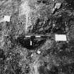
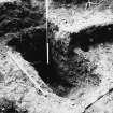
rench 62 was positioned within the scheduled monument area to determine the location of the outer defensive ditch surrounding Inveresk Roman fort. This may well have been accomplished, with a ditch feature having been recorded within the northern part of the trench. This ditch also displays evidence of an ‘ankle breaker’ placed at the bottom centre of the ditch (Figure 3).
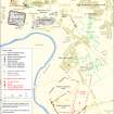
An overview of the trench locations from all phases of work thus far highlights where archaeological remains were found, within the scheduled area and to the south and south west of the scheduled monument area (Figure 4).
The evidence from this third phase of excavation work has highlighted the
significance of archaeological importance in contributing to the understanding of Inveresk’s Roman fort and pinpointing its location.
Information from OASIS Id: wardella2-404230 (M Hobson) 2020


