Edinburgh, Holyrood Park, General And Perimeter Wall
Boundary Wall (Post Medieval), Park (16th Century)
Site Name Edinburgh, Holyrood Park, General And Perimeter Wall
Classification Boundary Wall (Post Medieval), Park (16th Century)
Alternative Name(s) Queen's Park; Holyrood Royal Park; King's Park
Canmore ID 52219
Site Number NT27SE 197
NGR NT 27441 73482
NGR Description Centre
Datum OSGB36 - NGR
Permalink http://canmore.org.uk/site/52219
First 100 images shown. See the Collections panel (below) for a link to all digital images.
- Council Edinburgh, City Of
- Parish Edinburgh (Edinburgh, City Of)
- Former Region Lothian
- Former District City Of Edinburgh
- Former County Midlothian
NT27SE 5892 c.273 728
NT 273 728 Lion's Haunch/Guttit Haddie. An occasional watching brief was maintained between January and March 2003 on the laying of a new path on the SW slopes of Arthur's Seat, beside the Guttit Haddie and over the S slope of the Lion's Haunch. Nothing of archaeological significance was discovered.
Archive to be deposited in the NMRS.
Sponsor: HS
G Ewart 2003
NT 2730 7395 An archaeological assessment was undertaken to determine the impact of the various cultural events that are staged in the park each year. A desk-based assessment was undertaken in advance of a programme of trial trenching that comprised five long trenches covering 1000m2. The assessment identified a spread of archaeological features and structures dating to the late medieval and post-medieval periods. This included a possible outer precinct boundary for Holyrood Abbey, which defined a group of post-holes and pits of medieval date. The remains of post-medieval boundary walls of likely 16th or 17th-century date were identified in the area previously known as St Anne's Yard. Garden features and demolition spreads were also encountered. These are related to a substantial post-medieval building, eventually known as Clockmill House, which was demolished at the end of the 19th century.
A full report has been lodged with the NMRS.
Sponsor: Historic Scotland
S Stronach and C Moloney 2000
NT 277 723 A site visit was carried out to a section of the Holyrood Park boundary wall near to Wells o' Wearie in February 2000. Part of the wall had been dismantled where a large tree had damaged it. The affected area of the wall was photographed, the profile drawn, the line of the wall planned, and the area was located with reference to a nearby brick building.
Rig and furrow was noted in the area, but without excavation it could not be related to the wall.
Sponsor: Historic Scotland
A Radley 2000
NT 2712 7402 A minor excavation and recording exercise was undertaken in July 2001 in the area of a collapsed portion of the Holyrood Park boundary wall towards the N side of the park, just SE of Croft-an-Righ. This work is still in progress.
Sponsor: Historic Scotland
G Ewart 2001
NMRS Print Room
Inglis Photograph Collection Acc/No 1994/90
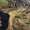
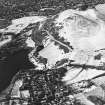
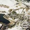
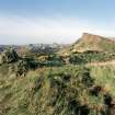
Holyrood Park, General
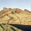
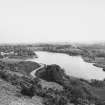
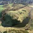
2 different views of St Margaret's Loch
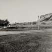
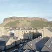
View from a rooftop near Holyrood Park Road into the park showing glasshouses
Excavation (1985)
NT 268 737 Three exploratory trenches were dug in the region of the 'Holyrood Triangle' road junction In order to assess the archaeological potential on either side of Queen's Drive. The Southern limits of 18th and 19th Century gardens as well as part of the original 18th Century Horse Wynd were uncovered. The alignment of the original Horse Wynd was also found to reflect the course of a wide, shallow ditch, backfilled by 1600 AD.
Sponsor: Historic Buildings and Monuments
G J Ewart
Kirkdale Archaeology
Field Visit (17 January 2000)
NT27SE 197 27 73
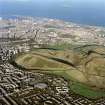
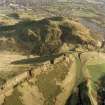
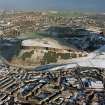
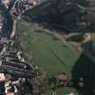
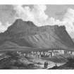
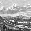
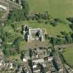
Holyrood Park, also known as the King's or Queen's Park, was created in 1541 by James V when he had the ground 'circulit about Arthurs Sett, Salisborie and Duddingston craggis' enclosed by a stone wall. The establishment of the Park accompanied the development of Holyrood as a royal residence following the move from Edinburgh castle instigated by James IV.
The earliest records of the land that now falls within the Park date from 1128-47, and indicate that in the early 12th century it was divided between royal demesne and the estate of Treverlen (Duddingston), then in the hands of Uviet the White (see NT27SE 3935). At this time, the royal demesne was used for hunting, and, according to legend, David I founded Holyrood Abbey by way of gratitude, having been spared during a hunting trip from death by an aggressive stag bearing a cross (or rood) between its antlers; it seems more probable, however, that the dedication of the abbey originates from its most precious relic, a fragment of the True Cross, inherited by David I through his brothers from his mother, Queen Margaret. With the foundation of Holyrood Abbey in 1128, David I granted demesne lands to the Augustinian canons, and Uviet endowed the abbey with part of Arthur's Seat. From the outset, Holyrood Abbey provided a royal guesthouse for the king and his court, and its popularity increased during the 14th and 15th centuries, so much so that in 1501 James IV began to build a palace at Holyrood. By 1542, it had displaced the castle as the principal royal residence. During these centuries, the Park acted as a sanctuary, however, in the early 16th century, the use of sanctuary for common criminals was repealed, and, following the Reformation, religious sanctuary was also abolished. With the annexation of monastic lands in the late 16th century, Holyrood Park reverted to the Crown and became a debtors' sanctuary related to the royal palace.
In 1564, while under crown property, Queen Mary created an artifical loch in Hunter's Bog as a resort for her courtiers, and in 1646, Charles I made Sir James Hamilton of Prestonfield House (NT27SE 94.00) and his heirs Hereditory Keepers of the Park. The Park remained in the care of his family for the next two hundred years, until the increasing unpopularity of the extensive quarrying of Salisbury Crags (see NT27SE 3946) led to the Crown reassuming control of the Park in 1846. During Queen Victoria's reign, her consort Prince Albert introduced various measures to landscape the Park, including drainage schemes and the removal of scrub vegetation, as well as the construction of the Queen's Drive, Dunsapie Loch and St Margaret's Loch. Further areas have been added to the Park since 1846, in particular the grounds immediately to the east of the palace and abbey (the Parade Ground), which were acquired in the late 19th century from the Belleville estate (see NT27SE 3955). The present boundary was completed in 1926 with the donation of the strip of ground to the east of Duddingston Loch.
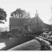
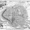
The wall enclosing Holyrood Park stands as testimony to this chequered past and ranges in construction material and technique. At numerous points on its perimeter, there is evidence for its modification, restoration and rebuilding. There are several pedestrian entrances into the Park, and four road entrances - Holyrood, St Leonards, Duddingston and Meadowbank - all of which are marked by lodges dating to the second half of the 19th century. The lodge at Dumbiedykes is dated to 1903. The OS maps depict these lodges, together with several structures associated with the pastoral use of the Park, but only the shepherd's cottage at Wells of Wearie survives; sheep were removed from the Park in 1977 following concerns of ecological damage. Amongst the other notable features infringing on the boundary of the Park, there is the Innocent Railway, now a public footpath and cycleway, which cuts through the southern margin of the Park (see NT27SE 3979) and was opened in 1831 to carry coal from Dalkeith into the city, while around Duddingston Loch boathouses and curling ponds are shown on the OS maps, and reflect the increasing use of the Park for recreation.
Visited by RCAHMS (ARG), 17 January 2000
Wickham-Jones 1996; RCAHMS 1999; NMRS, MS/726/96 (55-6, 68-71, 72-4 and 81-2, nos. 41, 66-74, 76-82 and 101).
Archaeological Evaluation (10 July 2000 - 14 July 2000)
NT 2730 7395 An archaeological assessment was undertaken to determine the impact of the various cultural events that are staged in the park each year. A desk-based assessment was undertaken in advance of a programme of trial trenching that comprised five long trenches covering 1000m2. The assessment identified a spread of archaeological features and structures dating to the late medieval and post-medieval periods. This included a possible outer precinct boundary for Holyrood Abbey, which defined a group of post-holes and pits of medieval date. The remains of post-medieval boundary walls of likely 16th or 17th-century date were identified in the area previously known as St Anne's Yard. Garden features and demolition spreads were also encountered. These are related to a substantial post-medieval building, eventually known as Clockmill House, which was demolished at the end of the 19th century.
A full report has been lodged with the NMRS.
Sponsor: Historic Scotland
S Stronach and C Moloney 2000
Watching Brief (February 2001 - March 2001)
NT27SE 4618 c.273 726
NT 273 728 A limited archaeological presence was maintained for the monitoring of any potential areas of archaeological interest affected by the 'Phase 7 Erosion Control Works' during February and March 2001. No features or deposits of archaeological interest were revealed.
Sponsor: Historic Scotland
A Radley and G Ewart 2001
Excavation (11 July 2001 - 26 July 2001)
While Kirkdale Archaeology were already contracted to excavate a trench at Holyrood Palace, a small area of the boundary wall of the parklands, immediately to the E of the Palace, collapsed. A small trench was excavated along this area to investigate its construction and dating. An earlier cobbled surface was found, dating somewhere between the construction of the Abbey and the Post-Medieval period. After the (probably) Post-Medieval construction of the boundary wall, considerable landscaping work was undertaken to the S in the park, presumably in the 19th century, while gardens were created for the tenements to the N. The remaining wall did not appear to be in danger of collapse.
G Ewart 2001
Sponsor: HS
Kirkdale Archaeology
Standing Building Recording (5 November 2001 - 6 November 2001)
NT 271 726 A watching brief was undertaken in November and December 2001 while contractors cut a deep pipe trench in the W of Holyrood Park, close to the boundary wall separating the park from Pollock Halls of Residence. The absence of archaeological features or finds in this area of the park may be the result of landscaping related to the building of the park road and footpath, or it may be that this area was simply left to agricultural or park activity.
G Ewart and D Stewart 2002
Sponsor: Historic Scotland
Kirkdale Archaeology
Excavation (27 February 2003 - 28 February 2003)
NT 269 738 Further to the trail trenching in January further larger scale excavations were monitored in February 2003 over the entire Broad Pavement car park.
G Ewart 2003
Sponsor: Historic Scotland
Kirkdale Archaeology
Excavation (8 January 2003)
NT 269 738 Trial trenching was undertaken at the Broad Pavement car park in January 2003 to establish the nature of the deposits in the 1.5m of ground below the present surface. The procedure involved the cutting of four test pits by machine at relevant points along the length of the car park.
G Ewart 2003
Sponsor: Historic Scotland
Kirkdale Archaeology
Excavation (3 March 2003 - 12 March 2003)
NT 269 738 Further to the trial trenching and excavations in January and February larger scale excavation continued in March 2003 over the entire Board Pavement car park plus the adjacent area of grass to the SW.
It seems that a shallow, low lying depression at the base of the Crags became filled by a large volume (at least 250 x 40m) of sewage from the Canongate and Cowgate. This area then appears to have been cultivated before finally being sealed over and landscaped.
G Ewart 2003
Sponsor: Historic Scotland
Kirkdale Archaeology
Watching Brief (14 February 2007 - 8 March 2007)
Archaeological monitoring was undertaken during path renovation work on the SW side of Arthur's Seat, in the area known as the 'Gutted Haddie'. There were no finds or features of archaeological interest.
Information from David Murray (Kirkdale Archaeology) 16 September 2007.
OASIS ID: kirkdale1-249636
Watching Brief (16 October 2007)
Archaeological monitoring was undertaken while five test pits were excavated along the east embankment of the road between the north and south roundabouts at Kaim Head in Holyrood Park. The purpose of the test pits was to determine whether there was bedrock within the embankment along the route of a proposed cycle track to the north of the existing pavement. Bedrock was only seen in the southernmost pit, roughly halfway between the two roundabouts. A live electricity cable was revealed in the base of the other four pits showing that the area had been previously disturbed. Nothing of archaeological interest was discovered.
Information from Sarah Hogg (Kirkdale Archaeology) October 2008. OASIS ID: kirkdale1-249635
Field Visit (22 January 2008)
NT 2793 7306 A site inspection was carried out on 22 January 2008 on an area disturbed by vehicles. The wheel ruts were inspected to see if there was any damage to buried archaeology. The soft ground, reflecting poor drainage, has created a deep humic layer towards the top of the natural profile. This deposit has obscured any obvious signs of occupation activity at least to the depth observed in the wheel ruts, and there was no visible evidence of any archaeological features.
Archive: RCAHMS (intended)
Funder: Historic Scotland
Gordon Ewart (Kirkdale Archaeology), 2008
Watching Brief (8 September 2008 - 14 October 2008)
A series of watching briefs was maintained to monitor work undertaken by contractors to stabilise the cliff face known as Salisbury Crags in Holyrood Park, Edinburgh. This entailed periodic site visits over the five weeks of the project to ensure no features of archaeological importance were under threat. There were no finds or features of archaeological significance encountered during these works.
Sponsor: Historic Scotland
D Murray 2008
OASIS ID: kirkdale1-249675
Kirkdale Archaeology
Trial Trench (15 June 2009 - 9 September 2009)
(Circa NT 27011 74050) A watching brief was carried out during consolidation work on the boundary wall of Holyrood Park near Croft-an-Righ. This included the excavation of trial trenches on both sides of the wall, which revealed recently disturbed deposits containing abundant finds of late 19th-century date including brick and glass fragments, along with a substantial quantity of pan-tile, perhaps indicating the presence of a roofed structure adjacent to the wall, now demolished. The wall at this point was a in a poor state of repair, due in part to damage caused by tree roots. Also there were several areas of repair. Some fragments of stone were seen which seemed likely to have been taken from the ruined Holyrood Abbey nearby. After the initial examination and recording, a section of wall with a maximum length of 7.0m was demolished. Further investigation revealed that there were at least two phases of boundary wall in this area and the earlier of these was mostly removed when the later wall was erected. The later wall has also had numerous repairs.
Information from Alan Radley (Kirkdale Archaeology) 20 March 2010. OASIS ID: kirkdale1-249677
Watching Brief (19 May 2009 - 21 May 2009)
NT 28286 73499 to NT 28280 73566 (approximately). A watching brief was maintained to monitor work undertaken by contractors to excavate a new drain near the boundary wall of Holyrood Park just north of the Ulster Gate near the northeast corner of the park.. There were no finds or features of archaeological significance encountered during these works.
Information from Alan Radley (Kirkdale Archaeology) May 2009. OASIS ID: kirkdale1-249678
Watching Brief (22 September 2009 - 24 September 2009)
Under the terms of its PIC call‐off contract Kirkdale Archaeology was asked by Historic Scotland to monitor the excavation of a trench excavated in Holyrood Park, Edinburgh. The trench was located in the NW part of the park, at the base of the hill and directly across the road from the car park to the S of the Palace grounds. The excavation was for a new drain and to prevent flooding onto the adjacent cycle path.
There were six phases of activity discovered although most of these were thought to date to the last c 100 years, while the earliest features encountered were thought to be subsoil and hill wash. More recent features seen seemed to indicate large scale landscaping and the material used suggests a late 19th or early 20th‐century date.
G Ewart
Sponsor: Historic Scotland
Kirkdale Archaeology
Excavation (31 August 2010 - 3 September 2010)
Under the terms of its PIC call-off contract, Historic Scotland requested that Kirkdale Archaeology monitor a series of small scale excavations around Arthur’s Seat. The work took place at three discrete locations: The SW corner of St Margaret’s Loch car park; the NW corner of Dunsapie Loch car park; and an area just to the W of the Education Centre. The trenches were designed to enable the installation of bike racks, and all involved the digging of shallow rectangular slots, with four such slots required at the Education Centre and three at the other two sites. The work was undertaken over three days, from 31st August 2010 – 2nd September 2010, with the excavations carried out by Historic Scotland staff under archaeological supervision. At the Education Centre site the archaeologist assisted in the excavation, since the trenches did not need to be dug through tarmac.
G Ewart 2010
Sponsor: Historic Scotland
Kirkdale Archaeology
Watching Brief (8 November 2010 - 11 November 2010)
A watching brief was maintained during the clearance of rocks from the W face of Salisbury Crags, between the two quarry sites. Prior to any rocks being displaced, the area they would land in was inspected - as was the top of the hill, where anchor points for the ropes were to be hammered into the ground. There were no finds or features of archaeological significance.
Kirkdale Archaeology 2010 (A. Radley) OASIS ID: kirkdale1-171223
Watching Brief (17 January 2011 - 28 January 2011)
A watching brief was maintained during the construction of new steps at various points around Arthur's Seat. The steps were near three areas: Dry Dam, the Zig-Zags and Nether Hill (or Lion's Haunch). The material removed in all these appeared likely to be hillwash, and finds from the 'Zig-Zags' likely date to the Victorian Period, or later. Prior to the work commencing, it was thought most likely that that there could be archaeological remains in the vicinity of Nether Hill or the uppermost part of the Dry Dam and particular attention was paid to the work being carried out there. However, nothing was seen in the small areas excavated, and it is also highly likely that the hillwash covers any prehistoric archaeological features that survive on these slopes.
Sponsor: Historic Scotland
A Radley 2011
OASIS ID: kirkdale1-171209
Kirkdale Archaeology
Watching Brief (28 October 2015 - 30 October 2015)
A watching brief was maintained during excavations and works to repair footpaths around Holyrood Park. The areas affected were a c 180m length of the footpath between Gutted Haddie and Lion’s Haunch (NT 2755 7315) and various sections of the path to the south and west of St Anthony’s Chapel (NT 2742 7273; NT 2754 7373)
There were no finds of archaeological significance.
Information from Magdalena Benysek (Kirkdale Archaeology) October 2015. OASIS ID: kirkdale1-311371
Watching Brief (14 January 2016 - 22 March 2016)
Watching briefs were maintained during three programmes of work in Holyrood Park, part of an ongoing repair programme. HSCO-90131-2016-01 Monitoring of remedial work undertaken on the main path to the summit of Arthur's Seat from the north side. The first two (NT 2756 7325 and NT 2757 7345) revealed nothing of interest but a third area (NT 2751 7366) revealed redeposited material, with path gravel and flecks of blaze throughout all the deposits. Significant amounts of 19th-century (or later) material were noted, with a small selection retained. A single body sherd of medieval date was retained from an erosion scar adjacent to the path. These finds may represent more than simply casual loss - perhaps midden (enhanced) material was introduced in the 19th century to landscape the approach to Anthony's Chapel and associated features. 2016-02 - (NT 2701 7370) Monitoring of a small excavation to repair a blocked drain at the foot of Arthur's Seat. Evidence revealed for extensive infill deposits, possibly mid-19th century, when the Queen's Drive was constructed. 2016-04 - (NT 2701 7370) Monitoring during the excavation of a long drainage trench adjacent to 'Jacob's Ladder'. To the west of the bottom of the steps is the site known as Delf's Well. The machine-excavated trench was c. 220m in length x 0.4m wide x 0.75m deep. There were no finds or features of archaeological significance. The opportunity was taken to make a detailed written and photographic record, including a measured sketch plan, of Delf's Well.
Information from David Murray and Alan Radley (Kirkdale Archaeology) March 2016.
OASIS ID: kirkdale1-280319
Watching Brief (19 February 2018 - 14 March 2018)
A watching brief was carried out by CFA Archaeology Ltd within the
grounds of Holyrood Park, specifically the areas of Powderhouse
Corner and Piper’s Walk as part of the Minor Archaeological Services
Call Off Contract, during the repair of paths and the construction of
waterbars. No archaeological features, deposits or artefacts were
identified.
Information from Edward Raynor (CFA Archaeology Ltd) June 2018. OASIS ID: cfaarcha1-313610
Watching Brief (19 February 2018 - 14 March 2018)
A watching brief was carried out by CFA Archaeology Ltd within the grounds of Holyrood Park, specifically the areas of Powderhouse Corner and Piper’s Walk as part of the Minor Archaeological Services Call Off Contract, during the repair of paths and the construction of waterbars. No archaeological features, deposits or artefacts were identified.
Information from CFA Archaeology Ltd (E Rayner, M Johnson) 2018
OASIS ID: cfaarcha1-313610
Watching Brief (12 November 2018)
AOC Archaeology Group undertook a watching brief on behalf of Scottish Water in relation to a sewer upgrade in Holyrood Park. The work consisted of several test pits to test for services along the route of the new sewer and the cut for the sewer itself.
The sewer track was 40m x 5m to a maximum depth of 5m. The soil matrix consisted of a topsoil, overlying made ground deposits.
No significant archaeological finds or features were recovered. No
further work is required in relation to this development.
Information from Steven Watt (AOC Archaeology Group) 10 January 2019. OASIS ID: aocarcha1-338870


