Following the launch of trove.scot in February 2025 we are now planning the retiral of some of our webservices. Canmore will be switched off on 24th June 2025. Information about the closure can be found on the HES website: Retiral of HES web services | Historic Environment Scotland
Ness Of Burgi
Blockhouse (Prehistoric), Fort (Prehistoric), Unidentified Pottery (Iron Age)
Site Name Ness Of Burgi
Classification Blockhouse (Prehistoric), Fort (Prehistoric), Unidentified Pottery (Iron Age)
Canmore ID 515
Site Number HU30NE 2
NGR HU 38806 08406
Datum OSGB36 - NGR
Permalink http://canmore.org.uk/site/515
First 100 images shown. See the Collections panel (below) for a link to all digital images.
- Council Shetland Islands
- Parish Dunrossness
- Former Region Shetland Islands Area
- Former District Shetland
- Former County Shetland
Ness of Burgi 1, Shetland, portable carved stone disc
Measurements: Diam 70mm, 16mm
Stone type: sandstone
Place of discovery: HU 3878 0839
Present location: National Museums Scotland, Edinburgh (GA.138)
Evidence for discovery: found sometime prior to 1882 on the site of Ness of Burgi and given to the museum by John Bruce.
Present condition: some wear.
Description
Almost central to one face of this disc is an incised rectangle divided into a grid of six small rectangles, some of which have a diagonal line running across them. The other side is lightly incised with lines making no recognisable pattern.
Date: early medieval.
References: Thomas 1963, fig 3.6; Scott & Ritchie 2009, no 24.
Compiled by A Ritchie 2016
Ness of Burgi 2, Shetland, portable carved stone disc
Measurements: Diam 75mm, D 18mm
Stone type: sandstone
Place of discovery: HU 3878 0839
Present location: National Museums Scotland, Edinburgh (GA.137)
Evidence for discovery: found sometime prior to 1882 on the site of Ness of Burgi and given to the museum by John Bruce.
Present condition: some wear.
Description
Set a little inside the perimeter of one face of the disc is a firmly incised circular band of key pattern composed of running T-bars. Within this circle there is a curving line. On the other side of the disc there is a lightly incised design consisting of a central square, with lines radiating out from its corners and ending in spirals.
Date: early medieval.
References: Thomas 1963, fig 3.3; Scott & Ritchie 2009, no 26.
Compiled by A Ritchie 2016
HU30NE 2 3878 0839.
(HU 3878 0839) Brough (NR)
OS 6" map, Shetland, 2nd ed., (1903).
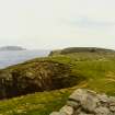
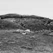
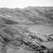
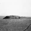
A gatehouse fort, probably datable to about 100 BC, isolated by a rampart, with a ditch on either side, cutting across the neck of the peninsula on which it stands.
The site was excavated by Miss C L Mowbray in 1935.
C L Mowbray 1936; RCAHMS 1946, visited 1930; E W MacKie 1965; R G Lamb 1980.
A gatehouse fort as described and planned by RCAHMS. At HU 3877 0855, the spread remains of a stone wall, now evident as a low turf covered bank, cuts off the whole promontory, and may possibly be associated with the 'fort'.
Visited by OS(RL) 2 May 1968.
In 1983, a single cutting was made through the enclosure bank at a point at its N end where it was being actively eroded by the sea, to record its structure and recover dating evidence. No artefacts were found.
S Carter, R McCullagh and A MacSween 1995.
Field Visit (17 July 1930)
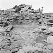
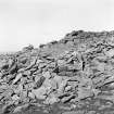
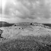
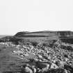
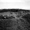
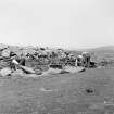
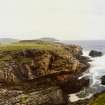
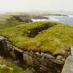
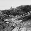
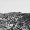
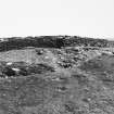
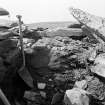
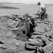
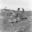
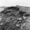
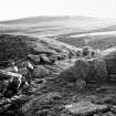
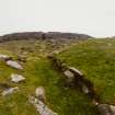
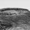
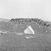
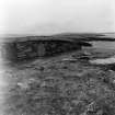
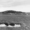
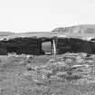
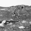
Fort, Ness of Burgi. This interesting monument, which was excavated on behalf of the Society of Antiquaries of Scotland in 1935 (Mowbray 1936), is situated on a small headland projecting S.E. into the West Voe of Sumburgh from the rocky peninsula in which the Scatness promontory terminates. The site is admirably adapted for defence, as the peninsula is cliff-bound and accessible only by a narrow path traversing a natural arch of rock. The headland consists of a small grass-covered plateau joined to the rest of the peninsula by a somewhat constricted neck, across which stretches a rampart (Fig. 505) of earth and stones 21 ft. in average breadth by about 7 ft. 6 in. in average height, and apparently revetted on its inner side with ·a roughly built wall about 3 ft. high. Some less definite traces of revetment are visible on the other side also. The rampart is bordered by a ditch on both its outer and inner sides and end by two boulders and lined on both sides with stones for about 8 ft. inwards. From the bottom of the inner ditch the natural rock rises steeply to the level of the plateau about 12 ft. above, and here, a few feet back from the edge of the ditch, stands the building which forms the most interesting part of the remains.
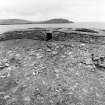
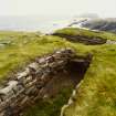
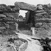
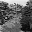
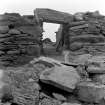
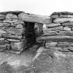
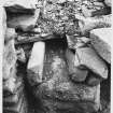
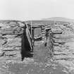
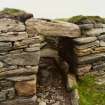
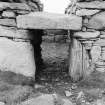
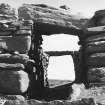
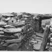
This building is, in essence, a more or less rectangular block of dry-stone masonry, containing three cells and pierced by a passage. The original length cannot be stated, as part of the S.W. end has disappeared; the present mean length, however, is about 74 ft., while the breadth varies from 21 ft. to 18 ft. 6 in. The passage, which is still covered by three of its original massive lintels, is 4 ft. high and varies considerably in width, being 3 ft. wide at the entrance (Fig. 506), contracting after 6 ft. 6 in. to 2 ft. 4 in. outside two door-checks, widening inside them to 4 ft., and again narrowing to 3 ft. 6 in. at the inner end. Behind the door-checks are two bar-holes, each of which runs through the wall into one of the immediately adjacent cells.
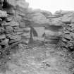
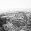
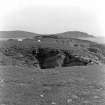
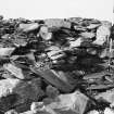
The N.E. cell (Fig. 507) is entered by a side passage 6 ft. 6 in. long, 2 ft . wide, and 2 ft. 10 in. high, which opens out at the centre of the main passage and still carries four lintels. This cell is 18 ft. long by 6 ft. 4 in. broad at its broadest part; the walls stand about 6 ft. high and converge slightly as they rise, in a manner which suggests that the roof was formed in the usual "beehive" fashion and was completed with lintels. Several slabs that may have served as lintels were found lying on the floor. The S.W. cell is entered by another tunnel-like passage 4 ft. 4 in. long, 2 ft. to 2 ft.4 in. wide, and 2 ft. 6 in. high, the doorway in this case being in the inner wall of the building 6 ft. S.W. of the inner end of the main entrance passage. Three lintels are still in situ, but above these the walls rise for a further 18 in. as if to like aperture that is commonly found in brochs. The cell, which is of irregular shape, measures 17 ft. in greatest length and 10 ft. 6 in. in greatest breadth; the walls stand up to 5 ft.in height. S. W. of this cell, again, are the remains of a third cell, now very much dilapidated; it appears to have measured about 7 ft. by 5 ft. 6 in. and may possibly have communicated with or formed part of a cell or passage lying still farther to the S.W .
No remains of a stairway were noted, and the quantity of fallen stone was not so great as to suggest that an upper storey had ever existed. Nor, with the possible exception of a single stone sunk vertically into the ground at the N.E. corner of the building, was there any trace of an extension of the building towards the edge of the cliff on this side, although some such extension would seem to have been necessary to fulfil the defensive intention that is implicit in the plan of the work.
Hearths, indicating two periods of occupation, were found in the S.W. cell, and some fragments of pottery, of Iron Age date, were recovered. It is also to be presumed that two carved stone discs, reported in 1883 to have been found in ‘the remains of a Broch . . .on the rocky point of Scatness’ (Smith 1883, 297), actually came from this fort.
RCAHMS 1946, visited 17 July 1930.
OS 6" map, Shetland, 2nd ed., (1903).
Measured Survey (1935)
RCAHMS surveyed the fort at Ness of Burgi with plane-table and alidade in c.1935. The site plan was redrawn in ink and published at a reduced scale (RCAHMS 1946, Fig. 502). RCAHMS also published a more detailed plan, sections and elevations of the blockhouse, redrawn in ink from originals provided by HM Office of Works (Ibid, Fig. 508).
Field Visit (2 May 1968)
A gatehouse fort as described and planned by RCAHMS. At HU 3877 0855, the spread remains of a stone wall, now evident as a low turf covered bank, cuts off the whole promontory, and may possibly be associated with the 'fort'.
Visited by OS(RL) 2 May 1968.
Aerial Photography (October 1973)
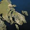
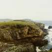
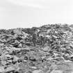
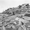
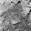
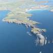
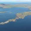
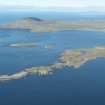
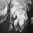
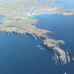
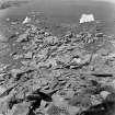
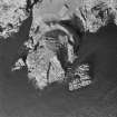
Oblique aerial photographs of Ness of Burgi taken by John Dewar in 1973.
Excavation (1983)
In 1983, a single cutting was made through the enclosure bank at a point at its N end where it was being actively eroded by the sea, to record its structure and recover dating evidence. No artefacts were found.
S Carter, R McCullagh and A MacSween 1995.
Publication Account (2002)
HU30 2 NESS OF BURGI
HU 389084 (visited 5/6/63)
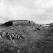
This gatehouse promontory fort, excavated in 1935 [2], stands near the south end of Scatness, overlooking the West Voe of Sumburgh, across the water from Jarlshof (Ills. 4.46 and 4.47). The defences consist of two ditches with a bank, which is probably a stone wall, between them; enclosed by these is a free-standing rectangular block of masonry with an entrance passage of standard broch type in the middle of it. The north-east end of this 'gatehouse' section is a built face with no trace of any further wall crossing the rest of the promontory which seems to be defended only by the ditches. The other end of the gatehouse is not so clearly defined and runs to the edge of the promontory.
Two large mural cells, one with a door into the entrance passage and the other opening to the interior, are on either side of the passage and there are traces of a third on the south-west. The gatehouse is about 74 ft. long at present though it was probably longer originally. It varies in width from 18 ft. 6 ins. to 21 ft. The entrance was equipped with door- checks and bar-holes and some lintels are still in position.
It can be argued that there must have been a wall joining the gatehouse to the north edge of the cliff promontory, although no traces now remain of it, for otherwise the structure could be easily by-passed by attackers once the outer defences had been crossed. Two carved stone discs seem to have been found on the site in about 1882 [2, 297].
In 1983 a trench was cut through the bank between the two ditches of the outer defences, near the north end where there is sea erosion [4, Ill. 11]. This was found to be a wall some 3.5 m wide the core of which was a mixture of dumped rubble and clay loam. There were no finds.
This kind of defence work is sometimes known as a 'blockhouse fort' but the term 'gatehouse' is preferred here. The evidence from Clickhimin (HU44 1) shows that the rectangular buildings were probably not designed as free-standing blockhouses but as a thicker part of the primary wall which contained the entrance passage.
Finds from 1935: only pottery was found (now in Lerwick Museum) but no drawings were published. Several wares were briefly described, with one photograph [3, fig. 5], including one vessel with a black burnished surface. The material was examined again by the 1983 excavators of Scatness (HU30 3) but the report was not published.
Sources: 1. OS card no. HU30 NE 2: 2. J.A. Smith 1883: 3. Mowbray 1936 (no plan): 4. RCAHMS 1946, vol. 3, no. 1154, 34-6 and figs. 502 and 505-8 (inc. plan): 5. Carter, McCullagh and MacSween 1996, 446-47 (inc. cross section of outer wall).
E W MacKie 2002
Note (1 March 2016 - 18 May 2016)
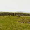
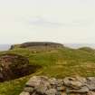
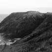
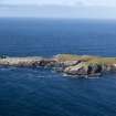
This fort occupies a rugged cliff-girt promontory on the E side of the peninsula running out to the Hog of Ness and sheltering the W flank of the West Voe of Sumburgh. The defences comprise a blockhouse facing WNE onto the inner of two broad ditches with a medial rampart, which bar access to an area on the top of the promontory measuring about 30m in length from NW to SE by 25m in breadth (0.07ha), though a much larger area of sloping outcrops descends to the sea on the ESE. The blockhouse was excavated in 1935 (Mowbray 1936) and subsequently in 1971 restored, comprising a rectangular block, which though eroded at one end, measures at least 23.8m in length by between 5.6m and 6.4m in breadth. A lintelled entrance passage with checks and a bar-hole towards the outer end leads through the centre of the block and has a doorway into a chamber on its N side, while a second chamber with an independent entrance opening into the interior lies immediately SSW of the passage, and a smaller third chamber in the partly destroyed SSW end. Two hearths representing successive occupations were found in the chamber on the SSW side of the entrance, and the earlier was associated with a number of cobbles set on end at the doorway. The entrance opens outwards onto the rocky scarp rising up some 3.5m above the bottom of the inner ditch, and lies roughly opposite the mouth of a passage aligned E and W through the medial rampart, but there may also have been access to the rest of the promontory around its NNE end, where the block stops well short of the cliff-edge, and the inner ditch likewise has not been cut all the way through the outcrops. The excavations recovered a range of pottery and midden from within the blockhouse, while two carved discs found in a 'Broch ...on the rocky point Scatness (Smith 1883, 296-7) are also considered to have come from here. Reassessment of the sherds found in 1935 tentatively assigns a date of 200 BC to AD 200 (Carter et al 1995, 447), though how these relate to the construction of the blockhouse is unknown.
Information from An Atlas of Hillforts of Great Britain and Ireland – 18 May 2016. Atlas of Hillforts SC4180


