
Following the launch of trove.scot in February 2025 we are now planning the retiral of some of our webservices. Canmore will be switched off on 24th June 2025. Information about the closure can be found on the HES website: Retiral of HES web services | Historic Environment Scotland
Carriden


Fort Annexe (Roman), Roman Fort (Roman), Settlement (Roman)
Site Name Carriden
Classification Fort Annexe (Roman), Roman Fort (Roman), Settlement (Roman)
Alternative Name(s) Carriden House
Canmore ID 49589
Site Number NT08SW 7
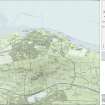
NGR NT 0255 8078
Datum OSGB36 - NGR
Permalink http://canmore.org.uk/site/49589


- Council Falkirk
- Parish Bo'ness And Carriden
- Former Region Central
- Former District Falkirk
- Former County West Lothian
NT08SW 7.00 0255 8078
(NT 0255 8078) Roman Fort (R) (site of)
OS 6" map, (1971).
NT08SW 7.01 NT 0233 8076 Paving
NT08SW 7.02 NT 0244 8084 Paving
See also NT08SW 31.
In 1945 a Roman fort at Carriden was observed on A Ps. 'In an arable field three parallel ditches, on a N-S alignment, mark the E side of the fort. They bend round to the W at their S end, and, rather less than halfway along their line from the S, there is an interrruption as if for a gate. A visit to the site in September 1945 showed that no remains were to be seen on the surface, the fields and gardens which cover the site having removed all traces.
A trial trench across the eastern defences at 100' N of the SE angle showed the middle ditch to be 10 1/2' wide and 4 1/4' deep. The inner ditch, at an interval of 30', was found to be 12 1/4' wide, but water prevented its depth from being determined. No remains of a rampart were found in this section. Two trenches dug within the area of the fort showed 18" of topsoil, covering natural clay and marl. Some rough scattered stones were also encountered, and a shallow pit, cut to a depth of 10" in the subsoil." This limited exploration yielded no remains of buildings, but Roman pottery of Antonine date was found, and donated to the National Museum of Antiquities of Scotland (NMAS). "An impression that the site had been heavily denuded was conveyed both by the removal of the rampart and the shallowness of the ditches as now existing.'
Roman altars, inscriptions, coins, and a gold medal of Vespasian are said to have been dug up at Carriden. A centurial stone, now disappeared, was built into the wall of Carriden House (G Macdonald 1901).
J K St Joseph 1949; G Macdonald 1934; Proc Soc Antiq Scot 1949.
No trace of the Roman fort at Carriden is visible on the ground. The W part of the fort lies in the grounds of Carriden House and the site is occupied by ornamental gardens. The E part lies in a field under cultivation, and there are no surface indications of the structure.
Visited by OS (D S) 24 January 1957.
NT 025 808. Roman pottery, including Samian, and a sestertius of Hadrian dateable to 119 - 138 A D, was found during ploughing (E J Price 1972). Mr Price has also discovered a stone-built water-course or aqueduct in a plantation NE of Carriden which he thinks may be Roman.
E J Price 1972; Information in telephone call from E J Price and E C Waight 27 July 1972.
A search of the wood NE of Carriden yielded no information on this watercourse.
The extent of the fort is visible on St Joseph air photographs; there is nothing to be seen on the ground.
Site surveyed at 1:2500 from air photographs.
Visited by OS (B S) 15 March 1974.
Large quantities of Roman pottery etc have been found within, and near to, this fort.
E J Price 1974; Cumbernauld Hist Soc 1974; DES 1976.
Air photographs of Carriden Roman fort, and the associated civil settlement, have been taken by the RCAHMS.
Visible on RCAHMS air photographs WL 1590-3, flown 1977)
The RCAHMS and St Joseph APs (12,13) show the cropmarks of an extensive civil settlement to the east of the fort. An area of approximately 6 hectares of linear and rectilinear ditch marks centred at NT 0280 8073 are visible in standing crop.
The easterly extent of the settlement cannot be ascertained from either set of APs (12, 13).
Visible on J K St Joseph air photographs DAU 50
There are no coherent traces of the settlement in a pasture field of gentle and amorphous undulations. No finds were made, and its full extent could not be estimated. The field to the S (centred NT 927 805), under fresh plough, showed no surface trace of occupation.
Fort re-surveyed at 1:2500 from air photographs.
Visited by OS (J R L) 25 February 1980; Visible on J K St Joseph air photographs ADU 59, A 20 and A 21.
Finds from Carriden, and many other places, donated to the NMAS by E J Price (1974) are listed under the general heading of-Roman and other material.
Proc Soc Antiq Scot 1981
Additional aerial photographs by CUCAP and the RCAHM.
Visible on CUCAP air photographs A 19, A 22, D 19-20, L 30-1, U 42, BD 54; GN 36-7, MP 49-52, APS 24; Visible on RCAHMS air photographs WL 2006-11, flown 1979.
NT 0245 8074. A two-week excavation to the W of the Roman fort at Carriden uncovered two defensive ditches demarcating the S side of an annexe. They were 3.4m apart: the inner measuring 2.6m wide and 1.0m deep; the outer 2.8m wide and 1.0m deep. As it approached the SW corner of the fort ditches the inner annexe ditch terminated in an entrance causeway. The road through this was lightly metalled. A small blocking trench had been subsequently dug on the line of the ditch rendering the road obsolete.
Sponsor: Falkirk Museum.
G Bailey 1994.
The fort is located partly in a field east of Carriden House and in Carriden House gardens c 80m from the coast edge on the top of the raised beach. A fort was seen on aerial photographs in 1945. Trial trenches confirmed its presence and Roman pottery has been found here in the past. No remains are visible on the ground and the field is under cultivation. This site is not threatened by coastal erosion.
Site recorded by GUARD during the Coastal Assessment Survey for Historic Scotland, 'The Firth of Forth from Dunbar to the Coast of Fife' 19th February 1996.
NT 0255 8078 Magnetic survey to the E of the fort in October 2006 indicated useful detail, not visible on the air photographs, that may relate to civilian settlement. A structure with a ditch appeared immediately S of the fort. The survey also examined the area to the immediate W of the fort towards the Steadings. Interpretation is still in progress.
Archive location not yet known.
Sponsor: EU Culture 2000
Richard Jones, 2006.
Aerial Photography (1945)
Aerial Photography (26 July 1946)
Aerial Photography (1946)
Aerial Photography (1948)
Aerial Photography (6 July 1949)
Aerial Photography (1951)
Aerial Photography (22 July 1953)
Aerial Photography (1954)
Field Visit (24 January 1957)
No trace of the Roman fort at Carriden is visible on the ground. The W part of the fort lies in the grounds of Carriden House and the site is occupied by ornamental gardens. The E part lies in a field under cultivation, and there are no surface indications of the structure.
Visited by OS (D S) 24 January 1957.
Aerial Photography (1958)
Aerial Photography (17 July 1961)
Aerial Photography (1962)
Aerial Photography (20 July 1974)
Field Visit (15 March 1974)
A search of the wood NE of Carriden yielded no information on this watercourse.
The extent of the fort is visible on St Joseph air photographs; there is nothing to be seen on the ground.
Site surveyed at 1:2500 from air photographs.
Visited by OS (B S) 15 March 1974.
Aerial Photography (1974)
Field Visit (August 1977)
Carriden, Fort NT 026 808 NT08SW 7 and 8
Roman fort with probable vicus. An inscribed stone incorporated into Carriden House and altar found at NT 028 807 nearby. Roman road E of fort has been traced by probing as far as NT 0298 8055.
RCAHSM 1978, visited August 1977.
(St Joseph 1949, 167-70; Richmond and Steer 1957, 1-6; Collingwood and Wright 1965, 657, no. 2138; DES, 1972, 45; Robertson 1973, 43; DES, 1974, 67, 69)
Aerial Photography (1977)
Aerial Photography (31 July 1979)
Field Visit (25 February 1980)
There are no coherent traces of the settlement in a pasture field of gentle and amorphous undulations. No finds were made, and its full extent could not be estimated. The field to the S (centred NT 927 805), under fresh plough, showed no surface trace of occupation.
Fort re-surveyed at 1:2500 from air photographs.
Visited by OS (J R L) 25 February 1980; Visible on J K St Joseph air photographs ADU 59, A 20 and A 21.
Reference (1981)
Finds from Carriden, and many other places, donated to the NMAS by E J Price (1974) are listed under the general heading of-Roman and other material.
Proc Soc Antiq Scot 1981
Trial Trench (November 1991)
NT08SW 31 Centred NT 02800 80590
See also NT08SW 7.00.
NT028 807 Limited excavations were undertaken in November 1991 within the field system believed to be the location of a vicus, to the E of Carriden Roman fort (NT08SW 7.00). A complex field system is clearly visible on oblique aerial photographs. This system respects the alignment of a road issuing from the eastern side of the fort.
Six 2m by 2m trenches were excavated at standard intervals of 80m from NW (Trench 1) to SE (Trench 6), in advance of the replacement of an overhead power line. Only stratified ploughsoil survived above the level of the subsoil in each trench. A single definite Roman potsherd was recovered from the buried ploughsoil in Trench 3. Ditches cut into the subsoil were located in three of the trenches examined (1, 3, 4). Each of these can be equated with reasonable certainty to features visible on aerial photographs. Two of these appear to be components of the field system (3, 4), whereas the third appears to be an intrusive secondary feature (1). Heavily truncated remains of stakeholes were found in trench 2. No archaeological features were encountered in trenches 5 and 6, which lie outside the area of the field system as defined by aerial photography.
The excavations neither confirm nor deny a Roman origin for the field system. No artefacts were recovered in association with the stratified features.
CFA 1992.
The field system is located to the east of Carriden Fort. The field has been recently ploughed and nothing is visible on the ground.
Site recorded by GUARD during the Coastal Assessment Survey for Historic Scotland, 'The Firth of Forth from Dunbar to the Coast of Fife' 19th February 1996.
Aerial Photography (28 August 1994)
Excavation (July 1994)
NT 0245 8074. A two-week excavation to the W of the Roman fort at Carriden uncovered two defensive ditches demarcating the S side of an annexe. They were 3.4m apart: the inner measuring 2.6m wide and 1.0m deep; the outer 2.8m wide and 1.0m deep. As it approached the SW corner of the fort ditches the inner annexe ditch terminated in an entrance causeway. The road through this was lightly metalled. A small blocking trench had been subsequently dug on the line of the ditch rendering the road obsolete.
Sponsor: Falkirk Museum.
G Bailey 1994.
Field Visit (19 February 1996)
The fort is located partly in a field east of Carriden House and in Carriden House gardens c 80m from the coast edge on the top of the raised beach. A fort was seen on aerial photographs in 1945. Trial trenches confirmed its presence and Roman pottery has been found here in the past. No remains are visible on the ground and the field is under cultivation. This site is not threatened by coastal erosion.
Site recorded by GUARD during the Coastal Assessment Survey for Historic Scotland, 'The Firth of Forth from Dunbar to the Coast of Fife' 19th February 1996.
Magnetic Susceptibility (October 2006)
NT 0255 8078 Magnetic survey to the E of the fort in October 2006 indicated useful detail, not visible on the air photographs, that may relate to civilian settlement. A structure with a ditch appeared immediately S of the fort. The survey also examined the area to the immediate W of the fort towards the Steadings. Interpretation is still in progress.
Archive location not yet known.
Sponsor: EU Culture 2000
Richard Jones, 2006.
Magnetometry (September 2007)
NT 0255 8078 The magnetic survey was undertaken in September 2007 in the large field E of the fort was continued (see DES 2006), covering an area of c12.5 ha. A smaller area to the S of this field was also surveyed. From a Roman perspective, the shallow ditch parallel to and c100m E from the fort's ditches and extending S as far as the road leading from the fort's E gate may be significant. Elsewhere, several phases of the remarkable field system and associated rig and furrow were identified, extending what has already emerged from aerial reconnaissance. What appears to be a relict stream bed runs from the ditches of the Roman fort eastwards along the axis of the field. Nothing of the promontory fort at the east end of the field was detected.
Archive location not yet decided.
Funder: EU Culture 2000: Frontiers of the Roman Empire project.
Field Walking (8 March 2008)
NT 0261 8073 Fieldwalking on 8 March 2008 over the ploughed fort site recovered 10 sherds of samian, 6 mortaria, 59 amphora and 24 other Roman wares.
Funder: Falkirk Local History Society & Edinburgh Archaeological Field Society
Geoff Bailey, 2008
Publication Account (2008)
A 1:25000 scale map of the Antonine Wall was published by RCAHMS in 2008. The map shows the course of the Antonine Wall on a modern map base, including areas where the Wall is in public ownership or care and can be visited. The data had been collated as part of the project to prepare maps for the World Heritage Site nomination bid.
Excavation (August 2009)
NT 0243 8070
Two weeks of excavation in August 2009 provided the outline of an annexe to the S of the Roman fort at Carriden. The defences consisted of a V-shaped ditch and an earth rampart with a stone base. An annexe
entrance was found next to the S gate of the fort. The ditch was subsequently filled in and replaced by a water leat or aqueduct. Traces of Roman occupation outside the annexe may have belonged to a vicus.
Funder: Falkirk Local History Society and EAFS
G Bailey 2009
External Reference (2 September 2011)
(Index no. 12653). Scheduled as 'Carriden House, Roman fort, annexe and settlement [comprising] a Roman fort associated with the Antonine Wall, its annexe and associated extramural settlement with evidence of field systems.'
Information from Historic Scotland, scheduling document dated 2 September 2011.
Aerial Photographic Interpretation
The RCAHMS and St Joseph APs (12,13) show the cropmarks of an extensive civil settlement to the east of the fort. An area of approximately 6 hectares of linear and rectilinear ditch marks centred at NT 0280 8073 are visible in standing crop.
The easterly extent of the settlement cannot be ascertained from either set of APs (12, 13).
Visible on J K St Joseph air photographs DAU 50
Aerial Photographic Interpretation
Additional aerial photographs by CUCAP and the RCAHM.
Visible on CUCAP air photographs A 19, A 22, D 19-20, L 30-1, U 42, BD 54; GN 36-7, MP 49-52, APS 24; Visible on RCAHMS air photographs WL 2006-11, flown 1979.

